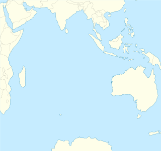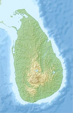
Sri Lanka, formerly called "Ceylon", is an island nation in the Indian Ocean, southeast of the Indian subcontinent, in a strategic location near major Indian Ocean sea lanes. The nation has a total area of 65,612 km², with 62,707 km² of land and 2,905 km² of water. Its coastline is 1,340 km (830 mi) long. The main island of Sri Lanka has an area of 65,268 km²; it is the twenty-fifth largest island of the world by area. Dozens of offshore islands account for the remaining 342 km² area. The largest offshore island, Mannar Island, leads to Adam's Bridge.

A spit or sandspit is a deposition bar or beach landform off coasts or lake shores. It develops in places where re-entrance occurs, such as at a cove's headlands, by the process of longshore drift by longshore currents. The drift occurs due to waves meeting the beach at an oblique angle, moving sediment down the beach in a zigzag pattern. This is complemented by longshore currents, which further transport sediment through the water alongside the beach. These currents are caused by the same waves that cause the drift.

Pulicat Lagoon is the second largest brackish water lagoon in India, after Chilika Lake. Pulicat Lagoon is considered to be the second largest brackish water body in India measuring 759 square kilometres (293 sq mi). The Lagoon is one of the three important wetlands to attract North-East Monsoon rain clouds during October to December season to Tirupati Region. The lagoon comprises the following regions, which adds up 759 square kilometres (293 sq mi) according to Andhra Pradesh Forest Department: 1) Pulicat Lake 2) Marshy/Wetland Land Region (AP) 3) Venadu Reserve Forest (AP) 4) Pernadu Reserve Forest (AP) The lagoon was cut across in the middle by the Sriharikota Link Road, which divided the water body into lagoon and marshy land. The lagoon encompasses the Pulicat lagoon Bird Sanctuary. The barrier island of Sriharikota separates the lagoon from the Bay of Bengal and is home to the Satish Dhawan Space Centre. Major part of the lagoon comes under Nellore district of Andhra Pradesh.

Batticaloa is a major city in the Eastern Province, Sri Lanka, and its former capital. It is the administrative capital of the Batticaloa District. The city is the seat of the Eastern University of Sri Lanka and is a major commercial city. It is on the east coast, 111 kilometres (69 mi) south of Trincomalee, and is situated on an island. Pasikudah is popular tourist destinations situated 35 km northwest with beaches and flat year-round warm-water shallow-lagoons.

The Ébrié Lagoon lies in Ivory Coast, separated for almost all of its length from the Atlantic Ocean by a narrow coastal strip. The 130 km (80 mi) long lagoon is linked to the sea by the Vridi Canal, while the Comoë River flows into it. The lagoon averages 4 km in width, and 5 m (16 ft) in depth. Abidjan and towns such as Grand Bassam, Bingerville, Jacqueville, Attécoubé, and Tiagba lie on the lagoon.

North Western Province is a province of Sri Lanka. The province consists of the districts of Kurunegala and Puttalam. Its capital is Kurunegala, which has a population of 28,571. The province is known mainly for its numerous coconut plantations. Other main towns in this province are Chilaw (24,712) and Puttalam (45,661), which are both small fishing towns. The majority of the population of Wayamba province is of Sinhalese ethnicity. There is also a substantial Sri Lankan Moor minority around Puttalam and Sri Lankan Tamils in Udappu and Munneswaram. Fishing, prawn farming and rubber tree plantations are other prominent industries of the region. The province has an area of 7,888 km², and a population of 2,370,075.
Jaffna Lagoon is a large lagoon off Jaffna District and Kilinochchi District, northern Sri Lanka. The lagoon is surrounded by the densely populated Jaffna Peninsula containing palmyra palms, coconut plantations, and rice paddies. There are numerous fishing villages and some salt pans. The lagoon has extensive mudflats, seagrass beds and some mangroves. The lagoon attracts a wide variety of water birds including American flamingoes, ducks, gulls, terns and other shorebirds.
Kokkilai lagoon is an estuarine lagoon in Mullaitivu District and Trincomalee District, north-east Sri Lanka. The town of Kokkilai is located on a sand bar between the lagoon and the Indian Ocean.
Vadamarachchi lagoon is a lagoon in Jaffna District, northern Sri Lanka. The lagoon is sometimes referred to as Thondamannar lagoon. The lagoon separates the Vadamarachchi region from the Valikamam and Thenmarachchi regions.

Chundikkulam Lagoon is a lagoon in Jaffna District and Kilinochchi District, north-east Sri Lanka. The town of Chundikkulam is located on a narrow piece of land between the lagoon and the Indian Ocean. The lagoon is sometimes referred to as Elephant Pass Lagoon.
Chalai Lagoon is a lagoon in Mullaitivu District, north-east Sri Lanka. The town of Chalai is located on a sand bar between the lagoon and the Indian Ocean.
Nai Aru Lagoon is an estuarine lagoon in Mullaitivu District, north-east Sri Lanka.
Ullackalie Lagoon is a lagoon in Trincomalee District, eastern Sri Lanka.
Upaar Lagoon is an estuarine lagoon in Batticaloa District, eastern Sri Lanka.

Negombo Lagoon is a large estuarine lagoon in Negombo, south-west Sri Lanka.
Mundal Lagoon is a lagoon in Puttalam District, western Sri Lanka. The lagoon is sometimes referred to as Mundal Lake.

Valvettithurai, sometimes shortened as VVT or Valvai, is a coastal town of Jaffna District on the northeast coast of the Jaffna Peninsula in Northern Province, Sri Lanka governed by an Urban Council of the same name. Valvettithurai was historically known as a seafaring port and its olden shipping trade.

Valaichchenai Lagoon is an estuarine lagoon in Batticaloa District, eastern Sri Lanka. Batticaloa district has three lagoons, such Valaichchenai Lagoon, Batticaloa Lagoon and Vakari Lagoon. Valaichchenai lagoon is situated in populated areas of Valaichchenai, Oddamavadi

Koggala Lagoon is a coastal waterbody located in Galle District, Southern Sri Lanka. It is situated near the town of Koggala and adjacent to the southern coast, about 110 km (68 mi) south of Colombo. The lagoon is embellished with eight ecologically rich small islands.

Rekawa Lagoon is a coastal waterbody located in Hambantota Districtt in the Southern Province, Sri Lanka and it is located 200 km (120 mi) south of Colombo. The lagoon possesses a rich biodiversity with a variety of flora and fauna.


