
Dartmouth Dam is a large rock-fill embankment dam with an uncontrolled chute spillway across the Mitta Mitta, Gibbo and Dart rivers, the Morass Creek and a number of small tributaries. The dam is located near Mount Bogong in the north-east of the Australian state of Victoria. The dam's purpose includes irrigation, the generation of hydro-electric power, water supply and conservation. The impounded reservoir is called Dartmouth Reservoir, sometimes called Lake Dartmouth. The Dartmouth Power Station, a hydro-electric power station that generates power to the national grid, is located near the dam wall.

The Samanala Dam is a dam primarily used for hydroelectric power generation in Sri Lanka. Commissioned in 1992, the Samanalawewa Project is the third-largest hydroelectric scheme in the country, producing 405 GWh of energy annually. It was built with financial support from Japan and the United Kingdom. It is notable for a large leak on its right bank. Power production continues as planned despite the leakage, and the water from the leak now provides two thirds of the water issued by the reservoir for agriculture in downstream areas.

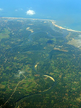
Gal Oya National Park in Sri Lanka was established in 1954 and serves as the main catchment area for Senanayake Samudraya, the largest reservoir in Sri Lanka. Senanayake Samudraya was built under the Gal Oya development project by damming the Gal Oya at Inginiyagala in 1950. An important feature of the Gal Oya National Park is its elephant herd that can be seen throughout the year. Three important herbs of the Ayurveda medicine, triphala: Terminalia chebula, Terminalia bellirica and Emblica officinalis are amongst the notable flora of the forest. From 1954 to 1965 the park was administrated by the Gal Oya Development Board until the Department of Wildlife Conservation took over administration. The national park is situated 314 km (195 mi) from Colombo.

The Upper Kotmale Dam is located in Talawakele, within the Nuwara Eliya District, in the Central Province of Sri Lanka. The dam feeds the third largest hydroelectric power station in the country.
Senanayake Samudraya is the biggest reservoir and man-made lake in Sri Lanka. It is locally known as the sea. Senanayake Samudraya was opened on 28 August 1949 under the Gal Oya Multipurpose Scheme, which was completed in 1953 by D. S. Senanayake.

The Broadlands Dam is a 35 MW run-of-the-river hydroelectric complex currently under construction in Kitulgala, Sri Lanka. The project is expected to be completed in 2020, and will consist of two dams, and a power station downstream.

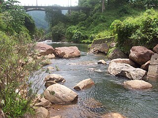
The Rantembe Dam is a 52-megawatt hydroelectric gravity dam at Rantembe, in the Central Province of Sri Lanka. Construction of the dam began in January 1987, and was completed on schedule in April 1990. The dam was constructed by the German 'Joint Venture Randenigala'; a different German joint venture has built the Randenigala Dam, further upstream.
The Bowatenna Dam is a 100 ft (30 m) high gravity dam at Bowatenna, in Central Province of Sri Lanka. The dam was built in June 1981, and is used primarily for irrigation. A 40 MW power station is also constructed 5,800 ft (1,800 m) downstream, for hydroelectric power generation.

The Maskeliya Dam is a large gravity dam at Maskeliya, in the Central Province of Sri Lanka. Along with the Castlereigh Dam, the dams are the highest point and beginning of the Laxapana Hydropower Complex, involving a number of dams, penstocks, and hydroelectric power stations. The dam creates the Maskeliya Reservoir over the route of Maskeliya Oya, a major tributary of the Kelani River, which is the 4th longest in the country.

The Castlereigh Dam is a gravity dam built across the Kehelgamu Oya, a major tributary to the Kelani River, approximately 3 km (1.9 mi) south-west of Hatton, in the Central Province of Sri Lanka.

The Polgolla Barrage is a barrage built across the Mahaweli River at Polgolla, in the Central Province of Sri Lanka. The barrage is used to increase the volume of water, for transfer to the hydroelectric power station located 8 km (5 mi) north, via penstock.

The Norton Dam is the gravity dam built across the Kehelgamu Oya, which is a main tributary to the Kelani River. The dam is built at Norton Bridge, in the Central Province of Sri Lanka.

The Canyon Dam is a large arch-gravity dam built across the Maskeliya Oya, 4.5 km (2.8 mi) upstream of the iconic Laxapana Falls, in the Central Province of Sri Lanka. The associated power station plays a major role in the national power grid, due to its significant output. The dam is surrounded by steel structures of the substation.

The Laxapana Dam is a gravity dam built across the Maskeliya Oya, 2.8 km (1.7 mi) downstream of the Laxapana Falls, in the Central Province of Sri Lanka.
The Maskeliya Oya is a major upstream tributary of the Kelani River. This 40 km (25 mi) long tributary originates in the hills of the Peak Wilderness Sanctuary, before passing through the Maskeliya Reservoir. The Maskeliya Oya converges with the Kehelgamu Oya at Kalugala, forming the 100 km (62 mi) long Kelani River. The river is heavily used for hydroelectric power generation.
The Kukule Ganga Dam is a 110 m (360 ft) gravity dam built across the Kukule River in Kalawana, Sri Lanka. The run-of-river dam feeds an underground hydroelectric power station located approximately 5 kilometres (3.1 mi) away, via tunnel.

The Udawalawe Dam is a large irrigation dam in Udawalawe, in the Southern Province of Sri Lanka. The dam consists of an embankment section and a gravity section, combining the total dam length to approximately 3.9 km (2.4 mi). The dam is also used for hydroelectric power generation, powering two 2 MW units, commissioned in April 1969.
The Deduru Oya Dam is an embankment dam built across the Deduru River in Kurunegala District of Sri Lanka. Built in 2014, the primary purpose of the dam is to retain for irrigation purposes approximately a billion cubic metres of water, which would otherwise flow out to sea. Site studies of the dam began in 2006 and construction started in 2008. It was ceremonially completed in 2014, with the presence of then President Mahinda Rajapaksa.
The Uma Oya Hydropower Complex (also internally called Uma Oya Multipurpose Development Project or UOMDP) is an irrigation and hydroelectric complex currently under construction in the Badulla District of Sri Lanka. Early assessments of project dates back to 1989, when the first studies was conducted by the country's Central Engineering and Consultancy Bureau. The complex involves building a dam across Dalgolla Oya, and channelling water over a 3,975 m (13,041 ft) tunnel to Mathatilla Oya, both of which are tributaries of the Uma Oya. At Mathatilla Oya, another dam is constructed to channel 145,000,000 m3 (5.1×10⁹ cu ft) of water per annum, via a 15,290 m (50,160 ft) headrace tunnel to the Uma Oya Power Station, where water then discharged to the Alikota Aru via a 3,335 m (10,942 ft) tailrace tunnel. The Alikota Aru is a tributary of the Kirindi Oya.

