Maryland Route 852

Last updated

MD Route 852.svg

Maryland Route 852

Route information
Maintained by MDSHA and City of Westminster
Existed1960–present
Location
Country United States
State Maryland
Counties Carroll
Highway system
MD Route 851.svg MD 851 MD Route 853.svg MD 853

Maryland Route 852 (MD 852) is a collection of state highways in the U.S. state of Maryland. These 11 highways are service roads related to and sections of an old alignment of MD 31 between New Windsor and Manchester in Carroll County. Between Westminster and Manchester, the sections of MD 852 follow MD 27, which replaced MD 31 north of Westminster in 1967. MD 852 has three distinct sections of mainline highway: MD 852 runs from New Windsor to south of Westminster, MD 852K runs from south of Westminster into the county seat, and MD 852G runs from north of Westminster to Mexico. What are now parts of MD 852 were originally constructed as MD 31 around 1920 south of Westminster and in the early 1910s north of Westminster. The sections of MD 852 were assigned north of Westminster in the late 1950s and south of Westminster in the mid-1960s.

Contents

Route description

View north along MD 852C south of Manchester 2016-08-20 13 31 02 View north along Maryland State Route 852 (Old Manchester Road) at Little Lane just south of Manchester in Carroll County, Maryland.jpg
View north along MD 852C south of Manchester

There are three mainline sections of MD 852:

New WindsorWestminster

MD Route 852.svg

Maryland Route 852

Location New Windsor Westminster
Length3.72 mi [1]  (5.99 km)

MD 852 begins at an intersection with MD 31 (New Windsor Road) just east of the town of New Windsor. The state highway heads north as a two-lane undivided road perpendicular to MD 31, then curves east and starts to follow old alignment at its intersection with MD 852M (Old New Windsor Road), which heads southwest to a dead end adjacent to MD 31. MD 852 follows a curvy path through farmland in the Wakefield Valley. After crossing Little Pipe Creek just west of its intersection with Adams Mill Road, the state highway veers to the southeast to parallel the creek. MD 852 runs along the southwestern edge of Wakefield Valley Golf Course before reaching its eastern terminus at MD 31 southwest of Westminster. [1] [2]

Westminster

MD Route 852.svg

Maryland Route 852K

Location Westminster
Length2.19 mi [1]  (3.52 km)

MD 852K begins at an intersection with MD 31 (New Windsor Road) a short distance east of MD 852's eastern terminus southwest of Westminster. The state highway heads south as two-lane undivided Stone Chapel Road to a three-way intersection where Stone Chapel Road turns west as a county highway. MD 852K turns east onto New Windsor Road. MD 852K closely parallels the eastbound direction of MD 31, serving as a service road for properties on the south side of the two highways. There appears to be a connector between MD 31 and MD 852K at MD 31's intersection with Tahoma Farm Road; however, barriers prevent access between the two highways. Access between the two highways was cut off in 2008 when a traffic signal was added at the MD 31Tahoma Farm Road intersection. [3] [4] MD 852K diverges from MD 31 just inside the city limit of Westminster. MD 852K becomes municipally-maintained just south of where houses start to line the westbound side of the highway. The state highway climbs to the top of the ridge on which downtown Westminster sits and reaches its eastern terminus at the intersection of Main Street and Uniontown Road on the edge of the Western Maryland College Historic District and the district's namesake, McDaniel College. [1] [5]

WestminsterMexico

MD Route 852.svg

Maryland Route 852G

Location Westminster Mexico
Length2.70 mi [1]  (4.35 km)

MD 852G begins at an intersection with MD 27 (Manchester Road) just north of the latter highway's crossing of the Maryland Midland Railway. MD 852G heads southeast as a two-lane undivided road to the intersection of MD 852H (Cranberry Road North) and Lucabaugh Mill Road, where the state highway picks up MD 31's old alignment and crosses Cranberry Branch. MD 852G curves to the northeast and passes through a mix of farmland and scattered residences. In the village of Mexico, the state highway intersects MD 482 (Hampstead Mexico Road) and that highway's old alignment, MD 849 (Leisters Church Road). North of Mexico, MD 852G veers north and reaches its northern terminus at MD 27 (Manchester Road). [1] [6]

History

MD 31 from New Windsor to Westminster was originally constructed as a 15-foot (4.6 m) wide concrete road between 1919 and 1921. [7] [8] The state highway was widened to 21 feet (6.4 m) with a pair of 3-foot (0.91 m) wide macadam shoulders between 1936 and 1939. [9] MD 852 was assigned to its present course after MD 31's present alignment was constructed between 1963 and 1965. [10] [11] MD 852K was assigned to its present course after MD 31's present alignment from southwest of Westminster to MD 140 was completed in 1967. [12] By 1978, the state highway was municipally-maintained on its present stretch, which was named Doyle Avenue. [13]

MD 27 from Westminster to Manchester was originally part of MD 31; Manchester Road became a northern extension of MD 27 in 1967. [12] [14] The WestminsterManchester road was one of the original state roads marked for improvement by the Maryland State Roads Commission in 1909. [15] The highway was completed from the Westminster city limit north to Cranberry Station on the Western Maryland Railway (now Maryland Midland Railway) in 1911. [16] [17] The road was extended to just south of Mexico in 1913; in addition, construction on the state road began from the Manchester end. The gap between Mexico and south of Manchester was filled in 1914. [17] Construction began on reconstructing and widening MD 31 from Manchester to Westminster in 1957. [18] This project involved several relocations of the highway by the time it was completed in 1960; sections of old road became segments of MD 852, including MD 852G between Westminster and Mexico. [19]

Junction lists

The entire route of all sections of MD 852 is in Carroll County.

MD 852

Locationmi
[1]
kmDestinationsNotes
New Windsor 0.000.00MD Route 31.svg MD 31 (New Windsor Road)Western terminus
0.070.11Old New Windsor Road westUnsigned MD 852M
Westminster 3.725.99MD Route 31.svg MD 31 (New Windsor Road)Eastern terminus
1.000 mi = 1.609 km; 1.000 km = 0.621 mi

MD 852K

The entire route is in Westminster.

mi
[1]
kmDestinationsNotes
0.000.00MD Route 31.svg MD 31 (New Windsor Road) New Windsor Western terminus
0.020.032Stone Chapel Road southMD 852K turns east onto New Windsor Road
2.193.52Main Street / Uniontown Road westEastern terminus
1.000 mi = 1.609 km; 1.000 km = 0.621 mi

MD 852G

Locationmi
[1]
kmDestinationsNotes
Westminster 0.000.00MD Route 27.svg MD 27 (Manchester Road) Manchester Southern terminus
0.220.35Cranberry Road North south / Lucabaugh Mill Road northCranberry Road North is MD 852H
Mexico 2.213.56MD Route 482.svg MD 482 (Hampstead Mexico Road) Hampstead
2.313.72Leisters Church Road eastUnsigned MD 849
2.704.35MD Route 27.svg MD 27 (Manchester Road) Westminster, Manchester Northern terminus
1.000 mi = 1.609 km; 1.000 km = 0.621 mi

Auxiliary routes

There are eight existing sections of MD 852 that are shorter than 1 mile (1.6 km). MD 852M is located in New Windsor. MD 852H and 852I are on the north side of Westminster. MD 852A, 852B, 852C, 852F, and 852J are between Mexico and Manchester.

See also

Related Research Articles

<span class="mw-page-title-main">Maryland Route 32</span> State highway in Maryland, US

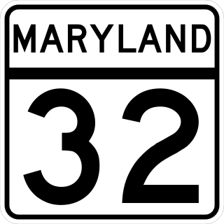
Maryland Route 32 (MD 32) is a state highway in the U.S. state of Maryland. The road runs 51.79 miles (83.35 km) from Interstate 97 (I-97) and MD 3 in Millersville west and north to Washington Road in Westminster. The 30 mile four- to six-lane freeway portion of MD 32 is the Patuxent Freeway between I-97 and I-70 in West Friendship. The freeway passes through Odenton and Fort Meade, the site of Fort George G. Meade and the National Security Agency (NSA), in western Anne Arundel County and along the southern part of Columbia in Howard County. Via I-97, MD 32 connects those communities with U.S. Route 50 (US 50)/US 301 in Annapolis. MD 32 also intersects the four primary highways connecting Baltimore and Washington: the Baltimore–Washington Parkway, US 1, I-95, and US 29. MD 32's north–south section, Sykesville Road, connects West Friendship and Westminster by way of Sykesville and Eldersburg in southern Carroll County.

<span class="mw-page-title-main">Maryland Route 31</span> State highway in Maryland, US

Maryland Route 31 is a state highway in the U.S. state of Maryland. Known for most of its length as New Windsor Road, the state highway runs 16.95 miles (27.28 km) from MD 26 in Libertytown east to MD 140 in Westminster. MD 31 connects the county seats of Frederick and Westminster via Libertytown in eastern Frederick County and New Windsor in western Carroll County. MD 31 originally extended from Frederick to Manchester, using the paths of what are now MD 26 and MD 27. MD 26 assumed MD 31 west of Libertytown in 1933 and MD 27 took over MD 31's route north of Westminster in 1967. The Westminster–Manchester portion of the state highway was constructed as one of the original state roads in the early 1910s. The remainder of the highway was built in the early to mid-1920s. MD 31 was relocated north of Westminster in the late 1950s and south of Westminster in the mid-1960s. The bypassed sections of the state highway became parts of MD 852.

<span class="mw-page-title-main">Maryland Route 713</span> State highway in Maryland, United States

Maryland Route 713 is a state highway in the U.S. state of Maryland. The highway runs 3.05 miles (4.91 km) from an entrance to Fort George G. Meade north to MD 176 in Hanover. In addition to serving as an access point to the U.S. Army installation, MD 713 provides the primary access to the Arundel Mills regional shopping mall and the Live! Casino & Hotel. MD 713 was constructed as part of MD 175 in the late 1920s and received its present designation in the mid-1940s. The northern end of the highway was relocated in the mid-1990s for the construction of MD 100 and modified again when Arundel Mills was built a few years later. One of MD 713's auxiliary routes connects the mall and casino with MD 295 via the first diverging diamond interchange in Maryland.

<span class="mw-page-title-main">Maryland Route 194</span> State highway in Maryland, United States

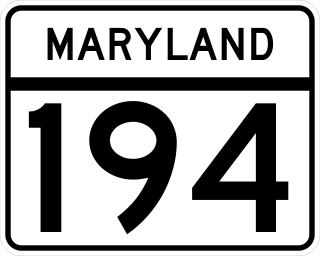
Maryland Route 194 (MD 194) is a state highway in the U.S. state of Maryland. The state highway runs 23.87 miles (38.42 km) from MD 26 in Ceresville north to the Pennsylvania state line near Taneytown, where the highway continues as Pennsylvania Route 194 (PA 194) toward Hanover. MD 194 is the main highway between Frederick and Hanover; the state highway connects the towns of Walkersville and Woodsboro in northeastern Frederick County with Keymar and Taneytown in northwestern Carroll County. MD 194 was blazed as a migration route in the 18th century and a pair of turnpikes in Frederick County in the 19th century, one of which was the last private toll road in Maryland. The state highway, which was originally designated MD 71, was built as a modern highway in Frederick County in the mid-1920s and constructed as Francis Scott Key Highway in Carroll County in the late 1920s and early 1930s. MD 194 received its modern route number in 1956 as part of a three-route number swap. The state highway's bypasses of Walkersville and Woodsboro opened in the early 1980s and mid-1990s, respectively.

<span class="mw-page-title-main">Maryland Route 27</span> State highway in Maryland, United States

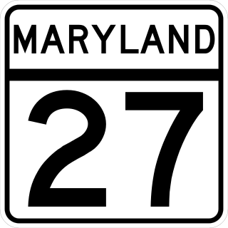
Maryland Route 27 is a state highway in the U.S. state of Maryland. Known for most of its length as Ridge Road, the highway runs 39.17 miles (63.04 km) from MD 355 in Germantown north to MD 30 in Manchester. MD 27 follows a ridge that separates several watersheds in northern Montgomery County and Carroll County. The highway connects Germantown and Manchester with Damascus in far northern Montgomery County; Westminster, the county seat of Carroll County; and Mount Airy, which lies at the junction of Carroll, Frederick, Howard, and Montgomery counties and where MD 27 intersects Interstate 70 (I-70)/U.S. Route 40.

<span class="mw-page-title-main">Maryland Route 575</span> State highway in Maryland, United States

Maryland Route 575 is a state highway in the U.S. state of Maryland. Known as Worcester Highway, the state highway runs 2.70 miles (4.35 km) from U.S. Route 113 in Friendship north to MD 589 and US 113 in Showell. MD 575 is the old alignment of US 113 in northern Worcester County. The state highway was assigned in 2000 when US 113 was relocated as a four-lane divided highway through the area. As part of the overall project to expand US 113 to four lanes from Berlin to the Delaware state line, 14 unsigned auxiliary routes of MD 575 were designated on old alignments or service roads between 2002 and 2004.

<span class="mw-page-title-main">Maryland Route 51</span> State highway in Allegany County, Maryland, US

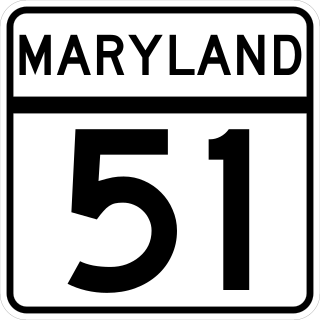
Maryland Route 51 is a state highway in the U.S. state of Maryland. Known for most of its length as Oldtown Road, the state highway runs 25.53 miles (41.09 km) from an interchange with Interstate 68 (I-68) in Cumberland south to the West Virginia state line at the Potomac River, where the highway continues east as West Virginia Route 9 toward Paw Paw. Around Cumberland, MD 51 is a major highway that provides a bypass of the South End neighborhood of that city and access to industrial areas along the North Branch Potomac River. South of North Branch, MD 51 is a rural highway connecting small communities along the river in southeastern Allegany County, including Oldtown. Documentation from the Maryland State Highway Administration depict the highway as following an east-west alignment, but all signage indicates a north-south road.

<span class="mw-page-title-main">Maryland Route 75</span> State highway in Maryland, US

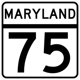
Maryland Route 75 is a state highway in the U.S. state of Maryland. Known for most of its length as Green Valley Road, the state highway runs 28.40 miles (45.71 km) from MD 355 near Hyattstown north to MD 31 in New Windsor. MD 75 serves as the main north–south highway of eastern Frederick County, where it connects Hyattstown with New Market, Libertytown, Johnsville, and the Carroll County town of Union Bridge. The first sections of MD 75 were constructed around New Windsor and between Green Valley and New London in the early 1910s. The latter highway was extended south to Green Valley in the late 1910s. In the early 1920s, MD 75 was constructed between New Windsor and Union Bridge and from Libertytown to Johnsville. The remainder of the state highway was constructed in the late 1920s and early 1930s. MD 75 was relocated between Union Bridge and New Windsor in the early 1960s, around its interchange with Interstate 70 (I-70)/U.S. Route 40 in New Market in the early 1970s, and at its northern terminus in New Windsor in 2007.

<span class="mw-page-title-main">Maryland Route 765</span> State highway in Maryland, United States

Maryland Route 765 is a collection of state highways in the U.S. state of Maryland. These 26 highways are service roads constructed or old alignments maintained to provide access to private property or county highways whose access was compromised by the realignment of MD 2 and MD 4 in Calvert County. There are six signed mainline segments of MD 765 comprising the old alignment of the concurrency of MD 2 and MD 4 through Solomons, Lusby, St. Leonard, and Port Republic, and the county seat of Prince Frederick in southern Calvert County. There are also 20 unsigned sections of MD 765 south of Prince Frederick and along MD 2 between its junction with MD 4 in Sunderland and Owings in northern Calvert County.

<span class="mw-page-title-main">Maryland Route 84</span> State highway in Carroll County, Maryland, US

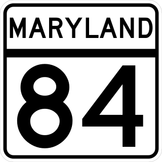
Maryland Route 84 is a state highway in the U.S. state of Maryland. The state highway runs 5.75 miles (9.25 km) from MD 75 near New Windsor north to MD 832 near Frizzelburg. MD 84 provides access to Uniontown and forms part of the connection between New Windsor and Taneytown in western Carroll County. The state highway was constructed from New Windsor to Uniontown in the mid-1920s. The northernmost portion of the highway was constructed in the late 1930s as MD 630, which became a disjoint part of MD 84 in 1951. The gap in MD 84 north of Uniontown was filled in 1956.

<span class="mw-page-title-main">Maryland Route 806</span> State highway in Maryland, United States

Maryland Route 806 is a state highway in the U.S. state of Maryland. The state highway runs a total of 4.05 miles (6.52 km) in two segments from U.S. Route 15 near Catoctin Furnace north to Roddy Creek Road near Thurmont. MD 806A, which has a length of 3.04 miles (4.89 km) from Catoctin Furnace to Thurmont, and MD 806R, which extends 0.55 miles (0.89 km) on the north side of Thurmont, are separated by a section of municipally-maintained road on the south side of Thurmont and a segment of MD 550 north of MD 77. MD 806 is the old alignment of US 15 through Catoctin Furnace and Thurmont. The state highway was originally constructed in the 1910s. MD 806 was assigned to the highway when US 15 bypassed Thurmont in the late 1950s. The state highway became a split route in the late 1980s. There have been several other segments of MD 806 along former sections of US 15 in Frederick County, including portions around Lewistown and south of Frederick.

<span class="mw-page-title-main">Maryland Route 482</span> State highway in Maryland, United States

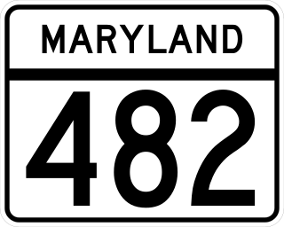
Maryland Route 482 is a state highway in the U.S. state of Maryland. Known as Hampstead Mexico Road, the state highway runs 5.45 miles (8.77 km) from MD 27 in Mexico east to MD 30 Business in Hampstead. In conjunction with MD 27, MD 482 connects Westminster with Hampstead. The state highway was constructed at both ends in the early 1930s; the middle section was completed in the late 1940s. MD 482 was relocated in Mexico around 1960 and in Hampstead in 2009, the latter to connect with the new alignment of MD 30.

<span class="mw-page-title-main">Maryland Route 800</span> State highway in Maryland, United States

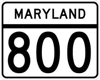
Maryland Route 800 is a collection of state highways in the U.S. state of Maryland. The longest section of MD 800, officially MD 800D and known as Watson Lane, is signed and runs 1.57 miles (2.53 km) between two intersections with MD 75 near the unincorporated village of Linwood in western Carroll County. The multiple segments of MD 800 are sections of old alignment of MD 75 between Union Bridge and New Windsor. MD 75 was originally constructed through Linwood in the early 1920s. MD 800 sections were assigned after MD 75 was relocated through the area in the early 1960s.

<span class="mw-page-title-main">Maryland Route 808</span> State highway in Maryland, United States

Maryland Route 808 is a state highway in the U.S. state of Maryland. Officially MD 808A and known as Main Street, the state highway runs 2.34 miles (3.77 km) from Ridgeville Boulevard north to MD 27 within Mount Airy. MD 808 follows the Carroll–Frederick county line for a portion of its length near its southern terminus. The county line portion is considered to be in Carroll County for maintenance purposes. MD 808 is the old alignment of MD 27 through Mount Airy. A portion of Main Street was paved by 1910; the sections south and north of the town center were constructed in the early 1910s and late 1910s, respectively. MD 808 was assigned to Main Street after MD 27's bypass of Mount Airy was completed in the mid-1970s.

<span class="mw-page-title-main">Maryland Route 854</span> Highway in Maryland

Maryland Route 854 is a collection of state highways in the U.S. state of Maryland. This pair of highways comprise the old alignment of MD 97 between MD 26 near Eldersburg and MD 32 in Fenby in Carroll County. MD 854A and MD 854B, which have lengths of 2.64 miles (4.25 km) and 3.93 miles (6.32 km), respectively, are separated by Morgan Run Natural Environment Area.

<span class="mw-page-title-main">Maryland Route 850</span> State highway in Maryland, United States

Maryland Route 850 is a collection of state highways in the U.S. state of Maryland. These seven highways are sections of old alignments of MD 26, most of which are named Old Liberty Road, in the communities of Taylorsville, Winfield, and Eldersburg in southern Carroll County. There are also at least three former sections of MD 850: two are in Eldersburg and one is in Frederick. MD 26 was constructed west of Eldersburg between the early 1920s and early 1930s. That highway was extensively relocated and reconstructed across southern Carroll County in the late 1950s and early 1960s; many of the segments of Old Liberty Road became portions of MD 850.

References

  1. 1 2 3 4 5 6 7 8 9 10 11 12 13 14 15 16 17 18 Highway Information Services Division (December 31, 2013). Highway Location Reference. Maryland State Highway Administration. Retrieved 2011-04-18.
  2. Google (2011-04-18). "Maryland Route 852" (Map). Google Maps . Google. Retrieved 2011-04-18.
  3. Highway Information Services Division (December 31, 2007). Highway Location Reference. Maryland State Highway Administration. Retrieved 2011-04-18.
  4. Highway Information Services Division (December 31, 2008). Highway Location Reference. Maryland State Highway Administration. Retrieved 2011-04-18.
  5. Google (2011-04-18). "Maryland Route 852K" (Map). Google Maps . Google. Retrieved 2011-04-18.
  6. Google (2011-04-18). "Maryland Route 852G" (Map). Google Maps . Google. Retrieved 2011-04-18.
  7. "Report of the State Roads Commission of Maryland". 1916–1919. Baltimore: Maryland State Roads Commission. January 1920: 24 . Retrieved 2011-04-21.{{cite journal}}: Cite journal requires |journal= (help)
  8. Map of Maryland: Showing State Road System and State Aid Roads (Map) (1921 ed.). Maryland Geological Survey.
  9. "Report of the State Roads Commission of Maryland". 1937–1938. Baltimore: Maryland State Roads Commission. 1939-03-04: 127 . Retrieved 2011-04-21.{{cite journal}}: Cite journal requires |journal= (help)
  10. "NBI Structure Number: 100000060057020". National Bridge Inventory. Retrieved 2011-04-21.
  11. Maryland: Official Highway Map (Map) (1965 ed.). Maryland State Roads Commission.
  12. 1 2 Maryland: Official Highway Map (Map) (1967 ed.). Maryland State Roads Commission.
  13. Maryland: Official Highway Map (Map) (1978 ed.). Maryland State Highway Administration.
  14. Map of Maryland: Showing State Road System and State Aid Roads (Map) (1927 ed.). Maryland Geological Survey.
  15. Map of Maryland (Map) (1910 ed.). Maryland Geological Survey.
  16. Map of Maryland: Showing State Road System and State Aid Roads Completed or Under Construction December 31, 1911 (Map) (1911 ed.). Maryland Geological Survey.
  17. 1 2 "Report of the State Roads Commission of Maryland". 1912–1915. Baltimore: Maryland State Roads Commission. May 1915: 106 . Retrieved 2011-04-21.{{cite journal}}: Cite journal requires |journal= (help)
  18. "Report of the State Roads Commission of Maryland". 1957–1958. Baltimore: Maryland State Roads Commission. 1958-12-15: 91 . Retrieved 2011-04-21.{{cite journal}}: Cite journal requires |journal= (help)
  19. Maryland: Official Highway Map (Map) (1960 ed.). Maryland State Roads Commission.
  20. Google (2011-04-18). "Maryland Route 852A" (Map). Google Maps . Google. Retrieved 2011-04-18.
  21. Google (2011-04-18). "Maryland Route 852B" (Map). Google Maps . Google. Retrieved 2011-04-18.
  22. Google (2011-04-18). "Maryland Route 852C" (Map). Google Maps . Google. Retrieved 2011-04-18.
  23. Google (2011-04-18). "Maryland Route 852F" (Map). Google Maps . Google. Retrieved 2011-04-18.
  24. Google (2011-04-18). "Maryland Route 852H" (Map). Google Maps . Google. Retrieved 2011-04-18.
  25. Google (2011-04-18). "Maryland Route 852I" (Map). Google Maps . Google. Retrieved 2011-04-18.
  26. Google (2011-04-18). "Maryland Route 852J" (Map). Google Maps . Google. Retrieved 2011-04-18.
  27. Google (2011-04-18). "Maryland Route 852M" (Map). Google Maps . Google. Retrieved 2011-04-18.
Template:Attached KML/Maryland Route 852
KML is from Wikidata