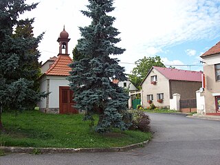
Kliszkowice is a village in the administrative district of Gmina Żmigród, within Trzebnica County, Lower Silesian Voivodeship, in south-western Poland. Prior to 1945 it was in Germany.
Bắc Trà My is a district (huyện) of Quảng Nam Province in the South Central Coast region of Vietnam. The district is known for its production of Saigon Cinnamon. As of 2003 the district had a population of 21,139. The district covers an area of 823 km². The district capital lies at Tra Cang.

Buszkowo is a village in the administrative district of Gmina Koronowo, within Bydgoszcz County, Kuyavian-Pomeranian Voivodeship, in north-central Poland. It lies 6 kilometres (4 mi) north-west of Koronowo and 27 km (17 mi) north of Bydgoszcz.

The N85 road is a national secondary road in Ireland connecting Ennis and Ennistymon. The route connects to the M18 Ennis bypass and forms part of the Ennis outer ring road as the "N85 Western Relief Road". From Ennis the route continues in a north - west direction and terminates at the junction with the N67 at Ennistymon. It is located entirely in County Clare.

Zabełcze is a village in the administrative district of Gmina Annopol, within Kraśnik County, Lublin Voivodeship, in eastern Poland. It lies approximately 5 kilometres (3 mi) south of Annopol, 27 km (17 mi) west of Kraśnik, and 68 km (42 mi) south-west of the regional capital Lublin.

Krosnowa is a village in the administrative district of Gmina Słupia, within Skierniewice County, Łódź Voivodeship, in central Poland. It lies approximately 3 kilometres (2 mi) west of Słupia, 18 km (11 mi) south-west of Skierniewice, and 33 km (21 mi) east of the regional capital Łódź.

Stanin is a village in Łuków County, Lublin Voivodeship, in eastern Poland. It is the seat of the gmina called Gmina Stanin. It lies approximately 14 kilometres (9 mi) south-west of Łuków and 73 km (45 mi) north of the regional capital Lublin.

Wyszmontów is a village in the administrative district of Gmina Ożarów, within Opatów County, Świętokrzyskie Voivodeship, in south-central Poland. It lies approximately 4 kilometres (2 mi) south of Ożarów, 18 km (11 mi) east of Opatów, and 74 km (46 mi) east of the regional capital Kielce.

Jaworowo-Jastrzębie is a village in the administrative district of Gmina Zawidz, within Sierpc County, Masovian Voivodeship, in east-central Poland. It lies approximately 7 kilometres (4 mi) north-east of Zawidz, 18 km (11 mi) east of Sierpc, and 103 km (64 mi) north-west of Warsaw.

Józefowo is a village in the administrative district of Gmina Piaski, within Gostyń County, Greater Poland Voivodeship, in west-central Poland. It lies approximately 5 kilometres (3 mi) south-east of Piaski, 9 km (6 mi) east of Gostyń, and 62 km (39 mi) south of the regional capital Poznań.
Kamień-Kolonia is a settlement in the administrative district of Gmina Ceków-Kolonia, within Kalisz County, Greater Poland Voivodeship, in west-central Poland.

Sątopy is a village in the administrative district of Gmina Nowy Tomyśl, within Nowy Tomyśl County, Greater Poland Voivodeship, in west-central Poland. It lies approximately 6 kilometres (4 mi) east of Nowy Tomyśl and 49 km (30 mi) west of the regional capital Poznań.
Jerzmanice is a village in the administrative district of Gmina Rzepin, within Słubice County, Lubusz Voivodeship, in western Poland.

Grzybno Górne ,(German: Ober Gribno) is a settlement in the administrative district of Gmina Kartuzy, within Kartuzy County, Pomeranian Voivodeship, in northern Poland. It lies approximately 3 kilometres (2 mi) north of Kartuzy and 28 km (17 mi) west of the regional capital Gdańsk.

Folwark is a village in the administrative district of Gmina Stary Dzierzgoń, within Sztum County, Pomeranian Voivodeship, in northern Poland. It lies approximately 5 kilometres (3 mi) north-east of Stary Dzierzgoń, 29 km (18 mi) east of Sztum, and 78 km (48 mi) south-east of the regional capital Gdańsk.

Lubiatowo is a village in the administrative district of Gmina Choczewo, within Wejherowo County, Pomeranian Voivodeship, in northern Poland. It lies approximately 7 kilometres (4 mi) north of Choczewo, 34 km (21 mi) north-west of Wejherowo, and 70 km (43 mi) north-west of the regional capital Gdańsk.

Żółwia Błoć is a village in the administrative district of Gmina Goleniów, within Goleniów County, West Pomeranian Voivodeship, in north-western Poland. It lies approximately 6 kilometres (4 mi) north-east of Goleniów and 28 km (17 mi) north-east of the regional capital Szczecin.
Węglewo is a settlement in the administrative district of Gmina Szczecinek, within Szczecinek County, West Pomeranian Voivodeship, in north-western Poland.

Osek is a municipality and village in Beroun District in the Central Bohemian Region of the Czech Republic, located 95KM north-west of Prague.

Riverview is a hamlet in central Alberta, Canada within the County of St. Paul No. 19. It is located approximately 18 kilometres (11 mi) east of Highway 41 and 76 kilometres (47 mi) northwest of Lloydminster.


