
Masilamea is a village on the island of Tongatapu in Tonga. The village had a population of 284 at the 2021 census. [1]

Masilamea is a village on the island of Tongatapu in Tonga. The village had a population of 284 at the 2021 census. [1]
In September 2022 the Tongan government began construction of new homes in the village for displaced survivors of the Hunga Tonga–Hunga Haʻapai eruption and tsunami. [2] In December 2022, displaced citizens of the island of Atatā were permanently resettled near the village. [3] [4]
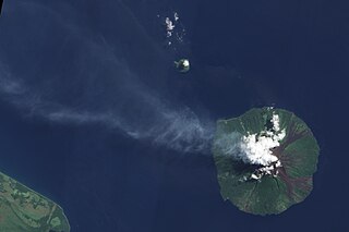
Manam, known locally as Manam Motu, is an island located in the Bismarck Sea across the Stephan Strait from Yawar on the northeast coast of mainland Papua New Guinea's Bogia District. The island is 10 kilometers wide, and was created by the activity of the Manam Volcano, one of the country’s most active. It was evacuated in 2004 and its residents resettled elsewhere in Papua New Guinea, but many have begun to return despite concerns of future volcanic activity. Manam is erupting again as of May 2022.
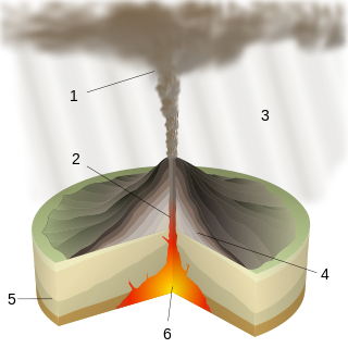
Plinian eruptions or Vesuvian eruptions are volcanic eruptions marked by their similarity to the eruption of Mount Vesuvius in 79 AD, which destroyed the ancient Roman cities of Herculaneum and Pompeii. The eruption was described in a letter written by Pliny the Younger, after the death of his uncle Pliny the Elder.

Niuafoʻou is the northernmost island in the kingdom of Tonga. One of the Niua Islands, it is located in the southern Pacific Ocean between Fiji and Samoa, 574 km (357 mi) north of Tongatapu island group and 337 km (209 mi) northwest of Vavaʻu. It is a volcanic rim island with an area of 15 km2 (5.8 sq mi) and a population of 431. The volcano is active and has erupted regularly since 1814, with its last major eruption in 1985.

Haʻapai is a group of islands, islets, reefs, and shoals in the central part of Tonga. It has a combined land area of 109.30 square kilometres (42.20 sq mi). The Tongatapu island group lies to its south, and the Vavaʻu group lies to its north. Seventeen of the Haʻapai islands are inhabited. Their combined population is 5,419. The highest point in the Ha‘apai group, and in all of Tonga, is on Kao, which rises almost 1,050 metres (3,440 ft) above sea level.
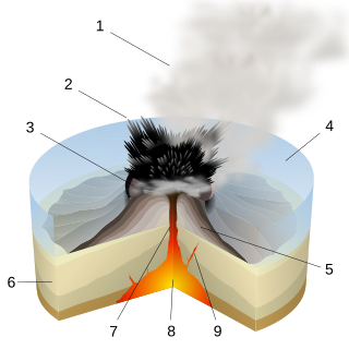
A Surtseyan eruption is an explosive style of volcanic eruption that takes place in shallow seas or lakes when rapidly rising and fragmenting hot magma interacts explosively with water and with water-steam-tephra slurries. The eruption style is named after an eruption off the southern coast of Iceland in 1963 that caused the emergence of a new volcanic island, Surtsey.

Hunga Tonga–Hunga Haʻapai is a submarine volcano in the South Pacific located about 30 km (19 mi) south of the submarine volcano of Fonuafoʻou and 65 km (40 mi) north of Tongatapu, Tonga's main island. It is part of the highly active Kermadec-Tonga subduction zone and its associated volcanic arc, which extends from New Zealand north-northeast to Fiji, and is formed by the subduction of the Pacific Plate under the Indo-Australian Plate. It lies about 100 km (62 mi) above a very active seismic zone.
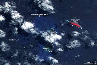
The 2009 Tonga undersea volcanic eruption began on 16 March 2009, near the island of Hunga Tonga, approximately 62 kilometres (39 mi) from the Tongan capital of Nukuʻalofa. The volcano is in a highly active volcanic region that represents a portion of the Pacific Ring of Fire. It is estimated that there are up to 36 undersea volcanoes clustered together in the area.
Liahona High School is a high school in Tonga owned and operated by the Church of Jesus Christ of Latter-day Saints. The school is named after the Liahona, a religious artifact described in the Book of Mormon, which gave a family direction in the wilderness. As of 2022, it is one of six LDS schools on Tongatapu, the main island of Tonga.
The Oceanian section of the 2022 FIFA World Cup qualification acted as qualifiers for the 2022 FIFA World Cup, to be held in Qatar, for national teams which are members of the Oceania Football Confederation (OFC). A total of 0.5 slots in the final tournament were available for OFC teams, which equated to one inter-confederation play-off slot.

A volcanic tsunami, also called a volcanogenic tsunami, is a tsunami produced by volcanic phenomena. About 20–25% of all fatalities at volcanoes during the past 250 years have been caused by volcanic tsunamis. The most devastating volcanic tsunami in recorded history was that produced by the 1883 eruption of Krakatoa. The waves reached heights of 40 m (130 ft) and killed 36,000 people.
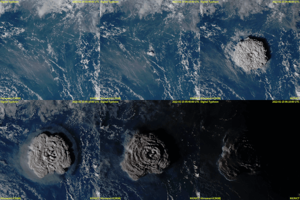
In December 2021, an eruption began on Hunga Tonga–Hunga Haʻapai, a submarine volcano in the Tongan archipelago in the southern Pacific Ocean. The eruption reached a very large and powerful climax nearly four weeks later, on 15 January 2022. Hunga Tonga–Hunga Haʻapai is 65 km (40 mi) north of Tongatapu, the country's main island, and is part of the highly active Tonga–Kermadec Islands volcanic arc, a subduction zone extending from New Zealand to Fiji. In the Volcanic Explosivity Index scale, the eruption was rated at least a VEI-5. Described by scientists as a "magma hammer", the volcano at its height produced a series of four underwater thrusts, displaced 10 cubic kilometers of rock, ash and sediment, and generated the largest atmospheric explosion recorded by modern instrumentation.

Atatā is an island in Tonga, near the capital city Nukuʻalofa. The island was completely evacuated after the 2022 Hunga Tonga–Hunga Ha'apai eruption and tsunami. Before the eruption, the island's population was 106.
Mango is a small island in Tonga, 9 kilometres south-east of the larger island of Nomuka, and part of the Nomuka or ʻOtu Muʻomuʻa group of islands, which are the southern part of the Haʻapai group. Mango had a population of 62 in the 2021 census.

The 1871 Ruang eruption began on March 3, and ended on March 14 at the Ruang volcano in the Molucca Sea, Indonesia. The eruption triggered a locally devastating tsunami measuring 25 meters. It flooded many villages on nearby islands, killing some 400 people.
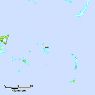
Fonoifua is an island in Tonga.
Events in the year 2022 in Tonga.
The following lists events that happened during 2022 in Niue.
Coordinates: 21°07′27″S175°19′32″W / 21.12417°S 175.32556°W