
Chikmagalur, officially Chikkamagaluru is an administrative district in the Malnad subregion of Karnataka, India. Coffee was first cultivated in India in Chikmagalur. The hills of Chikmagalur are parts of the Western Ghats and the source of Tunga and Bhadra rivers. Mullayanagiri, the highest peak in Karnataka is located in the district. The area is well known for the Sringeri Mutt that houses the Dakshina Peeta established by Adi Shankaracharya.

Tumakuru district is an administrative district in the state of Karnataka in India. It is the third largest district in Karnataka by land area with an area of 10,598 km2, and fourth largest by Population. It is a one-and-a-half-hour drive from Bengaluru, the state capital. The district is known for the production of coconuts and is also called as 'Kalpataru Nadu'. It is the only discontiguous district in Karnataka.

Kalaburagi district, formerly known as Gulbarga district, is one of the 31 districts of Karnataka state in southern India. Kalaburagi city is the administrative headquarters of the district. The district is the headquarters of Kalaburagi division.

Hassan is one of the 31 districts of Karnataka, India. The district headquarter is Hassan. It was part of Manjarabad Faujdari a.k.a. Patnada Rayada between 1832-81. In 1882, it was reduced into a sub-division under erstwhile Kadur district. But in 1886, the Hassan district was restored to its current form.
Mandya district is an administrative district of Karnataka, India. The district is bordered on the south by Mysore and Chamarajangar districts, on the west by Hassan district, on the north by Tumkur district and on the east by Ramanagara district. The district Mandya was carved out of larger Mysore district in the year 1939.

Davanagere district is an administrative district of Karnataka state in India. It is the centre of Karnataka. The city of Davanagere is the district headquarters. It had a population of 1,643,494 of which 32.31% was urban as of 2011. This district was separated from Chitradurga district in 1997 by the then Chief minister of Karnataka J. H. Patel including Chennagiri and Honali Taluks Shimoga district.
Chikkanayakanahalli is a town in Tiptur sub-division of Tumakuru district, in the state of Karnataka, India. It is 30 km away from Tiptur and 132 km from Bangalore.
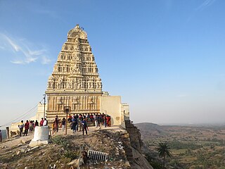
Pavagada is a town and a taluk in the Tumkur district of Karnataka, India. Historically it was part of the Mysore kingdom. Though it is geographically connected to Chitradurga district inside state of Karnataka, it comes under Tumkur district. It is 157.8 km from state capital of Bengaluru. Uttara Pinakini river flows into this Taluk. Pavagada Taluk falls on the border of Karnataka, hence a majority of the population are bilingual speaking Kannada and Telugu. The town is famous for its fort located on the hill, Kote Anjaneya temple at the foothills and also the temple of Sri Shani Mahatma.
Chinchali is a village in Raybag Taluk, Belagavi District, Karnataka, India. It is located near the state boundary with Maharashtra, approximately 84 kilometres north of the district seat Belgaum, and 10 kilometres northeast of the taluk seat Raibag. In the year 2011, the village has a population of 18,986.
Bukkapatna is a village in the southern state of Karnataka, India. It is located in the Sira taluk of Tumkur district in Karnataka.
Byadanur is a village in the southern state of Karnataka, India. It is located in the Pavagada taluk of Tumkur district in Karnataka.
Huliyar is a town in the southern state of Karnataka, India. It is located in the Chiknayakanhalli taluk of Tumakuru district in Karnataka. It is 42 km (26 mi) from its sub-divisional headquarters, Tiptur and 90 km (56 mi) from district headquarter Tumakuru.
Kenkere is a small town in the southern state of Karnataka, India. It is located in the Chiknayakanhalli taluk of Tumkur district in Karnataka. It is the headquarters of the Village Panchayat.
Madalur is a village in the southern state of Karnataka, India. It is located in the Sira taluk of Tumkur district in Karnataka.

Yallappa Nayakana Hosakote, often written as Y. N. Hosakote is a small town in the southern state of Karnataka, India. It is located in the Pavagada taluk of Tumkur district in Karnataka. In 1556 a local king named Yallappa Nayaka founded the fort on the hill Siddarabetta beside Kundurpi, named Yallappanayakana hosakote.
Chikkabanavara is a town in Bengaluru, Karnataka, India. It is located in the Bangalore North taluk of Bangalore Urban district in Karnataka. It has one of the oldest surviving lakes in Bangalore. The lake is located at a distance of 1.5 km north of Chikkabanavara railway station on the Bangalore-Tumkur railway line.
Adagondanahalli is a village in the southern state of Karnataka, India. It is located in the Gubbi taluk of Tumkur district in Karnataka.
Mohare is a village in Bailhongal Taluk, Belagavi District of Karnataka, India. It is located near the state border with Maharashtra, about 26 kilometres east of the district seat Belgaum, and 16 kilometres northwest of the taluk seat Bailhongal. As of 2011, it has a total population of 2,365.
Arasikere is a village in Pavagada Taluk in Tumkur District of Karnataka, India. It belongs to Bangalore Division. It is located 97 km towards North from the District headquarters Tumakuru. 24 km from Pavagada and 161 km from State capital Bangalore.
Badavanahalli is a village within Madhugiri Taluk, Tumakuru District, Karnataka, India. It is located at 37 kilometres north of the district seat Tumkur, and 16 kilometres west of the subdistrict seat Madhugiri. In the year 2011, it has a total population of 4,332.

