Woerden is a city and a municipality in central Netherlands. Due to its central location between Amsterdam, Rotterdam, The Hague, and Utrecht, and the fact that it has rail and road connections to those cities, it is a popular town for commuters who work in those cities.

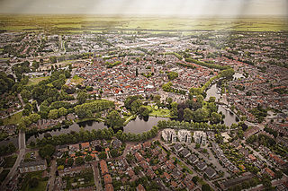
Alphen aan den Rijn is a city and municipality in the western Netherlands, in the province of South Holland. The city is situated on the banks of the river Oude Rijn, where the river Gouwe branches off. The municipality had a population of 112,587 in 2021, and covers an area of 132.50 km2 (51.16 sq mi) of which 6.27 km2 (2.42 sq mi) is water.

Germania, also called Magna Germania, Germania Libera, or Germanic Barbaricum to distinguish it from the Roman province of the same name, was a historical region in north-central Europe during the Roman era, which was associated by Roman authors with the Germanic people. The region stretched roughly from the Middle and Lower Rhine in the west to the Vistula in the east. It also extended at some point as far south as the Upper and Middle Danube and Pannonia, and to the known parts of southern Scandinavia in the north. Archaeologically, these people correspond roughly to the Roman Iron Age of those regions. While dominated by Germanic people, Magna Germania was also inhabited by a few other Indo-European people.

Legio IV Macedonica, was a legion of the Imperial Roman army founded in 48 BC by Gaius Julius Caesar with Italian legionaries. The legion was disbanded in AD 70 by Emperor Vespasian. The legion symbols were a bull and a capricorn.
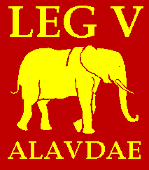
Legio V Alaudae, sometimes also known as Legio V Gallica, was a legion of the Roman army founded in 52 BC by the general Gaius Julius Caesar. It was levied in Transalpine Gaul to fight the armies of Vercingetorix, and was the first Roman legion to comprise non-citizens. Historians disagree whether the legion was destroyed during the Batavian rebellion in AD 70, or during the First Battle of Tapae.
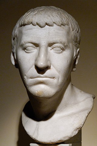
Gnaeus Domitius Corbulo was a popular Roman general, brother-in-law of the emperor Caligula and father-in-law of Domitian. The emperor Nero, highly fearful of Corbulo's reputation, ordered him to commit suicide, which the general carried out faithfully, exclaiming "Axios", meaning "I am worthy", and fell on his own sword.

The Oude Rijn is a branch of the Rhine delta in the Dutch provinces of Utrecht and South Holland, starting west of Utrecht, at Harmelen, and running by a mechanical pumping station into the North Sea at Katwijk. Its present-day length is 52 kilometres.
The Vangiones appear first in history as an ancient Germanic tribe of unknown provenance. They threw in their lot with Ariovistus in his bid of 58 BC to invade Gaul through the Doubs river valley and lost to Julius Caesar in a battle probably near Belfort. After some Celts evacuated the region in fear of the Suebi, the Vangiones, who had made a Roman peace, were allowed to settle among the Mediomatrici in northern Alsace.. They gradually assumed control of the Celtic city of Burbetomagus, later Worms.
The Limes Germanicus, or 'Germanic Limes', is the name given in modern times to a line of frontier fortifications that bounded the ancient Roman provinces of Germania Inferior, Germania Superior and Raetia, dividing the Roman Empire and the unsubdued Germanic tribes from the years 83 to about 260 AD. The frontier used either a natural boundary such as a river or typically an earth bank and ditch with a wooden palisade and watchtowers at intervals, and a system of linked forts was built behind them.

The Mattiaci were by Tacitus recorded as an ancient Germanic tribe and related to the Chatti, their Germanic neighbors to the east. There is no clear definition of what the tribe's name meant. The Dictionary of Greek and Roman Geography suggests that the name is derived from a combination of 'matte', meaning 'a meadow', and 'ach', signifying water or a bath.

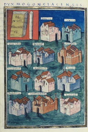
Forum Hadriani, in the modern town of Voorburg, was the northernmost Roman city on the European continent and the second oldest city of the Netherlands. It was located in the Roman province Germania Inferior and is mentioned on the Tabula Peutingeriana, a Roman road map.

Brittenburg was a Roman ruin site west of Leiden between Katwijk aan Zee and Noordwijk aan Zee, presumably identical to the even older Celtic Lugdunum fortress. The site is first mentioned in 1401, was uncovered more completely by storm erosion in 1520, 1552 and 1562, and has subsequently been entirely eroded away. When built, it was located at the mouth of the Oude Rijn, which has since moved. The site was about a kilometre west of the European Space Research and Technology Centre, now offshore in the North Sea).

The Vliet is a canal in the western Netherlands, in the province of South Holland. It starts at the Oude Rijn at Leiden and joins the Delfshavense Schie canal at Delft. Places along its banks include Voorschoten, Leidschendam, Voorburg, The Hague and Rijswijk.

For around 450 years, from around 55 BC to around 410 AD, the southern part of the Netherlands was integrated into the Roman Empire. During this time the Romans in the Netherlands had an enormous influence on the lives and culture of the people who lived in the Netherlands at the time and (indirectly) on the generations that followed.
Praetorium Agrippinae was a Roman settlement in the province of Lower Germania, in the area of the Cananefates, located in modern-day Valkenburg, Netherlands. It was an army encampment on the Old Rhine, on the northern border of the Roman Empire, the limes. Praetorium Agrippinae is mentioned on the Tabula Peutingeriana between the castella of Matilo in the east and Lugdunum Batavorum to the west.
Albaniana was the name the ancient Romans gave a settlement on the southern banks of Rhine river, some 40 kilometers from its mouth in the North Sea, known as Alfen and modern-day Alphen aan den Rijn, Netherlands. They did build a military fort there, as part of a range strategically built encampments, to protect and guard the river, frontier (limes) of the Roman empire and main transport route of goods and troops. The historical map Tabula Peutingeriana situates the settlement in between Matilo (Leiden) and Praetorium Agrippinae (Valkenburg) downstream and Nigrum Pullum (Zwammerdam) and Fectio (Vechten) upstream. The village was mentioned in Antoninus' register of roads Itinerarium Antonini from the 3rd century. The fortress must have been surrounded by a wall of ground and wooden poles, with gates and watch towers.

The Numerus Batavorum, also called the cohors Germanorum, Germani corporis custodes, Germani corpore custodes, Imperial German Bodyguard or Germanic bodyguard was a personal, imperial guards unit for the Roman emperors of the Julio-Claudian dynasty composed of Germanic soldiers. Although the Praetorians may be considered the Roman emperor's main bodyguard, the Germanic bodyguards were a unit of more personal guards recruited from distant parts of the Empire, so they had no political or personal connections with Rome or the provinces.
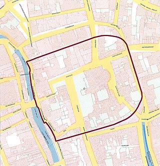
Traiectum was a Roman fort, on the frontier of the Roman Empire in Germania Inferior. The remains of the fort are in the center of Utrecht, Netherlands, which takes its name from the fort.

The Classis Germanica was a Roman fleet in Germania Superior and Germania Inferior. Besides the Channel Fleet, it was one of the largest naval forces of the Roman Empire, ranking above all other provincial fleets.

The Lower Germanic Limes is the former frontier between the Roman province of Germania Inferior and Germania Magna. The Lower Germanic Limes separated that part of the Rhineland left of the Rhine as well as the southern part of the Netherlands, which was part of the Roman Empire, from the less tightly controlled regions east of the Rhine.

