Related Research Articles

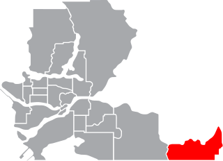
Abbotsford is a federal electoral district in British Columbia, Canada, that has been represented in the House of Commons of Canada since 2004.

Pitt Meadows—Maple Ridge—Mission was a federal electoral district in British Columbia, Canada, that was represented in the House of Commons of Canada from 1997 to 2015.
Naval Radio Section Aldergrove, or NRS Aldergrove, is a Canadian Forces naval radio communications facility located in both Aldergrove and Matsqui, British Columbia.
The Williams Lake First Nation is a First Nations government of the Secwepemc (Shuswap) Nation, located in the Cariboo region of the Central Interior region of the Canadian province of British Columbia, at the city of Williams Lake. It was created when the government of the then-Colony of British Columbia established an Indian reserve system in the 1860s. It is a member government of the Northern Shuswap Tribal Council. Its main Indian Reserve is Williams Lake Indian Reserve No. 1, a.k.a. "Sugarcane" or "The Cane" or "SCB".
The Esk'etemc First Nation, also known as the Alkali Lake Indian Band, is a First Nations government of the Secwepemc (Shuswap) people, located at Alkali Lake in the Cariboo region of the Central Interior of the Canadian province of British Columbia. It was created when the government of the then-Colony of British Columbia established an Indian reserve system in the 1860s. It is one of three Secwepemc bands that is not a member of either the Shuswap Nation Tribal Council or the Northern Shuswap Tribal Council.
Huntingdon is a community within Abbotsford, British Columbia, Canada. It is located immediately north of the Canada–US border, and is the location of the Sumas-Huntingdon Border Crossing. The main road through the community is Highway 11. The name of the community is also the present name of the border crossing connecting to Sumas, Washington.
Mount Lehman or Mt. Lehman is a small rural community located in the Fraser Valley of south western British Columbia, Canada. The community was established in 1874 and became part of the District of Matsqui in 1892. The District of Matsqui was incorporated into the present day City of Abbotsford, British Columbia in 1995.
Woodlands is a part of the District of North Vancouver in British Columbia, Canada. It was first settled after the Second Boer War. The community is located at the foot of Mount Seymour on Indian Arm, itself a branch of Burrard Inlet, which forms Vancouver's harbour. It is about 14 kilometres (8.7 mi) from Downtown Vancouver.
The Dewdney-Alouette Regional District was a regional district in the Lower Mainland of British Columbia, Canada, comprising the district municipalities of Pitt Meadows, Maple Ridge and Mission and unincorporated areas east to the Harrison River and north to the southern end of Lillooet Lake. The regional district was partitioned when the Greater Vancouver Regional District was expanded in 1995 to take in Pitt Meadows and Maple Ridge; the regional district's eastern half was combined with the former Central Fraser Valley Regional District and the Regional District of Fraser-Cheam to form the Fraser Valley Regional District.
The San Jose River is a river in the Cariboo region of the Central Interior of British Columbia, Canada. It rises in the area just northwest of 100 Mile House and includes in its watershed Lac La Hache, flowing northwestwards from there to its mouth at the head of Williams Lake, at the city of the same name. Williams Lake is drained by the Williams Lake River, effectively the continuation of the San Jose, and flows only a short distance before entering the Fraser River just west of the city.
Bradner is a community within the City of Abbotsford, British Columbia, Canada, located in a rural northwest region of that city which also includes Mount Lehman. Bradner occupies a height of land above the Fraser River, immediately across which is the community of Silverdale, a part of the District of Mission, and Ruskin, on the border between Mission and Maple Ridge. On the floodplain below to the west is the Langley rural neighbourhood of Glen Valley, while on the floodplain to the east, which is called Matsqui Prairie, the nearest Abbotsford neighbourhood is Matsqui Village. Bradner was formerly part of the District of Matsqui, which in 1995 was amalgamated into the City of Abbotsford.

The Katzie First Nation or Katzie Nation is the band government of the Katzie people of the Lower Fraser Valley region of British Columbia, Canada.
Matsqui is a former district municipality in British Columbia, Canada. It was incorporated in 1892 and merged with the district municipality of Abbotsford in 1995 to create the new City of Abbotsford. Matsqui used to be the western part of what is now Abbotsford. It had commercial growth in the Clearbrook area which then spilled over to Abbotsford.
Cottonwood River is a tributary of the Fraser River in the Central Interior of British Columbia, Canada. Rising at the confluence of the Swift River and Lightning Creek at Coldspring House in the Cariboo goldfields of the northern Cariboo Plateau, it flows northwest and then turns southwest to join the Fraser just north of the city of Quesnel, which is at the confluence of the Quesnel River with the Fraser.
The Leq'á:mel First Nation, formerly known as Lakahahmen First Nation, is a First Nations band government whose community and offices are located in the area near Deroche, British Columbia in the Fraser Valley region in Canada, about 12 kilometres east of the District of Mission. They are a member government of the Sto:lo Nation Chiefs Council, which is one of two tribal councils of the Sto:lo.
The Central Fraser Valley Regional District was a regional district in the province of British Columbia, Canada, located in the Lower Mainland region, south of the Fraser River and west of Chilliwack. It comprised the Township and City of Langley, the Village of Abbotsford, and the Districts of Matsqui and Sumas, plus adjoining unincorporated areas.
Sumas was a district municipality in the Fraser Valley region of British Columbia, Canada, located between the then-Village of Abbotsford (W) and Chilliwack (E). It was amalgamated with the Village of Abbotsford in 1972 into the District of Abbotsford.
Atchelitz is a rural community within the City of Chilliwack in the Eastern Fraser Valley region of British Columbia, Canada. It is located southwest of the city core, to the north of the Vedder Canal.

Hatzic is a historic community in the Central Fraser Valley region of the Lower Mainland of British Columbia, Canada, located on the east side of the District of Mission and including areas beyond the municipal boundary to the east and northeast.

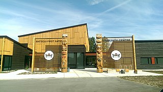
The Matsqui people are a Sto:lo Aboriginal group located in the Central Fraser Valley region of British Columbia, Canada. Their band government is the Matsqui First Nation, a member of the Sto:lo Nation tribal council. The core traditional territory of the Matsqui stretches along the Fraser River from Crescent Island to Sumas Mountain, and southward beyond the Canada-United States border. Today the band administers four reserves and has a population of 225. Their original language is Halq'eméylem.
References
Coordinates: 49°07′00″N122°20′00″W / 49.11667°N 122.33333°W