
Eldoret is a city in the Rift Valley region of Kenya. It serves as the capital of Uasin Gishu County. Located in western Kenya, and lying south of the Cherangani Hills, the local elevation varies from about 2,100 metres (6,900 ft) at the Eldoret International Airport to more than 2,700 metres (8,900 ft) in nearby areas.

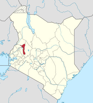
Uasin Gishu County is one of the 47 counties of Kenya located in the former Rift Valley Province. Eldoret city has the county's largest population centre as well as its administrative and commercial centre..It is bordered by Elgeyo-Marakwet to the East, Trans Nzoia to the North, Kakamega to the west, Nandi and Kericho to the South West and Baringo to the South East. It is a highland plateau with altitudes falling gently from 2,700 metres (8,900 ft) above sea level to about 1,500 metres (4,900 ft) above sea level. The topography is higher to the east and declines gently towards the western border".
Malaba, Kenya is a town in Teso North Sub-County, Busia County, on Kenya's western border with Uganda. It sits across the Malaba River, which forms the international border from Malaba, Uganda.

The Elgeyo are an ethnic group who are part of the larger Kalenjin ethnic group of Nilotic origin. They live near Eldoret, Kenya, in the highlands of the former Keiyo District, now part of the larger Elgeyo Marakwet County. The Elgeyo originally settled at the foothills of the Elgeyo escarpment, in the area between Kerio river to the east and the escarpment to the west. Due to drought and famine in the valley, the Keiyos climbed the escarpment and started to settle on the highland east of Uasin Gishu plateau. When the British came, the Keiyos were pushed to settle in clusters called reserves.

Nandi County is a county in Kenya in the North Rift, occupying an area of 2,884.4 square kilometres. Its capital, Kapsabet, is the largest town in the county while other towns include Mosoriot, Tinderet, Kobujoi, Kaiboi, Kabiyet and Nandi Hills. According to a 2019 census, the county has a population of 885,711, made up of a number of Kenyan communities, the majority of whom belong to the native tribe called Nandi.
Kaptagat is a settlement in Uasin Gishu County, in the southwestern part of Kenya. This part of the country, where the two counties of Uasin Gishu and Elgeyo Marakwet County share a border, is used by the majority of Kenyan professional long-distance runners to train for professional competition. Eliud Kipchoge, the former marathon world record holder, and the Tokyo Olympics and Rio Olympics marathon gold medalist, maintains a training camp in Kaptagat.

Eldoret Airport is an international airport in Kenya.
Eldoret East Constituency was a former electoral constituency in Kenya. It was one of three constituencies in the former Uasin Gishu District, now Uasin Gishu County. The constituency was established for the 1988 elections.
Eldoret South Constituency was an electoral constituency in Kenya. It was one of three constituencies in the former Uasin Gishu District, now Uasin Gishu County. The constituency was established for the 1966 elections.
Moi's Bridge is a small town with the third largest National Cereals and Produce Board (NCPB) in East Africa. Moi's Bridge is an electoral ward of the Soy Constituency and Uasin Gishu County. It is sometimes called the 'bread basket' of Kenya. Moi's Bridge is also a location in the Soy division of Uasin Gishu District.

Sub-counties, formerly known as Districts, are the decentralised units through which government of Kenya provides functions and services. At national level, sub-counties take a more administrative function like security, statistical purposes, provision of government services, etc. Even though the sub-counties are divisions of counties, powers to create new national sub-counties lies with the national government. As of 2023, there are 314 sub-counties, compared to 290 constituencies. A deputy county commissioner is appointed by the state to lead each sub-county. The sub-counties are further divided into divisions, locations and sub-locations.
Elgeyo-Marakwet County is one of Kenya's 47 counties. Located in the former Rift Valley Province, its capital and largest town is Iten. It borders the counties of West Pokot to the north, Baringo County to the east, southeast and south, Uasin Gishu to the southwest and west, and Trans Nzoia to the northwest.
Uasin Gishu District, also known as Eldoret District, was one of the districts of Kenya, located in the Rift Valley Province. The town of Eldoret was its capital, administrative and commercial centre. It bordered the Trans-Nzoia District.
Jackson Kiplagat Arap Mandago is a Kenyan politician who currently serves as the senator of Uasin Gishu County. He served as the first Governor of Uasin Gishu County from 2013-2022. He was first elected Governor in 2013 and re-elected in 2017 for his second and final term.
Soy is a constituency in Kenya, one of six constituencies in Uasin Gishu County.
Mau Summit is a town in the Nakuru County of Kenya. At Google Maps, Mau Summit sits adjacent to Londiani in Kericho County.
Gladys Jepkosgei Boss is a Kenyan politician who is currently the Deputy Speaker of the Kenya National Assembly and woman representative for Uasin Gishu County She is a member of the United Democratic Alliance.

Kesses Dam is a small man-made lake in Kenya. It is one of the sources of the Yala River. It is used as a source of water for irrigation and domestic use, and also for boating and other water activities.
Burnt Forest is a town in Uasin Gishu County, Kenya.
Jonathan Bii Chelilim commonly known as Koti Moja is a Kenyan politician. He is currently the second governor of Uasin Gishu County, elected into office during the 2022 Kenyan general election. He is a member of the United Democratic Alliance, an affiliate of the Kenya Kwanza which is the ruling coalition in Kenya
