
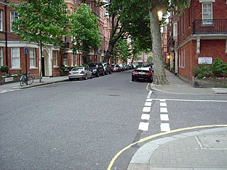
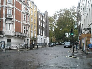
Mayfair Place is a street in the City of Westminster, London. The street joins Stratton Street to Berkeley Street.
Mayfair Place is a street in the City of Westminster, London. The street joins Stratton Street to Berkeley Street.

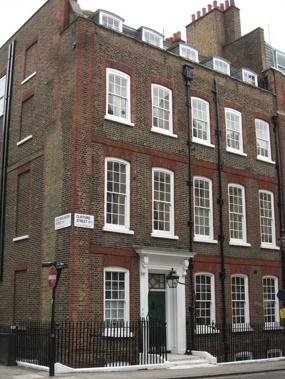
Mayfair Place was built in 1924, following the demolition of the original Devonshire House in that year. [1] The new Devonshire House, which completely takes up the south side of Mayfair Place, is a grade II listed building with Historic England. [2]

Berkeley Square is a garden square in the West End of London. It is one of the best known of the many squares in London, located in Mayfair in the City of Westminster. It was laid out in the mid 18th century by the architect William Kent, and originally extended further south. The garden's very large London Plane trees are among the oldest in central London, planted in 1789.

Hanover Square is a green square in Mayfair, Westminster, south west of Oxford Circus where Oxford Street meets Regent Street. Six streets converge on the square which include Harewood Place with links to Oxford Street, Princes Street, Hanover Street, Saint George Street, Brook Street and Tenderden Street, linking to Bond Street and Oxford Street.

Devonshire House in Piccadilly, was the London townhouse of the Dukes of Devonshire during the 18th and 19th centuries. Following a fire in 1733 it was rebuilt by William Cavendish, 3rd Duke of Devonshire, in the Palladian style, to designs by William Kent. Completed circa 1740, it stood empty after the First World War and was demolished in 1924.

The May Fair Hotel is a luxury hotel on Stratton Street in Mayfair, London, near the site of Devonshire House in Piccadilly. It opened in 1927 with King George V and Queen Mary in attendance. The hotel is now owned by Edwardian Hotels, and Inderneel Singh, son of the chairman and CEO Jasminder Singh, is the managing director.

The Punch Bowl, at 41 Farm Street, Mayfair, is a London public house, dating from circa 1750. It is listed as Grade II by English Heritage. It is a Georgian building and, although altered over the years, retains many period features including a dog-leg staircase, internal cornicing and dado panelling.

Langan's Brasserie is a restaurant situated on Stratton Street in Mayfair, London. Opened by the Irish entrepreneur Peter Langan on 20 October 1976 in partnership with the actor Michael Caine, the Brasserie quickly attracted celebrities and became hugely successful. Langan's Brasserie remains one of the most popular restaurants in London today.
Flood Street is a residential street in Chelsea, London, England. It runs between King's Road to the north and Royal Hospital Road to the south. Just further to the south is the River Thames. The closest tube station is Sloane Square to the northeast. The street commemorates Luke Thomas Flood, a major Chelsea land owner and a benefactor of the poor.

Flemings Mayfair is a luxury hotel located in the Mayfair area of London, England. It is home to Manetta's Bar, the original hangouts in the 1930s for famous artists and literati of the day; and Ormer Mayfair, a fine-dining restaurant under the direction of Sofian Msetfi. Ormer Mayfair was awarded its first Michelin star in 2024, four AA Rosettes, and is consistently voted one of the top restaurant for fine-dining in London.

The Coach and Horses is a Grade II listed public house at 5 Hill Street, Mayfair, London. It dates from the 1740s.
Clifford Street is a street in central London, built in the early 18th century, on land that once formed part of the Burlington Estate. It is named after the Clifford family, Earls of Cumberland. The daughter and heiress of the last holder of that title was the mother of the first Lord Burlington.

Thayer Street is a street in the Marylebone district of the City of Westminster, London, that contains four listed buildings.
Hinde Street is a street in the Marylebone district of the City of Westminster, London, that contains the Hinde Street Methodist Church and was home to the novelist Rose Macaulay until her death.

Mount Street is an east–west, quite narrow, archetypal street in the Mayfair district of the City of Westminster, London fronted by many mid-rise buildings, mostly of a narrow frontage. The sides of two very grand hotels flank part of either end of the street. Small, high-end property businesses, investment funds and accountancy businesses punctuate the buildings as well as a row of traditional businesses and conversion-style mansion block apartments or, more generally, authentic such homes.

Bolton Street is a street in Mayfair London, between Curzon Street to its north, and Piccadilly to its south. It is named after the Duke of Bolton, and was from its construction during the 17th century and 1708 the westernmost street of London.

Stratton Street is a street in the Mayfair district of the City of Westminster, London. It runs from Berkeley Street in the north to Piccadilly in the south.

Homer Row is a street in the Marylebone district of the City of Westminster, London, that runs form Old Marylebone Road in the north to the junction of Crawford Place and Crawford Street in the south.

The Cheshire Cheese is a public house at 5 Little Essex Street, London WC2, on the corner with Milford Lane.

South Audley Street is a major shopping street in Mayfair, London. It runs north to south from the southwest corner of Grosvenor Square to Curzon Street.

Chesterfield Street is a "virtually intact" Georgian street in London's Mayfair district. Several of the buildings are Grade II listed on the National Heritage List for England.
King Edward Street is a street in the City of London that runs from Newgate Street in the south to Little Britain in the north. It is joined by Greyfriars Passage in the west and Angel Street in the east. Postman's Park is on its east side where Bull and Mouth Street once lay and joined King Edward Street.
![]() Media related to Mayfair Place at Wikimedia Commons
Media related to Mayfair Place at Wikimedia Commons
| | This London road or road transport-related article is a stub. You can help Wikipedia by expanding it. |