| Mayo Lake | |
|---|---|
 Mayo Lake | |
| Location | Yukon |
| Coordinates | 63°45′46.7″N135°2′47″W / 63.762972°N 135.04639°W |
| Basin countries | Canada |
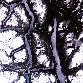
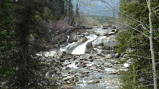
Mayo Lake is a lake of Yukon, Canada.
| Mayo Lake | |
|---|---|
| Mayo Lake | |
| Location | Yukon |
| Coordinates | 63°45′46.7″N135°2′47″W / 63.762972°N 135.04639°W |
| Basin countries | Canada |
Mayo Lake is a lake of Yukon, Canada.

Yukon is the smallest and westernmost of Canada's three territories. It is the second-least populated province or territory in Canada, with a population of 44,412 as of March 2023. Whitehorse, the territorial capital, is the largest settlement in any of the three territories.

The Yukon River is a major watercourse of northwestern North America. From its source in British Columbia, Canada, it flows through Canada's territory of Yukon. The lower half of the river continues westward through the U.S. state of Alaska. The river is 3,190 kilometres (1,980 mi) long and empties into the Bering Sea at the Yukon–Kuskokwim Delta. The average flow is 6,400–7,000 m3/s (230,000–250,000 cu ft/s). The total drainage area is 833,000 km2 (321,500 sq mi), of which 323,800 km2 (125,000 sq mi) lies in Canada. The total area is more than 25% larger than Texas or Alberta.
Atlin Lake is the largest natural lake in the province of British Columbia, Canada. The northern tip of the lake is in Yukon, as is Little Atlin Lake. However, most of the lake lies within the Atlin District of British Columbia. Atlin Lake is generally considered to be the source of the Yukon River although it is drained via the short Atlin River into Tagish Lake. Atlin Lake was named by the Tlingit First Nation people of the region.
The Atlin Road is a road in British Columbia and Yukon, Canada. It is designated as Highway 7 in Yukon, and has no official highway number in British Columbia.

Yukon is in the northwestern corner of Canada and is bordered by Alaska and the Northwest Territories. The sparsely populated territory abounds with natural scenic beauty, with snowmelt lakes and perennial white-capped mountains, including many of Canada's highest mountains. The territory's climate is Arctic in territory north of Old Crow, subarctic in the region, between Whitehorse and Old Crow, and humid continental climate south of Whitehorse and in areas close to the British Columbia border. Most of the territory is boreal forest with tundra being the main vegetation zone only in the extreme north and at high elevations.
The Ta'an Kwach'an Council or Ta'an Kwäch’än Council is a self-governing Indigenous government whose traditional territory is located around the Whitehorse and Lake Laberge area in Canada's Yukon Territory. It split from the Kwanlin Dün First Nation to negotiate a separate land claim. The language originally spoken by the Ta’an Kwäch’än was Southern Tutchone. The Ta’an Kwäch’än comprise people of Southern Tutchone, Tagish and Tlingit descent. Approximately 50 per cent of the Ta’an Kwäch’än citizens now live in Whitehorse, Yukon Territory, with the balance disbursed throughout the rest of Canada, in the United States of America, and abroad. The Ta'an Kwäch’än take their name from Tàa'an Män in the heart of their traditional territory - so they called themselves ″People from Lake Laberge″.
Tagish is an unincorporated community in Yukon, Canada. It is 30 kilometres (19 mi) east of Carcross, Yukon, on the Tagish Road at the northern end of Tagish Lake. The greater Tagish area also includes the Tagish Estates, Tagish Beach and Taku subdivisions, the latter two developed for cottages but now serving for many year-round homes. Tagish Beach and Taku have their own community hall. The Tagish Road was built in 1942 as part of an oil pipeline project, and the community sprouted around a bridge built over the narrow water between Tagish Lake and Marsh Lake.
Mount Lorne is a hamlet in Canada's Yukon. The hamlet is considered a local advisory area with an advisory council providing local government.
Marsh Lake is an unincorporated community on the Alaska Highway on the shores of Marsh Lake southeast of Whitehorse in Canada's Yukon. The area was organized in 2001, as a local area council to help the residents with some form of municipal government.
Upper Liard is a chiefly First Nation settlement immediately west of Watson Lake in Canada's Yukon. It is situated at historical mile 642 of the Alaska Highway. Most of the residents are citizens of the Liard River First Nation, who also prominently populate the Two Mile area just north of Watson Lake.
The Atsutla Range is a granitic mountain range on the Kawdy Plateau in northern British Columbia, Canada. The Atsutla Range lies south of the Yukon border in between Teslin Lake and the Stewart-Cassiar Highway, roughly 120 km (75 mi) north-northeast of Dease Lake.
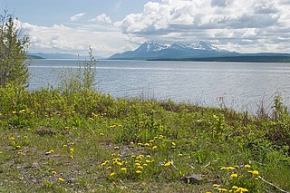
Teslin Lake is a large lake spanning the border between British Columbia and Yukon, Canada. It is one of a group of large lakes in the region of far northwestern BC, east of the upper Alaska Panhandle, which are the southern extremity of the basin of the Yukon River, and which are known in Yukon as "the Southern Lakes". The lake is fed and drained primarily by the Teslin River, south and north, but is also fed from the east by the Jennings River and the Swift River, and from the west by the Hayes River.
The Horseranch Range is a 40 km (25 mi) long north–south trending mountain range in northern British Columbia, Canada, located at the head of the Red River to the northwest of Deadwood Lake. Part of the Dease Plateau of either the Yukon Plateau or Cassiar Mountains system, it contains no glaciers and lies completely above tree line.
The Yukon Plateau is a plateau located in the Yukon Territory, comprising much of the central and southern Yukon Territory and the far northern part of British Columbia, Canada between Tagish Lake (W) and the Cassiar Mountains (E) and north of the Nakina River.
Watson Lake Cone is a cinder cone in southern Yukon, Canada, located near the British Columbia-Yukon border. It formed and last erupted during the Pleistocene period and is part of the Northern Cordilleran Volcanic Province.
Aishihik Lake is a lake in southwestern Yukon, Canada. Yukon Electric Corporation operates a 37 megawatt hydroelectric dam, built in 1975, at the south end of the lake, where it drains southward into the Aishihik River.
Frances Lake is a lake of Yukon, Canada. It is the largest lake in Southeast Yukon. Several rivers and creeks flow into Frances Lake, forming extensive deltas. The lake and surrounding area was featured in Anton Money's 1975 autobiographical book This Was the North and one of the creeks is named Money Creek after this early settler to the area.

Unorganized Yukon, or Yukon, Unorganized, is the unorganized area covering the majority of Yukon, Canada. It represents 98% of Yukon's 474,712.64 km2 (183,287.57 sq mi) land mass, and is recognized as a census subdivision by Statistics Canada.
Two Mile and Two and One-Half Mile Village is a designated place within the Town of Watson Lake in southeast Yukon, Canada that includes the Indian settlements of Two Mile Village and Two and One-Half Mile Village.
| | This article about a Yukon location is a stub. You can help Wikipedia by expanding it. |
| | This article related to a lake in Canada is a stub. You can help Wikipedia by expanding it. |