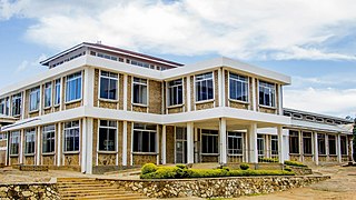
Iringa Region is one of Tanzania's 31 administrative regions. The region covers an area of 35,503 km2 (13,708 sq mi). The region is comparable in size to the combined land area of the nation state of Guinea Bissau. Iringa Region is bordered to the east by Morogoro Region and south by Njombe Region. On the west the region is bordered by Mbeya Region. Dodoma Region and Singida Region border Iringa on the north. The regional capital is the city Iringa for which the city is named after. According to the 2022 census, the region has a total population of 1,192,728. Iringa Region is home to Ruaha National Park, Tanzania's second national largest park.

Mbeya Region is one of Tanzania's 31 administrative regions. The region covers an area of 35,954 km2 (13,882 sq mi). The region is comparable in size to the combined land area of the nation state of Guinea Bissau. Mbeya Region is bordered to the east by Singida Region, Iringa Region and Njombe Region. The region is bordered to the south by Malawi and Lake Nyasa. To the north the region borders southern Tabora Region. Lastly, Mbeya is bordered to the west by Songwe Region. The regional capital is the city of Mbeya. According to the 2022 national census, the region had a population of 2,343,754.

Shinyanga Urban District is one of the eight districts of the Shinyanga Region of Tanzania and includes the city of Shinyanga. It is bordered to the north by the Mwanza Region, to the south by the Shinyanga Rural District, to the east by the Kishapu District and to the west by the Kahama Urban District.

Uyui District is one of the seven districts of the Tabora Region of Tanzania. It is bordered to the north by Nzega District and Igunga District as well as by the Shinyanga Region, to the south by Sikonge District, to the west by Urambo District and Kaliua District, and to the east by the Singida Region. Tabora Urban District is an enclave within the Uyui District. Its administrative seat is the city of Tabora.

Sikonge District is one of the seven districts of the Tabora Region of Tanzania. The town of Sikonge is the administrative seat. The district has an area of 27,873 square kilometres (10,762 sq mi), but 26,834 square kilometres (10,361 sq mi) of it is in forest and game reserves. It is bordered to the northwest by Urambo District, to the north by Uyui District, to the east by Manyoni District of Singida Region, to the south by Chunya District of Mbeya Region, and to the southwest by Mlele District of Katavi Region.

Iringa Rural District is one of the four districts of the Iringa Region of Tanzania, East Africa. It is bordered to the north by the Dodoma Region, to the east by Kilolo District and encircles Iringa Urban District, to the south by the Mufindi District, to the southwest by the Mbeya Region and to the northwest by the Singida Region.

Chunya District is one of the seven districts of Mbeya Region, Tanzania. It is bordered to the north by Tabora Region, to the northeast by Singida Region, to the east by Mbarali District, to the south by Mbeya Rural District, and to the west by Songwe District.

Mbeya Rural District is one of the seven districts of Mbeya Region, Tanzania. It is bordered to the north by Mbarali District and Chunya District, to the south by Mbeya Urban District and Rungwe District, to the east by Iringa Region and to the west by Mbozi District.

Ileje District is a district in Songwe Region, Tanzania. It is bordered to the north by Mbeya Urban and Rungwe districts, to the east by Kyela District, to the northwest by Mbozi District and to the south by Zambia and Malawi.

Mbozi District is a district in Songwe Region, Tanzania. It is bordered to the north by the Songwe District and Chunya District of the Mbeya Region, to the east by Mbeya Rural District of the Mbeya Region, to the south by the Ileje District and to the west by Momba District.

Rungwe is a District in Mbeya Region, Tanzania. It is bordered to the north by Mbeya Rural District, to the east by Busokelo District, to the southeast by Kyela District, to the southwest by Ileje District and to the west by Mbeya District.

Songea Urban District is one of the five districts in the Ruvuma Region of Tanzania. It is bordered to the north by the Songea Rural District, to the east by the Namtumbo District, to the south by Mozambique and to the west by the Mbinga District.
Bujela is an administrative ward in the Rungwe district of the Mbeya Region of Tanzania. The ward covers an area of 34.80 km2 (13.44 sq mi) with an average elevation of 937 m (3,074 ft).
Katumba is an administrative ward in the Rungwe District of the Mbeya Region of Tanzania. According to the 2002 census, the ward has a total population of 10,965.
Masukulu is an administrative ward in the Rungwe district of the Mbeya Region of Tanzania. According to the 2002 census, the ward has a total population of 9,516.
Mpuguso is an administrative ward in the Rungwe district of the Mbeya Region of Tanzania. According to the 2002 census, the ward has a total population of 12,223.
Nkunga is an administrative ward in the Rungwe district of the Mbeya Region of Tanzania. According to the 2002 census, the ward has a total population of 14,685.
Masoko is an administrative ward in Rungwe District, Mbeya Region, Tanzania. As of 2002, the ward had a total population of 14,284.
Swaya is an administrative ward in Rungwe District, Mbeya Region, Tanzania. As of 2002, the ward had a total population of 14,284.
Suma is an administrative ward in Rungwe District, Mbeya Region, Tanzania. As of 2002, the ward had a total population of 11,448.


