
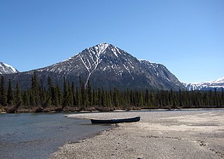
Whitehorse is the capital and only city of Yukon, and the largest city in northern Canada. It was incorporated in 1950 and is located at kilometre 1426 on the Alaska Highway in southern Yukon. Whitehorse's downtown and Riverdale areas occupy both shores of the Yukon River, which originates in British Columbia and meets the Bering Sea in Alaska. The city was named after the White Horse Rapids for their resemblance to the mane of a white horse, near Miles Canyon, before the river was dammed.

Eagle is a city on the south bank of the Yukon River near the Canada–US border in the Southeast Fairbanks Census Area, Alaska, United States. It includes the Eagle Historic District, a U.S. National Historic Landmark. The population was 86 at the 2010 census. Every February, Eagle hosts a checkpoint for the long-distance Yukon Quest sled dog race.

Dawson City, officially the Town of the City of Dawson, is a town in the Canadian territory of Yukon. It is inseparably linked to the Klondike Gold Rush (1896–99). Its population was 1,375 as of the 2016 census., making it the second largest town of Yukon.

Birch Creek is a 150-mile (240 km) tributary of the Yukon River in the U.S. state of Alaska. Beginning at the confluence of Ptarmigan and Eagle creeks near Porcupine Dome, it flows southwest, then south under the Steese Highway and into the Steese National Conservation Area. It then turns east, then north, again passing under the Steese Highway and entering the Yukon Flats National Wildlife Refuge. Turning northwest, it ends where it splits into two distributaries, Lower Mouth Birch Creek and Upper Mouth Birch Creek, near Birch Creek, Alaska. The distributaries flow into the Yukon River at separate locations downstream of Fort Yukon.

Carmacks is a village in Yukon on the Yukon River along the Klondike Highway, and at the west end of the Robert Campbell Highway from Watson Lake. The population is 493. It is the home of the Little Salmon/Carmacks First Nation, a Northern Tutchone-speaking people.

Yukon–Charley Rivers National Preserve is a United States national park and preserve located in east central Alaska along the border with Canada. Managed by the National Park Service, the preserve encompasses 115 miles (185 km) of the 1,800-mile (3,000 km) Yukon River and the entire Charley River basin. The preserve protects the undeveloped Charley River and a significant portion of the upper Yukon. The interior Alaskan region experiences extremes of weather, with temperatures that can vary from −50 °F (−46 °C) in winter to 97 °F (36 °C) in summertime. The Yukon provided a means of access to the region, which is entirely roadless, during the late 19th century and early 20th centuries. Gold rushes in Alaska brought prospectors, who operated gold dredges to recover significant quantities of placer gold from area creeks. Today the preserve includes part of the route of the annual Yukon Quest dogsled race, which runs every February. During the summer float trips are popular on the Yukon and Charley Rivers.
Pelly Crossing is a community in Yukon, Canada. It lies where the Klondike Highway crosses the Pelly River. Population in 2008 was 291.

Battlefield House near King Street East and Centennial Parkway in Stoney Creek, Hamilton, Ontario, Canada is a living history museum and site of the historic Battle of Stoney Creek on June 6, 1813, which was fought during the War of 1812. It was built in 1796. The house and 15.5 acres (6.3 ha) of parkland, were the property of the Women's Wentworth Historical Society, (1899-1962), and given by this society to the Niagara Parks Commission on January 19, 1962. The park was designated a National Historic Site of Canada in 1960.

Slaven's Cabin, also called Slaven's Roadhouse and Frank Slaven Roadhouse, is a public-use facility in the Yukon-Charley Rivers National Preserve in Alaska. The cabin is located on the Yukon River, 42 miles (68 km) southeast of Circle, Alaska, and 138 miles (222 km) northeast of Fairbanks, Alaska. It is listed on the National Register of Historic Places.
The Takhini River is a watercourse in Yukon, Canada. The river is located just north of Whitehorse, Yukon, and flows from west to east, meeting the Yukon River at a point between Whitehorse and Lake Laberge. During the winter, the river freezes and serves as part of the route of the Yukon Quest sled dog race.

Braeburn Lodge is a roadhouse on the Klondike Highway in the Yukon Territory of Canada. It is located east of Braeburn Lake and north of Braeburn Mountain, on the path of the former Dawson Overland Trail, which was built in 1902 between Whitehorse and Dawson City. The lodge itself is a tourist destination and is famous for its large cinnamon buns. Nearby Cinnamon Bun Airport is named for the lodge's cinnamon buns. Every February, Braeburn Lodge hosts a checkpoint of the long-distance Yukon Quest sled dog race.

Bonanza Creek is a watercourse in Yukon Territory, Canada. It runs for about 20 miles (32 km) from King Solomon's Dome to the Klondike River. In the last years of the 19th century and the early 20th century, Bonanza Creek was the centre of the Klondike Gold Rush, which attracted tens of thousands of prospectors to the creek and the area surrounding it. Prior to 1896 the creek was known as Rabbit Creek. Its name was changed by miners in honour of the millions of dollars in gold found in and around the creek.
Trout Creek is a small tributary of the Yukon River in the U.S. state of Alaska. It is about 11 miles (18 km) long and is located about 27 miles (43 km) northwest of the town of Eagle. In winter, a small cabin at the creek's mouth is a hospitality stop for the Yukon Quest sled dog race.
Scroggie Creek is a tributary of the Stewart River in Yukon, Canada. Every February, it forms part of the trail for the 1,000-mile Yukon Quest sled dog race. The creek has some placer gold deposits being actively mined.
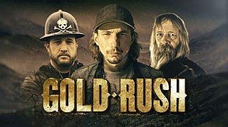
Gold Rush is a reality television series that airs on Discovery and its affiliates worldwide. The series follows the placer gold mining efforts of various family-run mining companies mostly in the Klondike region of Dawson City, Yukon, Canada, although the prospecting efforts of Todd Hoffman's 316 Mining company have ranged across both South America and western North America.
The Yukon River Quest is the world's longest annual canoe and kayak race. The Yukon River Quest's stated mission is, "To challenge paddlers in a world class wilderness event – a race to the midnight sun." The race takes place in late June / early July.


