
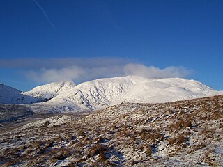
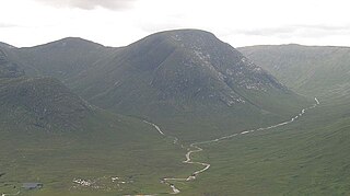
Stuchd an Lochain is a mountain in the Breadalbane region of the southern Scottish Highlands. It is a Munro, with a height of 960 metres (3,150 ft). It lies at the western end of Glen Lyon and forms the southern side of Loch an Daimh. The summit sits above a large corrie that contains a small lake called Lochan na Cat.
Meall Buidhe is a Munro situated in the southern highlands of Scotland. It forms the northern side of Loch an Daimh and is often climbed in conjunction with Stuchd an Lochain. The normal route climbs north from the eastern end of the loch until easier ground is reached. The route angles east and then north once the ridge is gained. Strong walkers can continue round the loch and take in a Corbett, Sron a' Choire Chnapanich, and the aforementioned Stuchd an Lochain.

Meall a' Bhùiridh (IPA:[ˈmauɫ̪ˈaˈvuːɾʲɪʝ]) is a mountain on the edge of Rannoch Moor in the Highlands of Scotland. It lies near the top of Glen Coe and Glen Etive, overlooking the Kings House Hotel inn and the A82 road. The Glencoe Ski area is located on the northern slopes of the peak.
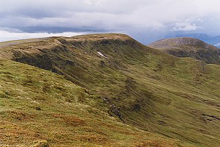
Meall Garbh is a mountain in the southern part of the Scottish Highlands. With Meall Greigh it forms the north-eastern end of the Ben Lawers range. Its craggy south face overlooks Lochan nan Cat.
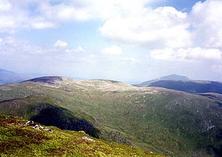
Meall Garbh is a mountain on the north side of Glen Lyon in the Scottish Highlands. The flat summit of the hill has two tops of almost equal height, the north-west one being considered the higher.
Sgùrr Eilde Mòr or Sgùrr Èilde Mhòr is a mountain in the Mamores range of the Grampian Mountains, Scotland. It is 6 kilometres north-east of Kinlochleven. It is a steep, conical peak of scree and quartzite boulders, capped with a layer of schist. With a height of 1010 m (3314 ft) it is classed as a Munro, so is popular with hillwalkers. It is most commonly climbed from Kinlochleven by way of a stalker's path which leads to a col at Coire an Lochan, and then by either the south or the west ridge - both routes involving an ascent of steep, bouldery terrain.

Creise is a mountain summit in the Black Mount range, in the Scottish Highlands. It overlooks the northern end of Glen Etive and its height is 1,100 metres (3,600 ft). Creise is one of four Munros in the Black Mount, along with Meall a' Bhuiridh, Stob Ghabhar and Stob a' Choire Odhair. The mountain is a long and flattish ridge, whose highest point was unnamed until 1981. It is popular with cross-country skiers, being near the White Corries ski area from where it is often climbed along with adjoining Meall a' Bhuiridh. The steep and craggy northern buttress, Sròn na Crèise, is well seen from the A82 road and the Kings House Hotel.

Sgùrr nan Clach Geala is a mountain in Wester Ross in the Northwest Highlands of Scotland, south of Ullapool. With a height of 1,093 metres (3,586 ft), it is one of ten Munros in the group of hills known as the Fannichs.

Càrn Mairg is a mountain in the Breadalbane region of the Scottish Highlands, with a height of 1,042 metres (3,419 ft). It stands in a group of four Munro mountains known as the 'Càrn Mairg group', on the north side of Glen Lyon, Perthshire.

Càrn Gorm is a mountain in the Breadalbane region of the Scottish Highlands, with a height of 1,029 metres (3,376 ft). It stands in a group of four Munro mountains known as the Càrn Mairg group or the Glen Lyon Horseshoe, on the north side of Glen Lyon, Perthshire.

Chno Dearg is a mountain in the Lochaber area of the Scottish Highlands. It overlooks Glen Spean to the north and Loch Treig to the west. With a height of 1,046 metres (3,432 ft), it is classed as a Munro.

Meall Greigh is a mountain in the southern part of the Scottish Highlands. With Meall Garbh it forms the north-eastern end of the Ben Lawers range.

Meall nan Tarmachan is a mountain in the Southern Highlands of Scotland near Killin just west of Ben Lawers. It is often climbed as part of the Tarmachan ridge, the other peaks of which are Meall Garbh, Beinn nan Eachan and Creag na Caillich ; these three peaks are Tops rather than Munros, and lie to the south-west of Meall nan Tarmachan.

Meall Ghaordaidh is a mountain in the Southern Highlands of Scotland, approximately 10 km north-west of Killin.

Meall Mor is a mountain in the Grampian Mountains of Scotland. It lies above the Glencoe village at the foot of Glen Coe in Lochaber, Scotland.
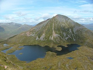
Meall nan Eun is a mountain in the Grampian Mountains of Scotland. It is located east of Glen Etive in Argyll and Bute.
Beinn a' Chapuill is a mountain in the Northwest Highlands of Scotland. It is located in Ross and Cromarty, close to the community of Glenelg.

Meall Mheinnidh is a mountain in the Northwest Highlands of Scotland. It lies in the Wester Ross region, north of Loch Maree.

Glas Bheinn (792 m) is a mountain in the Grampian Mountains of Scotland, northeast of the village of Kinlochleven in Lochaber.

Carn Dearg Mor is a mountain in the Grampian Mountains of Scotland. It lies in the Badenoch and Strathspey area of Inverness-shire, east of the town of Kingussie.

