Related Research Articles
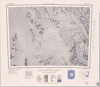
Austvollen Bluff is a steep rock bluff forming the east side of Festninga Mountain in the Mühlig-Hofmann Mountains, Queen Maud Land. It was mapped by Norwegian cartographers from surveys and from air photos by the Sixth Norwegian Antarctic Expedition (1956–60) and named "Austvollen".
Fitch Glacier is a tributary glacier that flows south along the east side of the McGregor Range to enter Man-o-War Glacier in the Admiralty Mountains of northeastern Victoria Land, Antarctica. It was mapped by the United States Geological Survey from surveys and U.S. Navy air photos taken in the years 1960–62. It was named by the Advisory Committee on Antarctic Names for Lieutenant E.E. Fitch, U.S. Navy, medical officer at Hallett Station, 1963.

The Gruber Mountains are a small group of mountains consisting of a main massif and several rocky outliers, forming the northeast portion of the Wohlthat Mountains in Queen Maud Land, Antarctica. They were discovered and plotted from air photos by the Third German Antarctic Expedition (GerAE), 1938–39, under Alfred Ritscher. The mountains were remapped by the Sixth Norwegian Antarctic Expedition, 1956–60, who named them for Otto von Gruber, the German cartographer who compiled maps of this area from air photos taken by the GerAE. This feature is not to be confused with "Gruber-Berge," an unidentified toponym applied by the GerAE in northern the Mühlig-Hofmann Mountains.
Øvrevollen Bluff is a rock and ice bluff just south of Festninga Mountain in the Mühlig-Hofmann Mountains of Queen Maud Land. It was mapped by Norwegian cartographers from surveys and air photos by the Norwegian Antarctic Expedition (1956–60) and named Øvrevollen.
Jøkulskarvet Ridge is a large mountainous ridge with an ice-capped summit, just northeast of Høgfonna Mountain in the Borg Massif of Queen Maud Land. It was mapped by Norwegian cartographers from surveys and from air photos by the Norwegian–British–Swedish Antarctic Expedition (1949–52) and named Jøkulskarvet.
Kulen Mountain is a projecting-type mountain on the northwest side of Jøkulskarvet Ridge, in the Borg Massif of Queen Maud Land, Antarctica. It was mapped and named by Norwegian cartographers from surveys and air photos by the Norwegian–British–Swedish Antarctic Expedition (1949–52).

Koms Glacier is a glacier, 5 nautical miles (9 km) long, flowing north between Mefjell Mountain and Komsa Mountain in the Sør Rondane Mountains of Antarctica. It was mapped by Norwegian cartographers in 1957 from air photos taken by U.S. Navy Operation Highjump, 1946–47, and named Komsbreen.
The Freyberg Mountains are a group of mountains in Victoria Land, Antarctica, bounded by Rennick Glacier, Bowers Mountains, Black Glacier, and Evans Neve. Named for New Zealand's most famous General, Lord Bernard Freyberg, by the Northern Party of New Zealand Geological Survey Antarctic Expedition (NZGSAE), 1963-64. This mountain group includes the Alamein Range. These topographical features all lie situated on the Pennell Coast, a portion of Antarctica lying between Cape Williams and Cape Adare.
Mount Dzhalil' is a small mountain, 2,510 metres (8,230 ft) high, in the Linnormen Hills of the Payer Mountains, in Queen Maud Land. It was mapped from air photos and surveys by the Sixth Norwegian Antarctic Expedition, 1956–60. It was remapped by the Soviet Antarctic Expedition, 1960–61, and named after Musa Dzhalil', the Soviet poet.
Isingufsa Bluff is a rock bluff forming the northeast corner of Isingen Mountain in the Sverdrup Mountains of Queen Maud Land, Antarctica. It was photographed from the air by the Third German Antarctic Expedition (1938–39). It was mapped by Norwegian cartographers from surveys and air photos by the Norwegian–British–Swedish Antarctic Expedition (1949–52) and from air photos by the Norwegian expedition (1958–59) and named Isingufsa.

Festninga Mountain is a broad, ice-topped mountain, 2,535 metres (8,320 ft) high, standing west of Mount Hochlin at the west end of the Mühlig-Hofmann Mountains, in Queen Maud Land, Antarctica. it was mapped by Norwegian cartographers from surveys and air photos by the Sixth Norwegian Antarctic Expedition (1956–60) and named Festninga. Austvollen Bluff forms the east side of the mountain.
The Flårjuvnutane Peaks are a group of small rock peaks about 1 nautical mile (2 km) west of Flårjuven Bluff, on the Ahlmann Ridge in Queen Maud Land, Antarctica. They were mapped by Norwegian cartographers from surveys and air photos by the Norwegian–British–Swedish Antarctic Expedition (1949–52) and named Flårjuvnutane.
Hålisrimen Peak is a peak, 2,655 metres (8,710 ft) high, rising 2 nautical miles (4 km) northwest of Halisstonga Peak in the Kurze Mountains of Queen Maud Land, Antarctica. It was mapped by Norwegian cartographers from surveys and air photos by the Sixth Norwegian Antarctic Expedition (1956–60) and named Hålisrimen.
The Halsknappane Hills are a group of low rock hills just west of Skorvehalsen Saddle in the eastern part of the Mühlig-Hofmann Mountains, Queen Maud Land. Antarctica. They were mapped by Norwegian cartographers from surveys and air photos by the Sixth Norwegian Antarctic Expedition (1956–60) and named Halsknappane.
Hamarskorvene Bluff is a rock and ice bluff just east of Kvithamaren Cliff in the Mühlig-Hofmann Mountains of Queen Maud Land, Antarctica. It was mapped and named by Norwegian cartographers from surveys and air photos by the Sixth Norwegian Antarctic Expedition (1956–60).
The Medmulen Spurs are a group of rock spurs extending from the north side of Risemedet Mountain, in the Gjelsvik Mountains of Queen Maud Land, Antarctica. They were mapped by Norwegian cartographers from surveys and air photos by the Sixth Norwegian Antarctic Expedition (1956–60) and named "Medmulen".
Snøbjørga Bluff is a rock and ice bluff at the east side of the head of Stuttflog Glacier, in the Mühlig-Hofmann Mountains of Queen Maud Land. It was mapped by Norwegian cartographers from surveys and air photos by the Norwegian Antarctic Expedition (1956–60) and named Snøbjørga.
Vestvollen Bluff is a rock and ice bluff forming the west side of Festninga Mountain in the Muhlig-Hofmann Mountains, Queen Maud Land. It was mapped by Norwegian cartographers from surveys and air photos by the Norwegian Antarctic Expedition (1956–60) and named Vestvollen, meaning "the west wall."
Langskavlen Glacier is a short, steep glacier flowing from the north side of Skavlhø Mountain in the Payer Mountains of Queen Maud Land, Antarctica. It was mapped by Norwegian cartographers from surveys and air photos by the Sixth Norwegian Antarctic Expedition (1956–60) and named Langskavlen.
References
- ↑ "Medhovden Bluff". Geographic Names Information System . United States Geological Survey, United States Department of the Interior . Retrieved 2013-09-12.
![]() This article incorporates public domain material from "Medhovden Bluff". Geographic Names Information System . United States Geological Survey.
This article incorporates public domain material from "Medhovden Bluff". Geographic Names Information System . United States Geological Survey.