Boechout is a municipality of Belgium located in the Flemish province of Antwerp.

Weert is a village in the municipality of Bornem, Antwerp Province, Belgium.
Sint-Maria-Oudenhove is a village in the Denderstreek and in the Flemish Ardennes, the hilly southern part of the province of East Flanders, Belgium.
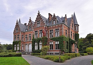
Leeuwergem is a village belonging to the municipality of Zottegem. It is located on the Molenbeek, in the Denderstreek and Flemish Ardennes, which is part of the hilly southern part of the East Flanders province, Belgium.

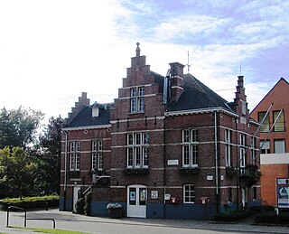
Parike is a village and deelgemeente (sub-municipality) of the municipality of Brakel. It is located in the Denderstreek in the province of East Flanders in Belgium. It used to be an independent municipality until 1977 when it was merged into Brakel.

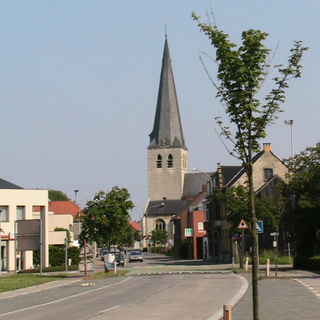
Erwetegem is a village and deelgemeente (sub-municipality) belonging to the municipality of Zottegem. It is located in the Denderstreek and in the Flemish Ardennes, the hilly southern part of the province of East Flanders, Belgium. Erwetegem used to an independent municipality until 1970.

Hingene is a village and deelgemeente (sub-municipality) of the municipality of Bornem in the province of Antwerp, Belgium. The village is bordered to the north by the Scheldt and to the east by the Rupel. It is located about 16 kilometres (9.9 mi) south-west of the city of Antwerp.
Oelegem is a village and deelgemeente (sub-municipality) of the municipality of Ranst in the province of Antwerp, Belgium. The village is located about 14 kilometres (8.7 mi) east of the city of Antwerp.

Zevergem is a village and deelgemeente (sub-municipality) of De Pinte in East Flanders, Belgium. It is located on the Scheldt about 8 kilometres (5.0 mi) south of Ghent.

Kieldrecht is a village and deelgemeente (sub-municipality) of Beveren in East Flanders, Belgium. Kieldrecht was an independent municipality until 1977, when it merged with Beveren as part of the fusion of municipalities in Belgium. The village is located on the border with the Netherlands, and forms a single urban area with the Dutch village of Nieuw-Namen.
Vrasene is a village in the municipality of Beveren in the Belgian province of East Flanders. It is located about 15 kilometres (9.3 mi) east of Antwerp.

Haasdonk is a village and deelgemeente (sub-municipality) of Beveren in East Flanders, Belgium. Haasdonk was an independent municipality until 1 January 1977, when it merged with Beveren as part of the fusion of municipalities in Belgium. It is located about 12 kilometres (7.5 mi) west of Antwerp.

Sleidinge is a village in the municipalities of Evergem in the province of East Flanders, Belgium. It is located about 10 kilometres (6.2 mi) north-west of Ghent.

Kluizen is a village in the municipalities of Evergem and Ghent in the province of East Flanders, Belgium. Large parts of the original municipality have become part of the Port of Ghent.

Meer is a village in the Belgian municipality of Hoogstraten in the province of Antwerp. As of 2021, it has 3,542 inhabitants.

Minderhout is a village in the Belgian municipality of Hoogstraten in the province of Antwerp close to the border with the Netherlands. As of 2021, it has about 4,420 inhabitants.
Loenhout is a village and deelgemeente (sub-municipality) of the municipality of Wuustwezel in the province of Antwerp, Belgium. The village is located near the Dutch border, and about 26 kilometres (16 mi) north-east of the city of Antwerp.
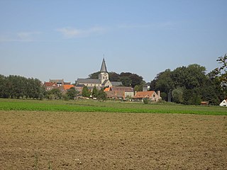
Huise is a village on a hill within the municipality of Zingem, part of the province of East Flanders in Belgium.

Kallo is a village and deelgemeente (sub-municipality) of Beveren in East Flanders, Belgium. Kallo was an independent municipality until 1 January 1977, when it merged with Beveren as part of the fusion of municipalities in Belgium. Most of the deelgemeente consists of harbours and industrial zones.
Ouwegem is a village and deelgemeente (sub-municipality) in the municipality of Kruisem in the province of East Flanders in Belgium. The village is located on the edge of the Flemish Ardennes and about 17 kilometres (11 mi) south-west of Ghent.