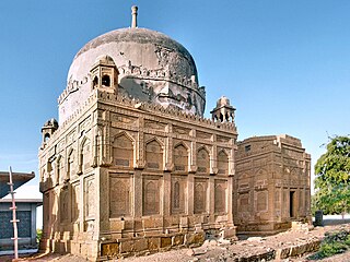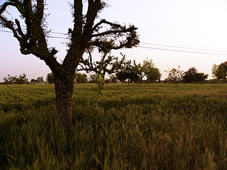
Rajasthan is a state in northwestern India. It covers 342,239 square kilometres (132,139 sq mi) or 10.4 per cent of India's total geographical area. It is the largest Indian state by area and the seventh largest by population. It is on India's northwestern side, where it comprises most of the wide and inhospitable Thar Desert and shares a border with the Pakistani provinces of Punjab to the northwest and Sindh to the west, along the Sutlej-Indus River valley. It is bordered by five other Indian states: Punjab to the north; Haryana and Uttar Pradesh to the northeast; Madhya Pradesh to the southeast; and Gujarat to the southwest. Its geographical location is 23°.3' to 30°.12' North latitude and 69°.30' to 78°.17' East longitude, with the Tropic of Cancer passing through its southernmost tip.

Chhatarpur is a city and a municipality in Chhatarpur district in the state of Madhya Pradesh, India. It is the administrative headquarters of Chhatarpur District.

Jodhpur is the second-largest city of the north-western Indian state of Rajasthan after its capital Jaipur. As of 2023, the city has a population of 1.83 million. It serves as the administrative headquarters of the Jodhpur district and Jodhpur division. It is historic capital of the Kingdom of Marwar, founded in 1459 by Rao Jodha, a Rajput chief of the Rathore clan. On 11 August 1947, 4 days prior to the Indian independence, Maharaja Hanwant Singh the last ruler of Jodhpur state signed the Instrument of Accession and merged his state in Union of India. On 30 March 1949, it became part of the newly formed state of Rajasthan, which was created after merging the states of the erstwhile Rajputana Agency.

Mirpur Khas is a city in Sindh province, Pakistan. The city was built by Talpur rulers of Mankani branch. According to the 2017 Census of Pakistan, its population was 205,913. Mirpur Khas is known for its mango cultivation, with hundreds of varieties of the fruit produced each year - it is also called the “City of Mangoes,” and has been home to an annual mango festival since 1955. After the completion of Hyderabad-Mirpurkhas dual carriage way, the city has become hub of commercial activities.

Marwar is a region of western Rajasthan state in North Western India. It lies partly in the Thar Desert. The word 'maru' is Sanskrit for desert. The word "wad" literally means fence in Rajasthani languages. English translation of the word 'Marwar' is the region protected by desert.

Sri Ganganagar is the northernmost city of the Indian state of Rajasthan, near the international border of India and Pakistan. It is the administrative headquarters of Sri Ganganagar district. It is named after Maharaja Shri Ganga Singh Bahadur, Maharaja of Bikaner. The city is also known as the "Food Basket of Rajasthan".

Tirunelveli district is one of the 38 districts of Tamil Nadu state in India. It is the largest district in terms of area with Tirunelveli as its headquarters. The district was formed on 1 September 1790 by the British East India Company and comprised the present Tirunelveli and Thoothukudi, Tenkasi and parts of Virudhunagar and Ramanathapuram district. As of 2011, the undivided district had a population of 30,77,233.

Barmer District is a district in Rajasthan state of India. It is located in the western part of Rajasthan state forming a part of the Thar Desert. Barmer is the third largest district by area in Rajasthan and fifth largest district in India, occupying an area of 28,387 km2. Being in the western part of the state, it includes a part of the Thar Desert. Jaisalmer is to the north of this district while Jalore is in its south. Pali and Jodhpur form its eastern border and it shares a border with Pakistan in the west. Partially being a desert, this district has a large variation in temperature. The temperature in summer can rise up to 51 °C and falls near to 0 °C in winter. Luni is the longest river in Barmer district. After travelling a length of almost 500 km, it passes through Jalore and merges in the marshy land of Runn of Kutch. District headquarters is in the town of Barmer. The other major towns in the district are: Balotra, Guda Malani, Baytoo, Siwana, and Chohatan. Recently, a large onshore oil field has been discovered and made functional in Barmer district. Barmer is also famous for pomegranate.

Jaisalmer district is the largest district in the Indian state of Rajasthan, and the third largest district in India. Located in Marwar, the city of Jaisalmer is the administrative headquarters of the district. It is around 289 km (180 mi) from the city of Jodhpur, and around 559 km (347 mi) from Jaipur, the capital of Rajasthan. As of the 2011 population census, it is the least populous district out of all 50 districts in Rajasthan.
Ilkal is a City in Bagalkot district in the Indian state of Karnataka. The town is located in a valley that lies in south-east corner of Bagalkot district and is quite close to the borders of Kushtagi taluk of the Koppal district. Now Ilkal city becomes taluk previous the city falls within the jurisdiction of Hungund taluk and lies at a distance of about 12 km (7.5 mi) south of taluk headquarters. Between these two towns, Ilkal is an important centre of trade, commerce, education, and industry. Ilkal is well connected with state and national highways. It is also famous for its hospitality and education institutions.
Kalavai is a panchayat town in Ranipet district in the Indian state of Tamil Nadu. The main occupation represented in the area is farming. The town has a pond and a lake after rainy season. Villagers use the lake water and palar river for irrigation. Corporation Bank, State Bank Of India and Indian Bank are the banks that have branches in the locality. The secondary occupation is garment outlets. One government higher secondary school is also located in a nearby village.

Kalol is a city in Gandhinagar district in the Indian state of Gujarat, located alongside Gujarat State Highway 41 between the cities of Mehsana and Ahmedabad.
Phalodi is a city in Phalodi district in the Indian state of Rajasthan. It is the headquarters for Phalodi district. Phalodi is also called the "salt city" due to the salt industry in Rin. Phalodi is in the buffer zone of Thar Desert and often subject to extreme temperature conditions due to its arid climate. The highest temperature in the history of Phalodi is 51°C, which is the highest ever verified temperature in the country.
Degana is a town municipality and headquarter to Sub-Division and Tehsil located in Nagaur district of Rajasthan, India.

Rajasthan is a mineral-rich state having agriculture, mining and tourism as its main engines of growth. The state mines produce gold, silver, sandstone, limestone, marble, rock phosphate, copper and lignite. It is the second-largest producer of cement and contributes one tenth of the salt produced in India.

The Culture of Rajasthan has developed over the past millennia, Rajasthan is the largest state in India, is known for its rich cultural heritage, vibrant traditions, and historical significance. The culture of Rajasthan is a blend of various elements, including music, dance, cuisine, festivals, art, and architecture.

Dhani or Thok is a type of hamlet, the smallest conglomeration of houses, in the sandy Bagar region of the northwestern states of Rajasthan, Haryana and Punjab in India. Per the Census of India, 70% of Indians live in villages. 80% of the villages have a population of less than 1000 people and each consists of a cluster of hamlets. Most dhanis are nucleated settlements, while others are more dispersed. A dhani could be as small as one isolated house for a single family or a small cluster of several houses which could grow in number with successive generations, and even become a village by itself. All families living in a dhani are relatives or at least are of the same caste. An isolated collection of several dhanis, which could be few hundred meters apart, constitutes a gram panchayat village community. A typical dhani in the arid zone of Rajasthan is a cluster of huts with a boundary made of dried shrubs around it and with owners' livestock such as goats, sheep and camels inside the bara. Dhani are atypically mud huts in Rajasthan. Houses in dani nowadays are made of modern brick and mortar, specially in affluent higher-per-capita-income states of Haryana and Punjab, and some richer families of Rajasthan.

Bhoodha Ka Bas is a village in the Laxmangarh administrative region of the Sikar district of Indian state Rajasthan. Bhoodha Ka Bas village is separated from the Beerodi Bari village and situated in the north-east side of the Sikar district. Village is situated approximately 22 kilometres (14 mi) east of Laxmangarh town and 4 kilometres (2.5 mi) west of Nawalgarh town.
Arnay is a village in the Sanchore district, Rajasthan, India. Arnay is situated 18km from tehsil headquarters. Agriculture is the main occupation of this village. The population of this village is 6,312 according to Census 2011. This village has an average literacy rate of 52%; male literacy is 65% and female literacy is 38%.

Kigwema is a village in the southern region of Nagaland, India. It is located in Jakhama Circle of Kohima District. The village is located 15 km (9.3 mi) south of Kohima, the capital of Nagaland.


