The Platte River is a tributary of the Mississippi River in central Minnesota in the United States. It is 55.1 miles (88.6 km) long. Platte is a name derived from the French meaning "flat".

Krzywiec is a village in the administrative district of Gmina Aleksandrów Łódzki, within Zgierz County, Łódź Voivodeship, in central Poland. It lies approximately 5 kilometres (3 mi) south of Aleksandrów Łódzki, 12 km (7 mi) south-west of Zgierz, and 13 km (8 mi) west of the regional capital Łódź.
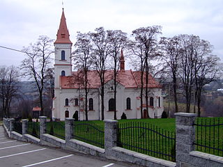
Dylągowa is a village in the administrative district of Gmina Dynów, within Rzeszów County, Subcarpathian Voivodeship, in south-eastern Poland. It lies approximately 8 kilometres (5 mi) south-east of Dynów and 36 km (22 mi) south-east of the regional capital Rzeszów.
Duża Klonia is a village in the administrative district of Gmina Czersk, within Chojnice County, Pomeranian Voivodeship, in northern Poland.
Ostrowy is a village in the administrative district of Gmina Czersk, within Chojnice County, Pomeranian Voivodeship, in northern Poland.
Gosław is a village in the administrative district of Gmina Polanów, within Koszalin County, West Pomeranian Voivodeship, in north-western Poland. It lies approximately 13 kilometres (8 mi) south-east of Polanów, 45 km (28 mi) south-east of Koszalin, and 159 km (99 mi) north-east of the regional capital Szczecin.

The Amthausgasse is one of the streets in the Old City of Bern, the medieval city center of Bern, Switzerland. It is part of the Innere Neustadt which was built during the expansion of 1255 to 1260. One building, a Burgher house at Amthausgasse 5 is listed on the Swiss inventory of heritage site of national significance and it is part of the UNESCO Cultural World Heritage Site that encompasses the Old City.

The Pfeiferbrunnen is a fountain near Spitalgasse 21 in Bern, Switzerland. It is one of the Old City of Bern's 16th-century fountains and is part of the list of Swiss heritage sites of national significance.
Menzel Ennour is a town and commune in the Monastir Governorate, Tunisia.

Šeganje is a village in the municipality of Višegrad, Bosnia and Herzegovina.

Bettwiesen Castle is a castle in the municipality of Bettwiesen of the Canton of Thurgau in Switzerland. It is a Swiss heritage site of national significance.
Unterhof Castle is a castle in the municipality of Diessenhofen of the Canton of Thurgau in Switzerland. It is a Swiss heritage site of national significance.
Freudenfels Castle is a castle in the municipality of Eschenz of the Canton of Thurgau in Switzerland. It is a Swiss heritage site of national significance.
Tannegg Castle is a castle in the municipality of Fischingen of the Canton of Thurgau in Switzerland. It is a Swiss heritage site of national significance.

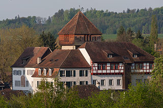
Frauenfeld Castle is a castle in the municipality of Frauenfeld of the Canton of Thurgau in Switzerland. It is a Swiss heritage site of national significance.
Hauptwil Castle is a castle in the municipality of Hauptwil-Gottshaus of the Canton of Thurgau in Switzerland. It is a Swiss heritage site of national significance.

Mammern Castle is a castle in the municipality of Mammern of the Canton of Thurgau in Switzerland. It is a Swiss heritage site of national significance.

Louisenberg Castle is a castle in the municipality of Salenstein of the Canton of Thurgau in Switzerland. It is a Swiss heritage site of national significance.

Sonnenberg Castle is a castle in the municipality of Stettfurt of the Canton of Thurgau in Switzerland. It is a Swiss heritage site of national significance.

The Théâtre du Jorat, inaugurated 9 May 1908, is a theater hall located in the Vaud commune of Mézières, about 20 km from Lausanne, in the Jorat region.


