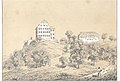
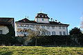
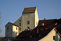
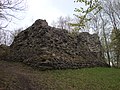
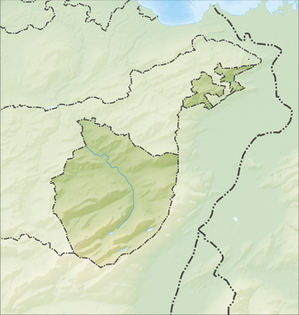
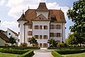
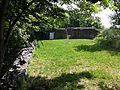
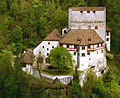
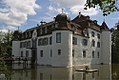
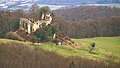
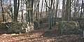
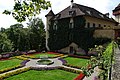
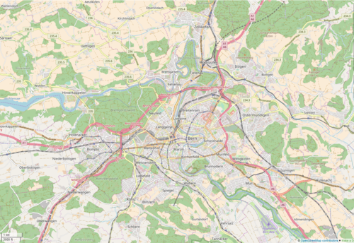
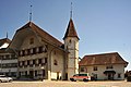
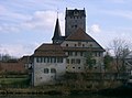
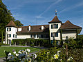
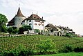
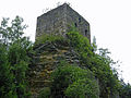
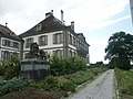
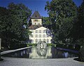
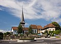
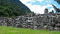
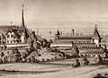
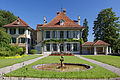
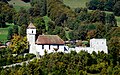
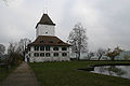
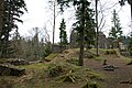
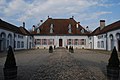
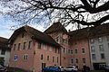
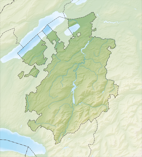
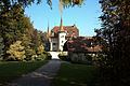
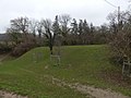
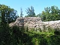
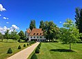
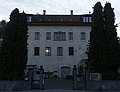
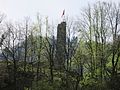
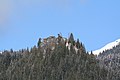
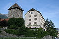
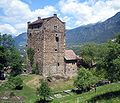
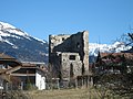
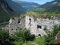
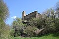
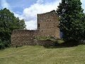
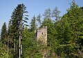
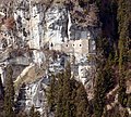
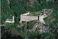
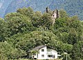
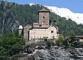
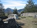
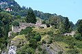
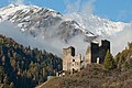
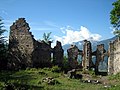
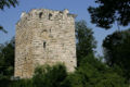
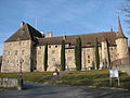
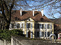
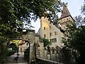
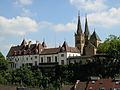
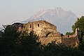
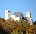
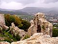
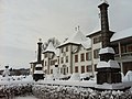
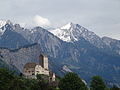
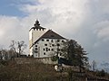
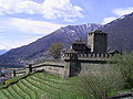
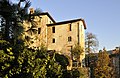
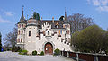
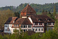
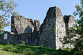
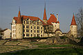
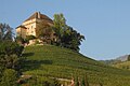
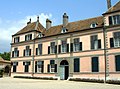
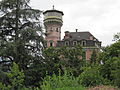
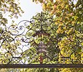
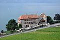
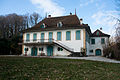
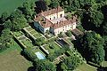
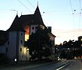
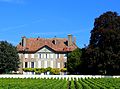
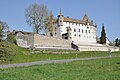
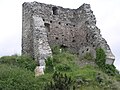
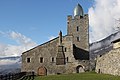
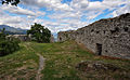
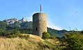
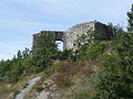
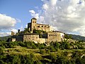
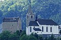
List of castles and fortresses in Switzerland

Last updated

Schloss Rapperswil as seen from Seedamm (December 2009) Rapperswil - Schloss - Holzbrucke IMG 3874.JPG
Schloss Rapperswil as seen from Seedamm (December 2009)

This list includes castles and fortresses in Switzerland.

Contents

Entries list the name and location of the castle, fortress or ruins in each Canton in Switzerland.

Aargau

Reliefkarte Aargau blank.png
Red pog.svg
Schlossli
Red pog.svg
Aarburg
Red pog.svg
Altenburg
Red pog.svg
Alt-Wartburg
Red pog.svg
Auenstein
Red pog.svg
Bernau
Red pog.svg
Biberstein
Red pog.svg
Bottstein
Red pog.svg
Brestenberg
Red pog.svg
Brunegg
Red pog.svg
Freudenau
Red pog.svg
Habsburg
Red pog.svg
Hallwyl
Red pog.svg
Hilfikon
Red pog.svg
Horben
Red pog.svg
Alt-Homberg
Red pog.svg
Iberg
Red pog.svg
Kasteln
Red pog.svg
Klingnau
Red pog.svg
Landvogteischloss
Red pog.svg
Laufenburg
Red pog.svg
Lenzburg
Red pog.svg
Liebegg
Red pog.svg
Rued
Red pog.svg
Schafisheim
Red pog.svg
Schenkenberg
Red pog.svg
Schwarzer
Red pog.svg
Schwarzwasserstelz
Red pog.svg
Stein
Red pog.svg
Tegerfelden
Red pog.svg
Alt-Thierstein
Red pog.svg
Trostburg
Red pog.svg
Urgiz
Red pog.svg
Waldhausen
Red pog.svg
Wildenstein
Red pog.svg
Wildegg
Castles in Aargau
NameImageLocationTypeDateNotes
Aarburg Castle Aarburg-Burg-02.jpg Aarburg
47°19′17.91″N7°54′3.36″E / 47.3216417°N 7.9009333°E / 47.3216417; 7.9009333
12th century, 1659–1673Houses Kantonale Jugendheim, for juvenile offenders
Altenburg Castle Altenburg Schloesschen.jpg Brugg
47°28′55.24″N8°11′39.62″E / 47.4820111°N 8.1943389°E / 47.4820111; 8.1943389
Roman fort 370
Medieval castle 10th century
Includes part of a Roman wall. Today a youth hostel
Auenstein Castle Auenstein Schloss.jpg Auenstein
47°24′55.48″N8°8′23.17″E / 47.4154111°N 8.1397694°E / 47.4154111; 8.1397694
13th centuryPrivately owned, not open to the public
Bernau Castle Schloss Bernau im Aargau.jpg Leibstadt
47°35′43″N8°10′20″E / 47.59528°N 8.17222°E / 47.59528; 8.17222
Ruined hill castle 1157Ruined castle, destroyed in 1844
Biberstein Castle CH-NB - Biberstein, Schloss, von Osten - Collection Gugelmann - GS-GUGE-WOLF-C-3.tif Biberstein
47°24′47.60″N8°5′0.70″E / 47.4132222°N 8.0835278°E / 47.4132222; 8.0835278
around 1280Group home for adults
Böttstein Castle Schloss Bottstein Tor 1.JPG Böttstein
47°33′14.80″N8°13′27.23″E / 47.5541111°N 8.2242306°E / 47.5541111; 8.2242306
1100–1200Became headquarters of Beznau Nuclear Power Plant construction in 1965, converted to restaurant and hotel in 1974
Brestenberg Castle Brestenberg.jpg Seengen
47°19′11.50″N8°12′29.52″E / 47.3198611°N 8.2082000°E / 47.3198611; 8.2082000
1625Museum
Brunegg Castle Schloss Brunegg 1792.jpg Brunegg
47°25′19.78″N8°12′52.16″E / 47.4221611°N 8.2144889°E / 47.4221611; 8.2144889
13th century
Freudenau Castle Ruine Freudenau 01.jpg Untersiggenthal
47°30′44.5″N8°14′2.5″E / 47.512361°N 8.234028°E / 47.512361; 8.234028
Ruined lowland castle around 1240Ruined castle
Habsburg Castle Picswiss AG-24-05.jpg Habsburg
47°27′45.86″N8°10′51.74″E / 47.4627389°N 8.1810389°E / 47.4627389; 8.1810389
hill castle, summit location Around 1020/30 to 1300Original home of the Habsburg family
Hallwyl Castle Schloss Hallwyl July 21st 2005.jpg Seengen
47°19′23.5″N8°11′39″E / 47.323194°N 8.19417°E / 47.323194; 8.19417
water castle 1265Part of Cantonal Museum
Hilfikon Castle Schloss Hilfikon.jpg Hilfikon
47°19′51″N8°14′49″E / 47.33071°N 8.24692°E / 47.33071; 8.24692
1290
Alt Homberg Castle Wittnau, Aargau
47°29′28″N7°58′23″E / 47.491056°N 7.972999°E / 47.491056; 7.972999
Ruined castlearound 1100Only fragments still visible
Horben Castle Schloss Horben 03.JPG Beinwil (Freiamt)
47°13′12.29″N8°19′36.34″E / 47.2200806°N 8.3267611°E / 47.2200806; 8.3267611
1700Privately owned
Iberg Castle Riniken Iberg Burgmauer 8028.jpg Iberg, Riniken
47°30′20.01″N8°11′12.64″E / 47.5055583°N 8.1868444°E / 47.5055583; 8.1868444
Ruined hill castle 11th century
Kasteln Castle Oberflachs SchlossKasteln.jpg Oberflachs
47°26′32.57″N8°07′08.87″E / 47.4423806°N 8.1191306°E / 47.4423806; 8.1191306
1238School for special needs students
Klingnau Castle Klingnau Schloss.jpg Klingnau
47°34′51.75″N8°14′54.29″E / 47.5810417°N 8.2484139°E / 47.5810417; 8.2484139
Castle After 1239Residence of Bishop of Constance in 14th century. Today privately owned
Landvogtei Castle Baden
Laufenburg Castle Laufenburg
Lenzburg Castle Schloss Lenzburg - Gesamtansicht1.jpg Lenzburg
47°23′15″N8°11′08″E / 47.38738°N 8.18548°E / 47.38738; 8.18548
hill castle before 1036Originally home of the Counts of Lenzburg. Now part of the Cantonal Museum
Liebegg Castle Liebegg.jpg Gränichen
47°20′11″N8°07′04″E / 47.33630°N 8.11770°E / 47.33630; 8.11770
hill castle 1150-1200Cantonal Agricultural School beginning 1958. Between 1983 and 1998 home to the Cantonal Teacher's College
Rued Castle Schlossrued
Schafisheim Castle Schafisheim
Schwarzwasserstelz Castle Fisibach
Schenkenberg Castle Ruine Schenkenberg.jpg Thalheim
47°26′31.16″N8°06′2.66″E / 47.4419889°N 8.1007389°E / 47.4419889; 8.1007389
Ruined hill castle 1243Originally residence of ministeriales family.
Schlössli Aarau
Schöftland Castle Schöftland
Schwarzer Turm Brugg
Stein Castle Baden Stein 9664.jpg Baden
47°28′23.38″N8°18′19.62″E / 47.4731611°N 8.3054500°E / 47.4731611; 8.3054500
hill castle Before 1000, 1658–1670Destroyed in 1415 by the Swiss Confederation. Rebuilt in 1658-70, demolished in 1712
Alt-Thierstein Castle Gipf-Oberfrick Ruined Castle
Tegerfelden Castle Tegerfelden
Trostburg Castle Trostburg in Teufenthal.JPG Teufenthal
47°19′51.38″N8°07′06.49″E / 47.3309389°N 8.1184694°E / 47.3309389; 8.1184694
hill castle 120019th century music box factory, partially repaired in 1999
Urgiz Castle Densbüren Ruined Castle
Waldhausen Castle Fisibach
Alt-Wartburg Castle Oftringen
Wildenstein Castle Veltheim
Wildegg Castle Möriken-Wildegg 1242

Appenzell Ausserrhoden

NameImageLocationTypeDateNotes
Rosenberg Ruine Rosenberg.jpg Herisau-Burghalden
47°23′47″N9°16′55″E / 47.3964°N 9.2819°E / 47.3964; 9.2819
Ruined hill castle about 1150Ruined castle
Rosenburg/Ramsenberg Ruine Ramsenburg innen Eingang Turm.JPG Herisau
47°23′18″N9°15′16″E / 47.3883°N 9.2544°E / 47.3883; 9.2544
Ruined hill castle about 1150Ruined castle
Urstein Castle Herisau
47°23′07″N9°19′28″E / 47.38516°N 9.32438°E / 47.38516; 9.32438

Appenzell Innerrhoden

Reliefkarte Appenzell Innerrhoden blank.png
Castles in Appenzell Innerrhoden
NameImageLocationTypeDateNotes
Appenzell Castle Appenzell Schloss sw.JPG Appenzell
47°19′48″N9°24′35″E / 47.329947°N 9.409615°E / 47.329947; 9.409615
Manor house1563Original owner Antoni Löw executed 1584. 1584-1682 used as Franciscan monastery. Today known as "Doctor's House" and privately owned.
Clanx Castle Appenzell
47°20′50″N9°24′40″E / 47.347312°N 9.411171°E / 47.347312; 9.411171
Ruined castle1219Burned during Appenzell Wars. Ruins rediscovered in 1885.
Hoch-Altstätten Castle Oberegg
47°24′01″N9°32′40″E / 47.40023°N 9.54442°E / 47.40023; 9.54442
Ruins

Basel-Land

NameImageLocationTypeDateNotes
Aesch Castle Schloss Aesch von Osten mit Springbrunnen wiki.jpg Aesch
47°27′12″N07°35′39″E / 47.45333°N 7.59417°E / 47.45333; 7.59417
Manor house1606Now municipal administration building
Altenberg Castle Burg Altenberg Fullinsdorf.jpg Füllinsdorf
47°30′34.31″N7°44′23.84″E / 47.5095306°N 7.7399556°E / 47.5095306; 7.7399556
Ruinsabout 1000
Angenstein Castle Angenstein-Uebersicht-Schloss.jpg Duggingen
47°27′47.89″N7°36′17.3″E / 47.4633028°N 7.604806°E / 47.4633028; 7.604806
Partly ruined hill castleMid 13th century
Bärenfels Castle Duggingen Ruins
Burg Castle (Burg im Leimental) Picswiss BL-62-10.jpg Burg im Leimental
47°27′25″N7°26′26″E / 47.456807°N 7.440613°E / 47.456807; 7.440613
hill castle about 1250
Alt-Biederthal Castle Burg im Leimental Ruins
Binningen Castle Binningen
Hintere Birseck Castle Arlesheim
Vordere Birseck Castle Birseck.jpg Arlesheim
47°29′31″N7°37′43″E / 47.49194°N 7.62861°E / 47.49194; 7.62861
hill castle 1243/44Partially ruined castle, outer castle well preserved
Mittlere Birseck Castle Arlesheim
Bischofstein Castle Bischofstein-Uebersicht.jpg Sissach
47°28′28.72″N7°49′37.32″E / 47.4746444°N 7.8270333°E / 47.4746444; 7.8270333
Ruined hill castle Mid 13th centuryExtensive, preserved walls
Bottmingen Castle Picswiss BL-45-03.jpg Bottmingen
47°31′25″N7°34′13″E / 47.523701°N 7.570191°E / 47.523701; 7.570191
water castle 13th century
Ebenrain Castle Sissach-Schloss-Ebenrain.jpg Sissach
47°27′51″N7°48′18″E / 47.464228°N 7.80496°E / 47.464228; 7.80496
Manor house1774-76
Engenstein Castle Pfeffingen
Farnsburg Castle Farnsburg-Uebersicht.jpg Ormalingen
47°29′35.5″N7°52′14.05″E / 47.493194°N 7.8705694°E / 47.493194; 7.8705694
Ruined hill castle Between 1319 and 1342Ruined castle
Frohberg Castle Frohberg-Suedmauer.jpg Aesch
47°28′4.25″N07°33′43.1″E / 47.4678472°N 7.561972°E / 47.4678472; 7.561972
Ruined hill castle Late 13th centuryRuined castle
Fürstenstein Castle Ettingen Ruined castle
Gutenfels Castle Bubendorf Ruined castle
Holeeschlösschen Castle Binningen
Neu-Homburg Castle Ruine Homburg Schweiz Basel-Landschaft Homburgertal.jpg Läufelfingen
47°24′10.5″N7°51′18″E / 47.402917°N 7.85500°E / 47.402917; 7.85500
hill castle 1240Ruined castle residence of counts.
Madeln Castle Pratteln Ruined castle
Münchenstein Castle Westuebersicht Schloss Muenchenstein wiki.jpg Münchenstein
47°30′45.22″N07°37′17.1″E / 47.5125611°N 7.621417°E / 47.5125611; 7.621417
Ruined hill castle likely 1260 to 1275Ruined castle residence of Ministerialis.
Münchsberg Castle Pfeffingen Ruined castle
Ödenburg Castle Wenslingen Ruined castle
Pfeffingen Castle Pfeffingen.jpg Pfeffingen
47°27′12″N7°35′29″E / 47.45333°N 7.59139°E / 47.45333; 7.59139
Ruined hill castle about 1135Ruined castle
Schloss Pratteln Pratteln
Ränggen Castle Diegten Ruined castle
Ramstein Castle Bretzwil Ruined castle
Reichenstein Castle Burg Reichenstein bei Arlesheim - 0112.jpg Arlesheim
47°29′48.50″N7°37′44.61″E / 47.4968056°N 7.6290583°E / 47.4968056; 7.6290583
hill castle 1239 (first mention)
Riedfluh Castle Eptingen Ruined castle
Schalberg Castle Pfeffingen Ruined castle
Alt-Schauenburg Castle Alt-Schauenburg-Schildmauer+Zugang.jpg Frenkendorf
47°29′44.0″N7°40′23.7″E / 47.495556°N 7.673250°E / 47.495556; 7.673250
Ruined hill castle, spur castle 1275/1280
Neu-Schauenburg Castle Neu-Schauenburg-Lage-Uebersicht.jpg Frenkendorf
47°30′2.07″N7°40′56.5″E / 47.5005750°N 7.682361°E / 47.5005750; 7.682361
Ruined hill castle 12th century
(possible 11th century)
Destroyed in 1356 Basel earthquake, rebuilt then abandoned. 1480-1523 a cloistered house for Beguines lay sisters
Schönenberg Castle Burg im Leimental Ruined castle
Sissacherfluh Castle Sissacherfluh-Tor-innen.jpg Sissach
47°28′49.55″N7°49′4.05″E / 47.4804306°N 7.8177917°E / 47.4804306; 7.8177917
Ruined refuge castle Ruined castle, first used in Bronze Age, again in Early Middle Ages and Thirty Years' War
Spitzburg Castle Ramlinsburg Ruined castle
Fortified Church of St. Arbogast Muttenz St Arbogast.jpg Muttenz
47°31′20″N7°38′44″E / 47.52222°N 7.64556°E / 47.52222; 7.64556
Fortified church 1100Only fortified church remaining in Switzerland. Still an active church
Waldenburg Castle Waldenburg
Hintere Wartenberg Castle Muttenz Ruined castle
Mittlere Wartenberg Castle Muttenz Ruined castle
Vordere Wartenberg Castle Muttenz Ruined castle
Wild-Eptingen Castle Eptingen Ruined castle
Wildenstein Castle Gartenanlage Schloss Wildenstein.jpg Bubendorf
47°25′54″N7°44′9″E / 47.43167°N 7.73583°E / 47.43167; 7.73583
about 1200Owned by the municipality
Zwingen Castle Zwingen

Basel-Stadt

Reliefkarte Basel-Stadt blank.png
Castles in Basel Stadt
NameImageLocationTypeDateNotes
Gundeldingen Castle 008 BS Schlosschen gundeldingen.jpg Basel
47°32′24″N7°35′32″E / 47.539944°N 7.592092°E / 47.539944; 7.592092
Manor house 14th centuryFour castles of which parts remain of only two

Bern

Reliefkarte Bern blank.png
Red pog.svg
Aarberg
Red pog.svg
Aarwangen
Red pog.svg
Allmendingen
Red pog.svg
Amsoldingen
Red pog.svg
Aris ob Kien
Red pog.svg
Belp
Red pog.svg
Bipp
Red pog.svg
Blankenburg
Red pog.svg
Brandis
Red pog.svg
Burgdorf
Red pog.svg
Büren
Red pog.svg
Burgistein
Red pog.svg
Erguel
Red pog.svg
Erlach
Red pog.svg
Felsenburg
Red pog.svg
Gampelen
Red pog.svg
Grasburg
Red pog.svg
Grünenberg
Red pog.svg
Hindelbank
Red pog.svg
Hofwil
Red pog.svg
Hünegg
Red pog.svg
Hünigen
Red pog.svg
Jegenstorf
Red pog.svg
Landshut
Red pog.svg
Laupen
Red pog.svg
Upper Mannenberg
Red pog.svg
Mülenen
Red pog.svg
Münchenwiler
Red pog.svg
Münsingen
Red pog.svg
Nidau
Red pog.svg
Oberdiessbach
Red pog.svg
Oberhofen
Red pog.svg
Oberried
Red pog.svg
Restiturm
Red pog.svg
Riggisberg
Red pog.svg
Ringgenberg
Red pog.svg
Rümligen
Red pog.svg
Schlossberg
Red pog.svg
Schlosswil
Red pog.svg
Schadau
Red pog.svg
Schwarzenburg
Red pog.svg
Spiez
Red pog.svg
Tellenburg
Red pog.svg
Thorberg
Red pog.svg
Thun
Red pog.svg
Thunstetten
Red pog.svg
Toffen
Red pog.svg
Trachselwald
Red pog.svg
Unspunnen
Red pog.svg
Wangen an der Aare
Red pog.svg
Wartenstein
Red pog.svg
Weissenburg
Red pog.svg
Wimmis
Red pog.svg
Worb
Red pog.svg
Alt-Signau
Red pog.svg
Neu-Signau
Red pog.svg
Wiedlisbach
Castles in the Canton of Bern
Bern Switzerland Regional Map.png
Red pog.svg
Bremgarten
Red pog.svg
Altes Bümpliz
Red pog.svg
Neues Bümpliz
Red pog.svg
Felsenburg
Red pog.svg
Gümligen
Red pog.svg
Holligen
Red pog.svg
Ittigen
Red pog.svg
Köniz
Red pog.svg
Kehrsatz
Red pog.svg
Lohn
Red pog.svg
Muri
Red pog.svg
Reichenbach
Red pog.svg
Wittigkofen
Castles near Bern city
NameImageLocationTypeDateNotes
Aarberg Castle Schloss Aarberg 01 10.jpg Aarberg
47°2′37.32″N7°16′32.52″E / 47.0437000°N 7.2757000°E / 47.0437000; 7.2757000
13th centuryresidence of ministeriales.
Aarwangen Castle Schlossaarwangen.JPG Aarwangen
47°14′45″N7°45′48″E / 47.245722°N 7.763425°E / 47.245722; 7.763425
1300built by the Walter von Aarwangen. Owned by the Canton of Bern, open to the public
Allmendingen Castle Schloss Allmendingen.JPG Allmendingen
46°55′00″N7°31′20″E / 46.9166°N 7.5223°E / 46.9166; 7.5223
Before 1239
Amsoldingen Castle SchlossAmsoldingen 6354.jpg Amsoldingen
46°43′38″N7°34′44″E / 46.727182°N 7.578859°E / 46.727182; 7.578859
Castle10th centuryOwned by the Canton of Bern, not open to the public
Aris ob Kien Castle Reichenbach im Kandertal
46°36′31″N7°41′44″E / 46.60861°N 7.69556°E / 46.60861; 7.69556
12th century
Belp Castle Schloss Belp.jpg Belp
46°53′34″N7°30′07″E / 46.892701°N 7.501996°E / 46.892701; 7.501996
Bipp Castle Schloss Bipp 193b.jpg Oberbipp
47°15′49″N7°39′08″E / 47.263592°N 7.652264°E / 47.263592; 7.652264
Hill castle by 1268residence of Ministerialis, Landvogt.
Blankenburg Castle Schloss Blankenburg Sudansicht.jpg Zweisimmen
46°32′23″N7°23′12″E / 46.5397781°N 7.3867936°E / 46.5397781; 7.3867936
c. 1329Owned by the Interessengemeinschaft Schloss Blankenburg, open to the public
Brandis Castle SNB, GUGE-NOTHIGER-F-13.jpg Lützelflüh
47°00′46″N7°40′42″E / 47.012915°N 7.678318°E / 47.012915; 7.678318
Hill castle 13th CenturyResidence of Freiherren von Brandis. Owned by the Interessengemeinschaft Schloss Blankenburg, open to the public
Bremgarten Castle Schloss Bremgarten Hauptfassade.jpg Bremgarten
46°58′39″N7°26′36″E / 46.9776°N 7.4433°E / 46.9776; 7.4433
16th centuryOwned by the Interessengemeinschaft Schloss Blankenburg, open to the public
Burgdorf Castle Castle burgdorf1.jpg Burgdorf
47°03′17″N7°37′45″E / 47.054763°N 7.629163°E / 47.054763; 7.629163
Castle1200built by the Berthold V, Duke of Zähringen. Owned by the Canton of Bern, open to the public
Altes Schloss Bümpliz AltesSchlossBuempliz.JPG Bümpliz
46°56′N7°23′E / 46.94°N 7.39°E / 46.94; 7.39
Open to the public
Neues Schloss Bümpliz NeuesSchlossBuempliz.JPG Bümpliz
46°56′39″N7°23′31″E / 46.94417°N 7.39194°E / 46.94417; 7.39194
Büren Castle Schlossli Buren an der Aare.jpeg Büren an der Aare
47°08′24″N7°22′17″E / 47.140074°N 7.37142°E / 47.140074; 7.37142
1621-24Open to the public
Burgistein Castle Burgistein 02.JPG Burgistein
46°47′14″N7°30′19″E / 46.787203°N 7.505297°E / 46.787203; 7.505297
1260built by the Jordan I of Thun. Owned by the Canton of Bern, not open to the public
Erguel Castle Ruines du Chateau d'Erguel 02 10.jpg Sonvilier
47°08′08″N6°58′37″E / 47.13567°N 6.97708°E / 47.13567; 6.97708
before 1264Owned by the Canton of Bern, not open to the public
Erlach Castle Schloss Erlach 2.jpg Erlach
47°02′40″N7°05′39″E / 47.044537°N 7.094293°E / 47.044537; 7.094293
1090-1100built by the Burkart von Fenis. Owned by the Canton of Bern, not open to the public
Felsenburg Bern - Felsenburg2.jpg Bern
46°56′57.89″N7°27′30.5″E / 46.9494139°N 7.458472°E / 46.9494139; 7.458472
1260-1270Owned by the Canton of Bern, not open to the public
Felsenburg Castle Felsenburg 01.jpg Kandergrund
46°31′55″N7°40′24″E / 46.531894°N 7.673257°E / 46.531894; 7.673257
12th centurybuilt by the Freiherr of Kien, open to the public
Gampelen Castle Gampelen
Grasburg Castle Grasburg Ruins Wahlern Sep2010.jpg Schwarzenburg
46°50′02″N7°19′55″E / 46.833823°N 7.331811°E / 46.833823; 7.331811
Castle Ruins11th-12th centuryOwned by the Canton of Bern, open to the public
Grünenberg Castle 2012-03-17-Supra Argovio (Foto Dietrich Michael Weidmann) 174.JPG Melchnau
47°11′N7°52′E / 47.18°N 7.86°E / 47.18; 7.86
Ruined castle11th-12th centuryOwned by the Stiftung Burgruine Grünenberg Melchnau, open to the public
Gümligen Castle Guemligen Schloss Baumgarten.jpg Muri bei Bern
46°56′05″N7°30′55″E / 46.934693°N 7.515197°E / 46.934693; 7.515197
Manor House1736Headquarters for Henri Guisan during WWII.
Hofgut Castle Muri bei Bern
Habstetten Castle Bolligen
Hindelbank Castle Castle Hindelbank outdoor.JPG Hindelbank
47°02′00″N7°32′28″E / 47.03333°N 7.54111°E / 47.03333; 7.54111
Castle1721-25Open to the public
Hofwil Castle Schloss Hofwil Munchenbuchsee1.jpg Münchenbuchsee
47°01′16″N7°27′40″E / 47.021034°N 7.461037°E / 47.021034; 7.461037
1784
Holligen Castle Schloss Holligen West 1.jpg Bern
46°56′37″N7°25′07″E / 46.94361°N 7.41861°E / 46.94361; 7.41861
Castlearound 1500Built by Wilhelm von Diesbach, not open to the public
Hünegg Castle Schloss Hunegg 01.JPG Hilterfingen
46°44′16″N7°39′18″E / 46.737794°N 7.654931°E / 46.737794; 7.654931
Manor house1861Built for Baron Albert Emil Otto von Parpart
Hünigen Castle Parkhotel Schloss Hunigen Wiese.jpg Konolfingen
46°52′22″N7°37′22″E / 46.872835°N 7.622867°E / 46.872835; 7.622867
1554Built by the Niklaus von Scharnachtal. Owned by the Parkhotel Schloss Hünigen, open to the public
Ittigen Castle Ittigen,Talgut 1.jpg Ittigen
46°58′30″N7°29′01″E / 46.9750°N 7.4837°E / 46.9750; 7.4837
17th centuryRebuilt at end of 17th century by Samuel Jenner
Jegenstorf Castle Jegenstorf Castle.JPG Jegenstorf
47°02′52″N7°30′35″E / 47.047829°N 7.509621°E / 47.047829; 7.509621
12th centurybuilt by the Lords of Jegistorf, open to the public
Kehrsatz Castle Schloss Kehrsatz 10.JPG Kehrsatz
46°54′35″N7°28′22″E / 46.90972°N 7.47278°E / 46.90972; 7.47278
late 16th centuryOpen to the public
Köniz Castle Koeniz Schloss.jpg Köniz
46°55′15″N7°24′50″E / 46.92089°N 7.413877°E / 46.92089; 7.413877
11th centuryBuilt for Augustinian Canons
Landshut Castle SchlossLandshut.jpg Utzenstorf
47°08′14″N7°32′55″E / 47.137361°N 7.548613°E / 47.137361; 7.548613
12th centuryBuilt by the Dukes of Zähringen. Destroyed in Gümmenenkrieg (1332) and rebuilt. Owned by the Schweizer Museum für Wild und Jagd, open to the public
Laupen Castle Schloss Laupen Nordansicht.JPG Laupen
46°54′08″N7°14′30″E / 46.902194°N 7.241723°E / 46.902194; 7.241723
10th-13th century
Ligerz Castle Ligerz
Lohn Estate Kehrsatz Landsitz Lohn DSC05534.jpg Kehrsatz
46°54′31″N7°28′29″E / 46.90861°N 7.47472°E / 46.90861; 7.47472
17th century
Langenstein Castle Melchnau
Upper Mannenberg Castle Oberer Mannenberg - 1.jpg Zweisimmen
46°34′18″N7°22′55″E / 46.5717°N 7.3820°E / 46.5717; 7.3820
Ruinsbefore 1190Owned by the Burg Mannenberg foundation, open to the public
Lower Mannenberg Castle Zweisimmen
Villa Mettlen Castle Muri bei Bern
Moutier Castle Moutier
Mülenen Castle Reichenbach BE, Letzi Mulenen.jpg Reichenbach im Kandertal
46°38′16″N7°41′31″E / 46.63776°N 7.692°E / 46.63776; 7.692
12th centuryBuilt by the Freiherr of Kien, open to the public
Münchenwiler Castle Munchenwiler Castle Apr 2011.jpg Münchenwiler
46°54′44″N7°07′37″E / 46.912157°N 7.126946°E / 46.912157; 7.126946
1100Owned by the Burg Mannenberg foundation, open to the public
Münsingen Castle Schloss Muensingen Schweiz Sommer-1.jpg Münsingen
46°52′32″N7°33′36″E / 46.875454°N 7.560106°E / 46.875454; 7.560106
1550built by Hans Franz Nägeli. Now a museum
Muri Castle Albrecht Kauw, Schloss Muri.jpg Muri bei Bern
46°55′52″N7°29′17″E / 46.93106°N 7.48807°E / 46.93106; 7.48807
1650During French Revolution home of future King Charles X of France. Now privately owned
Nidau Castle Nidau entree du chateau.jpg Nidau
47°07′40″N7°14′25″E / 47.12778°N 7.240195°E / 47.12778; 7.240195
13th centuryBuilt by the Ulrich III or Rudolf I of Nidau. Owned by the Canton of Bern, open to the public
Oberdiessbach Castle Oberdiessbach Neues Schloss-06.jpg Oberdiessbach
46°50′20″N7°37′34″E / 46.838927°N 7.626079°E / 46.838927; 7.626079
Manor House1666-1668Open to the public
Oberhofen Castle Schloss Oberhofen.jpg Oberhofen am Thunersee
46°43′47″N7°40′07″E / 46.7297°N 7.6686°E / 46.7297; 7.6686
water castle 13th centuryResidence of Freiherr, now Historical Museum of Bern, open to the public
Oberried Estate Campagna Oberried01843.jpg Belp
46°53′19″N7°29′41″E / 46.888686°N 7.494615°E / 46.888686; 7.494615
Manor house1735-6
Ralligen Castle Sigriswil
Reichenbach Castle Zollikofen Schloss.jpg Zollikofen
46°59′26″N7°26′57″E / 46.99056°N 7.44917°E / 46.99056; 7.44917
14th centuryCompletely rebuilt in 1685
Restiturm B-Meiringen-Burgruine-Resti.jpg Meiringen
46°43′36.49″N8°11′46.39″E / 46.7268028°N 8.1962194°E / 46.7268028; 8.1962194
Ruined tower13th century
Riggisberg Castle B-Riggisberg-Schloss.jpg Riggisberg
46°34′18″N7°22′55″E / 46.5717°N 7.3820°E / 46.5717; 7.3820
Before 13th centurySecond castle built 1700
Ringgenberg Castle Ringgenberg Kirche und Burgruine DSC06225.jpg Ringgenberg
46°42′04″N7°53′49″E / 46.700988°N 7.897057°E / 46.700988; 7.897057
Ruins / Church12th centuryCastle burned in 1381, church built in ruins in 1670
Rümligen Castle SchlossRuemligen 6329.jpg Rümligen
46°49′45″N7°29′24″E / 46.829282°N 7.48987°E / 46.829282; 7.48987
Around 1076Privately owned, not open to the public
Schlossberg Castle B-La-Neuveville-Schlossberg.jpg La Neuveville
47°03′59″N7°05′04″E / 47.0663°N 7.0844°E / 47.0663; 7.0844
1283-88Built by Prince-Bishop Henry von Isny.
Schlosswil Castle Schloss Wil Sudansicht.jpg Schlosswil
46°54′29″N7°36′29″E / 46.908139°N 7.608028°E / 46.908139; 7.608028
12th centuryBurned down in 1546, soon rebuilt. Owned by the Steinmann Foundation, not open to the public
Spiez Castle Schloss Spiez.jpg Spiez
46°41′20.95″N7°41′14.56″E / 46.6891528°N 7.6873778°E / 46.6891528; 7.6873778
933
Spittel Castle Sumiswald
Schadau Castle SchlossSchadau 6383.jpg Thun
46°44′46″N7°38′14″E / 46.746111°N 7.637222°E / 46.746111; 7.637222
Manor house1846Home of the Swiss Gastronomy Museum
Schwarzenburg Castle Schloss Schwarzenburg, Gesamtansicht.jpg Schwarzenburg
46°48′54″N7°20′29″E / 46.815049°N 7.341401°E / 46.815049; 7.341401
1573-76Owned by the Schloss Schwarzenburg foundation, open to the public
Seeburg Castle Iseltwald
Alt-Signau Castle Ruine Alt-Signau 1.jpg Bowil
46°54′15″N7°43′22″E / 46.9043°N 7.7227°E / 46.9043; 7.7227
Ruined hill castle about 1130
Neu-Signau Castle Bowil
46°54′34″N7°42′34″E / 46.9094°N 7.7095°E / 46.9094; 7.7095
Ruined hill castle, spur castle 14th CenturyResidence of Freiherren von Signau. No above ground ruins remain
Tellenburg Castle Tellenburg Frutigen 01 09.jpg Frutigen
46°34′33″N7°39′08″E / 46.575884°N 7.652103°E / 46.575884; 7.652103
Ruined castle1200Ruined castle built by the Lords of Kien. Owned by the Canton of Bern, open to the public
Thielle Castle Thielle
Thorberg Castle Thorberg heute.JPG Krauchthal
47°00′09″N7°33′51″E / 47.0025°N 7.5643°E / 47.0025; 7.5643
Former monastery12th-13th centuryCarthusian monastery until 1528, lunatic asylum 1805, prison since 1849
Thun Castle 2011-07-23 Lago de Thun (Foto Dietrich Michael Weidmann) 509.JPG Thun
46°45′36.28″N7°37′47.36″E / 46.7600778°N 7.6298222°E / 46.7600778; 7.6298222
Keep 12th centuryCourthouse until 2009, museum since 1888
Thunstetten Castle 2012-03-17-Supra Argovio (Foto Dietrich Michael Weidmann) 259.JPG Thunstetten
47°12′19″N7°45′13″E / 47.205406°N 7.753621°E / 47.205406; 7.753621
Manor house1711Owned by the Thunstetten Castle Foundation
Toffen Castle SchlossToffen 8935.jpg Toffen
46°51′48″N7°29′21″E / 46.863447°N 7.489037°E / 46.863447; 7.489037
Castlebefore 1306built by Johann von Bremgarten. Owned by the von May-von Werdt family, not open to the public
Trachselwald Castle SchlossTrachselwald.jpg Trachselwald
47°01′03″N7°44′31″E / 47.017514°N 7.741878°E / 47.017514; 7.741878
Hill castle 11th or 12th century
Unterseen Castle Unterseen
Unspunnen Castle B-Wilderswil-Ruine-Unspunnen.jpg Wilderswil
46°40′07″N7°51′26″E / 46.66861°N 7.85722°E / 46.66861; 7.85722
Ruined castle
Wangen an der Aare Castle 2011-11-30-Mezlando (Foto Dietrich Michael Weidmann) 066.JPG Wangen an der Aare
47°14′10″N7°39′16″E / 47.236144°N 7.654504°E / 47.236144; 7.654504
13th century
Wartenstein Castle Ruine Wartenstein Turmruine innen.jpg Lauperswil
46°58′16″N7°43′57″E / 46.9711°N 7.7325°E / 46.9711; 7.7325
Ruined castleBefore 1228Burned during Burgdorferkrieg, 1383, never rebuilt
Wiedlisbach Castle Wiedlisbach-Wohnturm.jpg Wiedlisbach
47°15′7.38″N7°38′45.72″E / 47.2520500°N 7.6460333°E / 47.2520500; 7.6460333
Tower house 13th centuryBuilt by the Count Ludwig the Elder von Frohburg. Rebelled during Swiss peasant war of 1653, captured and gate taken away by Bern
Weissenburg Castle Ruine Weissenburg, Sudmauer.jpg Därstetten
46°39′30″N7°28′24″E / 46.65833°N 7.473333°E / 46.65833; 7.473333
Ruined hill castle 13th centuryresidence of Freiherr.
Wimmis Castle SchlossWimmis.jpg Wimmis
46°40′21″N7°38′04″E / 46.672515°N 7.634414°E / 46.672515; 7.634414
Castle12th-13th centurybuilt by the Lords of Wimmis/Strättligen. Owned by the Municipality of Wimmis, not open to the public
Wittigkofen Castle Schloss wittigkofen.jpg Bern
46°56′33″N7°28′55″E / 46.942501°N 7.481927°E / 46.942501; 7.481927
13th century
Worb Castle SchlossWorb.jpg Worb
46°55′53″N7°34′03″E / 46.931363°N 7.567573°E / 46.931363; 7.567573
before 1130Built by the Freiherr de Worvo, not open to the public

Fribourg

NameImageLocationTypeDateNotes
Barberêche Castle Barbereche-Castle.jpg Courtepin
46°51′28″N7°09′57″E / 46.857853°N 7.165775°E / 46.857853; 7.165775
1522
Bulle Castle Bulle-Chateau.jpg Bulle
46°37′03″N7°03′29″E / 46.61757°N 7.057924°E / 46.61757; 7.057924
1273
Corbières Castle Castle Corbieres Sep 2010.jpg Corbières
46°39′37″N7°05′58″E / 46.660322°N 7.099407°E / 46.660322; 7.099407
Baillival Castle (Vuippens) Bailiffs Castle Vuippens Sep 2010.jpg Marsens
46°39′30″N7°04′41″E / 46.658341°N 7.078045°E / 46.658341; 7.078045
Baillival Castle (Surpierre) Bailiffs Castle Surpierre Aug 2011.jpg Surpierre
46°44′42″N6°51′50″E / 46.7450°N 6.8638°E / 46.7450; 6.8638
13th century
Bossonnens Castle Tour ronde - Chateau de Bossonnens.png Bossonnens
46°31′14″N6°50′54″E / 46.520646°N 6.848427°E / 46.520646; 6.848427
12th centuryRuined castle
Castella Castle Chateau de Castella.jpg Delley-Portalban
46°54′57″N6°58′04″E / 46.915914°N 6.967896°E / 46.915914; 6.967896
Manor house
Chenaux Castle Picswiss FR-15-03.jpg Estavayer-le-Lac
46°51′05″N6°50′56″E / 46.851512°N 6.848799°E / 46.851512; 6.848799
14th century
De Diesbach Castle De Diesbach Torny-Le-Grand Aug 2011.jpg Torny
46°46′20″N6°57′57″E / 46.772193°N 6.965747°E / 46.772193; 6.965747
Manor house
Griset de Forel Castle Griset de Forel Torny-Middes Aug 2011.jpg Torny
46°46′06″N6°56′48″E / 46.768469°N 6.946574°E / 46.768469; 6.946574
Manor house
Gruyères Castle Greyerz-02.jpg Gruyères
46°35′05″N7°05′02″E / 46.584818°N 7.083988°E / 46.584818; 7.083988
Square castle1270-82
Illens Castle Chateau d'Ilens 11.2010.JPG Rossens
46°44′19″N7°06′38″E / 46.738589°N 7.110481°E / 46.738589; 7.110481
1150-1276Destroyed 1475
Löwenberg Castle Lowenberg Castle Apr 2011.jpg Murten
46°56′20″N7°08′16″E / 46.939001°N 7.137731°E / 46.939001; 7.137731
Manor house 15th-16th centuryPartly used as classrooms for the SBB-CFF-FFS
Mézières Castle Meziereschateau.jpg Mézières
46°40′46″N6°55′36″E / 46.679414°N 6.92663°E / 46.679414; 6.92663
Murten Castle Murten
Poya Castle Castle de la Poya Jan 2011.jpg Fribourg
46°48′50″N7°09′34″E / 46.813787°N 7.159551°E / 46.813787; 7.159551
Manor house 1698
Romont Castle Romont chateau1 ag1.jpg Romont
46°41′40″N6°55′07″E / 46.694572°N 6.918707°E / 46.694572; 6.918707
Hill castle before 1260
Rue Castle Rue castle - Switzerland.jpg Rue
46°37′12″N6°49′21″E / 46.619994°N 6.822431°E / 46.619994; 6.822431
Saint-Germain Castle Fribourg - Gruyeres - Chateau Saint-Germain - 2.jpg Gruyères
46°35′03″N7°04′57″E / 46.58405°N 7.082402°E / 46.58405; 7.082402
Home of the H. R. Giger Museum
Vaulruz Castle Vaulruz
Grand-Vivy Castle Barbareche de Grand Vivy.jpg Courtepin
46°52′16″N7°10′36″E / 46.871074°N 7.1767°E / 46.871074; 7.1767
Late Gothic castle built on site of an earlier castle
Petit-Vivy Castle Chateau de Petit-Vivy.jpg Courtepin
46°51′57″N7°10′20″E / 46.865721°N 7.172253°E / 46.865721; 7.172253
Keep Late 13th century

Geneva

NameImageLocationTypeDateNotes
Bâtie-Beauregard LaBatieBeauregard-Hill VieilleBatie-CollexBossy RomanDeckert19122020 02.jpg Collex-Bossy
46°17′28″N6°07′11″E / 46.290989°N 6.119592°E / 46.290989; 6.119592
Ruined hill castle 1278
Bellerive Castle Collonge chateau de Bellerive 2011-09-11 13 39 02 PICT4671.JPG Collonge-Bellerive
46°15′28″N6°11′45″E / 46.257781°N 6.195752°E / 46.257781; 6.195752
Château
Compesières Commandry Compesieres-Chateau-2004.jpg Bardonnex
46°09′07″N6°07′14″E / 46.151944°N 6.120556°E / 46.151944; 6.120556
Commandry 1270Commandry of the Order of Malta, today owned by the municipality with a museum of the Order inside
Choully Castle Satigny chateau Choully 2011-08-28 14 32 55 PICT4272.jpg Satigny
46°13′23″N6°01′47″E / 46.223068°N 6.029759°E / 46.223068; 6.029759
Manor house
Dardagny Castle Chateau-Dardagny-20081018.jpg Dardagny
46°11′39″N5°59′43″E / 46.194167°N 5.995278°E / 46.194167; 5.995278
13th centuryRestored in 1926, 1932. Used as a school and government offices
Crest Castle Chateau-Dardagny-20081018.jpg Jussy
46°14′10″N6°15′24″E / 46.236111°N 6.256667°E / 46.236111; 6.256667
1220Since 2005 maintained by the Foundation Micheli-du-Crest
Rothschild Castle Pregny-Chambésy
46°14′07″N6°08′30″E / 46.235268°N 6.141761°E / 46.235268; 6.141761
manor house 1858Built for the banker Adolphe Carl de Rothschild, still privately owned by the family
Rouelbeau Castle Rouelbeau 2011-07-03 15 30 04 PICT3081.JPG Meinier
46°14′31″N6°13′04″E / 46.241944°N 6.217806°E / 46.241944; 6.217806
Ruined castle
Merlinge Castle Gy
Château de Tournay Chateau de Tournay (2).jpg Pregny-Chambésy
46°14′13″N6°08′17″E / 46.236944°N 6.138056°E / 46.236944; 6.138056
Manor House
Penthes Castle Chateau de Penthes 3.jpg Pregny-Chambésy
46°13′57″N6°8′25″E / 46.23250°N 6.14028°E / 46.23250; 6.14028
Manor House
Château de Versoix ChateauDeVersoix Front RomanDeckert07122020.jpg Versoix
46°16′41.4″N6°10′5.1″E / 46.278167°N 6.168083°E / 46.278167; 6.168083
Manor House

Glarus

Reliefkarte Glarus blank.png
Castles in Glarus
NameImageLocationTypeDateNotes
Vorburg Oberurnen Vorburg.JPG Glarus Nord
47°07′05″N9°03′26″E / 47.118015°N 9.057323°E / 47.118015; 9.057323
13th centuryRuined castle

Grisons

Reliefkarte Graubunden blank.png
Red pog.svg
Red pog.svg
Red pog.svg
Red pog.svg
Red pog.svg
Red pog.svg
Red pog.svg
Red pog.svg
Red pog.svg
Red pog.svg
Red pog.svg
Red pog.svg
Red pog.svg
Red pog.svg
Red pog.svg
Red pog.svg
Red pog.svg
Red pog.svg
Red pog.svg
Red pog.svg
Red pog.svg
Marmels
Red pog.svg
Red pog.svg
Mesocco
Red pog.svg
Red pog.svg
Norantola
Red pog.svg
Red pog.svg
Red pog.svg
Planta
Red pog.svg
Red pog.svg
Red pog.svg
Red pog.svg
Riom
Red pog.svg
Red pog.svg
Red pog.svg
Red pog.svg
Servieze
Red pog.svg
Spaniola
Red pog.svg
Spliatsch
Red pog.svg
San Peder
Red pog.svg
Sta. Maria
Red pog.svg
Steinsberg
Red pog.svg
Red pog.svg
Red pog.svg
Tarasp
Red pog.svg
Tschanüff
Red pog.svg
Wildenberg
Red pog.svg
Red pog.svg
Arrows 12x12 ne.svg
Rhäzüns
Hochjuvalt
Ortenstein
Alt-Sins
Neu-Sins
Heinzenberg
Rietberg
Hasensprung
Schauenstein
Fürstenau
Campell
Ehrenfels
Hohenratien
Castles in Graubünden
NameImageLocationTypeDateNotes
Alt Aspermont Castle Alt Aspermont Nordwestmauer.jpg Trimmis
46°54′48″N9°34′20″E / 46.91333°N 9.57222°E / 46.91333; 9.57222
hill castle 12th century
Neu-Aspermont Castle Aspermont von W.jpg Jenins
47°00′12″N9°33′55″E / 47.003243°N 9.565202°E / 47.003243; 9.565202
c. 1235Ruined castle built by the Lords of Aspermont. Owned by the canton of Grisons, open to the public
Baldenstein Castle Baldenstein Ansicht.jpg Sils im Domleschg
46°42′23″N9°27′37″E / 46.70639°N 9.46028°E / 46.70639; 9.46028
hill castle around 1246Castle owned by the canton of Grisons, open to the public
Belfort Castle Belfort.jpg Brienz/Brinzauls
46°40′16″N9°36′37″E / 46.671151°N 9.610291°E / 46.671151; 9.610291
1222-31Ruined castle built by the Lords of Vaz. Owned by the canton of Grisons, open to the public
Belmont Castle Belmont Burghugel.jpg Flims
46°50′44″N9°20′3″E / 46.84556°N 9.33417°E / 46.84556; 9.33417
Höhenburg, Felslageabout 1000
Bernegg Castle Bernegg Lage.jpg Calfreisen, Arosa
46°50′29″N9°35′47.3″E / 46.84139°N 9.596472°E / 46.84139; 9.596472
hill castle about 1260Ruined castle.
Bishop's Castle or Unteres Schloss Unteres Schloss Furstenau.jpg Fürstenau about 1270Current structure dates to the early 18th century, while the site has been occupied since the 13th.
Bothmar Castle Malans
Brandis Castle or Maienfeld Castle Schloss Brandis.jpg Maienfeld
47°00′23″N9°31′51″E / 47.006394°N 9.530862°E / 47.006394; 9.530862
Castle 13th Century
Cagliatscha Castle Cagliatscha Lage.jpg Andeer
46°36′50″N9°25′20″E / 46.61389°N 9.42222°E / 46.61389; 9.42222
hill castle around 1265
Campell Castle or Campi Campell mit Weiler.jpg Sils im Domleschg
46°42′1.6″N9°28′17″E / 46.700444°N 9.47139°E / 46.700444; 9.47139
hill castle early 13th century
Canaschal Castle Trin Canaschal.jpg Trin
46°49′41″N9°21′56″E / 46.828056°N 9.365556°E / 46.828056; 9.365556
Ruined castle south-east of Trin. Sometimes called Hohentrins or combined with Sogn Parcazi
Castelberg Castle Castelberg.jpg Ilanz/Glion
46°45′24″N9°12′35″E / 46.75667°N 9.20972°E / 46.75667; 9.20972
hill castle 13th centuryRuined castle
Castelmur Castle CH Coltura Palazzo Castelmur 2.jpg Bregaglia
46°20′23″N9°33′42″E / 46.339828°N 9.5617°E / 46.339828; 9.5617
1723Palazzo built for Johannes Redolfi, today a museum
Castelmur Castle Castelmur Turm von SE2.jpg Bondo, Bregaglia
46°20′28″N9°33′38″E / 46.341112°N 9.560451°E / 46.341112; 9.560451
hill castle before 842
Castels Castle Castels Turm Ostseite.jpg Luzein
46°55′29″N9°44′42″E / 46.92472°N 9.74500°E / 46.92472; 9.74500
hill castle 13th century
Ehrenfels Castle Ehrenfels Nord.jpg Sils im Domleschg
46°41′48″N09°27′06″E / 46.69667°N 9.45167°E / 46.69667; 9.45167
hill castle early 13th century
Falkenstein Castle Igis
Torre Fiorenzana Grono Fiorenzana.jpg Grono
46°15′01″N9°09′01″E / 46.25023°N 9.150185°E / 46.25023; 9.150185
late 12th centuryPrivately owned
Fracstein Castle Fracstein Sud.jpg Seewis im Prättigau
46°58′33″N9°37′00″E / 46.9759°N 9.6166°E / 46.9759; 9.6166
Cave castle about 1200Ruined castle
Frauenberg Castle (Frundsberg) Ruschein
Friedau Castle Friedau Ansicht.jpg Zizers
46°56′3.3″N9°33′46″E / 46.934250°N 9.56278°E / 46.934250; 9.56278
Lowland castle about 1200 to 1300Ruined castle in the center of Zizers
Greifenstein Castle Greifenstein NW.jpg Filisur
46°40′34″N9°41′35.41″E / 46.67611°N 9.6931694°E / 46.67611; 9.6931694
hill castle 12th centuryRuined castle
Grottenstein Castle Grottenstein aussen.jpg Haldenstein
46°53′2″N09°31′22″E / 46.88389°N 9.52278°E / 46.88389; 9.52278
Cave castle about 1180Ruined castle
Grüneck Castle Gruneck Winter 2015a.jpg Ilanz/Glion
46°46′33.6″N9°11′41.6″E / 46.776000°N 9.194889°E / 46.776000; 9.194889
hill castle around 1200Ruined castle
Guardaval Castle Guardaval Lage.JPG Madulain
46°35′08″N9°55′59.59″E / 46.58556°N 9.9332194°E / 46.58556; 9.9332194
hill castle 13th centuryRuined castle
Alt-Haldenstein Castle Haldenstein Ruine.jpg Haldenstein
46°52′50″N9°31′24″E / 46.880556°N 9.523333°E / 46.880556; 9.523333
Rock castle around 1100 to 1299Ruined castle
Haldenstein Castle Haldenstein Hauptgebaude.jpg Haldenstein
Hasensprung Castle Hasensprung Lage.jpg Pratval village, Domleschg
46°43′53″N9°26′38.3″E / 46.73139°N 9.443972°E / 46.73139; 9.443972
hill castle between 1200 and 1300Ruined castle
Heinzenberg Castle Heinzenberg Ansicht.jpg Präz village, Cazis
46°44′23″N9°24′31″E / 46.73972°N 9.40861°E / 46.73972; 9.40861
hill castle about 1200Ruined castle
Hochjuvalt Castle Hochjuvalt unten.jpg Rothenbrunnen
46°46′40″N9°25′15″E / 46.77778°N 9.42083°E / 46.77778; 9.42083
hill castle 12th centuryRuined castle
Hohenrätien Castle Hohraet hoch rialt.jpg Sils im Domleschg
46°41′31″N9°26′41″E / 46.69194°N 9.44472°E / 46.69194; 9.44472
hill castle 11th centuryRuined castle
Innerjuvalt Castle Innerjuvalt Lage.jpg Rothenbrunnen
46°46′6″N9°25′54″E / 46.76833°N 9.43167°E / 46.76833; 9.43167
hill castle around 1250Ruined castle
Jörgenberg Castle Jorgenberg Glockenturm.jpg Waltensburg/Vuorz
46°46′49″N09°08′17″E / 46.78028°N 9.13806°E / 46.78028; 9.13806
hill castle, spur castle 765Ruined castle
Klingenhorn Castle Klingenhorn Lage.jpg Malans
46°59′39″N9°34′46.46″E / 46.99417°N 9.5795722°E / 46.99417; 9.5795722
hill castle 13th centuryRuined castle
Kropfenstein Castle Kropfenstein Lage.jpg Waltensburg/Vuorz
46°46′12″N9°06′05″E / 46.769868°N 9.101305°E / 46.769868; 9.101305
13th centuryOpen to the public
Lichtenstein Castle Lichtenstein Lage.jpg Haldenstein
46°53′4.2″N09°31′35″E / 46.884500°N 9.52639°E / 46.884500; 9.52639
hill castle early 12th centuryRuined castle
Marmels Castle Marmels Castle, aerial photography 2.jpg Marmorera
46°30′24″N9°37′18.25″E / 46.50667°N 9.6217361°E / 46.50667; 9.6217361
Cave Castlearound 1100Ruined castle
Marschlins Castle Marschlins Eckturm.jpg Landquart
46°57′16.36″N09°35′4.14″E / 46.9545444°N 9.5844833°E / 46.9545444; 9.5844833
water castle 13th centuryPrivately owned. Used as the residence of the Bishop of Chur.
Mesocco Castle Mesocco castle 2.jpg Mesocco
46°22′48″N9°13′57″E / 46.38000°N 9.23250°E / 46.38000; 9.23250
Hill castle Before 1219Ruined castle
Neuburg Castle Neuburg Lage.jpg Untervaz
46°54′46″N09°32′39″E / 46.91278°N 9.54417°E / 46.91278; 9.54417
hill castle about 1300Ruined castle
Nivagl Castle Vaz/Obervaz
Norantola Castle Norantola Lage.jpg Cama
46°16′59.59″N9°10′35″E / 46.2832194°N 9.17639°E / 46.2832194; 9.17639
hill castle 12th centuryRuined castle
Ortenstein Castle Ortenstein2.jpg Domleschg
46°45′35″N9°26′07″E / 46.759765°N 9.435285°E / 46.759765; 9.435285
hill castle about 1250Privately owned
Pala Castle Torre Palas Talseite2.jpg San Vittore
46°14′23.35″N9°06′19.27″E / 46.2398194°N 9.1053528°E / 46.2398194; 9.1053528
hill castle 12th centuryRuined castle
Parpan Castle Parpan Schlossli.JPG Churwalden
46°45′37.94″N9°33′29.11″E / 46.7605389°N 9.5580861°E / 46.7605389; 9.5580861
Planta Tower Tuor Planta, Zuoz GR.jpg Zuoz
46°36′07.93″N9°57′35.33″E / 46.6022028°N 9.9598139°E / 46.6022028; 9.9598139
tower house 13th centuryHouses the archives of the Oberengadin Kreis
Rappenstein Castle Rappenstein.jpg Untervaz
46°55′30″N9°31′11″E / 46.92500°N 9.51972°E / 46.92500; 9.51972
Cave castle around 1250Ruined cave castle
Rhäzüns Castle Schloss Rhazuns2.JPG Rhäzüns
46°47′54.10″N9°24′11.80″E / 46.7983611°N 9.4032778°E / 46.7983611; 9.4032778
hill castle 10th centuryHome of the Barons of Rhäzüns
Reichenau Castle Reichenau
Rietberg Castle Schloss Rietberg von Nordwesten1.jpg Pratval village, Domleschg
46°44′09″N9°26′53″E / 46.735794°N 9.448035°E / 46.735794; 9.448035
hill castle early 13th centurySite of the murder of Pompeius Planta during the Bündner Wirren.
Riom Castle Riom Lage.jpg Surses
46°36′33.33″N9°35′03.61″E / 46.6092583°N 9.5843361°E / 46.6092583; 9.5843361
motte-and-bailey castlearound 1226
Ober-Ruchenberg Castle Trimmis
Salenegg Castle Schloss Salenegg.jpg Maienfeld
San Peder Castle B-Sent-Baselgia-S-Peder.jpg Scuol
46°48′58.01″N10°19′58.38″E / 46.8161139°N 10.3328833°E / 46.8161139; 10.3328833
hill castle 12th-13th centuryRuined tower and church
Santa Maria in Calanca Torre Sta. Maria Ansicht.jpg Santa Maria in Calanca
46°15′44.50″N09°08′44.84″E / 46.2623611°N 9.1457889°E / 46.2623611; 9.1457889
hill castle about 1300Ruined castle
Schauenstein Castle SchlossSchauenstein.JPG Fürstenau
Schiedberg Castle Schiedberg Westen.jpg Sagogn
46°47′30″N09°16′0″E / 46.79167°N 9.26667°E / 46.79167; 9.26667
hill castle about 1000Ruined castle
Schwarzenstein Castle Schwarzenstein Lage.jpg Obersaxen Mundaun
46°45′1.35″N9°04′22″E / 46.7503750°N 9.07278°E / 46.7503750; 9.07278
hill castle about 1250Ruined castle, residence of ministeriales.
Serviezel Castle Serviezel Sudmauer.jpg Valsot
46°52′59″N10°27′10″E / 46.88306°N 10.45278°E / 46.88306; 10.45278
hill castle 12th centuryRuined castle
Alt-Sins Castle or Alt-Süns Castle Alt Suns Lage.jpg Paspels village, Domleschg
46°44′58″N9°26′21″E / 46.74944°N 9.43917°E / 46.74944; 9.43917
hill castle about 1200Ruined castle
Neu-Sins Castle or Neu-Süns Castle Canova Turm.jpg Paspels
46°44′39″N9°26′52″E / 46.74417°N 9.44778°E / 46.74417; 9.44778
hill castle between 1250 and 1300Ruined castle residence of ministeriales in service to the Vaz family.
Sogn Parcazi Parcazi Zeichnung.jpg Trin
46°49′45.628″N09°21′2.444″E / 46.82934111°N 9.35067889°E / 46.82934111; 9.35067889
hill castle about 750 (?)Ruined fortified church and castle
Solavers Castle Solavers Ansicht.jpg Seewis
46°59′00″N9°38′39″E / 46.983375°N 9.644217°E / 46.983375; 9.644217
hill castle 11th centuryRuined castle
Spaniola Castle Spaniola Ansicht.jpg Pontresina
46°29′21.46″N9°54′35.50″E / 46.4892944°N 9.9098611°E / 46.4892944; 9.9098611
hill castle around 1200Ruined castle
Spliatsch Castle Spliatsch Lage.jpg Sur village, Surses
46°31′01″N9°37′37″E / 46.51694°N 9.62694°E / 46.51694; 9.62694
hill castle around 1200Ruined castle
Splügen Castle Splugen von NW.jpg Splügen
46°33′24″N9°20′04″E / 46.55667°N 9.33444°E / 46.55667; 9.33444
motte-and-bailey castlearound 1275Ruined castle residence of free nobility.
Steinsberg Castle Steinsberg Kirche1.jpg Ardez
46°46′27.40″N10°12′18″E / 46.7742778°N 10.20500°E / 46.7742778; 10.20500
hill castle 12th centuryRuined castle
Strahlegg Castle Fideris
Strassberg Castle Strassberg 2010.jpg Churwalden
46°48′22.70″N09°32′01.80″E / 46.8063056°N 9.5338333°E / 46.8063056; 9.5338333
hill castle around 1200
Tagstein Castle Masein
Tschanüff Castle Tschanuff gegen Piz Spadla.jpg Ramosch, Valsot
46°49′58.50″N10°22′32.22″E / 46.8329167°N 10.3756167°E / 46.8329167; 10.3756167
hill castle 12th centuryRuined castle. Residence of ministerialis knights in service to the Bishop of Chur.
Obertagstein Castle Obertagstein Lage.jpg Thusis
46°41′6″N9°25′40″E / 46.68500°N 9.42778°E / 46.68500; 9.42778
hill castle about 1300Ruined castle
Tarasp Castle 160618 Schloss Tarasp 3.jpg Scuol
46°46′44″N10°15′42″E / 46.77889°N 10.26167°E / 46.77889; 10.26167
hill castle 11th centuryPrivately owned
Wildenberg Castle (Falera) Falera
Wildenberg Castle (Zernez) Zernez Schloss Wildenberg.jpg Zernez
46°41′59.1″N10°5′46.4″E / 46.699750°N 10.096222°E / 46.699750; 10.096222
13th century
Wynegg Castle Wynegg Ubersicht.jpg Malans
46°59′40″N09°34′12″E / 46.99444°N 9.57000°E / 46.99444; 9.57000
hill castle, spur castle About 1200Ruined castle
Upper Castle Zizers Oberes Schloss Zizers (Ruckseite).jpg Zizers
Lower Castle Zizers Johannesstift zizers.jpg Zizers

Jura

NameImageLocationTypeDateNotes
Asuel Castle Asuel.jpg La Baroche
47°23′57″N7°12′36″E / 47.399154°N 7.210003°E / 47.399154; 7.210003
Ruined castle
Löwenburg Castle 2015-Pleigne-Loewenburg-Ruine.jpg Pleigne
47°25′45″N7°18′58″E / 47.42926°N 7.31617°E / 47.42926; 7.31617
Ruined castle13th/14th century
Mont-Terri Castle Mont Terri.JPG Cornol
47°23′28″N7°09′40″E / 47.391222°N 7.161164°E / 47.391222; 7.161164
Ruins1st century BC / 13th centuryA ruined medieval castle above a prehistoric hillfort
Montvoie Castle Clos du Doubs
47°21′57″N7°03′24″E / 47.365919°N 7.056713°E / 47.365919; 7.056713
Prince-Bishops' Castle Chateau episcopal de Delemont.jpg Delémont
47°21′50″N7°20′34″E / 47.363878°N 7.342824°E / 47.363878; 7.342824
Château 18th century
Porrentruy Castle 230-Porrentruy-chateau.JPG Porrentruy
47°25′10″N7°04′21″E / 47.419486°N 7.072403°E / 47.419486; 7.072403
13th centuryResidence of the prince-bishops of Basel from 1527 until 1792, while they were in exile

Lucerne

NameImageLocationTypeDateNotes
Beromünster Castle Beromünster
Buttisholz Castle Schloss, Buttisholz IMG 4989.jpg Buttisholz
47°06′54″N8°05′49″E / 47.115101°N 8.097011°E / 47.115101; 8.097011
Götzental Castle Dierikon, Schlossli Gotzental IMG 4791.jpg Dierikon
47°05′30″N8°22′37″E / 47.091792°N 8.376996°E / 47.091792; 8.376996
Heidegg Castle Schloss Heidegg Schlossturm.jpg Gelfingen village, Hitzkirch
47°13′0.33″N8°16′22.92″E / 47.2167583°N 8.2730333°E / 47.2167583; 8.2730333
12th-13th centuryresidence of Home of Lords of Heidegg, then of Lucerne patricians, today museum.
Huwyl Burg Huwyl Burg Castle by 1665 Hans Conrad Gyger Map.jpg Römerswil
Only appears on a 1665 map, ruins excavated in 1902
Kastelen Tower Ruins Picswiss LU-24-26.jpg Alberswil
47°08′49″N7°59′35″E / 47.14695°N 7.99298°E / 47.14695; 7.99298
hill castle 1252Ruined castle tower
Bailiff's Castle (Willisau) Picswiss LU-25-21.jpg Willisau
47°07′10″N7°59′26″E / 47.119313°N 7.990534°E / 47.119313; 7.990534
Meggenhorn Castle Schloss Meggenhorn.jpg Meggen
47°02′07″N8°21′22″E / 47.035207°N 8.356217°E / 47.035207; 8.356217
Manor house 1868Houses a Welte Philharmonic Organ, used for concerts and as a reception hall
Neuhabsburg Castle CH-NB - Meggen, Neuhabsburg, Gesamtaussenansicht - Collection Gugelmann - GS-GUGE-GESSNER-S-1-13.tif Meggen
47°02′30″N8°22′25″E / 47.041667°N 8.373611°E / 47.041667; 8.373611
1244Destroyed in 1352. In 1871 a Gothic Revival castle built on site. Today privately owned
Nünegg Castle Ruine-Nunegg Westwand.jpg Hohenrain
47°12′32″N8°18′14″E / 47.208892°N 8.303861°E / 47.208892; 8.303861
Ruined castle
Schauensee Castle 2017-Kriens-Schloss-Schauensee.jpg Kriens
47°01′38″N8°16′52″E / 47.02735556°N 8.28123611°E / 47.02735556; 8.28123611
13th century
Wyher Castle Picswiss LU-24-02.jpg Ettiswil
47°8′31.3″N8°1′25.6″E / 47.142028°N 8.023778°E / 47.142028; 8.023778
Water castle 1304 first mentionedMuseum since 1996

Neuchâtel

NameImageLocationTypeDateNotes
Auvernier Castle Chateau d'Auvernier 20110831 1809 HDR1.jpg Auvernier
46°58′29″N6°52′37″E / 46.974747°N 6.876818°E / 46.974747; 6.876818
Boudry Castle Chateau de Boudry vu du nord-est -- Caste Boudry seen from the north-east.jpg Boudry

46°56′58″N6°50′04″E / 46.94940°N 6.83432°E / 46.94940; 6.83432

Now a museum for wine-making and viticulture; also a tasting center for Neuchâtel wines. Hosts private events.
Colombier Castle Facade sud du chateau de Colombier.jpg Colombier
46°57′58″N6°51′47″E / 46.966111°N 6.863056°E / 46.966111; 6.863056
11th centuryBuilt atop Roman ruins, today an infantry training center
Gorgier Castle Gorgier Chateau de Gorgier 20100831 4054HDR.jpg Gorgier
46°54′30″N6°47′09″E / 46.908311°N 6.785866°E / 46.908311; 6.785866
Privately owned. Not open to the public.
Ivernois Castle MotierIvernois.jpg Val-de-Travers
46°54′38″N6°36′43″E / 46.910461°N 6.611885°E / 46.910461; 6.611885
Château
Jeanjaquet Castle Cressier chateau Jeanjaquet.JPG Cressier
47°02′55″N7°01′34″E / 47.04863°N 7.026058°E / 47.04863; 7.026058
Monts Castle Le Locle Chateau des Monts musee horlogerie.jpg Le Locle
47°03′49″N6°45′00″E / 47.063659°N 6.74992°E / 47.063659; 6.74992
ChâteauNow a museum for watchmaking.
Neuchâtel Castle KGS-Nr 4059 Chateau, Cloitre, Collegiale.jpg Neuchâtel
46°59′32″N6°55′37″E / 46.992264°N 6.926986°E / 46.992264; 6.926986
Seat of the Canton's government; also seat of the Canton's Grand Conseil (legislative assembly).
Souaillon Castle Cornaux
47°01′28″N7°00′20″E / 47.024555°N 7.00567°E / 47.024555; 7.00567
Valangin Castle Chateau de valangin.jpg Valangin
47°00′53″N6°54′24″E / 47.014587°N 6.906756°E / 47.014587; 6.906756
Now a museum.
Vaumarcus Castle Vaumarcus

Nidwalden

NameImageLocationTypeDateNotes
Rotzberg Castle B-Ennetmoos-Burgruine-Rotzberg.jpg Rotzberg by Ennetmoos
46°57′51″N8°20′11″E / 46.964207°N 8.336464°E / 46.964207; 8.336464
hill castle, spur castle 10th-12th centuryRuined castle
Schnitzturm Schnitzturm.Stansstad.jpg Stansstad
46°58′51″N8°20′16″E / 46.980929°N 8.337663°E / 46.980929; 8.337663
square tower1206/07

Obwalden

Reliefkarte Obwalden blank.png
Red pog.svg
Hexenturm
Red pog.svg
Landenberg
Red pog.svg
Rosenberg
Red pog.svg
Rudenz
Castles in Obwalden
NameImageLocationTypeDateNotes
Hexenturm Hexenturm an der Sarneraa, April 2013.jpg Sarnen
46°53′44″N8°14′37″E / 46.895683°N 8.243706°E / 46.895683; 8.243706
1285/86built by the Niklaus and Heinrich Kellner.
Landenberg Castle Landenberg Sarnen.jpg Sarnen
46°53′48.16″N8°14′37.94″E / 46.8967111°N 8.2438722°E / 46.8967111; 8.2438722
11th centuryRuined castle, 18th century armory and firing range built on site
Rosenberg Castle Giswil02.JPG Giswil-Kleinteil
46°49′55.4″N8°9′19.82″E / 46.832056°N 8.1555056°E / 46.832056; 8.1555056
13th centuryRuined bailiff's castle.
Rudenz Castle B-Giswil-Ruine-Burg-Rudenz.jpg Giswil-Rudenz
46°49′57″N8°11′04″E / 46.832366°N 8.184432°E / 46.832366; 8.184432
hill castle, spur castle 1200 to 1250Ruined castle, residence of ministeriales family.

Schaffhausen

NameImageLocationTypeDateNotes
Herblingen Castle Picswiss SH-02-31.jpg Stetten
47°44′01″N8°39′40″E / 47.7335°N 8.6612°E / 47.7335; 8.6612
spur castle 13th centuryprivately owned.
Hohenklingen Castle Hohenklingen.jpg Stein am Rhein
47°40′0″N8°51′30″E / 47.66667°N 8.85833°E / 47.66667; 8.85833
hill castle, spur castle 1225residence of Freiherren.
Munot Schaffhausen - Munot - Feuerthalen IMG 9843.JPG Schaffhausen
47°41′49″N8°38′23″E / 47.69694°N 8.63972°E / 47.69694; 8.63972
1563–1585City fortifications
Wörth Castle Rheinfall - Schloss Worth IMG 3774.jpg Neuhausen am Rheinfall
47°40′37″N8°36′49″E / 47.676838°N 8.61363°E / 47.676838; 8.61363
water castle Built on a river island at the Rheinfalls
Radegg Castle Ruine-Radegg.jpg
47°39′06″N8°30′24″E / 47.651700°N 8.506615°E / 47.651700; 8.506615
hill castle, spur castle 13th CenturyRuined castle residence of Freiherren von Radegg, destroyed around 1300.

Schwyz

NameImageLocationTypeDateNotes
Alt Rapperswil Castle Altendorf
47°11′06″N8°50′28″E / 47.184953°N 8.841181°E / 47.184953; 8.841181
Ruinsbefore 1200
Schwanau Castle Schwanau.jpg Lauerz
47°01′57″N8°35′51″E / 47.032476°N 8.597395°E / 47.032476; 8.597395
Ruinsabout 12th century
Gesslerburg Kuessnacht-Gesslerburg-Ostseite.jpg Küssnacht
47°04′55″N8°26′55″E / 47.082018°N 8.448663°E / 47.082018; 8.448663
hill castle about 9th centuryRuined castle
Grynau Castle Grynau - Fridgrabenkanal 2015-11-10 14-18-53.JPG Tuggen
47°12′59″N8°58′13″E / 47.216324°N 8.970278°E / 47.216324; 8.970278
early 13th centuryToday a country inn
Pfäffikon Castle Schlossanlage Pfaffikon3.JPG Freienbach
47°12′18″N8°46′25″E / 47.20499°N 8.77357°E / 47.20499; 8.77357
water castle 13th centuryBuilt by Einsiedeln Abbey as an abbot's residence

Solothurn

NameImageLocationTypeDateNotes
Balm Castle ruins Grottenburg Balm.jpg Balm bei Günsberg
47°15′20″N7°33′18″E / 47.25556°N 7.55500°E / 47.25556; 7.55500
Cave castle 11th centuryRuined castle
Alt-Bechburg Castle Ruine Alt-Bechburg.jpg Holderbank
47°19′56″N7°46′18″E / 47.33222°N 7.77167°E / 47.33222; 7.77167
hill castle c. 1000-1100Ruined castle residence of counts.
Neu-Bechburg Castle Schloss Neu Bechburg Oensingen.jpg Oensingen
47°17′50″N7°43′07″E / 47.29722°N 7.71861°E / 47.29722; 7.71861
hill castle c. 1250residence of Freiherr.
Blauenstein Zentralbibliothek Solothurn - Das Schloss Blauenstein im Canton Solothurn - aa0851.tif Kleinlützel
47°25′53″N7°24′58″E / 47.4315°N 7.4160°E / 47.4315; 7.4160
Ruined Hill Castle13th century
Blumenstein Castle Historisches museum blumenstein suedfassade.jpg Solothurn
47°12′59″N7°32′13″E / 47.216436°N 7.536828°E / 47.216436; 7.536828
Régence style house1725-28Today houses Historical Museum of Solothurn
Buchegg Castle 2011-11-11-Mezlando (Foto Dietrich Michael Weidmann) 300.JPG Kyburg-Buchegg
47°08′29″N7°30′34″E / 47.141475°N 7.509403°E / 47.141475; 7.509403
1546
Dorneck Castle Dorneck1.JPG Dornach
47°28′47.97″N07°37′41.05″E / 47.4799917°N 7.6280694°E / 47.4799917; 7.6280694
Ruined hill castle c. 1050
Alt-Falkenstein Castle Balsthal
Neu-Falkenstein Castle Balsthal-Neu-Falkenstein.jpg Balsthal
47°19′22″N7°42′36″E / 47.32278°N 7.71000°E / 47.32278; 7.71000
Ruined hill castle c. 1100
Frohburg Castle Ruine Frohburg in Trimbach.jpg Trimbach
47°22′45″N7°53′24″E / 47.37917°N 7.89000°E / 47.37917; 7.89000
hill castle c. 800Ruined castle, residence of counts.
Gilgenberg Castle Zullwil
Rotberg Castle Burg-Rotberg.jpg Metzerlen-Mariastein
47°27′54″N7°29′04″E / 47.4651078°N 7.4843221°E / 47.4651078; 7.4843221
Steinbrugg Castle Schloss Steinbrugg.jpg Solothurn
47°12′44″N7°32′48″E / 47.212217°N 7.546575°E / 47.212217; 7.546575
Manor house
Sternenberg Castle Hofstetten
Neu-Thierstein Castle Neu-Thierstein-2010a retouched.jpg Büsserach
47°23′06″N7°32′18″E / 47.384941°N 7.53822°E / 47.384941; 7.53822
spur castle c. 1180/1190Ruined castle
Waldegg Castle Schloss Waldegg, Solothurn - panoramio.jpg Feldbrunnen-St.Niklaus
47°13′24″N7°32′54″E / 47.223378°N 7.54842°E / 47.223378; 7.54842
1682-86

St. Gallen

NameImageLocationTypeDateNotes
Blatten Castle Oberriet
Dottenwil Castle Wittenbach
Freudenberg Castle Freudenberg Ruine.jpg Bad Ragaz
47°0′32″N9°29′33″E / 47.00889°N 9.49250°E / 47.00889; 9.49250
Ruined hill castle about 1200-1250
Frischenberg Castle Sennwald
47°13′54″N9°26′57″E / 47.23167°N 9.44917°E / 47.23167; 9.44917
Ruined hill castle after 1313Ruined castle
Forstegg Castle Schloss Forstegg.jpg Sennwald
47°14′44″N9°29′45″E / 47.24556°N 9.49583°E / 47.24556; 9.49583
Ruined hill castle about 1200Residence of Freiherr of Sax/Misox.
Fründsberg Castle Goldingen
47°17′01″N8°56′29″E / 47.283593°N 8.941272°E / 47.283593; 8.941272
Ruined castle
Gräpplang Castle Grapplang.jpg Flums-Gräpplang
47°06′10″N09°19′56″E / 47.10278°N 9.33222°E / 47.10278; 9.33222
hill castle, spur castle about 1100-1200Ruined castle
Grünenstein Castle Balgach
Kleiner Hahnberg Castle Berg
47°29′41″N9°24′57″E / 47.494711°N 9.415868°E / 47.494711; 9.415868
Heerbrugg Castle Balgach
Hohensax Castle Ruine Hohensax.JPG Sennwald
47°13′49″N9°26′37″E / 47.23028°N 9.44361°E / 47.23028; 9.44361
Ruined hill castle 1200
Iberg Castle Yburg.jpg Wattwil
47°17′51″N09°04′48″E / 47.29750°N 9.08000°E / 47.29750; 9.08000
hill castle 1200Owned by the municipality
Oberberg Castle Gossau
Ramschwag Ruins Alt-Ramschwag.jpg Häggenschwil
47°29′24″N9°19′20″E / 47.4899°N 9.3223°E / 47.4899; 9.3223
Ruined castlearound 1200
Rapperswil Castle Rapperswil - Hafen - Schloss-Pfarrkirche - Seedamm 2014-09-23 15-20-02.JPG Rapperswil
47°13′38″N8°48′56″E / 47.227337°N 8.815509°E / 47.227337; 8.815509
water castle 1220Home of the Polish Museum, Rapperswil
Sargans Castle Sargans-001.jpg Sargans
47°03′01″N9°26′14″E / 47.050194°N 9.437282°E / 47.050194; 9.437282
hill castle 12th centuryToday a museum
Wartau Castle Wartau.jpg Wartau
47°05′55.44″N9°29′26.24″E / 47.0987333°N 9.4906222°E / 47.0987333; 9.4906222
ruined hill castle about 1225Ruined castle residence of Freiadelige.
Wartegg Castle Rorschacherberg
Wartensee Castle Rorschacherberg
Wartenstein Castle Wartenstein Pfafers3.jpg Pfäfers
46°59′39.30″N9°30′37.94″E / 46.9942500°N 9.5105389°E / 46.9942500; 9.5105389
ruined hill castle about 1206Ruined castle
Werdenberg Castle Schloss Werdenberg SE 1.jpg Grabs
47°10′07″N9°27′42″E / 47.168506°N 9.461647°E / 47.168506; 9.461647
hill castle 1228residence of counts of Werdenberg.
Wichenstein Castle Wichenstein Castle2.JPG Oberriet
47°19′38″N9°33′14″E / 47.327113°N 9.5539°E / 47.327113; 9.5539
ruined cave castle
Zuckenriet Castle Niederhelfenschwil Zuckenriet Grotte.jpg Niederhelfenschwil
47°29′19″N9°09′49″E / 47.488677°N 9.163647°E / 47.488677; 9.163647

Ticino

NameImageLocationTypeDateNotes
Castelgrande Bellinzona 066.jpg Bellinzona
46°11′34″N9°01′20″E / 46.192889°N 9.022333°E / 46.192889; 9.022333
Hill castle 13th centuryPart of UNESCO World Heritage Site
Montebello ChateauMontebelloBellinzona.jpg Bellinzona
46°11′29″N9°01′36″E / 46.191333°N 9.026611°E / 46.191333; 9.026611
Hill castle 1313Part of UNESCO World Heritage Site,
Houses a museum
Sasso Corbaro Bellinzona Castello di Sasso Corbaro aussen.jpg Bellinzona
46°11′17″N9°01′49″E / 46.188183°N 9.030156°E / 46.188183; 9.030156
Hill castle 1478Part of UNESCO World Heritage Site,
Houses a museum
S. Giorgio Castle Castello Magliaso 511.jpg Magliaso
45°59′13″N8°53′19″E / 45.986972°N 8.888557°E / 45.986972; 8.888557
1033
Pontegana Castle Pontegana1.tif Balerna
45°50′35″N9°00′57″E / 45.843009°N 9.015785°E / 45.843009; 9.015785
Ruined hill castle 10th centuryCastle ruins
Serravalle Castle Serravalle Saulen2.JPG Serravalle
46°24′46.10″N8°58′20.8″E / 46.4128056°N 8.972444°E / 46.4128056; 8.972444
Ruined hill castle 12th centuryRuined castle
Stalvedro Castle Airolo
Visconteo Castle CA KGS 5507 Locarno Castello.jpg Locarno
46°10′04″N8°47′36″E / 46.1679°N 8.7933°E / 46.1679; 8.7933
12th or 13th centuryOpen to the public, houses a museum

Thurgau

Reliefkarte Thurgau blank.png
Red pog.svg
Altenburg
Red pog.svg
Anwil
Red pog.svg
Bischofszell
Red pog.svg
Brunegg
Red pog.svg
Bürglen
Red pog.svg
Ebersberg
Red pog.svg
Eppishausen
Red pog.svg
Red pog.svg
Glarisegg
Red pog.svg
Heitnau
Red pog.svg
Helfenberg
Red pog.svg
Heidelberg
Red pog.svg
Heuberg
Red pog.svg
Horn
Red pog.svg
Hubberg
Red pog.svg
Kefikon
Red pog.svg
Klingenberg
Red pog.svg
Last
Red pog.svg
Liebburg
Red pog.svg
Neuburg
Red pog.svg
Red pog.svg
Roggwil
Red pog.svg
Red pog.svg
Schleifenrain
Red pog.svg
Red pog.svg
Steinegg
Red pog.svg
Weinfelden
Red pog.svg
Wellenberg
Castles in Thurgau
NameImageLocationTypeDateNotes
Altenburg Castle Märstetten
Altenklingen Castle Altenklingen.jpg Wigoltingen
47°36′08″N9°04′41″E / 47.602198°N 9.07793°E / 47.602198; 9.07793
Privately owned
Arbon Castle Arbon-Schloss.jpg Arbon
47°30′56″N9°26′13″E / 47.515662°N 9.436979°E / 47.515662; 9.436979
13th centuryHistorisches Museum Arbon, open to the public
Arenenberg Altenklingen.jpg Salenstein
47°40′22″N9°03′33″E / 47.672778°N 9.059167°E / 47.672778; 9.059167
Chateau 16th centuryHouses the Napoleon Museum
Bachtobel Castle Bachtobel Weinfelden.jpg Weinfelden
47°34′56″N9°05′24″E / 47.582085°N 9.08994°E / 47.582085; 9.08994
chateau
Bernegg Castle Bernegg01.jpg Kreuzlingen
47°38′39″N9°09′32″E / 47.644042°N 9.158995°E / 47.644042; 9.158995
about 1292
Alt-Bichelsee Castle Bichelsee Lage.jpg Bichelsee-Balterswil
47°26′50″N8°55′03″E / 47.447358°N 8.917382°E / 47.447358; 8.917382
hill castle about 1250Ruined castle
Bildegg Castle Zihlschlacht-Sitterdorf
47°30′13″N9°17′44″E / 47.503478°N 9.295562°E / 47.503478; 9.295562
Bischofszell Castle Bischofszell
Bettwiesen Castle Unteres Schloss Bettwiesen.jpg Bettwiesen
47°29′46″N9°01′47″E / 47.496003°N 9.029607°E / 47.496003; 9.029607
Brunegg Castle Kreuzlingen
Buhwil Castle Kradolf-Schönenberg
Bürglen Castle Bürglen
Castell Castle CastellNW.JPG Tägerwilen
47°38′44″N9°07′59″E / 47.645628°N 9.133143°E / 47.645628; 9.133143
Mansion1585
Eugensberg Castle Eugensberg2.jpg Salenstein
47°40′01″N9°02′36″E / 47.666971°N 9.043445°E / 47.666971; 9.043445
Manor house
Frauenfeld Castle Frauenfeld-Schloss.jpg Frauenfeld
47°33′19″N8°53′49″E / 47.555186°N 8.896877°E / 47.555186; 8.896877
Freudenfels Castle Eschenz
47°38′20″N8°53′24″E / 47.63899°N 8.89005°E / 47.63899; 8.89005
Alt-Gachnang Castle Gachnang
Neu-Gachnang Castle Gachnang
Girsberg Castle Kreuzlingen
Gottlieben Castle Schloss Gottlieben 01.jpg Gottlieben
47°39′50″N9°08′10″E / 47.664027°N 9.136021°E / 47.664027; 9.136021
1251Privately owned
Hagenwil Castle Amriswil Schloss Hagenwil.jpg Hagenwil, Amriswil
47°31′45″N9°18′19″E / 47.529124°N 9.305224°E / 47.529124; 9.305224
water castle 1264
Hauptwil Castle Hauptwil-Gottshaus
47°28′50″N9°15′06″E / 47.48043°N 9.25176°E / 47.48043; 9.25176
Heitnau Castle Braunau
Heuberg Castle Bischofszell Ruined castle
Hubberg Castle Salenstein
Hüttlingen Castle Hüttlingen
Kefikon Castle Gachnang
Klingenberg Castle Homburg
Liebenfels Castle Herdern
47°37′53″N8°55′33″E / 47.631368°N 8.925863°E / 47.631368; 8.925863
Louisenberg Castle Louisenberg.jpg Salenstein
47°40′19″N9°02′55″E / 47.671811°N 9.048546°E / 47.671811; 9.048546
Mammern Castle MammernSchlossCourt.jpg Mammern
47°38′48″N8°55′04″E / 47.646674°N 8.917707°E / 47.646674; 8.917707
Mammertshofen Castle Mammertshofen.jpg Roggwil
47°29′41″N9°23′53″E / 47.494611°N 9.397943°E / 47.494611; 9.397943
Neuburg Mammern
Öttlishausen Castle Hohentannen
Roggwil Castle Roggwil
Sandegg Castle Salenstein
Schleifenrain Castle Hugelshofen
Seeburg Castle SeeburgKreuzlingen2.JPG Kreuzlingen
47°38′58″N9°11′12″E / 47.64953°N 9.18665°E / 47.64953; 9.18665
Salenstein Castle Salenstein
Sonnenberg Castle Stettfurt-Schloss-Sonnenberg.jpg Stettfurt
47°31′41″N8°57′43″E / 47.52818°N 8.962037°E / 47.52818; 8.962037
Steinegg Castle Hüttwilen
Tannegg Castle Dussnang02.JPG Fischingen
47°25′50″N8°57′02″E / 47.430423°N 8.950518°E / 47.430423; 8.950518
Unterhof Castle Diessenhofen-Burg-Unterhof.jpg Diessenhofen
47°41′24″N8°44′52″E / 47.690053°N 8.747736°E / 47.690053; 8.747736
Weinfelden Castle Weinfelden
Wellenberg Castle Felben-Wellhausen

Uri

NameImageLocationTypeDateNotes
Apro Castle Seedorf-A-Pro.jpg Seedorf
46°53′12″N8°36′23″E / 46.88662°N 8.60639°E / 46.88662; 8.60639
Rural mansion1555
Rudenz Castle Fluelen 1089.jpg Flüelen
46°54′07″N8°37′30″E / 46.90185°N 8.62489°E / 46.90185; 8.62489
Early 13th centuryOwned by the municipality, used for events
Attinghausen Castle Attinghausen-Burg.jpg Attinghausen
46°51′44″N8°37′47″E / 46.86222°N 8.62972°E / 46.86222; 8.62972
about 1100Ruined castle
Hospental Castle Hospental-Wohnturm.jpg Hospental
46°37′07″N8°34′00″E / 46.618691°N 8.566786°E / 46.618691; 8.566786
spur castle 13th centuryRuined castle, partially preserved
Meierturm Silenen-Meierturm.jpg Silenen
46°46′45″N8°40′20″E / 46.779167°N 8.672222°E / 46.779167; 8.672222
Schweinsberg Castle Attinghausen-Wohnturm.jpg Attinghausen, Uri
46°51′51″N8°37′34″E / 46.86417°N 8.62611°E / 46.86417; 8.62611
13th centurybuilt by the Knights of Schweinsberg.
Seedorf Castle Seedorf
46°53′08″N8°36′23″E / 46.88552°N 8.60643°E / 46.88552; 8.60643
Ruined castle
Silenen Castle Silenen
Zwing Uri Castle Silenen-Zwing-Uri.jpg Silenen
46°46′28″N8°40′14″E / 46.774444°N 8.670556°E / 46.774444; 8.670556
13th centuryPossibly destroyed in 1307 during the Burgenbruch, during founding of Swiss Confederation

Vaud

NameImageLocationTypeDateNotes
Aigle Castle Aigle
46°18′54″N6°58′34″E / 46.31500°N 6.97611°E / 46.31500; 6.97611
hill castle 11th centuryNow the Vineyard and Wine museum
Aile Castle Le chateau de l'Aile, Vevey.jpg Vevey
46°27′33″N6°50′27″E / 46.459274°N 6.840972°E / 46.459274; 6.840972
Allaman Castle Allaman 2012.jpg Allaman
46°28′17″N6°23′52″E / 46.4713°N 6.3978°E / 46.4713; 6.3978
1253Privately owned
Aubonne Castle Aubonne-Eglise-Bourg.jpg Aubonne
46°29′48″N6°23′29″E / 46.496716°N 6.39127°E / 46.496716; 6.39127
11th century
Avenches Castle Picswiss VD-48-29.jpg Avenches
46°52′53″N7°02′28″E / 46.881334°N 7.041129°E / 46.881334; 7.041129
1175Built as the residence of Évêque de Lausanne. Owned by the Avenches municipality
Beaulieu Castle Lausannebeaulieu.jpg Lausanne
46°31′38″N6°37′30″E / 46.527183°N 6.624956°E / 46.527183; 6.624956
Château built by the Rodolphe de Crousaz.
Blonay Castle SchlossBlonay3.JPG Blonay
46°28′10″N6°53′24″E / 46.46944°N 6.89000°E / 46.46944; 6.89000
1175
Bossey Castle Bogis-Bossey
Champittet Castle Cheseaux
Champvent Castle Champvent chateau.jpg Champvent
46°46′44″N6°34′16″E / 46.778955°N 6.571238°E / 46.778955; 6.571238
1250residence of Ebal IV de Grandson.
Châtelard Castle Chatelard Chateau - 2011 - 01.jpg Montreux
46°26′51″N6°53′58″E / 46.447457°N 6.899315°E / 46.447457; 6.899315
Chillon Castle The Castle and the Mountain.jpg Veytaux
46°24′51″N6°55′39″E / 46.414167°N 6.9275°E / 46.414167; 6.9275
Water castle 1005Open to the public
Les Clées Castle Les-Clees-Burg.jpg Les Clées
46°43′51″N6°27′46″E / 46.73079°N 6.46268°E / 46.73079; 6.46268
Castle
Coppet Castle Coppet Schloss.jpg Coppet
46°18′57″N6°11′35″E / 46.315852°N 6.193048°E / 46.315852; 6.193048
Château 14th century
Crans Castle Chateau de Crans.JPG Crans-près-Céligny
46°21′28″N6°12′32″E / 46.357761°N 6.208863°E / 46.357761; 6.208863
1764built by the Jean-Louis Bovet. Owned by the Crans municipality
Crêtes Castle Chateau des Cretes (11).jpg Montreux
46°26′43″N6°53′27″E / 46.445186°N 6.89084°E / 46.445186; 6.89084
residence of Vincent Dubochet.
Curtilles Castle Chateau de Curtilles Vaud.jpg Curtilles
46°41′54″N6°50′54″E / 46.698304°N 6.848237°E / 46.698304; 6.848237
1584built by the François de Villarzel.
Donneloye Castle Chateau Donneloye 1904.jpg Donneloye
46°44′42″N6°42′58″E / 46.744864°N 6.716111°E / 46.744864; 6.716111
14th centuryprivately owned
Duillier Castle Chateau Duillier1.JPG Duillier
46°24′25″N6°14′03″E / 46.406822°N 6.234244°E / 46.406822; 6.234244
Dully Castle Armoiries sur le portail du chateau de Dully (Suisse).jpg Dully
46°25′46″N6°17′42″E / 46.429447°N 6.294973°E / 46.429447; 6.294973
D'En-Bas Castle Mexchateau.jpg Mex
46°34′37″N6°33′05″E / 46.57684°N 6.551309°E / 46.57684; 6.551309
1403
Echandens Castle Echandens
Glérolles Castle 2012-08-12 10-03-17 Switzerland Canton de Vaud Saint Saphorin.JPG Saint-Saphorin
46°28′28″N6°47′13″E / 46.47444°N 6.78694°E / 46.47444; 6.78694
Grandcour Castle Grandcour - Chateau.jpg Grandcour
46°52′25″N6°55′48″E / 46.873662°N 6.929989°E / 46.873662; 6.929989
Château residence of Abraham de Sinner.
Grandson Castle Grandson Schloss1.jpg Grandson
46°48′32″N6°38′46″E / 46.808898°N 6.64612°E / 46.808898; 6.64612
1050-1100
Guévaux Castle Chateau de Guevaux - devant.jpg Vully-les-Lacs
46°56′17″N7°03′23″E / 46.93812°N 7.056468°E / 46.93812; 7.056468
Château
Hauteville Castle Hauteville Manor view.jpg Saint-Légier-La Chiésaz
46°28′01″N6°52′06″E / 46.467°N 6.86844°E / 46.467; 6.86844
Château 1760s
L'Isle Castle Chateau de l'isle.jpg L'Isle
46°37′09″N6°24′42″E / 46.619153°N 6.411603°E / 46.619153; 6.411603
Chateau1694built by Jules Hardouin-Mansart. residence of Charles de Chandieu. Owned by L'Isle municipality
Lucens Castle Castle lucens.jpg Lucens
46°42′36″N6°50′19″E / 46.710093°N 6.838496°E / 46.710093; 6.838496
Medieval Tower house 13th centuryBuilt as a residence for the Bishop of Lausanne
Luins Castle Entree du chateau de Luins (Suisse).jpg Luins
46°26′40″N6°16′18″E / 46.444395°N 6.271569°E / 46.444395; 6.271569
14th centuryresidence of de Cossonay family. Owned by the Baechtold family
Lutry Castle Chateau des Rodeurs a Lutry, nuit ter.jpg Lutry
46°30′11″N6°41′13″E / 46.503068°N 6.686876°E / 46.503068; 6.686876
16th centuryresidence of Family of the Mayor of Lutry. Owned by the Lutry municipality
Château Saint-Maire Lausanne Saint-Maire.jpg Lausanne
46°31′30″N6°38′09″E / 46.524864°N 6.635706°E / 46.524864; 6.635706
1397 - 1406Seat of the cantonal government
Mathod Castle Chateau de Mathod et ses dependances.jpg Mathod
46°45′57″N6°33′58″E / 46.765872°N 6.566042°E / 46.765872; 6.566042
16th century
Mestral Castle Chateau de Mestral.jpg Échichens
46°32′43.14″N6°29′14.80″E / 46.5453167°N 6.4874444°E / 46.5453167; 6.4874444
17th century
Morges Castle Chateau de Morges - facade.jpg Morges
46°30′24″N6°29′48″E / 46.506692°N 6.496704°E / 46.506692; 6.496704
Castle 13th centuryHome to the Vaud Military Museum
Nyon Castle Chateau de Nyon.jpg Nyon
46°22′56″N6°14′26″E / 46.38218°N 6.24063°E / 46.38218; 6.24063
13th century
Orbe Castle Orbe 8.JPG Orbe
46°43′27″N6°31′54″E / 46.724222°N 6.531735°E / 46.724222; 6.531735
Oron Castle Oron Chateau - 2011 - 02.jpg Oron
46°34′28″N6°50′14″E / 46.57455°N 6.83726°E / 46.57455; 6.83726
Castle 13th century
Pampigny Castle Pampigny, chateau (3).jpg Hautemorges
46°34′52″N6°25′44″E / 46.5811°N 6.4289°E / 46.5811; 6.4289
Castle 13th centuryUsed as a school by the Pampigny municipality
Prangins Castle Chateau de Prangins.jpg Prangins
46°23′39″N6°15′07″E / 46.39416°N 6.25196°E / 46.39416; 6.25196
Owned by the Swiss federal government, part of the Swiss National Museum
Rolle Castle Rolle Schloss.jpg Rolle
46°27′31″N6°20′28″E / 46.458727°N 6.341234°E / 46.458727; 6.341234
Castle 1264Owned by the Rolle municipality
Saint-Prex Castle Saint-Prex
La Sarraz Castle La Sarraz-chateau-ag1.jpg La Sarraz
46°39′37″N6°30′51″E / 46.660397°N 6.514122°E / 46.660397; 6.514122
Castle 11th centuryresidence of La Sarraz family. Owned by the Fondation du Château de La Sarraz
La Tour de Peilz Castle La Tour-de-Peilz
Vincy Castle Gilly - Chateau de Vincy 01.jpg Gilly
46°27′43″N6°18′04″E / 46.462048°N 6.301003°E / 46.462048; 6.301003
Mansion1721residence of Jean and David de Vasserot.
Vufflens Castle Le chateau de Vufflens.jpg Vufflens-le-Château
46°31′29″N6°28′35″E / 46.524844°N 6.476292°E / 46.524844; 6.476292
1425residence of Henri de Colombier. Owned by the Famille de Saussure
Vullierens Castle Vullierens2.jpg Vullierens
46°34′16″N6°28′48″E / 46.571007°N 6.479867°E / 46.571007; 6.479867
Yverdon Castle Picswiss VD-47-01.jpg Yverdon-les-Bains
46°46′42″N6°38′30″E / 46.778228°N 6.64153°E / 46.778228; 6.64153
Castle 13th centurybuilt by the Jacques de Saint-Georges. Home of the Yverdon regional museum.

Valais

NameImageLocationTypeDateNotes
La Bâtiaz Castle Chateau de la batiaz.jpg Martigny
46°06′18″N7°04′09″E / 46.105105°N 7.069282°E / 46.105105; 7.069282
hill castle about 1232Ruined castle
Beauregard Castle Beauregard Chippis Valais Overview 2020.jpg Chippis
46°16′41″N7°33′08″E / 46.27806°N 7.55222°E / 46.27806; 7.55222
rock castle between 1000 and 1100Ruined castle
Chalais Castle Tour de Chalais.JPG Chalais
46°16′01″N7°30′33″E / 46.266989°N 7.509199°E / 46.266989; 7.509199
hill castle 13th centuryRuined castle
Fairy Rock Lower Schelter of the Rock Castle Fairy Rock in Crans Montana, Valais Switzerland, 2020.jpg Crans-Montana
46°19′33″N7°31′13″E / 46.3258°N 7.5202°E / 46.3258; 7.5202
rock castle about 1190Ruin
Gestelnburg Gestelnburg1.jpg Niedergesteln
46°18′49″N7°46′59″E / 46.31361°N 7.78306°E / 46.31361; 7.78306
rock castle
Leuk Castle Bischofsschloss Leuk 20 12 2014 01.jpg Leuk
46°18′58″N7°38′02″E / 46.31619°N 7.633858°E / 46.31619; 7.633858
Majorie Castle Majorie.jpg Sion
46°14′04″N7°21′43″E / 46.234455°N 7.361934°E / 46.234455; 7.361934
Ruined castle
Montorge Castle Mont 'Orge.jpg Sion
46°13′50″N7°20′05″E / 46.23068°N 7.33474°E / 46.23068; 7.33474
Ruined castle
Saillon Castle SaillonNord.jpg Saillon
46°10′14″N7°10′58″E / 46.17052°N 7.182654°E / 46.17052; 7.182654
hill castle 1259-62Ruined castle
Saxon Castle Tour de Saxon 3.JPG Saxon
46°08′35″N7°10′39″E / 46.14297°N 7.17757°E / 46.14297; 7.17757
hill castle 1259Ruined castle
Saint-Maurice Castle St-Maurice-Schloss.jpg Saint-Maurice
46°13′24″N7°00′11″E / 46.223261°N 7.003109°E / 46.223261; 7.003109
Soie Castle Ruines du chateau de la Soie, Saviese.JPG Savièse
46°14′36″N7°19′31″E / 46.2432°N 7.3252°E / 46.2432; 7.3252
1200Destroyed in the Raron affair (1417)
Stockalper Palace Stockalper castle.jpg Brig-Glis
46°18′55″N7°59′26″E / 46.315265°N 7.990656°E / 46.315265; 7.990656
1658-78
Tourbillon Castle 2019 Tourbillon Castle.jpg Sion
46°14′11″N7°22′01″E / 46.236455°N 7.366948°E / 46.236455; 7.366948
hill castle 1290-1308Built by the Boniface de Challant. Owned by the City of Sion, open to the public
Valère Basilica Sion Valere Castle 20070730.jpg Sion
46°14′01.7″N7°21′51.7″E / 46.233806°N 7.364361°E / 46.233806; 7.364361
fortified church 1200-1300Active church, minor basilica since 1984
Venthône Castle Chateau et eglise de Venthone.jpg Noble-Contrée
46°18′27″N7°31′55″E / 46.3075°N 7.5320°E / 46.3075; 7.5320
Tower13th century
Zen-Ruffinen Castle VonWerraSitz.JPG Leuk
46°19′01″N7°38′08″E / 46.31694°N 7.63556°E / 46.31694; 7.63556
1611-12, 19th centuryComplex built in several stages

Zug

Castles in Zug Kanton Zug Burgen und Schlosser.png
Castles in Zug
  1. Buonas Castle, Risch
  2. Freudenberg Castle, Risch-Rotkreuz
  3. Hünenberg Castle, Hünenberg
  4. St. Andreas Castle, Cham
  5. Wildenburg Castle (Zug), Baar
  6. Zug Castle, Zug

Zürich

Castles in Zurich Kanton Zurich Burgen und Schlosser.png
Castles in Zürich
  1. Au Castle, Wädenswil
  2. Ruins of Baldern Castle, Stallikon
  3. Ruins of Oberes Baliken Castle, Wald
  4. Ruins of Bernegg Castle, Hinwil
  5. Ruins of Alt-Bichelsee Castle, Bichelsee
  6. Ruins of Breitenlandenberg Castle, Turbenthal
  7. Bubikon Castle, Bubikon
  8. Ruins of Dübelstein Castle, Dübendorf
  9. Eglisau Castle, Eglisau
  10. Elgg Castle, Elgg
  11. Flaach Castle, Flaach
  12. Ruins of Freienstein Castle, Freienstein - Teufen
  13. Ruins of Friedberg Castle, Meilen
  14. Ruins of Friesenberg Castle, Friesenberg, Zürich
  15. Girsberg Castle, Girsberg
  16. Ruins of Glanzenberg Castle, Unterengstringen
  17. Greifenberg Castle, Bäretswil
  18. Greifensee Castle, Greifensee
  19. Grüningen Castle, Grüningen
  20. Hegi Castle, Winterthur
  21. Ruins of Hohenlandenberg Castle, Wila
  22. Irgenhausen Castrum, Irgenhausen
  23. Kyburg Castle, Kyburg
  24. Ruins of Alt-Landenberg Castle, Bauma
  25. Ruins of Alt-Lägern Castle, Boppelsen
  26. Laufen Castle, Laufen-Uhwiesen
  27. Liebenberg Castle, Zell
  28. Mörsburg Castle, Stadel (Winterthur)
  29. Ruins of Alt-Regensberg Castle, Regensdorf
  30. Neu-Regensberg Castle, Regensberg
  31. Ruins of Schauenberg Castle, Turbenthal
  32. Ruins of Schnabelburg Castle, Hausen am Albis
  33. Schwandegg Castle, Waltalingen
  34. Ruins of Sünikon Castle, Steinmaur
  35. Ruins of Tössegg Castle, Wildberg und Turbenthal
  36. Ruins of Uetliburg Castle, Uetliberg
  37. Uster Castle, Uster
  38. Ruins of Alt Wädenswil Castle, Richterswil
  39. Wart Castle, Neftenbach
  40. Wiesendangen Castle, Wiesendangen
  41. Ruins of Alt-Wildberg Castle, Wildberg
  42. Ruins of Alt-Wülflingen Castle, Wülflingen in Winterthur
  43. Wülflingen Castle, Wülflingen in Winterthur
  44. Ruins of Wulp Castle, Küsnacht
  45. Wyden Castle, Ossingen

See also

Related Research Articles

<span class="mw-page-title-main">Canton of Zürich</span> Canton of Switzerland

The canton of Zürich is a Swiss canton in the northeastern part of the country. With a population of 1,553,423, it is the most populous canton in the country. Zürich is the de facto capital of the canton, but is not specifically mentioned in the constitution. The official language is German. The local Swiss German dialect, called Züritüütsch, is commonly spoken.

<span class="mw-page-title-main">Landenberg</span>

The Landenberg family was a noble family in medieval Switzerland.

<span class="mw-page-title-main">Grüningen</span> Municipality in Zürich, Switzerland

Grüningen is a town and municipality in the district of Hinwil in the canton of Zürich in Switzerland, notable for its well-preserved historic nucleus.

<span class="mw-page-title-main">Rüti Monastery</span> Former Swiss Premonstratensian monastery

Rüti Monastery was a former Premonstratensian monastery, founded in 1206 and suppressed in 1525 on occasion of the Reformation in Zürich, situated in the municipality of Rüti in the canton of Zürich, Switzerland. The monastery's church was the final resting place of the Counts of Toggenburg, among them Count Friedrich VII and 13 other members of the Toggenburg family, and other noble families. Between 1206 and 1525, the monastery comprised 14 incorporated churches and the owner of extensive lands and estates at 185 localities.

<span class="mw-page-title-main">House of Rapperswil</span>

The House of Rapperswil respectively Counts of Rapperswil ruled the upper Zürichsee and Seedamm region around Rapperswil and parts of, as of today, Swiss cantons of St. Gallen, Glarus, Zürich and Graubünden when their influence was most extensive around the 1200s until the 1290s. They acted also as Vogt of the most influential Einsiedeln Abbey in the 12th and 13th century, and at least three abbots of Einsiedeln were members of Rapperswil family.

<span class="mw-page-title-main">Alt-Regensberg Castle</span> Building in Regensdorf, Switzerland

Alt-Regensberg Castle is a hill castle which was built about the mid-11th century AD by the House of Regensberg in the Swiss municipality of Regensdorf in the Canton of Zürich.