Stansstad

Last updated
Stansstad
6476 - Stansstad - Bahnhofstrasse.JPG
CHE Stansstad COA.svg
Location of Stansstad
Stansstad
Switzerland adm location map.svg
Red pog.svg
Stansstad
Reliefkarte Nidwalden blank.png
Red pog.svg
Stansstad
Coordinates: 46°58.602′N8°20.403′E / 46.976700°N 8.340050°E / 46.976700; 8.340050
Country Switzerland
Canton Nidwalden
District n.a.
Area
[1]
  Total17.11 km2 (6.61 sq mi)
Elevation
436 m (1,430 ft)
Population
 (31 December 2018) [2]
  Total4,576
  Density270/km2 (690/sq mi)
Time zone UTC+01:00 (Central European Time)
  Summer (DST) UTC+02:00 (Central European Summer Time)
Postal code(s)
6362
SFOS number 1510
Surrounded by Alpnach (OW), Ennetbürgen, Ennetmoos, Hergiswil, Horw (LU), Meggen (LU), Stans, Weggis (LU)
Website www.stansstad.ch
SFSO statistics

Stansstad is a municipality in the canton of Nidwalden in Switzerland.

Contents

Geography

Stansstad and Lake Lucerne Stansstad mit Vierwaldstaettersee.JPG
Stansstad and Lake Lucerne
Aerial view by Walter Mittelholzer (1919) ETH-BIB-Stansstad mit Brucke gegen den Lopperberg-Inlandfluge-LBS MH01-001613.tif
Aerial view by Walter Mittelholzer (1919)

Stansstad has an area, (as of the 2004/09 survey) of 9.07 km2 (3.50 sq mi). [3] Of this area, about 32.6% is used for agricultural purposes, while 49.6% is forested. Of the rest of the land, 15.4% is settled (buildings or roads) and 2.4% is unproductive land. In the 2004/09 survey a total of 80 ha (200 acres) or about 8.8% of the total area was covered with buildings, an increase of 15 ha (37 acres) over the 1981/82 amount. Over the same time period, the amount of recreational space in the municipality increased by 1 ha (2.5 acres) and is now about 0.99% of the total area. Of the agricultural land, 10 ha (25 acres) is used for orchards and vineyards and 307 ha (760 acres) is fields and grasslands. Since 1981/82 the amount of agricultural land has decreased by 24 ha (59 acres). Rivers and lakes cover 9 ha (22 acres) in the municipality. [4] [5]

Demographics

Stansstad has a population (as of December 2020) of 4,727. [6] As of 2014, 15.2% of the population are resident foreign nationals. In 2015 a small minority (234 or 5.3% of the population) was born in Germany. [7] Over the last 4 years (2010-2014) the population has changed at a rate of -1.44%. The birth rate in the municipality, in 2014, was 9.1, while the death rate was 8.0 per thousand residents. [5]

As of 2014, children and teenagers (0–19 years old) make up 14.1% of the population, while adults (20–64 years old) are 63.3% and seniors (over 64 years old) make up 22.6%. [5] In 2015 there were 1,800 single residents, 1,950 people who were married or in a civil partnership, 222 widows or widowers and 424 divorced residents. [8]

In 2014 there were 2,131 private households in Stansstad with an average household size of 2.03 persons. Of the 629 inhabited buildings in the municipality, in 2000, about 34.5% were single family homes and 39.6% were multiple family buildings. Additionally, about 13.7% of the buildings were built before 1919, while 14.8% were built between 1991 and 2000. [9] In 2013 the rate of construction of new housing units per 1000 residents was 1.36. The vacancy rate for the municipality, in 2015, was 2.7%. [5]

Most of the population (as of 2000) speaks German (90.1%), with Italian being second most common (2.1%) and Albanian being third (1.5%). [10]

Historical population

The historical population is given in the following chart: [11]

Stansstad

Politics

In the 2015 federal election the most popular party was the SVP with 83.8% of the vote, followed by local parties with the remaining 16.2%. In the federal election, a total of 1,805 votes were cast, and the voter turnout was 55.0%. [12]

In the 2007 federal election the most popular party was the FDP which received 88.6% of the vote. Most of the rest of the votes were given to local, small right-wing parties (10.8%). [10]

Education

In Stansstad about 77.9% of the population (between age 25–64) have completed either non-mandatory upper secondary education or additional higher education (either university or a Fachhochschule ). [10]

Economy

Stansstad is a high-income community. The municipality is part of the regional center of Stans. [13]

As of  2014, there were a total of 2,163 people employed in the municipality. Of these, a total of 74 people worked in 26 businesses in the primary economic sector. The secondary sector employed 525 workers in 63 separate businesses. A minority (26.1%) of the secondary sector employees worked in very small businesses. There were 10 small businesses with a total of 198 employees and two mid sized businesses with a total of 190 employees. Finally, the tertiary sector provided 1,564 jobs in 355 businesses. There were 20 small businesses with a total of 495 employees and two mid sized businesses with a total of 222 employees. [14]

In 2014 a total of 1.4% of the population received social assistance. [5]

In 2015 local hotels had a total of 19,501 overnight stays, of which 51.8% were international visitors. [15]

Transport

Stansstad is served by Stansstad station on the Luzern–Stans–Engelberg line, on which the Lucerne S-Bahn S4 service provides two trains per hour. The village is also served by post bus services, including services to Bürgenstock, Stans and Büren, and by shipping services of the Schifffahrtsgesellschaft des Vierwaldstättersees on Lake Lucerne. [16] [17] [18] [19]

Fürigenbahn was a funicular that led from Harissenbucht to the hotel at Fürigen (1924-2005).

Sights

Stansstad waterfront Stansstad.jpg
Stansstad waterfront

The main sights of Stansstad are a museum of the fortifications, a tower ( Schnitzturm ), and the chapel Marie Linden in Kehrsiten.

Heritage sites of national significance

The prehistoric lakeside settlement at Kehrsiten and the Teller/Palisaden and Schnitzturm, all part of the medieval fortifications are listed as Swiss heritage site of national significance. [20] The prehistoric settlement is part of the Prehistoric Pile dwellings around the Alps a UNESCO World Heritage Site. [21]

Related Research Articles

<span class="mw-page-title-main">Alpnach</span> Municipality in Obwalden, Switzerland

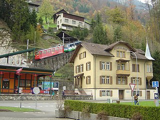
Alpnach is a village in the canton of Obwalden in Switzerland. It comprises the villages of Alpnach Dorf, Alpnachstad and Schoried.

<span class="mw-page-title-main">Engelberg</span> Municipality in Obwalden, Switzerland

Engelberg is a village resort and a municipality in the canton of Obwalden in Switzerland. Alongside the central village of Engelberg, the municipality encompasses additional settlements, including Grafenort, Oberberg and Schwand.

<span class="mw-page-title-main">Beckenried</span> Municipality in Nidwalden, Switzerland

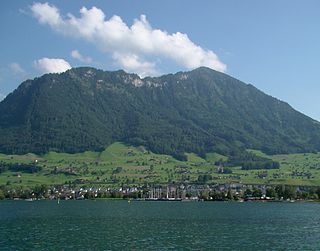
Beckenried is a municipality in the canton of Nidwalden in Switzerland.

<span class="mw-page-title-main">Buochs</span> Municipality in Nidwalden, Switzerland

Buochs is a municipality in the canton of Nidwalden in Switzerland.

<span class="mw-page-title-main">Dallenwil</span> Municipality in Nidwalden, Switzerland

Dallenwil is a municipality in the canton of Nidwalden in Switzerland.

<span class="mw-page-title-main">Hergiswil</span> Municipality in Nidwalden, Switzerland

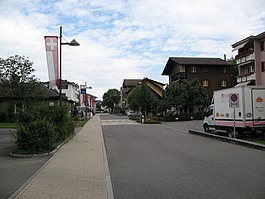
Hergiswil is a municipality in the canton of Nidwalden in Switzerland.

<span class="mw-page-title-main">Wolfenschiessen</span> Municipality in Nidwalden, Switzerland

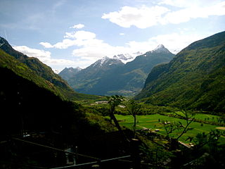
Wolfenschiessen is a village and municipality in the canton of Nidwalden in Switzerland. Besides the village of Wolfenschiessen itself, the municipality includes the settlements of Altzellen, Büren ob dem Bach, Dörfli, and Oberrickenbach, together with a large area of high alpine land, mountains, lakes, and glaciers.

<span class="mw-page-title-main">Reute</span> Municipality in Appenzell Ausserrhoden, Switzerland

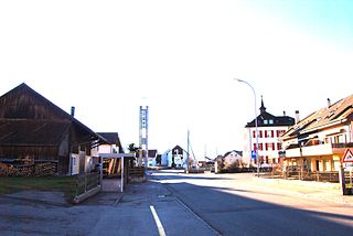
Reute is a municipality in the canton of Appenzell Ausserrhoden in Switzerland.

<span class="mw-page-title-main">Küssnacht</span> Municipality in Schwyz, Switzerland

Küssnacht am Rigi is a village and a district and a municipality in the canton of Schwyz in Switzerland. The municipality consists of three villages Küssnacht, Immensee, and Merlischachen, the hamlet Haltikon, the industrial area Fänn, and the alp Seeboden. It is situated at the north shore of Lake Lucerne and at the south shore of Lake Zug below mount Rigi.

<span class="mw-page-title-main">Sils im Engadin/Segl</span> Municipality in Graubünden, Switzerland

Sils im Engadin/Segl, often also as Sils i.E./Segl, is a municipality and village in the Maloja Region, Upper Engadine in the Swiss canton of the Grisons.

<span class="mw-page-title-main">Madulain</span> Municipality in Graubünden, Switzerland

Madulain is a municipality in the Maloja Region in the Swiss canton of Graubünden.

<span class="mw-page-title-main">Falera</span> Municipality in Graubünden, Switzerland

Falera is a municipality in the Surselva Region in the Swiss canton of Graubünden.

<span class="mw-page-title-main">Churwalden</span> Municipality in Graubünden, Switzerland

Churwalden is a municipality in the Plessur Region in the canton of Graubünden in Switzerland. It incorporates the former municipalities of Malix and Parpan.

<span class="mw-page-title-main">Horw</span> Municipality in Lucerne, Switzerland

Horw is a municipality in the district of Lucerne in the canton of Lucerne in Switzerland.

<span class="mw-page-title-main">Seedorf, Uri</span> Municipality in Uri, Switzerland

Seedorf is a municipality in the canton of Uri in Switzerland. On 1 January 2021 the former municipality of Bauen merged into the municipality of Seedorf.

<span class="mw-page-title-main">Maladers</span> Former municipality in Graubünden, Switzerland

Maladers is a former municipality in the Plessur Region in the canton of Graubünden in Switzerland. On 1 January 2020 the former municipality of Maladers merged into Chur.

<span class="mw-page-title-main">Sils im Domleschg</span> Municipality in Graubünden, Switzerland

Sils im Domleschg is a municipality in the Viamala Region in the Swiss canton of Graubünden.

Grono is a municipality in the Moesa Region in the Italian speaking part of the Swiss canton of Grisons. On 1 January 2017 the former municipalities of Leggia and Verdabbio merged into the municipality of Grono.

<span class="mw-page-title-main">Val Terbi</span> Municipality in Jura, Switzerland

Val Terbi is a municipality in the district of Delémont in the canton of Jura in Switzerland. The municipalities of Montsevelier, Vermes and Vicques merged on 1 January 2013 into the new municipality of Val Terbi. On 1 January 2018 the former municipality of Corban merged into the municipality of Val Terbi.

<span class="mw-page-title-main">Val-de-Charmey</span> Municipality in Fribourg, Switzerland

Val-de-Charmey is a municipality in the district of Gruyère in the canton of Fribourg in Switzerland. On 1 January 2014 the former municipalities of Cerniat and Charmey merged into the municipality of Val-de-Charmey.

References

  1. "Arealstatistik Standard - Gemeinden nach 4 Hauptbereichen". Federal Statistical Office. Retrieved 13 January 2019.
  2. "Ständige Wohnbevölkerung nach Staatsangehörigkeitskategorie Geschlecht und Gemeinde; Provisorische Jahresergebnisse; 2018". Federal Statistical Office. 9 April 2019. Retrieved 11 April 2019.
  3. Arealstatistik Standard - Gemeindedaten nach 4 Hauptbereichen
  4. "Arealstatistik Land Use - Gemeinden nach 10 Klassen". www.landuse-stat.admin.ch. Swiss Federal Statistical Office. 24 November 2016. Retrieved 27 December 2016.
  5. 1 2 3 4 5 Swiss Federal Statistical Office - Regional portraits accessed 27 October 2016
  6. "Ständige und nichtständige Wohnbevölkerung nach institutionellen Gliederungen, Geburtsort und Staatsangehörigkeit". bfs.admin.ch (in German). Swiss Federal Statistical Office - STAT-TAB. 31 December 2020. Retrieved 21 September 2021.
  7. Federal Statistical Office - Ständige und nichtständige Wohnbevölkerung nach institutionellen Gliederungen, Geburtsort und Staatsangehörigkeit (Land) accessed 31 October 2016
  8. Swiss Federal Statistical Office - Ständige und nichtständige Wohnbevölkerung nach institutionellen Gliederungen, Geschlecht, Zivilstand und Geburtsort (in German) accessed 8 September 2016
  9. Swiss Federal Statistical Office STAT-TAB - Thema 09 - Bau- und Wohnungswesen (in German) accessed 5 May 2016
  10. 1 2 3 Swiss Federal Statistical Office accessed 04-Sep-2009
  11. Swiss Federal Statistical Office STAT-TAB Bevölkerungsentwicklung nach institutionellen Gliederungen, 1850-2000 (in German) accessed 27 April 2016
  12. Swiss Federal Statistical Office - Nationalratswahlen 2015: Stärke der Parteien und Wahlbeteiligung nach Gemeinden Archived 2016-08-02 at the Wayback Machine (in German) accessed 18 July 2016
  13. "Die Raumgliederungen der Schweiz 2016" (in German, French, Italian, and English). Neuchâtel, Switzerland: Swiss Federal Statistical Office. 17 February 2016. Retrieved 14 December 2016.
  14. Federal Statistical Office -Arbeitsstätten und Beschäftigte nach Gemeinde, Wirtschaftssektor und Grössenklasse accessed 31 October 2016
  15. Federal Statistical Office - Hotellerie: Ankünfte und Logiernächte der geöffneten Betriebe accessed 31 October 2016
  16. "Luzern–Alpnachstad (Vierwaldstättersee)" (PDF). Bundesamt für Verkehr. Retrieved 2013-01-07.
  17. "Luzern–Stans–Engelberg" (PDF). Bundesamt für Verkehr. Retrieved 2013-01-14.
  18. "Stansstad–Obbürgen–Bürgenstock (Linie 321)" (PDF). Bundesamt für Verkehr. Retrieved 2013-01-18.
  19. "BürenNW–Oberdorf NW–Stans–Stansstad (Linie 323)" (PDF). Bundesamt für Verkehr. Retrieved 2013-01-18.
  20. "KGS-Inventar". KGS Inventar (in German). Federal Office of Civil Protection. 2009. Archived from the original on 28 June 2010. Retrieved 12 July 2010.
  21. UNESCO World Heritage Site - Prehistoric Pile dwellings around the Alps