Dallenwil | |
---|---|
Coordinates: 46°56′N8°23′E / 46.933°N 8.383°E | |
Country | Switzerland |
Canton | Nidwalden |
District | n.a. |
Area | |
• Total | 15.48 km2 (5.98 sq mi) |
Elevation | 545 m (1,788 ft) |
Population (31 December 2018) [2] | |
• Total | 1,845 |
• Density | 120/km2 (310/sq mi) |
Time zone | UTC+01:00 (Central European Time) |
• Summer (DST) | UTC+02:00 (Central European Summer Time) |
Postal code(s) | 6383 |
SFOS number | 1503 |
Surrounded by | Ennetmoos, Kerns (OW), Oberdorf, Stans, Wolfenschiessen |
Website | www SFSO statistics |
Dallenwil is a municipality in the canton of Nidwalden in Switzerland.
Dallenwil is first mentioned about 1199-1210 as Tellewilare or Telliwilare. In 1850 it was known as Thalwyl and it wasn't until 1913 that it became Dallenwil. [3]
Dallenwil has an area, as of 2006 [update] , of 15.5 square kilometers (6.0 sq mi). Of this area, 53.7% is used for agricultural purposes, while 38% is forested. Of the rest of the land, 4.6% is settled (buildings or roads) and the remainder (3.7%) is non-productive (rivers, glaciers or mountains). [4]
The municipality is located along the old cantonal highway from Stans to Wolfenschiessen and around the parish church.
Dallenwil has a population (as of 31 December 2020) of 1,848. [5] As of 2007 [update] , 7.1% of the population was made up of foreign nationals. [6] Over the last 10 years the population has grown at a rate of 2.8%. Most of the population (as of 2000 [update] ) speaks German (95.8%), with Albanian being second most common ( 1.4%) and Serbo-Croatian being third ( 0.7%). [4] As of 2008 [update] the gender distribution of the population was 51.0% male and 49.0% female.
As of 2000 [update] there are 607 households, of which 336 households (or about 55.4%) contain only one or two individuals. 82 or about 13.5% are large households, with at least five members. [7]
In the 2007 federal election the most popular party was the FDP which received 81.6% of the vote. Most of the rest of the votes went to local small right-wing parties (15.1%). [4]
The entire Swiss population is generally well educated. In Dallenwil about 68.2% of the population (between age 25–64) have completed either non-mandatory upper secondary education or additional higher education (either University or a Fachhochschule ). [4]
Dallenwil has an unemployment rate of 0.92%. As of 2005 [update] , there were 145 people employed in the primary economic sector and about 52 businesses involved in this sector. 165 people are employed in the secondary sector and there are 18 businesses in this sector. 245 people are employed in the tertiary sector, with 50 businesses in this sector. [4]
The historical population is given in the following table: [3]
year | population |
---|---|
1850 | 731 |
1900 | 612 |
1950 | 869 |
1980 | 1,142 |
1990 | 1,508 |
2000 | 1,732 |
2005 | 1,756 |
Dallenwil is served by Dallenwil station on the Luzern–Stans–Engelberg line. Lucerne S-Bahn S4 service provides two trains per hour to and from Lucerne, and the hourly InterRegio service between Lucerne and Engelberg also stops in Stans. [8]
The main sights of Dallenwil are the ski and summer resort Wiesenberg/Wirzweli, the church St. Laurentius, and the pilgrimage chapel Wiesenberg.
The canton of Lucerne is a canton of Switzerland. It is located in the country's central, German-speaking part. The population of the canton is 416,347. As of 2007, the population included 57,268 foreigners, or about 15.8% of the total population. The cantonal capital is the city of Lucerne.
Stans is the capital of the canton of Nidwalden (Nidwald) in Switzerland.
Engelberg is a village resort and a municipality in the canton of Obwalden in Switzerland. Alongside the central village of Engelberg, the municipality encompasses additional settlements, including Grafenort, Oberberg and Schwand.
Nidwalden or Nidwald is one of the 26 cantons forming the Swiss Confederation. It is composed of eleven municipalities and the seat of the government and parliament is in Stans. It is traditionally considered a "half-canton", the other half being Obwalden.
Beckenried is a municipality in the canton of Nidwalden in Switzerland.
Emmetten is a municipality in the canton of Nidwalden in Switzerland.
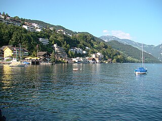
Ennetbürgen is a municipality in the canton of Nidwalden in Switzerland.
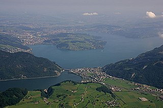
Ennetmoos is a municipality in the canton of Nidwalden in Switzerland.
Hergiswil is a municipality in the canton of Nidwalden in Switzerland.
Oberdorf is a municipality in the canton of Nidwalden in Switzerland. It consists of the villages and hamlets of Wil, Ennerberg, Waltersberg, Büren nid dem Bach and Niederrickenbach.
Stansstad is a municipality in the canton of Nidwalden in Switzerland.
Wolfenschiessen is a village and municipality in the canton of Nidwalden in Switzerland. Besides the village of Wolfenschiessen itself, the municipality includes the settlements of Altzellen, Büren ob dem Bach, Dörfli, and Oberrickenbach, together with a large area of high alpine land, mountains, lakes, and glaciers.
Rudolfstetten-Friedlisberg is a municipality in the district of Bremgarten in the canton of Aargau in Switzerland. Prior to 1953, the municipality was officially known simply as Rudolfstetten.
Horw is a municipality in the district of Lucerne in the canton of Lucerne in Switzerland.
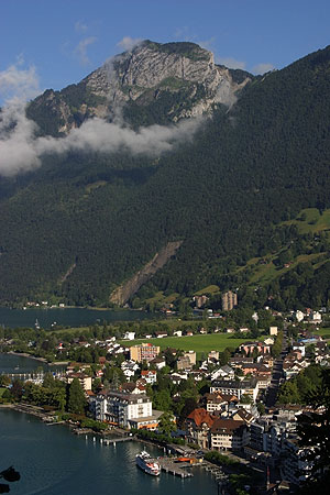
Ingenbohl is a municipality in Schwyz District in the canton of Schwyz in Switzerland.
Rothenthurm is a municipality in Schwyz District in the canton of Schwyz in Switzerland.
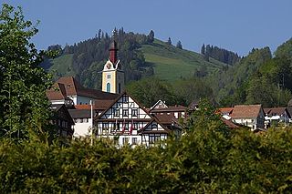
Sattel is a municipality in Schwyz District in the canton of Schwyz in Switzerland. Its name is the German word for "saddle".
Hasle is a municipality in the district of Entlebuch in the canton of Lucerne in Switzerland. Hasle is part of the UNESCO Entlebuch Biosphere Reserve since 2001.
Alberswil is a municipality in the district of Willisau in the canton of Lucerne in Switzerland.
Menznau is a municipality in the district of Willisau in the canton of Lucerne in Switzerland.