
Unterwalden, translated from the Latin inter silvas, is the old name of a forest-canton of the Old Swiss Confederacy in central Switzerland, south of Lake Lucerne, consisting of two valleys or Talschaften, now two separate Swiss cantons, Obwalden and Nidwalden.
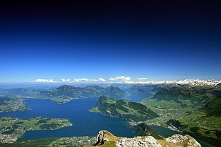
Lake Lucerne is a lake in central Switzerland and the fourth largest in the country.

Pilatus, also often referred to as Mount Pilatus, is a mountain massif overlooking Lucerne in Central Switzerland. It is composed of several peaks, of which the highest (2,128.5 m [6,983 ft]) is named Tomlishorn.

The canton of Lucerne is a canton of Switzerland. It is located in the country's central, German-speaking part. The population of the canton is 416,347. As of 2007, the population included 57,268 foreigners, or about 15.8% of the total population. The cantonal capital is the city of Lucerne.

Stans is the capital of the canton of Nidwalden (Nidwald) in Switzerland.

Obwalden or Obwald is one of the 26 cantons forming the Swiss Confederation. It is composed of seven municipalities and the seat of the government and parliament is in Sarnen. It is traditionally considered a "half-canton", the other half being Nidwalden.

Nidwalden or Nidwald is one of the 26 cantons forming the Swiss Confederation. It is composed of eleven municipalities and the seat of the government and parliament is in Stans. It is traditionally considered a "half-canton", the other half being Obwalden.

Stansstad is a municipality in the canton of Nidwalden in Switzerland.
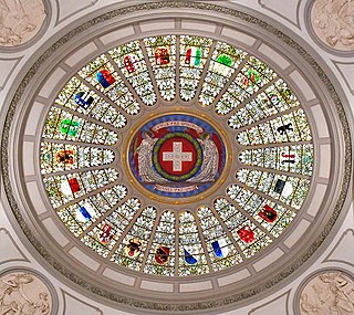
Each of the 26 modern cantons of Switzerland has an official flag and a coat of arms. The history of development of these designs spans the 13th to the 20th centuries.
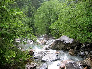
The Engelberger Aa is a river in Switzerland. It rises west of the Surenenpass in the Canton of Uri, flows through the valley of Engelberg (Obwalden) and Nidwalden. At Buochs it flows into Lake Lucerne and is therefore a tributary of the Reuss, which drains the lake.

The Castles of Bellinzona are a group of fortifications located around the town of Bellinzona, the capital of the Swiss canton of Ticino. Situated on the Alpine foothills, the group is composed of fortified walls and three castles named Castelgrande, Montebello and Sasso Corbaro. Castelgrande is located on a rocky peak overlooking the valley, with a series of walls that protect the old city and connect to Montebello. Sasso Corbaro, the highest of the three castles, is located on an isolated rocky promontory south-east of the other two. The Castles of Bellinzona with their defensive walls have been an UNESCO World Heritage Site since 2000.

Zug Castle is a castle in the municipality of Zug of the Canton of Zug in Switzerland. It is a Swiss heritage site of national significance.

Pfäffikon Castle is a castle in the municipality of Freienbach of the Canton of Schwyz in Switzerland. It is a Swiss heritage site of national significance.

Stansstad railway station is a Swiss railway station in the municipality of Stansstad in the canton of Nidwalden. It is on the Luzern–Stans–Engelberg line, owned by the Zentralbahn railway company, and is adjacent to the bridge that carries the line across the Alpnachersee arm of Lake Lucerne and into the Lopper II tunnel.
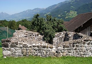
Rotzberg or Rotzburg is a ruined castle in the municipality of Ennetmoos in the canton of Nidwalden in Switzerland.

The Hexenturm is a stone tower in the municipality of Sarnen in the canton of Obwalden in Switzerland. It is a Swiss heritage site of national significance. The name refers to its use as a prison for suspected witches in the 17th century. Today it houses the Cantonal Archives of Obwalden.

Landenberg Castle is a ruined castle atop a hill in the municipality of Sarnen in the canton of Obwalden in Switzerland. In the 18th century an armory and firing range were built on the site. The Landenberg Armory is a Swiss heritage site of national significance. The ruins of the castle was the meeting place of the Landsgemeinde or Cantonal assembly for over three centuries.

Rudenz Castle is a ruined castle atop a hill in the municipality of Giswil in the canton of Obwalden in Switzerland. The castle and surroundings are a Swiss heritage site of national significance.
Rosenberg Castle is a ruined castle in the municipality of Giswil in the canton of Obwalden in Switzerland.


