Schwanau, Schwyz

Last updated
Schwanau
2007-06-19 Lauerzersee 02.jpg
View of the island from south side of the lake
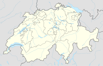
Switzerland adm location map.svg
Red pog.svg
Schwanau
Location in Switzerland
Geography
Location Lake Lauerz
Highest elevation469 m (1539 ft)
Administration
Canton Schwyz
District Schwyz

Schwanau is an island in Lake Lauerz, located in the canton of Schwyz in Central Switzerland. It is occupied by a ruined castle, the Burgruine Schwanau, a chapel and a restaurant. Administratively the island lies within the municipality of Lauerz, but it is owned by the canton of Schwyz. [1] [2]

Contents

The island is situated some 125 m (410.1 ft) off the south shore of the lake, close to the lakeside village of Lauerz. Its highest point is 22 metres (72.2 ft) above normal lake level or 469 metres (1,538.7 ft) above sea level. It is the largest of the two islands in Lake Lauerz (the other being Roggenburg). [1] [3]

The island is accessible by a public passenger ferry from the nearby shore. Access for persons with limited mobility is possible by use of a specially adapted boat and an inclined elevator to the terrace level where the castle, chapel and restaurant are located. [4]
History

Chapel, restaurant and castle Schwanau.jpg
Chapel, restaurant and castle
Aerial view (1960) ETH-BIB-Insel Schwanau-LBS H1-022440.tif
Aerial view (1960)

Traces of occupation on the island date back to around 1200 BC. There is little documentary evidence relating to the castle, but it is believed to have been built at the end of the 12th century and to have been ruined, probably as a result of a fire, as early as the middle of the 13th century. [3] [5]

The island in known to have been occupied by hermits at various times, including the 17th and 18th centuries. In 1684 a chapel was built on the island, but this was destroyed by the tsunami that followed the 1806 Goldau landslide. In 1808 the council of the church in Schwyz sold the island to General Ludwig Auf der Maur on the provision that he rebuild the chapel. The island remained in the possession of the general's descendants until 1967, when it was purchased by the canton of Schwyz. In 2009 it was completely renovated. [2] [3] [5]

Related Research Articles

Lake Zürich

Lake Zürich is a lake in Switzerland, extending southeast of the city of Zürich. Depending on the context, Lake Zürich or Zürichsee can be used to describe the lake as a whole, or just that part of the lake downstream of the Seedamm at Rapperswil, whilst the part upstream of Rapperswil may be called the Obersee or Upper Lake.

Canton of Schwyz Canton of Switzerland

The canton of Schwyz is a canton in central Switzerland between the Alps in the south, Lake Lucerne to the west and Lake Zürich in the north, centered on and named after the town of Schwyz.

Lake Lucerne Lake in Central Switzerland

Lake Lucerne is a lake in central Switzerland and the fourth largest in the country.

Goldau

Goldau is a city in the community of Arth, canton of Schwyz, Switzerland. It lies between two mountains, the Rigi and the Rossberg. Well known attractions include the Natur- und Tierpark Goldau and the Arth-Goldau valley station of the Arth-Rigi Bahn connecting to the Rigi mountain.

St. Peters Island

St. Peter's Island (French: Île Saint-Pierre ;German: Sankt Petersinsel; is a peninsula and former island situated in Lake Biel in the canton of Bern, Switzerland. It has a length of about 5 kilometres and a maximum width of 800 metres. Its highest point is 474 metres above sea level or 45 metres above lake level. It was formed in the last Ice Age, when the Rhône Glacier reached as far as the Jura mountains. It is a promontory of the Jolimont, above Erlach. Politically the island is split between the municipalities of Erlach and Twann-Tüscherz, the largest part belonging to the latter municipality.

Lake Lauerz

Lake Lauerz is a lake in the Canton of Schwyz, Switzerland. Its water area varies between 310 ha and 360 ha, a maximum depth of 14 m (45.9 ft), and a water level elevation above sea level of 447 m (1,466.5 ft).

Castles of Bellinzona

The Castles of Bellinzona are a group of fortifications located around the town of Bellinzona, the capital of the Swiss canton of Ticino. Situated on the Alpine foothills, the group is composed of fortified walls and three castles named Castelgrande, Montebello and Sasso Corbaro. Castelgrande is located on a rocky peak overlooking the valley, with a series of walls that protect the old city and connect to Montebello. Sasso Corbaro, the highest of the three castles, is located on an isolated rocky promontory south-east of the other two. The Castles of Bellinzona with their defensive walls have been an UNESCO World Heritage Site since 2000.

Ufenau

Ufenau is an island located, with the neighbouring island of Lützelau, in Lake Zürich in Switzerland between Freienbach and Rapperswil. Highlights on Ufenau include St. Peter & Paul church, St. Martin's chapel, and Ufenau's idyllic landscape in the Frauenwinkel protected area.

Lützelau

Lützelau is an island located, with the neighbouring island of Ufenau, in Lake Zürich in Switzerland between Rapperswil and Freienbach.

Rapperswil Former municipality of Switzerland in St. Gallen

Rapperswil is a former municipality and since January 2007 part of the municipality of Rapperswil-Jona in the Wahlkreis (constituency) of See-Gaster in the canton of St. Gallen in Switzerland, located at the east side of the Lake Zurich.

Seedamm

Seedamm is the partially artificial causeway and bridge at the most narrow area of Lake Zurich, between Hurden (SZ) and Rapperswil (SG). The Seedamm carries a road and a railway across the lake, with the railway being used by the S5 and S40 lines of the S-Bahn Zürich and by the Südostbahn Voralpen Express.

Holzbrücke Rapperswil-Hurden

Holzbrücke Rapperswil-Hurden is a wooden pedestrian bridge between the city of Rapperswil and the village of Hurden crossing the upper Lake Zürich (Obersee) in Switzerland. The prehistoric timber piles discovered to the west of the Seedamm date back to 1523 BC. The island settlement Technikum is a prehistoric pile-dwelling settlement which is part of the UNESCO World Heritage Site Prehistoric Pile dwellings around the Alps. The first wooden footbridge led across Lake Zürich, followed by several reconstructions at least until the late 2nd century AD when the Roman Empire built a 6 metres (20 ft) wide wooden bridge. Between 1358 and 1360, Rudolf IV, Duke of Austria, built a 'new' wooden bridge across the lake that was used until 1878. On 6 April 2001, the reconstructed wooden footbridge was opened, being the longest wooden bridge in Switzerland.

Hurden Former municipality of Switzerland in Schwyz

Hurden is a village in the municipality of Freienbach in the canton of Schwyz in Switzerland. First mentioned in 1217, the name "de Hurden" was used for the peninsula and for the fish traps made of woven work, called "Hürden" or "Hurden", which were used by the locals.

Alt Rapperswil Castle

Altendorf Castle was a medieval hill castle in the municipality of Altendorf in the canton of Schwyz. On the foundation of the round castle chapel stands the choir of the chapel of St. Johann.

Pfäffikon Castle

Pfäffikon Castle is a castle in the municipality of Freienbach of the Canton of Schwyz in Switzerland. It is a Swiss heritage site of national significance.

Obersee (Zürichsee)

The Obersee is the smaller of the two parts of Zürichsee in the cantons of St. Gallen and Schwyz in Switzerland.

Frauenwinkel

Frauenwinkel is a mire landscape in Switzerland, situated at the Seedamm area on Zürichsee lakeshore in the municipality of Freienbach in the Canton of Schwyz.

Grynau Castle

The Grynau Castle is the name of a castle tower in the municipality of Tuggen in the canton of Schwyz, built by the House of Rapperswil in the early 13th century AD.

Buechberg Buechberg (also Buchberg) is an elongated molasse hill in the Swiss cantons of Schwyz and St. Gallen on Obersee lakeshore.

Buechberg is an elongated molasse hill in the Swiss cantons of Schwyz and St. Gallen on Obersee lakeshore.

Lindenhof (Rapperswil)

Lindenhof in Rapperswil is a moraine hill and a public square being the historic center of Rapperswil, Switzerland.

References

  1. 1 2 map.geo.admin.ch (Map). Swiss Confederation. Retrieved 9 July 2015.
  2. 1 2 "Die Insel" [The Island] (in German). Restaurant Schwanau. Retrieved 9 July 2015.
  3. 1 2 3 "Schwanau". Historical Dictionary of Switzerland (in French). 17 November 2011. Retrieved 9 July 2015.
  4. "Die Fähre" [The Ferry] (in German). Restaurant Schwanau. Retrieved 9 July 2015.
  5. 1 2 "Geschichte" [History] (in German). Gemeinde Lauerz. Retrieved 9 July 2015.

Coordinates: 47°01′57″N8°35′51″E / 47.03256°N 8.59760°E / 47.03256; 8.59760