
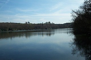
Melton Mowbray is a market town in the Melton district in Leicestershire, England, 19 miles (31 km) north-east of Leicester and 20 miles (32 km) south-east of Nottingham. It lies on the River Eye, known below Melton as the Wreake. The town had a population of 27,670 in 2019. The town is sometimes promoted as Britain's "Rural Capital of Food"; it is the home of the Melton Mowbray pork pie and is the location of one of six licensed makers of Stilton cheese.

Melton is a local government district with borough status in north-eastern Leicestershire, England. It is named after its only town, Melton Mowbray. The borough also includes numerous villages and surrounding rural areas. The north of the district includes part of the Vale of Belvoir. Melton is the least populous district of its type and the fourth least populous district in England overall.

Spelthorne is a local government district with borough status in Surrey, England. Its council is based in Staines-upon-Thames; other settlements in the area include Ashford, Sunbury-on-Thames, Shepperton, Stanwell and Laleham. It is named after the medieval Spelthorne Hundred which had covered the area.

West Bridgford is a town and the administrative centre of the Borough of Rushcliffe, in the county of Nottinghamshire, England. It lies south of Nottingham city centre, east of Wilford, north of Ruddington and west of Radcliffe-on-Trent; it is also south-west of Colwick and south-east of Beeston, which are on the opposite bank of the River Trent. The town is part of the Nottingham Urban Area and had a population of 36,487 in the 2021 Census.
Sandwell Valley Country Park is a country park, run by Sandwell Metropolitan Borough Council, in Sandwell Valley, on the River Tame in the middle of the urban conurbation between Birmingham and West Bromwich in West Midlands, England.
Danson Park is a public park in the London Borough of Bexley, South East London, located between Welling and Bexleyheath. At 75 hectares, it is the second largest public park in the borough, and the most used by the community. Opened in 1925, it is often considered the finest green open space in the borough, and is Grade II listed on the Register of Historic Parks and Gardens. The park also gives its name to the electoral ward that covers the park and the surrounding area. The park is located at grid reference TQ472752. The southern boundary of both the park and the ward is delineated by Rochester Way, the A2 road.

The River Crane, a tributary of the River Thames, runs 8.5 miles (13.6 km) in West London, England. It forms the lower course of Yeading Brook. It adjoins or passes through three London boroughs: Hillingdon, Hounslow and Richmond upon Thames, in the historic county of Middlesex. The drainage basin is heavily urbanised but many of the Hayes to Whitton flood-meadows have been conserved, forming a narrow, green vale, opening out to what remains of Hounslow Heath in the centre – a near-continuous belt of semi-natural habitat.

The Brent Reservoir is a reservoir in North West London. It straddles the boundary between the boroughs of Brent and Barnet and is owned by the Canal & River Trust. The reservoir takes its informal name from a public house called The Welsh Harp, which stood nearby until the early 1970s. It is a 68.6-hectare (170-acre) biological Site of Special Scientific Interest (SSSI), the only SSSI in either borough and among more than 30 SSSIs in Greater London.

Lady Bay is an area of West Bridgford, in Nottinghamshire, England, bounded by the River Trent to the north and the Grantham Canal to the south. It is within 2 miles of the centre of Nottingham, but is more suburban/semi-rural in its character.

Endcliffe Park is a large park in the city of Sheffield, South Yorkshire, England. The park was opened in 1887 to commemorate the Jubilee of Queen Victoria. When travelling West from the city centre it is the first in a series of parks and green spaces, known collectively as the Porter Valley Parks, all of which lie along the course of the Porter Brook. The next park in the sequence is Bingham Park, separated from Endcliffe Park by Rustlings Road. In 1924 Patrick Abercrombie said of the parks, "The Porter Brook Parkway, consisting as it does of a string of contiguous open spaces, is the finest example to be found in this country of a radial park strip, an elongated open space, leading from a built-up part of the city direct into the country, the land occupied being a river valley and so for the greater part unsuitable for building."

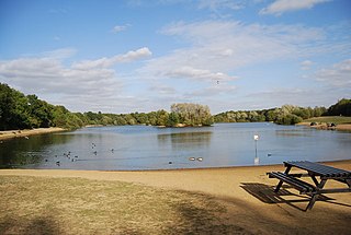
Dinton Pastures Country Park is a country park in the civil parish of St Nicholas Hurst, in the borough of Wokingham, near Reading in the English county of Berkshire.

Woodgate Valley Country Park is a country park within the Bartley Green and Quinton districts of Birmingham. It is the third largest Birmingham Country Park after Sutton Park and Lickey Hills Country Park. The park is maintained as a wildlife habitat but also has farm animals.
Haysden Country Park is a 64-hectare (160-acre) country park and Local Nature Reserve on the outskirts of Tonbridge in Kent. It is owned by Tonbridge and Malling Borough Council, the Highways Agency, Network Rail and the Environment Agency, and managed by the council.

Wandsworth Park is a Grade II listed public urban park on the banks of the River Thames in the London Borough of Wandsworth, situated between Putney and Wandsworth town centres.

Oak Hill Park is in East Barnet in the London Borough of Barnet. It is one of Barnet's premier parks and received a Green Flag Award for 2009–10. It is a large area of parkland with a wide range of facilities, including an outdoor gym, a bowls green, football pitches, a golf course, three tennis courts, a multi-sports court and a play area for toddlers.

Shorne Woods Country Park is located between Strood and Gravesend, in the English county of Kent. It was once part of a large estate, later passed to the county council to be used as a country park.
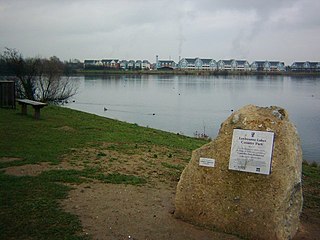
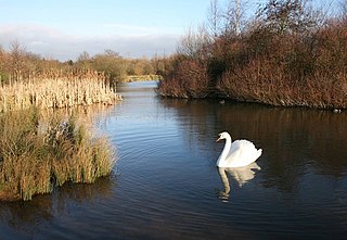
Leybourne Lakes Country Park is near Snodland, in Kent, England. The park, which opened in 2004, was created from disused gravel pits that have been flooded and landscaped to make fishing and wildlife lakes.
Tilgate Lake is the biggest of three lakes at Tilgate Park, and remains a popular water activity centre and tourist attraction in Crawley, West Sussex.Tilgate Lake has a wide variety of outdoor activities open to the general public, such as archery, canoeing, fishing, kayaking, mountain biking, raft building, rowing, running, sailing, standup paddleboarding, Open water swimming, team building, navigational challenges, tree climbing and zip trekking.

Brierley Forest Park, Sutton in Ashfield was designated a Local Nature Reserve in 2006. It contains Calcareous grassland, sown grassland, wildflower meadows with hoary ragwort, yellow-wort, wild carrot and lesser trefoil. There are four wetland feature areas, Brierley Waters, a reed swamp, Rooley Brook and the visitor centre pond. There are species rich hedgerows, woodland and semi natural vegetation.
The Tarn is a 9 acres (3.6 ha) site on Court Road between Mottingham and Eltham, in the Royal Borough of Greenwich, southeast London, United Kingdom, consisting of a public garden, a bird sanctuary nature reserve and a lake amongst woodland. The woodland and lake, which was historically known as Starbuck's Pond, were previously the southern part of the Great Park, one of three parks belonging to the estate of Eltham Palace and used as a royal deer hunting park for several centuries up until the English Civil War. As a garden The Tarn opened in 1935, after the Metropolitan Borough of Woolwich acquired the site from the adjacent Royal Blackheath Golf Course. The Tarn remains largely unchanged since the 1930s and contains several shelters, benches, a public toilets building and a circular path which crosses a wooden footbridge spanning the lake. There is also an 18th-century ice house in the garden, which is a listed structure.


