
Larsen Bay is a city in Kodiak Island Borough, Alaska, United States. At the 2010 census the population was 87, down from 115 in 2000.

Johnsonville is a village in Wayne County, Illinois, United States. The population was 69 at the 2000 census.

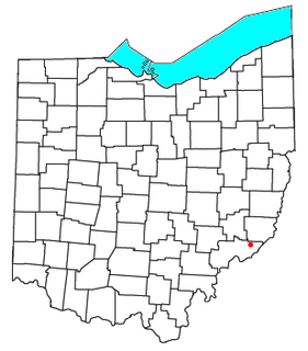
Masury is a census-designated place (CDP) in Trumbull County, Ohio, United States. The population was 2,618 at the 2000 census. It is part of the Youngstown–Warren–Boardman, OH-PA Metropolitan Statistical Area.

Pinhook Corners is a census-designated place (CDP) in Sequoyah County, Oklahoma, United States. It is part of the Fort Smith, Arkansas-Oklahoma Metropolitan Statistical Area. The population was 161 at the 2000 census.

Lindsay is a census-designated place (CDP) in Reeves County, Texas, United States. The population was 271 at the 2010 census.

Mathiston is a town in Choctaw and Webster counties, Mississippi. The population was 698 at the 2010 census.

Fox Island is an island in Narragansett Bay, Rhode Island, in the United States of America. It lies between Conanicut Island and North Kingstown just south of the village of Wickford, Rhode Island. The island is a part of the town of North Kingstown. The Native Americans called the island "Nanaquonset" The island was purchased from Native Americans by Randall Holden and Samuel Gorton in 1659. In the 1860s a Christian preacher named Captain Jimmie Hammond became the first full-time resident of the island where he lived with his chickens and cat. In 1880, Rev. William Pendleton Chapman, a pastor at the nearby Quidnessett Church, featured the island in his adventure book titled “Budd Boyd’s Triumph: The Boy Firm of Fox Island.” Various other private owners have owned the island since its first habitation. Since 2000 it has been privately owned by a corporation which uses a large wind generator on the east side of the island.

Garcia is an unincorporated community and a U.S. Post Office located in Costilla County, Colorado, United States, just north of the New Mexico border. The Garcia Post Office has the ZIP Code 81134.
Wingett Run is an unincorporated community in western Ludlow Township, Washington County, Ohio, United States. Although it is unincorporated, it has a post office, with the ZIP code 45789. It is located along State Route 26 and the Little Muskingum River.

Menauhant is a neighborhood at the southern end of Central Avenue in East Falmouth, Massachusetts, United States. The community, which lies between Bournes Pond on the west and Eel Pond on the east, is located across Vineyard Sound from Martha's Vineyard. The community has approximately 105 homes, the earliest of which date to the 1870s, a small chapel that serves the community during the summer months, and the public Menauhant Beach. The neighborhood is the home of the Menauhant Yacht Club, which owns two private beaches, tennis courts and several boats, and hosts a summer program for members.
Lakeside is an unincorporated community in southeastern Saline County, Arkansas, United States. The community is located three miles west of Woodson and twelve miles south of Little Rock on US Route 65. Lakeside is on the east shore of Ferguson Lake.

Southwest is an unincorporated community in Harrison Township, Elkhart County, Indiana.
Pirkey,Virginia carries the name of my family that moved to the Shenandoah Valley in the late 1600's. The family name has had several changes of spelling. The first Pirkey to be born in this area was Henry (Birgi-Berkey) Pirkey, Sr., born in 1720 in Staunton, Augustus Co., Virginia. He was among one of the earliest settlers of the Shenandoah Valley. The history of the family shows that three Mennonite brothers from Hesse-Casse, Germany settled in Rockingham County before 1760. These brothers were immigrants from the Palatine Region of Germany. Pirkey is an unincorporated community in Greene County, Virginia, United States.
Linkwood Wildlife Management Area is a 313-acre (1.27 km2) Wildlife Management Area in the state of Maryland. It is located in Dorchester County, near the town of Linkwood.
White Street Gallery District is a neighborhood within the City of Key West, Florida in Monroe County, United States.
Last Chance is a populated place in Okfuskee County, Oklahoma, United States. The name was collected by the United States Geological Survey between 1976 and 1979, and entered into the Geographic Names Information System on December 18, 1979.
The Skaggs Catholic Center is a 57 acres (230,000 m2) school and church campus in Draper, Utah, United States. It is the location of Juan Diego Catholic High School, Saint John the Baptist Middle School, Saint John the Baptist Elementary School, Guardian Angel Daycare, and the St. John the Baptist Parish Catholic church. Opened in 1999, the campus was funded by Leonard Samuel (Sam) Skaggs, Jr. and his wife Ailene, who donated $42 million to build the facility as a flagship for the Catholic community in predominantly-Mormon Utah. Upon its opening, the facility was reported to be the largest Catholic education campus in the United States, and the largest gift made for Catholic primary and secondary education.

Coupon is an unincorporated community in Cambria County, Pennsylvania, United States.
Summit is an unincorporated community in Hendricks County, Indiana, in the United States.
Russels Point is an unincorporated community in Otsego Township, Steuben County, in the U.S. state of Indiana.


