Southern Highlands is a province in Papua New Guinea. Its provincial capital is the town of Mendi. According to Papua New Guinea's national 2011 census, the total population of Southern Highlands is 515,511 spread across 15,089 square kilometers (5,826 sq mi).
Mendi, Papua New Guinea, is the provincial capital of the Southern Highlands Province. The Lai River flows by the town. It is served by Mendi Airport. The town falls under Mendi Urban LLG.

Talbot Islands are a group of Torres Strait Islands in Queensland, Australia. They lie between the Australian mainland and the island of New Guinea and a few kilometres west of Saibai Island, Torres Strait, only 4 km from the Papua New Guinea mainland at the mouth of the Mai Kussa River.

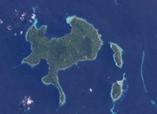
Nuakata Island is a small, mountainous island in the Goschen Strait south of Normanby Island and east of East Cape. It is part of Milne Bay Province in southeastern Papua New Guinea. Mount Tanorabwa is the highest point on the island at 1,072 feet.

Papua New Guinea has 326 local-level governments (LLGs) comprising 6,112 wards as of 2018.

This page is a list of districts of Papua New Guinea.
ISO 3166-2:PG is the entry for Papua New Guinea in ISO 3166-2, part of the ISO 3166 standard published by the International Organization for Standardization (ISO), which defines codes for the names of the principal subdivisions of all countries coded in ISO 3166-1.

The Engan, or more precisely Enga – Southern Highland, languages are a small family of Papuan languages of the highlands of Papua New Guinea. The two branches of the family are rather distantly related, but were connected by Franklin and Voorhoeve (1973).
Vunakapeake is a village located on the north coast of the Gazelle Peninsula on the island of New Britain, East New Britain Province, Papua New Guinea. The village lies to the east of Lassul Bay and to the west of Ataliklikun Bay.
Mondrabet is a large village on the island of New Britain, East New Britain Province, Papua New Guinea. The village lies in the south-western part of the Gazelle Peninsula, to the east of coastal village of Torin, upstream along the Torin River near its confluence with another river. It is also connected by dirt road to Matanakunai on the coast in the south-west.
Kalagunan is a village on the west coast of New Ireland, Papua New Guinea. There is a point here known as Kalagunan Point It is located in Sentral Niu Ailan Rural LLG.
Tatau Island is an island of the Tabar Group of Papua New Guinea, located to the east of New Ireland and about a mile south of Simberi Island.
Tsoilaunung Island is an island of Papua New Guinea, located to the east of New Hanover Island, to the north of New Ireland. The island is also known as Tsoi. Senta Pass separates it from Patio Island to its south.
Patio Island is a small island of Papua New Guinea, located to the southeast of New Hanover Island, to the north-west of New Ireland. Senta Pass separates it from Tsoilaunung Island to the north. To the south is Baudisson Island.
Baudisson Island is an island of Papua New Guinea, located south of New Hanover Island and west of the northern part of New Ireland. It is located between Selapiu Island and Manne Island. There is a plantation on the island.
Big Ndrova Island, sometimes called simply Ndrova Island, is an island of Manus Province, Papua New Guinea, one of the Admiralty Islands.
Little Ndrova Island, also called Ndawara Islet, is an island of Manus Province, Papua New Guinea, one of the Admiralty Islands.
Mendi Urban LLG is a local-level government (LLG) of Southern Highlands Province, Papua New Guinea. The Mendi language is spoken in the LLG.
Upper Mendi Rural LLG is a local-level government (LLG) of Southern Highlands Province, Papua New Guinea. The people living there speak at last 4 different languages: Tambul, Mendi, Ialibu and Engan. It has an estimated population of over 40,000 people.


