
The Gulf of Papua is located in the southern coast region of New Guinea. It has a total surface area of 70,400 km2 (27,200 sq mi).

Wewak is the capital of the East Sepik province of Papua New Guinea. It is on the northern coast of the island of New Guinea. It is the largest town between Madang and Jayapura. It is the see city (seat) of the Roman Catholic Diocese of Wewak.
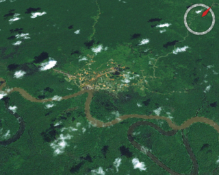
Goroka is the capital of the Eastern Highlands Province of Papua New Guinea. It is a town of approximately 19,000 people (2000), 1,600 meters above sea level. It has an airport and is on the "Highlands Highway", about 285 km (177 mi) from Lae in Morobe province and 90 km (56 mi) from the nearby town of Kainantu also in the Eastern Highlands. Other nearby towns include Kundiawa in Simbu Province and Mount Hagen in Western Highlands Province. It has a mild climate, known as a "perpetual Spring".
Kokoda is a station town in the Oro Province of Papua New Guinea. It is famous as the northern end of the Kokoda Track, site of the eponymous Kokoda Track campaign of World War II. In that campaign, it had strategic significance because it had the only airfield along the Track. In the decades preceding, it had been a foothills settlement near the gold fields.

Gulf Province is a province of Papua New Guinea located on the southern coast. The provincial capital is Kerema. The 34,472 km2 province is dominated by mountains, lowland river deltas, and grassland flood plains. In Gulf Province, the Kikori, Turama, Purari, and Vailala rivers meet the Papuan Gulf. The province has the second-smallest population of all the provinces of Papua New Guinea with 106,898 inhabitants. The province shares land borders with Western Province to the west, Southern Highlands, Chimbu, and Eastern Highlands to the north, Morobe Province to the east, and Central Province to the southeast.

Southern Highlands is a province in Papua New Guinea. Its provincial capital is the town of Mendi. According to Papua New Guinea's national 2011 census, the total population of Southern Highlands is 515,511 spread across 15,089 square kilometers (5,826 sq mi).

The Purari is a river that originates in the south central highlands especially in Kandep District of Enga Province of Papua New Guinea, flowing 630 kilometres (391 mi) though Gulf Province to the Gulf of Papua. The Purari has a 33,670 km2 (13,000 sq mi) drainage basin and is the third largest river in Papua New Guinea. The discharge varies through the year, averaging around 3,000 m3/s (110,000 cu ft/s)–4,000 m3/s (140,000 cu ft/s) at the delta.

Mount Hagen is the third largest city in Papua New Guinea, with a population of 46,250. It is the capital of the Western Highlands Province and is located in the large fertile Wahgi Valley in central mainland Papua New Guinea, at an elevation of 1,677 m (5,502 ft).
Kiunga is a port town on the Fly River in the Western Province of Papua New Guinea, just upstream from the D'Albertis Junction with the Ok Tedi River. It is the southernmost terminus of the Kiunga-Tabubil Highway. Local industry rests on a cornerstone of freight and haulage, particularly from the Ok Tedi Mine and provisioning for the much larger town of Tabubil. Natural rubber has been an emerging industry more recently, with a processing/manufacturing plant being built in town.

Alotau is the capital of Milne Bay Province, in the south-eastern tip of Papua New Guinea. It is located on the northern shore of Milne Bay and the township is conveniently situated within the Alotau Urban LLG.

Wabag is the capital of Enga Province, Papua New Guinea. It is the least populous provincial capital in the country. It is on the Lai River; the Highlands Highway passes through the town, between Mount Hagen and Porgera. Europeans first visited the site in 1938-39 A radio camp and airstrip were established in 1938-39 but restrictions on transportation and the surrounding land's infertility long inhibited Wabag's development.
Asaro River is a river in Eastern Highlands province, Papua New Guinea, located at 6.3666667°S 145.2°E. The Asaro is a tributary of the Tua, which in turn is a tributary of the Purari River.
Tari is the capital of the Tari-Pori District and is the centre of Huli country in the Hela Province of Papua New Guinea. It is the second largest settlement in the province, and accessible by road from Mendi. The town is administered under Tari Urban LLG.
Ialibu is a small township in the Southern Highlands Province of Papua New Guinea, serving as the headquarters for the Ialibu-Pangia District. It also caters for the Imbongungu speaking people of the Imbonggu Electorate. Ialibu is the transit point into the Kagua-Erave Electorate. The construction route of the Gulf Highway.

Papua New Guinea has 326 local-level governments (LLGs) comprising 6,112 wards as of 2018.

This page is a list of districts of Papua New Guinea.

Wapenamanda District is a district in Enga Province of Papua New Guinea. Its capital is Wapenamanda. The population of the district was 71,797 at the 2011 census. Wapenamanda Airport, the only airport in Enga Province is located in Wapenamanda Town. Air Niugini and PNG Air service flights daily to Wapenamanda out of Port Moresby.
Kandep Rural LLG is one of two LLGs of the Kandep District of Enga Province, Papua New Guinea. It is located in southern Wabag, the capital town of Enga Province. Kandep shares land borders with Laiagam - Porgera, Wabag, and Wapenimanda District, along with additional land borders between the Southern Highlands, the Western Highlands provinces, and the newly Provinces.
Wage Rural LLG in Kandep District is one of the two Local-Level Governments (LLGs) of the Kandep District of Enga Province, Papua New Guinea. It is located at Southern part of Wabag, capital town of [Enga Province]. Kandep shares land borders between Laiagam - Porgera, Wabag, and Wapenimanda District. Also shares borders with Southern Highland, Western highlands and newly breakaway Provinces of Hela.
Mendi Urban LLG is a local-level government (LLG) of Southern Highlands Province, Papua New Guinea. The Mendi language is spoken in the LLG.
