
The geography of Papua New Guinea describes the eastern half of the island of New Guinea, the islands of New Ireland, New Britain and Bougainville, and smaller nearby islands. Together these make up the nation of Papua New Guinea in tropical Oceania, located in the western edge of the Pacific Ocean.

Transport in Papua New Guinea is mainly based around roads and air travel. It is in many cases heavily limited by the mountainous terrain and copious amount of rainfall and frequent severe weather occurring in many locations, such as Lae. The capital, Port Moresby, is not linked by road to any of the other major towns and many highland villages can only be reached by light aircraft or on foot.

Port Moresby, also referred to as Pom City or simply Moresby, is the capital and largest city of Papua New Guinea. It is one of the largest cities in the southwestern Pacific outside of Australia and New Zealand. It is located on the shores of the Gulf of Papua, on the south-western coast of the Papuan Peninsula of the island of New Guinea. The city emerged as a trade centre in the second half of the 19th century. During World War II, it was a prime objective for conquest by the Imperial Japanese forces during 1942–43 as a staging point and air base to cut off Australia from Southeast Asia and the Americas.

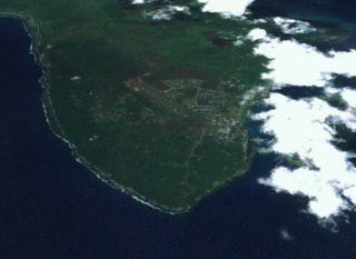
Rabaul is a township in the East New Britain province of Papua New Guinea, on the island of New Britain. It lies about 600 kilometres to the east of the island of New Guinea. Rabaul was the provincial capital and most important settlement in the province until it was destroyed in 1994 by falling ash from a volcanic eruption in its harbor. During the eruption, ash was sent thousands of metres into the air, and the subsequent rain of ash caused 80% of the buildings in Rabaul to collapse. After the eruption the capital was moved to Kokopo, about 20 kilometres (12 mi) away. Rabaul is continually threatened by volcanic activity, because it is on the edge of the Rabaul caldera, a flooded caldera of a large pyroclastic shield.
Lae is the capital of Morobe Province and is the second-largest city in Papua New Guinea. It is located near the delta of the Markham River and at the start of the Highlands Highway, which is the main land transport corridor between the Highlands Region and the coast. Lae is the largest cargo port of the country and is the industrial hub of Papua New Guinea. The city is known as the Garden City and home of the University of Technology.
Kavieng is the capital of the Papua New Guinean province of New Ireland and the largest town on the island of the same name. The town is located at Balgai Bay, on the northern tip of the island. As of 2009, it had a population of 17,248.
Goroka is the capital of the Eastern Highlands Province of Papua New Guinea. It is a town of approximately 19,000 people (2000), 1,600 meters above sea level. It has an airport and is on the "Highlands Highway", about 285 km from Lae in Morobe province and 90 km from the nearby town of Kainantu also in the Eastern Highlands. Other nearby towns include Kundiawa in Simbu Province and Mount Hagen in Western Highlands Province. It has a mild climate, known as a "perpetual Spring".

Mount Hagen is the third largest city in Papua New Guinea, with a population of 46,250. It is the capital of the Western Highlands Province and is located in the large fertile Wahgi Valley in central mainland Papua New Guinea, at an elevation of 1,677 m (5,502 ft).
PNG Air is an airline based on the grounds of Jacksons International Airport, Port Moresby, Papua New Guinea. It operates scheduled domestic and international flights, as well as contract corporate charter work. Its main base is Jacksons International Airport.
Kundiawa is the capital of Simbu Province, Papua New Guinea, with a population of 8,147. It lies along the Highlands Highway approximately halfway between Goroka and Mount Hagen, respectively the capitals of the Eastern Highlands and Western Highlands provinces.
Rugby league is a popular team sport in Papua New Guinea, and is the national sport. Papua New Guinea has a reputation for being the most passionate supporter of the game in the world.

This page is a list of districts of Papua New Guinea.
Dion Aiye is a Papua New Guinean rugby league footballer who plays as a stand-off, scrum-half or loose forward for Whitehaven in Betfred Championship.

Israel Eliab is a Papua New Guinea professional rugby league footballer who played for the PNG Hunters in the Queensland Cup. A Papua New Guinea international, most notably at the 2013 World Cup.
Ase Boas is a Papua New Guinean rugby league footballer who plays for Rabaul Gurias. A Papua New Guinean representative five-eighth, Boas previously played for the Featherstone Rovers in the Championship. He was a member of PNG's squads at the 2013 and 2017 World Cup tournaments.

The Agmark Rabaul Gurias are a semi professional Papua New Guinean rugby league team from Kokopo, East New Britain Province. They currently compete in the Papua New Guinea National Rugby League Competition. They play their home games at Kalabond Oval at the foot of active volcano Tavurvur. The Franchise is owned by NGIP Agmark Limited and was founded in 1991. The team has won six premierships in 2001, 2003, 2005, 2009, 2012 and 2015. The team has been a competitive team in the semi professional rugby game in Papua New Guinea over the past years and the team has developed professional rugby players who have played for the PNG Hunters like Israel Eliab, Ase Boas, Watson Boas and Wartovo Puara Jr. Former greats include Kumul strongman Lucas Solbat, Michael Marum, Normyle Eremas and Menzie Yere.
The Papua New Guinea Hunters (PNG Hunters) are a professional rugby league football club based in Papua New Guinea. They were formed in December 2013 and compete in the Queensland Cup, a second tier competition in Australia. The Hunters are the second Papua New Guinean side to enter the Queensland Cup following the Port Moresby Vipers who competed for two seasons in 1996 and 1997. Every Hunters match is shown live on national free-to-air television. The Hunters' home ground is the National Football Stadium in Port Moresby and their team colours are red, black and gold. The Hunters won the Hostplus Cup in 2017.
Wartovo Puara Jr is a Papua New Guinean professional rugby league footballer who plays as a hooker for the Sepik Pride Rugby League Football Club in the PNGNRL. He previously played for the Barrow Raiders in the Betfred Championship. He has represented the Papua New Guinean national team, most notably at the 2017 World Cup.
On 11 September 2022, an earthquake of moment magnitude 7.6–7.7 struck Papua New Guinea, in the northern part of Morobe Province. The normal faulting earthquake occurred with a hypocenter depth of 116.0 km (72.1 mi) beneath the Finisterre Range. A maximum perceived Modified Mercalli intensity of VIII (Severe) was estimated. Shaking was widely felt across the country and even in neighbouring Indonesia. At least 21 people died and 42 were injured, mostly due to landslides.

