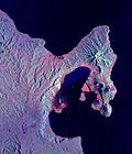
Tavurvur

Last updated
Tavurvur
Tavurvur volcano 2.jpg
Tavurvur erupting
Highest point
Elevation 688 m (2,257 ft) [1]
Coordinates 4°14′20″S152°12′36″E / 4.239°S 152.21°E / -4.239; 152.21 Coordinates: 4°14′20″S152°12′36″E / 4.239°S 152.21°E / -4.239; 152.21
Geography
Geology
Mountain type Cinder Cone volcano, vent of Rabaul caldera
Last eruption August to September 2014 [1]

Tavurvur is an active stratovolcano near Rabaul, on the island of New Britain, in Papua New Guinea. It is a sub-vent of the Rabaul caldera [1] and lies on the eastern rim of the larger feature. An eruption of the volcano largely destroyed the nearby town of Rabaul in 1994.

Contents

Mount Tavurvur is the most active volcano in Rabaul caldera, and erupted most recently on 29 August 2014. [2]

The correct pronunciation of the volcano's name is tah-VOOR-voor, according to the Rabaul Volcanological Observatory.[ citation needed ]

History

Related Research Articles

New Britain Island in Papua New Guinea

New Britain is the largest island in the Bismarck Archipelago, part of the Islands Region of Papua New Guinea. It is separated from New Guinea by a northwest corner of the Solomon Sea and from New Ireland by St. George's Channel. The main towns of New Britain are Rabaul/Kokopo and Kimbe. The island is roughly the size of Taiwan. While the island was part of German New Guinea, it was named Neupommern . In common with most of the Bismarcks it was largely formed by volcanic processes, and has active volcanoes including Ulawun, Langila, the Garbuna Group, the Sulu Range, and the volcanoes Tavurvur and Vulcan of the Rabaul caldera. A major eruption of Tavurvur in 1994 destroyed the East New Britain provincial capital of Rabaul. Most of the town still lies under metres of ash, and the capital has been moved to nearby Kokopo.

Rabaul Township in East New Britain, Papua New Guinea

Rabaul is a township in the East New Britain province of Papua New Guinea, on the island of New Britain. It lies about 600 kilometres to the east of the island of New Guinea. Rabaul was the provincial capital and most important settlement in the province until it was destroyed in 1994 by falling ash from a volcanic eruption in its harbor. During the eruption, ash was sent thousands of metres into the air, and the subsequent rain of ash caused 80% of the buildings in Rabaul to collapse. After the eruption the capital was moved to Kokopo, about 20 kilometres (12 mi) away. Rabaul is continually threatened by volcanic activity, because it is on the edge of the Rabaul caldera, a flooded caldera of a large pyroclastic shield.

Vulcan (volcano) Volcano in East New Britain, Papua New Guinea

Vulcan is a pumice cone in Papua New Guinea. It is a sub-vent of the Rabaul caldera and lies on its western rim. Its most recent eruption was in 1994, when it and another vent, Tavurvur, forced the city of Rabaul to be temporarily abandoned and the local administrative centres of East New Britain Province to be moved to a new capital, Kokopo. Today, the slopes of Vulcan are now forested, as a result of dormancy since 1994.

Manam Motu

Manam, known locally as Manam Motu, is an island located in the Bismarck Sea across the Stephan Strait from Yawar on the northeast coast of mainland Papua New Guinea's Bogia District. The island is 10 kilometers wide, and was created by the activity of the Manam Volcano, one of the country’s most active. It was evacuated in 2004 and its residents resettled elsewhere in Papua New Guinea, but many have begun to return despite concerns of future volcanic activity.

Ulawun Stratovolcano in Papua New Guinea

Ulawun is a basaltic and andesitic stratovolcano in West New Britain Province, on the island of New Britain in Papua New Guinea.

Karkar Island

Karkar Island is an oval-shaped volcanic island located in the Bismarck Sea, about 30 kilometres off the north coast of mainland Papua New Guinea in Madang Province, from which it is separated by the Isumrud Strait. The island is about 25 km in length and 19 km in width. In the centre is an active volcano with two nested calderas.

Vitu Islands

The Vitu Islands are a volcanic group with an area of 37 sq mi (96 km²) located in the Bismarck Sea off New Britain, in the southwestern Pacific Ocean. They are not technically part of the Bismarck Archipelago. Administratively they are part of Papua New Guinea. Formerly called the French Islands, the group is sometimes known as the Witu Islands.

Rabaul caldera Large volcano on the tip of the Gazelle Peninsula in East New Britain, Papua New Guinea

The Rabaul caldera, or Rabaul Volcano, is a large volcano on the tip of the Gazelle Peninsula in East New Britain, Papua New Guinea, and derives its name from the town of Rabaul inside the caldera. The caldera has many sub-vents, Tavurvur being the most well known for its devastating eruptions over Rabaul. The outer flanks of the highest peak, a 688-metre-high asymmetrical pyroclastic shield, are formed by thick pyroclastic flow deposits. There is no sign of a pyroclastic shield along the rim of the caldera, making the location likely underwater, on the caldera's floor.

Territory of New Guinea 1919–1949 Australian territory in northeast New Guinea

The Territory of New Guinea was an Australian-administered United Nations trust territory on the island of New Guinea from 1914 until 1975. In 1949, the Territory and the Territory of Papua were established in an administrative union by the name of the Territory of Papua and New Guinea. That administrative union was renamed as Papua New Guinea in 1971. Notwithstanding that it was part of an administrative union, the Territory of New Guinea at all times retained a distinct legal status and identity until the advent of the Independent State of Papua New Guinea.

Kokopo Capital of East New Britain, Papua New Guinea

Kokopo is the capital of East New Britain Province in Papua New Guinea. It is administered under Kokopo-Vunamami Urban LLG. The capital was moved from Rabaul in 1994 when the volcanoes Tavurvur and Vulcan erupted. As a result, the population of the town increased more than sixfold from 3,150 in 1990 to 20,262 in 2000.

Gazelle Peninsula

The Gazelle Peninsula is a large peninsula in northeastern East New Britain, Papua New Guinea located on the island of New Britain within the Bismarck Archipelago, situated in the southwestern Pacific Ocean. The Rabaul caldera is located on the northern tip of the peninsula. Upon the Gazelle Peninsula are the Baining Mountains, of which the highest point is Mount Sinewit at 2,063 metres (6,768 ft). The Gazelle Peninsula houses Vulcan Crater and Mount Tavurvur, both of which conducted volcanic activity in the 20th and 21st centuries and have provided extremely fertile soils. The body of the Gazelle Peninsula is about 80 kilometers. The southern isthmus upon which the Gazelle Peninsula is connected to the main body of East New Britain is reduced to about 32 kilometers.

Long Island (Papua New Guinea) Volcanic island north of New Guinea

Long Island is a volcanic island in Papua New Guinea. It is located north of the island of New Guinea, separated from it by the Vitiaz Strait.

Billy Mitchell (volcano)

Billy Mitchell is a pyroclastic shield in the central part of the island of Bougainville, just north-east of the Bagana Volcano in Papua New Guinea. It is a small pyroclastic shield truncated by a 2 km wide caldera filled by a crater lake. It is named after Billy Mitchell, a 20th-century United States Army general who is regarded as the father of the United States Air Force.

Pyroclastic shield Shield volcano formed mostly of pyroclastic and highly explosive eruptions

In volcanology, a pyroclastic shield or ignimbrite shield is an uncommon type of shield volcano. Unlike most shield volcanoes, pyroclastic shields are formed mostly of pyroclastic and highly explosive eruptions rather than relatively fluid basaltic lava issuing from vents or fissures on the surface of the volcano. They typically display low-angle flank slopes and often have a central caldera caused by large eruptions. Lava is commonly extruded after explosive activity has ended. The paucity of associated Plinian fall deposits indicates that pyroclastic shields are characterized by low Plinian columns.

Rabaul Airport

Rabaul Airport, also called Tokua Airport, is an airport serving Kokopo and Rabaul, the current and former capitals of East New Britain Province on New Britain island in Papua New Guinea.

Kadovar is a volcanic island in Papua New Guinea northeast of the much larger island of New Guinea. The volcano erupted in January 2018 and the eruption is ongoing as of 2021. There were some heightened thermal phenomena in 1976.

Dakataua

The Dakataua Caldera is located at the northern tip of the Willaumez Peninsula, New Britain, Papua New Guinea. The peninsula includes the 350 m high andesitic Mount Makalia stratovolcano. The last major collapse of Dakataua was during the Holocene around 800 CE. The most recent eruption on the caldera's rim was Mount Makalia in 1890, producing lava flows and cinder cones.

Lakunai Airfield

Lakunai Airfield, later known as Rabaul Airport; was an aerodrome located near Rabaul, East New Britain, Papua New Guinea. It was located at the foot of Tavurvur volcano, near Matupit Island. The airport was destroyed by the 1994 eruption that destroyed the town of Rabaul and subsequently a new airport was built and opened at Tokua, on the opposite side of the Rabaul caldera. The former airport was located at 04°13′S152°11′E.

The Agmark Rabaul Gurias are a semi professional Papua New Guinean rugby league team from Kokopo, East New Britain Province. They currently compete in the Papua New Guinea National Rugby League Competition. They play their home games at Kalabond Oval at the foot of active volcano Tavurvur. The Franchise is owned by NGIP Agmark Limited and was founded in 1991. The team has won six premierships in 2001, 2003, 2005, 2009, 2012 and 2015. The team has been a competitive team in the semi professional rugby game in Papua New Guinea over the past years and the team has developed professional rugby players who have played for the PNG Hunters like Israel Eliab, Ase Boas, Watson Boas and Wartovo Puara Jr. Former greats include Kumul strongman Lucas Solbat Normyle Eremas and Menzie Yere.

Kalabond Oval is a sporting oval in Kokopo, East New Britain Province, Papua New Guinea. It is home to rugby league team Agmark Gurias and has a capacity of just over 5,000 spectators. The stadium sits on the foot of an active volcano, Tavurvur.

References

  1. 1 2 3 "Rabaul". Global Volcanism Program . Smithsonian Institution . Retrieved 2020-03-25.
  2. "Rabaul (Tavurvur) volcano (New Britain, Papua New Guinea) activity update". volcanodiscovery.com. 2014-09-12. Retrieved 2014-11-11.