
New Britain is the largest island in the Bismarck Archipelago, part of the Islands Region of Papua New Guinea. It is separated from New Guinea by a northwest corner of the Solomon Sea and from New Ireland by St. George's Channel. The main towns of New Britain are Rabaul/Kokopo and Kimbe. The island is roughly the size of Taiwan.

Rabaul is a township in the East New Britain province of Papua New Guinea, on the island of New Britain. It lies about 600 kilometres to the east of the island of New Guinea. Rabaul was the provincial capital and most important settlement in the province until it was destroyed in 1994 by falling ash from a volcanic eruption in its harbor. During the eruption, ash was sent thousands of metres into the air, and the subsequent rain of ash caused 80% of the buildings in Rabaul to collapse. After the eruption the capital was moved to Kokopo, about 20 kilometres (12 mi) away. Rabaul is continually threatened by volcanic activity, because it is on the edge of the Rabaul caldera, a flooded caldera of a large pyroclastic shield volcano.

The Territory of Papua comprised the southeastern quarter of the island of New Guinea from 1883 to 1975. In 1883, the Government of Queensland annexed this territory for the British Empire. The United Kingdom Government refused to ratify the annexation but in 1884 a protectorate was proclaimed over the territory, then called British New Guinea. There is a certain ambiguity about the exact date on which the entire territory was annexed by the British. The Papua Act 1905 recites that this happened "on or about" 4 September 1888. On 18 March 1902, the Territory was placed under the authority of the Commonwealth of Australia. Resolutions of acceptance were passed by the Commonwealth Parliament, which accepted the territory under the name of Papua.

Tavurvur is an active stratovolcano near Rabaul, on the island of New Britain, in Papua New Guinea. It is a sub-vent of the Rabaul caldera and lies on the eastern rim of the larger feature. An eruption of the volcano largely destroyed the nearby town of Rabaul in 1994.

The Australian Naval and Military Expeditionary Force (AN&MEF) was a small volunteer force of approximately 2,000 men, raised in Australia shortly after the outbreak of World War I to seize and destroy German wireless stations in German New Guinea in the south-west Pacific. The German wireless installations were ordered to be destroyed because they were used by Vizeadmiral Maximilian von Spee's East Asia Squadron of the Imperial German Navy, which threatened merchant shipping in the region. Following the capture of German possessions in the region, the AN&MEF provided occupation forces for the duration of the war. New Zealand provided a similar force for the occupation of German Samoa.

The Battle of Rabaul, also known by the Japanese as Operation R, an instigating action of the New Guinea campaign, was fought on the island of New Britain in the Australian Territory of New Guinea, from 23 January into February 1942. It was a strategically significant defeat of Allied forces by Japan in the Pacific campaign of World War II, with the Japanese invasion force quickly overwhelming the small Australian garrison, the majority of which was either killed or captured. Hostilities on the neighbouring island of New Ireland are usually considered to be part of the same battle. Rabaul was significant because of its proximity to the Japanese territory of the Caroline Islands, site of a major Imperial Japanese Navy base on Truk.

Mount Rinjani is an active volcano in Indonesia on the island of Lombok. Administratively the mountain is in the Regency of North Lombok, West Nusa Tenggara. It rises to 3,726 metres (12,224 ft), making it the second highest volcano in Indonesia. It is also the highest point in the Indonesian province of West Nusa Tenggara. Adjacent to the volcano is a 6-by-8.5-kilometre caldera, which is filled partially by the crater lake known as Segara Anak or Anak Laut, due to the color of its water, as blue as the sea (laut). This lake is approximately 2,000 metres (6,600 ft) above sea level and estimated to be about 200 metres (660 ft) deep; the caldera also contains hot springs. The lake and mountain are sacred to the Sasak people and Hindus, and are the site of religious rituals. UNESCO made Mount Rinjani Caldera a part of the Global Geoparks Network in April 2018.

The Rabaul caldera, or Rabaul Volcano, is a large volcano on the tip of the Gazelle Peninsula in East New Britain, Papua New Guinea, and derives its name from the town of Rabaul inside the caldera. The caldera has many sub-vents, Tavurvur being the most well known for its devastating eruptions over Rabaul. The outer flanks of the highest peak, a 688-metre-high asymmetrical pyroclastic shield, are formed by thick pyroclastic flow deposits. There is no sign of a pyroclastic shield along the rim of the caldera, making the location likely underwater, on the caldera's floor.
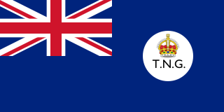
The Territory of New Guinea was an Australian-administered League of Nations and then United Nations trust territory on the island of New Guinea from 1914 until 1975. In 1949, the Territory and the Territory of Papua were established in an administrative union by the name of the Territory of Papua and New Guinea. That administrative union was renamed as Papua New Guinea in 1971. Notwithstanding that it was part of an administrative union, the Territory of New Guinea at all times retained a distinct legal status and identity until the advent of the Independent State of Papua New Guinea.

Kokopo is the capital of East New Britain Province in Papua New Guinea. It is administered under Kokopo/Vunamami Urban LLG. The capital was moved from Rabaul in 1994 when the volcanoes Tavurvur and Vulcan erupted. As a result, the population of the town increased more than sixfold from 3,150 in 1990 to 20,262 in 2000.

The Gazelle Peninsula is a large peninsula in northeastern East New Britain, Papua New Guinea located on the island of New Britain within the Bismarck Archipelago, situated in the southwestern Pacific Ocean. The Rabaul caldera is located on the northern tip of the peninsula. Upon the Gazelle Peninsula are the Baining Mountains, of which the highest point is Mount Sinewit at 2,063 m (6,768 ft). The Gazelle Peninsula houses Vulcan Crater and Mount Tavurvur, both of which conducted volcanic activity in the 20th and 21st centuries and have provided extremely fertile soils. The body of the Gazelle Peninsula is about 80 km (50 mi). The southern isthmus upon which the Gazelle Peninsula is connected to the main body of East New Britain is reduced to about 32 km (20 mi).
I-177 was an Imperial Japanese Navy Kaidai-type cruiser submarine of the KD7 subclass commissioned in 1942. She served during World War II, patrolling off Australia, taking part in the New Guinea campaign, operating in the North Pacific, and participating in the Palau campaign before she was sunk by the destroyer escort USS Samuel S. Miles (DE-183) in 1944, with no survivors.

George Anthony Morgan Taylor, GC was an Australian Volcanologist awarded the George Cross in 1952 for "conspicuous courage in the face of great danger" during the eruption of Mount Lamington in Papua from January to March 1951. Taylor was one of only five Australian civilians directly awarded the George Cross between its institution in 1941 and 1972 when it was replaced in the Australian honours system by the Cross of Valour.
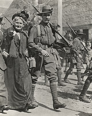
The Battle of Bita Paka was fought south of Kabakaul, on the island of New Britain, and was a part of the invasion and subsequent occupation of German New Guinea by the Australian Naval and Military Expeditionary Force (AN&MEF) shortly after the outbreak of the First World War. Similar to New Zealand's operation against German Samoa in August, the main target of the operation was a strategically important wireless station—one of several used by the German East Asia Squadron—which the Australians believed to be located in the area. The powerful German naval fleet threatened British interests and its elimination was an early priority of the British and Australian governments during the war.

Simpson Harbour is a sheltered harbour of Blanche Bay, on the Gazelle Peninsula in the extreme north of New Britain. The harbour is named after Captain Cortland Simpson, who surveyed the bay while in command of HMS Blanche in 1872. The former capital city of Rabaul is on its shores.

Kadovar is a volcanic island in Papua New Guinea northeast of the much larger island of New Guinea. The volcano erupted in January 2018 and the eruption is ongoing as of 2023, although the activity level is generally considered to be low. There were some heightened thermal phenomena in 1976.

Japanese settlement in the Territory of Papua and German New Guinea dates back to the early 20th century when migrants from Japan established copra plantations and trading businesses in the islands, specifically Rabaul. The Japanese community remained small throughout the first half of the 20th century, although there were Japanese migrating in and out of New Guinea in different years from 1901 to 1945, it generally never exceeded more than 100 as a whole community. Some Japanese stayed for short terms and were replaced by newer emigrants from Japan, others stayed for longer periods depending on their roles. Most Japanese in Papua were businessmen and plantation managers, although a few became fishermen. As almost all the migrants were men, many of them married local Papuan wives and raised mixed-race Japanese-Papuan families while other Japanese men staying only for short periods also had sexual cohabitations with local Papuan women, but in most cases without marrying. Many of them did produce offspring but they were generally abandoned by their Japanese fathers and raised by their single Papuan mothers or sent to the orphanage. These abandoned mixed-race children's were recorded as ethnic Papuans in the census as the ethnicity of their fathers was unknown.

The Allied occupation of German New Guinea was the takeover of the Pacific colony of German New Guinea in September – November 1914 by an expeditionary force from Australia, called the Australian Naval and Military Expeditionary Force.
Operation Scorpion was a proposed operation in World War II by Australia's Z Special Unit.
John Bexley Sedgers was an Australian businessman. He spent much of his career in the Territory of Papua and New Guinea, where he served in the Legislative Council from 1951 to 1954.

