Related Research Articles

Indonesia is an archipelagic country located in Southeast Asia and Oceania, lying between the Indian Ocean and the Pacific Ocean. It is located in a strategic location astride or along major sea lanes connecting East Asia, South Asia and Oceania. Indonesia is the largest archipelago in the world. Indonesia's various regional cultures have been shaped—although not specifically determined—by centuries of complex interactions with its physical environment.

The South China Sea is a marginal sea of the Western Pacific Ocean. It is bounded in the north by South China, in the west by the Indochinese Peninsula, in the east by the islands of Taiwan and northwestern Philippines, and in the south by Borneo, eastern Sumatra and the Bangka Belitung Islands, encompassing an area of around 3,500,000 km2 (1,400,000 sq mi). It communicates with the East China Sea via the Taiwan Strait, the Philippine Sea via the Luzon Strait, the Sulu Sea via the straits around Palawan, and the Java Sea via the Karimata and Bangka Straits. The Gulf of Thailand and the Gulf of Tonkin are part of the South China Sea.

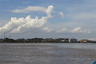
West Kalimantan is a province of Indonesia. It is one of five Indonesian provinces comprising Kalimantan, the Indonesian part of the island of Borneo. Its capital and largest city is Pontianak. It is bordered by East Kalimantan and Central Kalimantan to the east, the Malaysian state of Sarawak to the north, and the Bangka Belitung Islands to the west and the Java Sea to the south. The province has an area of 147,037 km2, and had a population of 4,395,983 at the 2010 Census and 5,414,390 at the 2020 Census; the official estimate as at mid 2023 was 5,623,328, and was projected to rise to 5,695,500 at mid 2024. Ethnic groups include the Dayak, Malay, Chinese, Javanese, Bugis, and Madurese. The borders of West Kalimantan roughly trace the mountain ranges surrounding the vast watershed of the Kapuas River, which drains most of the province. The province shares land borders with Central Kalimantan to the southeast, East Kalimantan to the east, and the Malaysian territory of Sarawak to the north.

The Riau Islands is a province of Indonesia—not to be confused with neighbouring Riau Province from which the Riau Islands Province were separated in 2002. The capital of the province is Tanjung Pinang, while the largest city is Batam. It shares a maritime border with Riau and Jambi to the west, Bangka Belitung Islands to the south, Singapore to the northeast, Malaysia and West Kalimantan to the east, and Vietnam and Cambodia to the north. It comprises a total of 2.408 islands scattered between Sumatra, Malay Peninsula, and Borneo including the Riau Archipelago. Situated on one of the world's busiest shipping lanes along the Malacca Strait and the Natuna Sea, the province shares water borders with neighboring countries such as Singapore, Malaysia, and Brunei. The Riau Islands also have relatively large potential mineral resources and energy, as well as marine resources.

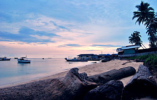
Natuna Regency is an islands regency located in the northernmost part of the Province of Riau Islands, Indonesia. It contains at least 154 islands, of which 127 of them are reported as uninhabited. This archipelago, with a land area of 1,978.49 km2 out of a total area of 264,198.37 km2 area, This area is divided into island clusters such as the Natuna Island Cluster and the Serasan Island Cluster. However, several other islands that are not located in the two clusters are spread over a wider area. This division reflects the geographical and administrative location of the district, but there are also other small islands that are outside these two main clusters and are not always included in the grouping. Administratively, this area is divided into 17 districts (kecamatan) which function to facilitate management and services for the local community and support the development of the potential of the region which is rich in natural resources and tourism. This regency also plays an important role in maintaining Indonesia's sovereignty in the northern border area.
The Mahakam River is third longest and volume discharge river in Borneo after Kapuas River and Barito River, it is located in Kalimantan, Indonesia. It flows 980 kilometers from the district of Long Apari in the highlands of Borneo, to its mouth at the Makassar Strait.

The Kapuas River is a river in the Indonesian part of Borneo island, at the geographic center of Maritime Southeast Asia. At 1,143 kilometers (710 mi) in length, it is the longest river in the island of Borneo and the longest river in Indonesia and one of the world's longest island rivers. It originates in the Müller mountain range at the center of the island and flows west into the South China Sea creating an extended marshy delta. The delta is located west-southwest of Pontianak, the capital of the West Kalimantan province. This Kapuas River should be distinguished from another Kapuas River, which starts on the other side of the same mountain range in central Borneo but flows to the south, merging with the Barito River and discharging into the Java Sea.
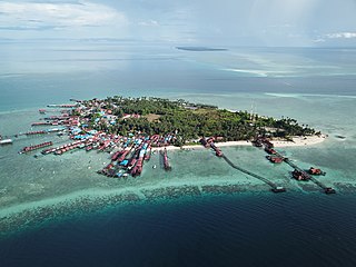
The Derawan Islands are in the province of East Kalimantan in Indonesia. They consist of 31 islands, most well known among these are the islands of Derawan, Kakaban, Maratua, and Sangalaki. There are also numerous submerged reefs and islets. They are located in the Sulawesi Sea, on the coastal shelf of East Kalimantan. The islands are part of the Berau Regency.

Raja Ampat, or the Four Kings, is an archipelago located off of the northwest tip of Bird's Head Peninsula, Southwest Papua province, Indonesia. It comprises over 1,500 small islands, cays, and shoals around the four main islands of Misool, Salawati, Batanta, and Waigeo, and the smaller island of Kofiau.

Bontang is a city on the eastern coast of the island of Borneo in Indonesia, in the province of East Kalimantan. It occupies an area of 161.88 km2 (62.50 sq mi), and the population was 140,787 at the 2010 census, and 178,917 at the 2020 census; the official estimate as of mid-2023 was 189,968. It is also the third most densely populated place in the province after Balikpapan and Samarinda.

Tarakan is an island and co-extensively the sole city within the Indonesian province of North Kalimantan. The island city is the largest urban area in North Kalimantan population-wise and is located in northern Borneo, midway along the coast of the province. The city boundaries are co-extensive with the island. Once a major oil-producing region during the colonial period, Tarakan had great strategic importance during the Pacific War and was among the first Japanese targets early in the conflict. It is the sole city within the newly established Indonesian province of North Kalimantan. According to Statistics Indonesia, the city had a population of 193,370 at the 2010 Census and 242,786 inhabitants at the 2020 Census; the official estimate as at mid 2023 was 249,960.
Berau Regency is the most northern of the seven regencies in East Kalimantan province in Indonesia. The capital is the town of Tanjung Redeb. The regency has an area of 36,962.37 km2 and had a population of 179,079 at the 2010 census and 248,035 at the 2020 census; the official estimate as at mid 2023 was 280,998.

The Coral Triangle (CT) is a roughly triangular area in the tropical waters around Indonesia, Malaysia, Papua New Guinea, the Philippines, Solomon Islands, and Timor-Leste. This area contains at least 500 species of reef-building corals in each ecoregion. The Coral Triangle is located between the Pacific and Indian oceans and encompasses portions of two biogeographic regions: the Indonesian-Philippines Region, and the Far Southwestern Pacific Region. As one of eight major coral reef zones in the world, the Coral Triangle is recognized as a global centre of marine biodiversity and a global priority for conservation. Its biological resources make it a global hotspot of marine biodiversity. Known as the "Amazon of the seas", it covers 5.7 million square kilometres (2,200,000 sq mi) of ocean waters. It contains more than 76% of the world's shallow-water reef-building coral species, 37% of its reef fish species, 50% of its razor clam species, six out of seven of the world's sea turtle species, and the world's largest mangrove forest. The epicenter of that coral diversity is found in the Bird’s Head Seascape of Indonesian Papua, which hosts 574 species. Within the Bird’s Head Seascape, the Raja Ampat archipelago is the world’s coral diversity bull’s eye with 553 species. In 2014, the Asian Development Bank (ADB) reported that the gross domestic product of the marine ecosystem in the Coral Triangle is roughly $1.2 trillion per year and provides food to over 120 million people. According to the Coral Triangle Knowledge Network, the region annually brings in about $3 billion in foreign exchange income from fisheries exports, and another $3 billion from coastal tourism revenues.

Bunaken National Park is a marine park in the north of Sulawesi Island, Indonesia. The park is located near the centre of the Coral Triangle, providing habitat to 390 species of coral as well as many fish, mollusks, reptiles and marine mammal species. The park is representative of Indonesian tropical water ecosystems, consisting of seagrass plains, coral reefs and coastal ecosystems.

The Natuna Sea is an extensive shallow sea located around the Natuna Regency, extending south of the Riau Islands, east of the Lingga Regency and west of Borneo, to the Bangka Belitung Islands. The islands of the Badas and Tambelan Archipelago are located at its center. Mostly located within Indonesian territorial waters, it is the southernmost portion of the South China Sea, and geologically part of Sunda Shelf. It communicates with the Java Sea to its southeast via the Karimata and Gaspar Strait east and west of Belitung, and with the Strait of Malacca to the west via the Berhala and Singapore Strait.

The Coral reefs of Solomon Islands consists of six major islands and over 986 smaller islands, in Oceania, to the east of Papua New Guinea and northwest of Vanuatu. Solomon Islands lie between latitudes 5° and 13°S, and longitudes 155° and 169°E. The distance between the westernmost and easternmost islands is about 1,500 km (930 mi). The Santa Cruz Islands are situated north of Vanuatu and are especially isolated at more than 200 km (120 mi) from the other islands. The Solomon Islands has the 22nd largest Exclusive Economic Zone of 1,589,477 km2 (613,701 sq mi) of the Pacific Ocean.
Lemukutan is an island that is administratively located in Sungai Raya Kepulauan District, Bengkayang Regency, West Kalimantan Province, Indonesia.
Temajo is a small island located in the waters of West Kalimantan, Indonesia.
Randayan is a small island on the coast of West Kalimantan, covering an area of approximately 4.5 hectares.
Penata is the name for two adjacent small islands located in the waters of West Kalimantan, namely Penata Besar Island and Penata Kecil Island. Administratively, these two islands are part of Bengkayang Regency.
References
- 1 2 "Pulau Merundung". World Islands. 30 December 2023. Retrieved 21 November 2024.
- ↑ "Peraturan Presiden Nomor 3 Tahun 2012" (PDF). Peraturan BPK RI. Retrieved 10 November 2024.