Related Research Articles

Mezen is a town and the administrative center of Mezensky District in Arkhangelsk Oblast, Russia, located on the right bank of the Mezen River close to the point where it flows into the White Sea. Population: 3,575 (2010 Census); 3,863 (2002 Census); 4,968 (1989 Census).

The Kazan Governorate, or the Government of Kazan, was a governorate of the Tsardom of Russia, the Russian Empire, and the Russian SFSR from 1708–1920, with its seat in the city of Kazan.

The Taurida Governorate or the Government of Taurida, was a historical governorate of the Russian Empire. It included the Crimean Peninsula and the mainland between the lower Dnieper River and the coasts of the Black Sea and Sea of Azov. It was formed after the Taurida Oblast was abolished in 1802 in the course of Paul I's administrative reform of the southwestern territories that had been annexed from the Crimean Khanate. The governorate's centre was the city of Simferopol. The province was named after the ancient Greek name of Crimea - Taurida.

The Chernigov Governorate, also known as the Government of Chernigov, was a guberniya in the historical Left-bank Ukraine region of the Russian Empire, which was officially created in 1802 from the Malorossiya Governorate with an administrative centre of Chernihiv. The Little Russian Governorate was transformed into the General Government of Little Russia and consisted of Chernigov Governorate, Poltava Governorate, and later Kharkov Governorate.

The Kherson Governorate or Government of Kherson was a guberniya, or administrative territorial unit, between the Dnieper and Dniester Rivers, of the Russian Empire. It was one of three governorates created in 1802 when the Novorossiya guberniya was abolished. It was known as the Nikolayev Governorate until 1803, when Nikolayev was separated into a special Nikolayev War Goveranorate as a center of the Black Sea Fleet and the governor seat was moved to Kherson.

The Yekaterinoslav Governorate or Government of Yekaterinoslav was a governorate in the Russian Empire. A common name for it in Ukrainian was Katerynoslavshchyna. Its capital was the city of Yekaterinoslav. Today its territory is part of Ukraine.
Within the framework of administrative divisions, Arkhangelsk Oblast is divided into six cities and towns of oblast significance, twenty-one districts, and two island territories. Besides, Mirny is a town under the federal government management.

The Poltava Governorate or Government of Poltava was a guberniya in the historical Left-bank Ukraine region of the Russian Empire. It was officially created in 1802 from the disbanded Malorossiya Governorate, which was split between the Chernigov Governorate and Poltava Governorate with an administrative center of Poltava.

Tambov Governorate was an administrative unit of the Russian Empire, Russian Republic, and later the Russian SFSR, centred around the city of Tambov. The governorate was located between 51°14' and 55°6' north and between 38°9' and 43°38' east. It bordered Vladimir Governorate and Nizhny Novgorod Governorate to north, Penza Governorate and Saratov Governorate to the east, Voronezh Governorate to south and west, and Oryol Governorate, Tula Governorate, and Ryazan Governorate to the west.

Vologda Governorate was an administrative division of the Russian Empire and the Russian SFSR, which existed from 1796 until 1929. Its administrative center was in the city of Vologda. The governorate was located in the north of Russian Empire.

Arkhangelsk Governorate was an administrative division of the Russian Empire and Russian SFSR, which existed from 1796 until 1929. Its seat was in Arkhangelsk. The governorate was located in the north of the Russian Empire and bordered Tobolsk Governorate in the south-east, Vologda Governorate in the south, Olonets Governorate in the southwest, Sweden in the west, and Norway in north-west. In the north, the governorate was limited by the White and Barents Seas.

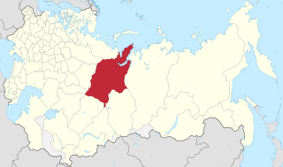
Tobolsk Governorate was an administrative division of the Russian Empire, located in the Ural Mountains and Siberia. It existed from 1796 to 1920; its seat was in the city of Tobolsk.

Perm Governorate was an administrative unit of the Russian Empire and the Soviet Union from 1781 to 1923. It was also known as the government of Perm. It was located on both slopes of the Ural Mountains, and its administrative center was the city of Perm. The region gave its name to the Permian period.

Mezensky District is an administrative district (raion), one of the twenty-one in Arkhangelsk Oblast, Russia. As a municipal division, it is incorporated as Mezensky Municipal District. It is located in the northeast of the oblast and borders with Nenets Autonomous Okrug in the northeast, Ust-Tsilemsky District of the Komi Republic in the east, Leshukonsky and Pinezhsky Districts in the south, and with Primorsky District in the southwest. From the north, the district borders the White Sea. The area of the district is 34,400 square kilometers (13,300 sq mi). Its administrative center is the town of Mezen. Population: 10,330 (2010 Census); 13,124 (2002 Census); 17,796 (1989 Census). The population of Mezen accounts for 34.6% of the total district's population.

Vyatka Governorate was a governorate of the Russian Empire and Russian SFSR, with its capital in city Vyatka, from 1796 to 1929. In the governorate’s area were situated most parts of modern Kirov Oblast and Udmurt Republic.

Ufa Governorate was a governorate of the Russian Empire with its capital in the city Ufa. It was created in 1865 by separation from Orenburg Governorate. On June 14, 1922 the governorate was transformed into the Bashkir Autonomous Soviet Socialist Republic. It occupied an area of 122,005 km2 and the territory of the governorate was divided to 6 uyezds.
Mezensky (masculine), Mezenskaya (feminine), or Mezenskoye (neuter) may refer to:

Kaluga Governorate (1796–1929) was a governorate of the Russian Empire and the Russian SFSR. Its capital was Kaluga.

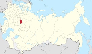
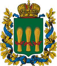
Penza Governorate was an administrative division of the Russian Empire and Russian SFSR, located in the Volga Region. It existed from 1796 to 1797 and again from 1801 to 1928; its seat was in the city of Penza.