Mostki is a village in the administrative district of Gmina Włocławek, within Włocławek County, Kuyavian-Pomeranian Voivodeship, in north-central Poland. It lies approximately 15 kilometres (9 mi) east of Włocławek and 63 km (39 mi) south-east of Toruń.
Laudańszczyzna is a village in the administrative district of Gmina Suchowola, within Sokółka County, Podlaskie Voivodeship, in north-eastern Poland. It lies approximately 7 kilometres (4 mi) north-east of Suchowola, 33 km (21 mi) north-west of Sokółka, and 56 km (35 mi) north of the regional capital Białystok.
Grabowy Las is a village in the administrative district of Gmina Stromiec, within Białobrzegi County, Masovian Voivodeship, in east-central Poland. It lies approximately 6 kilometres (4 mi) south-east of Stromiec, 16 km (10 mi) east of Białobrzegi, and 68 km (42 mi) south of Warsaw.
Dolne Pole is a village in the administrative district of Gmina Kaźmierz, within Szamotuły County, Greater Poland Voivodeship, in west-central Poland. It lies approximately 3 kilometres (2 mi) south-east of Kaźmierz, 12 km (7 mi) south of Szamotuły, and 24 km (15 mi) north-west of the regional capital Poznań.
Rejowiec, also called Rejowiec Poznański, is a village in the administrative district of Gmina Skoki, within Wągrowiec County, Greater Poland Voivodeship, in west-central Poland. It lies approximately 6 kilometres (4 mi) south of Skoki, 21 km (13 mi) south of Wągrowiec, and 30 km (19 mi) north-east of the regional capital Poznań.
Wysoka is a village in the administrative district of Gmina Skoki, within Wągrowiec County, Greater Poland Voivodeship, in west-central Poland. It lies approximately 9 kilometres (6 mi) south-east of Skoki, 21 km (13 mi) south of Wągrowiec, and 33 km (21 mi) north-east of the regional capital Poznań.
Krasne Dłusko is a village in the administrative district of Gmina Przytoczna, within Międzyrzecz County, Lubusz Voivodeship, in western Poland. It lies approximately 6 kilometres (4 mi) north-west of Przytoczna, 17 km (11 mi) north of Międzyrzecz, and 29 km (18 mi) south-east of Gorzów Wielkopolski.
Goszczanowiec is a village in the administrative district of Gmina Drezdenko, within Strzelce-Drezdenko County, Lubusz Voivodeship, in western Poland. It lies approximately 18 kilometres (11 mi) south-west of Drezdenko, 16 km (10 mi) south of Strzelce Krajeńskie, and 25 km (16 mi) east of Gorzów Wielkopolski.
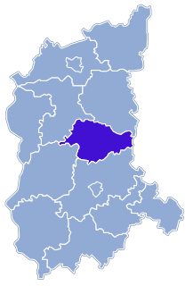
Glińsk is a village in the administrative district of Gmina Świebodzin, within Świebodzin County, Lubusz Voivodeship, in western Poland.
Jeziory is a village in the administrative district of Gmina Świebodzin, within Świebodzin County, Lubusz Voivodeship, in western Poland. It lies approximately 6 kilometres (4 mi) south-east of Świebodzin, 32 km (20 mi) north of Zielona Góra, and 63 km (39 mi) south-east of Gorzów Wielkopolski.
Lubinicko is a village in the administrative district of Gmina Świebodzin, within Świebodzin County, Lubusz Voivodeship, in western Poland. It lies approximately 3 kilometres (2 mi) south-east of Świebodzin, 33 km (21 mi) north of Zielona Góra, and 60 km (37 mi) south of Gorzów Wielkopolski.
Ługów is a village in the administrative district of Gmina Świebodzin, within Świebodzin County, Lubusz Voivodeship, in western Poland. It lies approximately 3 kilometres (2 mi) north-west of Świebodzin, 37 km (23 mi) north of Zielona Góra, and 55 km (34 mi) south of Gorzów Wielkopolski.
Nowy Dworek is a village in the administrative district of Gmina Świebodzin, within Świebodzin County, Lubusz Voivodeship, in western Poland. It lies approximately 10 kilometres (6 mi) north of Świebodzin, 44 km (27 mi) north of Zielona Góra, and 48 km (30 mi) south of Gorzów Wielkopolski.
Raków is a village in the administrative district of Gmina Świebodzin, within Świebodzin County, Lubusz Voivodeship, in western Poland. It lies approximately 9 kilometres (6 mi) south-east of Świebodzin, 28 km (17 mi) north of Zielona Góra, and 66 km (41 mi) south of Gorzów Wielkopolski.
Rusinów is a village in the administrative district of Gmina Świebodzin, within Świebodzin County, Lubusz Voivodeship, in western Poland. It lies approximately 4 kilometres (2 mi) north of Świebodzin, 39 km (24 mi) north of Zielona Góra, and 54 km (34 mi) south of Gorzów Wielkopolski.
Sieniawa is a village in the administrative district of Gmina Łagów, within Świebodzin County, Lubusz Voivodeship, in western Poland. It lies approximately 6 kilometres (4 mi) north-east of Łagów, 18 km (11 mi) north-west of Świebodzin, 42 km (26 mi) south of Gorzów Wielkopolski, and 49 km (30 mi) north of Zielona Góra.
Koźminek is a village in the administrative district of Gmina Szczaniec, within Świebodzin County, Lubusz Voivodeship, in western Poland. It lies approximately 7 kilometres (4 mi) south-east of Szczaniec, 15 km (9 mi) east of Świebodzin, 35 km (22 mi) north-east of Zielona Góra, and 67 km (42 mi) south-east of Gorzów Wielkopolski.
Myszęcin is a village in the administrative district of Gmina Szczaniec, within Świebodzin County, Lubusz Voivodeship, in western Poland. It lies approximately 4 kilometres (2 mi) north-west of Szczaniec, 8 km (5 mi) north-east of Świebodzin, 40 km (25 mi) north of Zielona Góra, and 57 km (35 mi) south-east of Gorzów Wielkopolski.
Smardzewo is a village in the administrative district of Gmina Szczaniec, within Świebodzin County, Lubusz Voivodeship, in western Poland. It lies approximately 8 kilometres (5 mi) south of Szczaniec, 12 km (7 mi) south-east of Świebodzin, 32 km (20 mi) north-east of Zielona Góra, and 67 km (42 mi) south-east of Gorzów Wielkopolski.
Kręcko is a village in the administrative district of Gmina Zbąszynek, within Świebodzin County, Lubusz Voivodeship, in western Poland. It lies approximately 5 kilometres (3 mi) south-west of Zbąszynek, 18 km (11 mi) east of Świebodzin, 37 km (23 mi) north-east of Zielona Góra, and 68 km (42 mi) south-east of Gorzów Wielkopolski.