Coronation Island Wilderness is a 19,232-acre (7,783 ha) wilderness area in the U.S. state of Alaska. It was designated by the United States Congress in 1980 in a provision of the Alaska National Interest Lands Conservation Act. The wilderness area encompasses the entirety of Coronation Island plus the Spanish Islands. It is part of Tongass National Forest, which is managed by the United States Forest Service.
Wielgie Milickie is a village in the administrative district of Gmina Milicz, within Milicz County, Lower Silesian Voivodeship, in south-western Poland. Prior to 1945 it was in Germany.

Olchowiec-Kolonia is a village in the administrative district of Gmina Wierzbica, within Chełm County, Lublin Voivodeship, in eastern Poland. It lies approximately 5 kilometres (3 mi) south-west of Wierzbica, 17 km (11 mi) north-west of Chełm, and 50 km (31 mi) east of the regional capital Lublin.

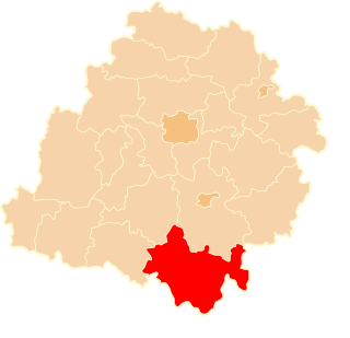
Podjaworek is a settlement in the administrative district of Gmina Bolesławiec, within Wieruszów County, Łódź Voivodeship, in central Poland. It lies approximately 7 kilometres (4 mi) north-east of Bolesławiec, 12 km (7 mi) south-east of Wieruszów, and 103 km (64 mi) south-west of the regional capital Łódź.

Cegłów is a village in the administrative district of Gmina Baranów, within Grodzisk Mazowiecki County, Masovian Voivodeship, in east-central Poland. It lies approximately 10 kilometres (6 mi) north-west of Grodzisk Mazowiecki and 34 km (21 mi) west of Warsaw.
Nowe Krubice is a village in the administrative district of Gmina Bulkowo, within Płock County, Masovian Voivodeship, in east-central Poland.

Szeligi is a village in the administrative district of Gmina Ożarów Mazowiecki, within Warsaw West County, Masovian Voivodeship, in east-central Poland. It lies approximately 5 kilometres (3 mi) east of Ożarów Mazowiecki and 10 km (6 mi) west of Warsaw.
Grądy Szlacheckie is a village in the administrative district of Gmina Długosiodło, within Wyszków County, Masovian Voivodeship, in east-central Poland.

Polska Cerekiew, in German Groß Neukirch, is a village in Kędzierzyn-Koźle County, Opole Voivodeship, in south-western Poland. It is the seat of the gmina called Gmina Polska Cerekiew. It lies approximately 15 kilometres (9 mi) south of Kędzierzyn-Koźle and 51 km (32 mi) south of the regional capital Opole.

Łobzowo is a village in the administrative district of Gmina Kołczygłowy, within Bytów County, Pomeranian Voivodeship, in northern Poland. It lies approximately 12 kilometres (7 mi) south of Kołczygłowy, 18 km (11 mi) west of Bytów, and 95 km (59 mi) west of the regional capital Gdańsk.

Huta Dolna is a village in the administrative district of Gmina Przywidz, within Gdańsk County, Pomeranian Voivodeship, in northern Poland. It lies approximately 4 kilometres (2 mi) north of Przywidz, 21 km (13 mi) west of Pruszcz Gdański, and 26 km (16 mi) south-west of the regional capital Gdańsk.

Brzeziny is a village in the administrative district of Gmina Przodkowo, within Kartuzy County, Pomeranian Voivodeship, in northern Poland. It lies approximately 4 kilometres (2 mi) west of Przodkowo, 6 km (4 mi) north of Kartuzy, and 27 km (17 mi) west of the regional capital Gdańsk.

Kamela is a village in the administrative district of Gmina Somonino, within Kartuzy County, Pomeranian Voivodeship, in northern Poland. It lies approximately 6 kilometres (4 mi) south-east of Somonino, 12 km (7 mi) south of Kartuzy, and 31 km (19 mi) south-west of the regional capital Gdańsk.

Rzepecka is a settlement in the administrative district of Gmina Luzino, within Wejherowo County, Pomeranian Voivodeship, in northern Poland. It lies approximately 7 kilometres (4 mi) south-west of Luzino, 17 km (11 mi) south-west of Wejherowo, and 43 km (27 mi) north-west of the regional capital Gdańsk.

Borówko is a village in the administrative district of Gmina Łęczyce, within Wejherowo County, Pomeranian Voivodeship, in northern Poland. It lies approximately 10 kilometres (6 mi) south-east of Łęczyce, 21 km (13 mi) south-west of Wejherowo, and 47 km (29 mi) west of the regional capital Gdańsk.

Jeleńska Huta is a village in the administrative district of Gmina Szemud, within Wejherowo County, Pomeranian Voivodeship, in northern Poland. It lies approximately 4 kilometres (2 mi) south of Szemud, 17 km (11 mi) south of Wejherowo, and 28 km (17 mi) west of the regional capital Gdańsk.

Dolna Kępa is a settlement in the administrative district of Gmina Elbląg, within Elbląg County, Warmian-Masurian Voivodeship, in northern Poland. It lies approximately 17 kilometres (11 mi) north of Elbląg and 92 km (57 mi) north-west of the regional capital Olsztyn.

Bajory Małe is a village in the administrative district of Gmina Srokowo, within Kętrzyn County, Warmian-Masurian Voivodeship, in northern Poland, close to the border with the Kaliningrad Oblast of Russia. It lies approximately 8 kilometres (5 mi) north of Srokowo, 25 km (16 mi) north of Kętrzyn, and 87 km (54 mi) north-east of the regional capital Olsztyn.

Skarżyn is a village in the administrative district of Gmina Biała Piska, within Pisz County, Warmian-Masurian Voivodeship, in northern Poland. It lies approximately 11 kilometres (7 mi) east of Biała Piska, 29 km (18 mi) east of Pisz, and 116 km (72 mi) east of the regional capital Olsztyn.
Skuodas Manor is a former residential manor in Skuodas, Lithuania.


