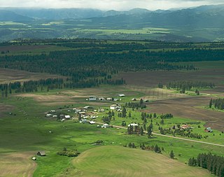
Opatowice is a village in the administrative district of Gmina Borów, within Strzelin County, Lower Silesian Voivodeship, in south-western Poland. Prior to 1945 it was in Germany. It lies approximately 4 kilometres (2 mi) south-east of Borów, 10 km (6 mi) north of Strzelin, and 29 km (18 mi) south of the regional capital Wrocław.
Lubnów is a village in the administrative district of Gmina Ziębice, within Ząbkowice Śląskie County, Lower Silesian Voivodeship, in south-western Poland. Prior to 1945 it was in Germany. It lies approximately 10 kilometres (6 mi) south of Ziębice, 18 km (11 mi) south-east of Ząbkowice Śląskie, and 68 km (42 mi) south of the regional capital Wrocław.
Nowe Jankowice is a village in the administrative district of Gmina Łasin, within Grudziądz County, Kuyavian-Pomeranian Voivodeship, in north-central Poland. It lies approximately 7 kilometres (4 mi) north-east of Łasin, 27 km (17 mi) east of Grudziądz, and 69 km (43 mi) north-east of Toruń.
Kamionek is a village in the administrative district of Gmina Mogilno, within Mogilno County, Kuyavian-Pomeranian Voivodeship, in north-central Poland. It lies approximately 10 kilometres (6 mi) south of Mogilno, 62 km (39 mi) south of Bydgoszcz, and 67 km (42 mi) south-west of Toruń.
Mościska is a village in the administrative district of Gmina Michałowo, within Białystok County, Podlaskie Voivodeship, in north-eastern Poland, close to the border with Belarus. It lies approximately 3 kilometres (2 mi) west of Michałowo and 29 km (18 mi) east of the regional capital Białystok.
Czarnowo is a village in the administrative district of Gmina Szczuczyn, within Grajewo County, Podlaskie Voivodeship, in north-eastern Poland. It lies approximately 5 kilometres (3 mi) west of Szczuczyn, 18 km (11 mi) south-west of Grajewo, and 81 km (50 mi) north-west of the regional capital Białystok.
Mazewo is a village in the administrative district of Gmina Szczuczyn, within Grajewo County, Podlaskie Voivodeship, in north-eastern Poland. It lies approximately 4 kilometres (2 mi) west of Szczuczyn, 18 km (11 mi) south-west of Grajewo, and 80 km (50 mi) north-west of the regional capital Białystok.
Załuski is a village in the administrative district of Gmina Szczuczyn, within Grajewo County, Podlaskie Voivodeship, in north-eastern Poland. It lies approximately 5 kilometres (3 mi) west of Szczuczyn, 18 km (11 mi) south-west of Grajewo, and 81 km (50 mi) north-west of the regional capital Białystok.
Lubiejki is a village in the administrative district of Gmina Milejczyce, within Siemiatycze County, Podlaskie Voivodeship, in north-eastern Poland. It lies approximately 9 kilometres (6 mi) north-west of Milejczyce, 20 km (12 mi) north-east of Siemiatycze, and 62 km (39 mi) south of the regional capital Białystok.
Jankowice is a village in the administrative district of Gmina Jedlińsk, within Radom County, Masovian Voivodeship, in east-central Poland. It lies approximately 8 kilometres (5 mi) west of Jedlińsk, 16 km (10 mi) north-west of Radom, and 80 km (50 mi) south of Warsaw.
Świątniki is a village in the administrative district of Gmina Rzgów, within Konin County, Greater Poland Voivodeship, in west-central Poland. It lies approximately 2 kilometres (1 mi) west of Rzgów Pierwszy, 18 km (11 mi) south-west of Konin, and 81 km (50 mi) east of the regional capital Poznań.
Mechnacz is a village in the administrative district of Gmina Kwilcz, within Międzychód County, Greater Poland Voivodeship, in west-central Poland. It lies approximately 4 kilometres (2 mi) north-west of Kwilcz, 11 km (7 mi) east of Międzychód, and 63 km (39 mi) west of the regional capital Poznań.

Jankowice Rybnickie is a village in Rybnik County, Silesian Voivodeship, in southern Poland. It is the seat of the gmina called Gmina Świerklany. It lies approximately 6 kilometres (4 mi) south of Rybnik and 41 km (25 mi) south-west of the regional capital Katowice.
Świerklany Dolne is a village in the administrative district of Gmina Świerklany, within Rybnik County, Silesian Voivodeship, in southern Poland. It lies approximately 4 kilometres (2 mi) south-east of Jankowice Rybnickie, 8 km (5 mi) south of Rybnik, and 40 km (25 mi) south-west of the regional capital Katowice.

Świerklany Górne is a village in the administrative district of Gmina Świerklany, within Rybnik County, Silesian Voivodeship, in southern Poland. It lies approximately 4 kilometres (2 mi) south-east of Jankowice Rybnickie, 8 km (5 mi) south of Rybnik, and 40 km (25 mi) south-west of the regional capital Katowice.
Jędrynie is a village in the administrative district of Gmina Strzelce Opolskie, within Strzelce County, Opole Voivodeship, in south-western Poland. It lies approximately 8 kilometres (5 mi) north of Strzelce Opolskie and 28 km (17 mi) south-east of the regional capital Opole.
Krupin is a village in the administrative district of Gmina Wieliczki, within Olecko County, Warmian-Masurian Voivodeship, in northern Poland. It lies approximately 6 kilometres (4 mi) north of Wieliczki, 5 km (3 mi) east of Olecko, and 139 km (86 mi) east of the regional capital Olsztyn.

Kurowo is a village in the administrative district of Gmina Bobolice, within Koszalin County, West Pomeranian Voivodeship, in north-western Poland. It lies approximately 10 kilometres (6 mi) north of Bobolice, 31 km (19 mi) south-east of Koszalin, and 148 km (92 mi) north-east of the regional capital Szczecin.

The Jankowice coal mine is a large mine in the south of Poland in Rybnik, Silesian Voivodeship, 294 km south-west of the capital, Warsaw. Jankowice represents one of the largest coal reserve in Poland having estimated reserves of 211.7 million tonnes of coal. The annual coal production is around 8.56 million tonnes.