Preston is an area in central Nova Scotia, Canada in the Halifax Regional Municipality, located on Trunk 7. Preston includes the subdivisions of East Preston, North Preston, Lake Major, Cherrybrook and Loon Lake. The definition sometimes extends to include Lake Echo. The population in 2016 was 3,223. This is a decline from 2006, when Preston had a population of 3,536.
East Preston is an expansive rural Black Nova Scotian community located in eastern Halifax Regional Municipality, Nova Scotia, in Atlantic Canada. The population at the time of the 2016 census was 869.
Grand Lake can refer to at least 9 different lakes in the Canadian province of Nova Scotia:

The Musquodoboit River is a Canadian river located in central Nova Scotia in the northeastern part of Halifax Regional Municipality. The river is approximately 97 kilometres (60 mi) in length with roughly 88 kilometres (55 mi) being traversable by paddle. It has a watershed area of 1,409 square kilometres (544 sq mi)
Route 318 is a collector road in the Canadian province of Nova Scotia.
Mineville, Nova Scotia is a suburban community in the east of Halifax Regional Municipality, Nova Scotia, Canada, between Lake Echo on Trunk 7, Highway 107 and Upper Lawrencetown on Route 207. The main road is Mineville Road. The other road is Candy Mountain Road. The community has two lakes: Lawrencetown Lake and Lake Echo.

Route 207 is a collector road in the Canadian province of Nova Scotia. It is located in the Halifax Regional Municipality and connects Dartmouth to Porters Lake on the Eastern Shore.
Dollar Lake Provincial Park is a seasonal provincial park located in the Musquodoboit Valley area of the Halifax Regional Municipality in Nova Scotia, Canada, in the community of Wyses Corner, 22 kilometres from the Halifax International Airport on the Old Guysborough Road.
East Lawrencetown is a rural community within Halifax Regional Municipality in Nova Scotia, Canada on the Eastern Shore on Route 207 along the scenic route Marine Drive. The community is 22.4 kilometers from Halifax. Lawrencetown Beach Provincial Park is located in the community, at the southern end of Lawrencetown Lake, a natural ocean inlet. The beach is a year-round destination for surfing, attracting both locals and those from abroad. There are also places to park vehicles, stroll along boardwalks, hike, mountain bike and swim. Available to the public in the summer is a canteen, showers, flush toilets and a section of beach that is supervised by the Nova Scotia Lifeguard Service.
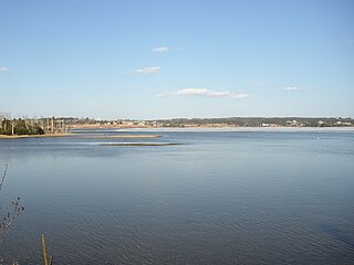
Porters Lake is a rural community in the Eastern Shore region of the Halifax, Nova Scotia, Canada, between Trunk 7 and Route 207, 27.8 km from Halifax. The residents mainly commute to jobs in Dartmouth, Burnside Industrial Park or in Downtown Halifax. The community is built around the lake from which it takes its name.
Three Fathom Harbour is a fishing community on the Eastern Shore of the Halifax Regional Municipality Nova Scotia on the shore of Atlantic Ocean off Route 207 on Three Fathom Harbour Road. The harbour had its own authority.
Beechville is a Black Nova Scotian settlement and suburban community within the Halifax Regional Municipality of Nova Scotia, Canada, on the St. Margaret's Bay Road. The Beechville Lakeside Timberlea (BLT) trail starts here near Lovett Lake, following the line of the old Halifax and Southwestern Railway. Ridgecliff Middle School, located in Beechville Estates, serves the communities of Beechville, Lakeside and Timberlea.

The Sackville River is a river in Hants County and Halifax Regional Municipality, Nova Scotia, Canada. It empties into Bedford Basin. The Little Sackville River is a tributary.
Lewis Lake, Nova Scotia could mean the following:
Whites Lake, could mean the following :
Oak Lake could mean the following lakes:
Gaetz Brook is a rural community of the Halifax Regional Municipality in the Canadian province of Nova Scotia. Gaetz Brook has a junior high school called Gaetz Brook Junior High for students in grades 7–9, and the students come from O'Connell Drive Elementary and Porter's Lake Elementary. They can also come from Atlanticview Elementary.
West Porters Lake, is a rural community of the Halifax Regional Municipality in the Canadian province of Nova Scotia.
There are various Black Lakes in Nova Scotia, Canada. They vary widely in size, depth and usability. Many counties, such as Cumberland, Halifax, Inverness, and Pictou Counties have more than one Black Lake so named, while other counties mentioned in this article have only one named Black Lake.
Upper Hammonds Plains is a Canadian suburban community located in Nova Scotia's Halifax Regional Municipality.
