
Guayaquil, officially Santiago de Guayaquil, is the largest city in Ecuador and also the nation's economic capital and main port. The city is the capital of Guayas Province and the seat of Guayaquil Canton. The city is located on the west bank of the Guayas River, which flows into the Pacific Ocean at the Gulf of Guayaquil.

Guayas is a coastal province in Ecuador. It is bordered to the west by Manabí, Santa Elena, and the Pacific Ocean ; to the east by Los Ríos, Bolívar, Chimborazo, Cañar, and Azuay; to the north by Los Ríos and Bolívar; and to the south by El Oro and the Pacific Ocean.

Ecuador is divided into 24 provinces. The provinces of Ecuador and their capitals are:
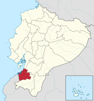
El Oro is the southernmost of Ecuador's coastal provinces. It was named for its historically important gold production. Today it is one of the world's major exporters of bananas. The capital is Machala.

Samborondon is a parish and town in Ecuador’s Guayas province. It is the seat of Samborondón Canton, which consist of 105 localities and two urban parishes and Samborondón Town and one rural parish (Tarifa). La Puntilla's parish is one of the most exclusive residential and entertainment districts in Ecuador. It has many Gated Communities, and several retail developments are located in the suburb. Its close proximity to the country's largest city, Guayaquil, allows many of its residents to work there. Most of the upper-class families in Guayaquil live at La Puntilla's Parish in Samborondón.
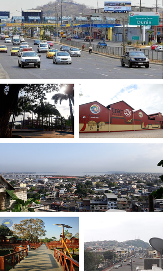
Durán, also known as Eloy Alfaro, is the second largest city in the province of Guayas, Ecuador and the seat of Durán Canton. It is located near the confluence of the Daule & Babahoyo rivers, where the Guayas River enters the ocean, across the Guayas River from Guayaquil. The name "Eloy Alfaro" was chosen because of the Ecuadorian ex-president Eloy Alfaro Delgado. According to the National census in 2022, the city had a population of 295,211. Many of its inhabitants commute to other places for work and it can be considered a "dormitory town". However, many people who live in Durán find work within the canton by opening "comedores" or small restaurants, selling produce at the market, or even opening little stores with basic produce and house necessities. The towns Durán, Samborondón, and Guayaquil are connected by the bridge Rafael Mendoza Avilés.

Balao is a town located in southern Guayas, Ecuador, near Azuay and El Oro provinces. It is the seat of Balao Canton, created in 1987.
Daule, Guayas, Ecuador is a city located in central Guayas, Ecuador, on the Daule River. It is the seat of Daule Canton, created November 26, 1820.
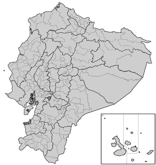
The Cantons of Ecuador are the second-level subdivisions of Ecuador, below the provinces. There are 221 cantons in the country, of which three are not in any province. The cantons are further sub-divided into parishes, which are classified as either urban or rural. Below is a list of cantons by province.

Ensenada is a municipality in the Mexican state of Baja California. It is the fourth-largest municipality in the country, with a land area of 19,526.8 km2 (7,539.3 sq mi) in 2020, making slightly smaller than the state of Hidalgo and larger than five other Mexican states.
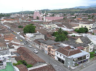
Buga, formally Guadalajara de Buga, is a city and municipality in the Valle del Cauca Department of Colombia. It is famous for its Basilica del Señor de los Milagros, which houses an image of Christ called el Señor de los Milagros.
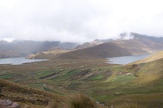
Alausí Canton is a canton in the Chimborazo Province in Ecuador. Its seat is Alausí. The canton is being promoted as a tourist region, and was named a Pueblo Mágico by the Ecuadorian Ministry of Tourism (MINTUR) in 2019.

Alfredo Baquerizo Moreno is a canton of the province of Guayas in the Republic of Ecuador. Its official name was given in honor of Alfredo Baquerizo Moreno, who served three times as the president of Ecuador. It is also known as Juján, a name which came from a regional plant. The canton covers an area of 228.6 square kilometres (88.3 sq mi). Its canton seat is also known as Alfredo Baquerizo Moreno or Juján.
Girón is a town and parish in Azuay Province, Ecuador. The town has a population of 4,353, and Girón parish as a whole has a population of 8,441.

El Triunfo Canton is a canton of Ecuador, located in the Guayas Province. Its capital is the town of El Triunfo. Its population at the 2001 census was 34,117.

Palestina Canton is a Canton located in northern Guayas, Ecuador, created in 1988. Palestina Canton has a population of 18,019, and its nearby cities are Santa Lucía, Daule, Colimes and Balzar. The town of Palestina is located 80 km north of Guayaquil, at the Northern Centre of the province. The canton occupies a territory of 186.6 km2.

Valencia is an ecuadorian city; cantonal head of the Valencia Canton, as well as the sixth most populated city in the Los Rios Province. It is located in the center-north of the coastal region of Ecuador, on an extensive plain, on the outer flanks of the western Andes mountain range, at an altitude of 105 meters above sea level and with a tropical rainy climate of 26 °C on average.

Denisse Priscila Robles Andrade is an Ecuadorian economist and politician. She formerly served as mayor of the city of Milagro. Her election in 2014 made her the youngest person to be elected as a mayor in Ecuador.

Alexandra Manuela Arce Plúas is an Ecuadorian politician and engineer. She was elected to the National Assembly in 2013, she became a Mayor and she was re-elected in 2023.
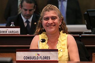
Consuelo Piedad Flores Carrera is an Ecuadorian lawyer and politician. She was a member of the National Assembly from 2009 to 2013, and has been a member of the Municipal Council of Guayaquil since 2014.


