Related Research Articles
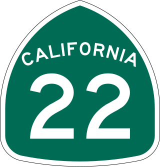
State Route 22 is an east–west state highway in the U.S. state of California that serves southern Los Angeles County and northern Orange County. It runs between Pacific Coast Highway in Long Beach and the Costa Mesa Freeway in Orange by way of Garden Grove. The westernmost part of SR 22 runs along Long Beach's 7th Street. From West Garden Grove to its eastern terminus in Orange, it is known as the Garden Grove Freeway. It is one of the two principal east–west routes in Orange County.
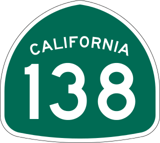
State Route 138 is an east–west state highway in the U.S. state of California that generally follows the northern foothills of the San Gabriel Mountains and the western Mojave Desert. The scenic highway begins in the west at its junction with Interstate 5 located south of Gorman in the Sierra Pelona Mountains, continues eastward through the Antelope Valley and Cajon Pass, to its junction with State Route 18 in the east, located in the San Bernardino Mountains south of Crestline.

State Route 140 is a state highway in the U.S. state of California, 102 miles (164 km) in length. It begins in the San Joaquin Valley at Interstate 5 near Gustine, and runs east into Sierra Nevada, terminating in Yosemite National Park.
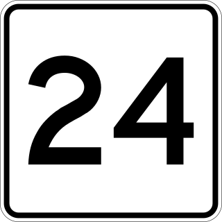
Route 24 is a 40.91-mile-long (65.84 km) freeway south of Interstate 93 (I-93) in southeastern Massachusetts, linking Fall River with the Boston metropolitan area. It begins in the south in Fall River at the border with Tiverton, Rhode Island where it connects with Rhode Island Route 24, and runs north to an interchange with I-93/U.S. Route 1 in Randolph. Route 24 is also known as the Fall River Expressway, and officially as the Amvets Highway. Route 24 has a total of 21 interchanges

State Route 120 is a state highway in the central part of California, connecting the San Joaquin Valley with the Sierra Nevada, Yosemite National Park, and the Mono Lake area. Its western terminus is at Interstate 5 in Lathrop, and its eastern terminus at U.S. Route 6 in Benton. While the route is signed as a contiguous route through Yosemite, the portion inside the park is federally maintained and is not included in the state route logs. The portion at Tioga Pass at Yosemite's eastern boundary is the highest paved through road in the California State Route system. This part is not maintained in the winter and is usually closed during the winter season.

State Route 23 is a state highway in the U.S. state of California that connects the Pacific coast and the Santa Monica Mountains to the Conejo and Santa Clara River valleys. It runs from Pacific Coast Highway in Malibu in Los Angeles County to Ventura Street in Fillmore in Ventura County.

State Route 84 is a state highway in the U.S. state of California that consists of two unconnected segments, one in the San Francisco Bay Area and the other primarily in the Sacramento–San Joaquin River Delta area.

Interstate 395 (I-395) is an auxiliary Interstate Highway in the U.S. states of Connecticut and Massachusetts; it is maintained by the Connecticut Department of Transportation (CTDOT) and the Massachusetts Department of Transportation (MassDOT). Spanning nearly 67 miles (108 km) on a south–north axis, it is the only spur route of I-95 in Connecticut. The 36-mile (58 km) section between its splits from I-95 in East Lyme and Connecticut Route 695 in Plainfield is a component highway of the Connecticut Turnpike. Within that state, the highway is named the American Ex-Prisoner of War Memorial Highway from Plainfield to Thompson.

Interstate 290 (I-290) is an auxiliary Interstate Highway in the US state of Massachusetts, maintained by the Massachusetts Department of Transportation (MassDOT). Spanning approximately 20 miles (32 km), it is signed as an east–west spur route of I-90 in Central Massachusetts. The route begins in Auburn at I-90 as a northward continuation of I-395. It follows an L-shaped route, the nominally western half of which runs north into the city of Worcester, and, upon leaving the city, turns to the east to its eastern terminus at I-495 in Marlborough. Past I-495, the road continues as an unnumbered one-mile (1.6 km) connector to the town of Hudson. The route serves as the main freeway route through Worcester, as well as being part of a longer distance travel corridor through New England, connecting Connecticut and Western Massachusetts with much of New Hampshire and Maine.
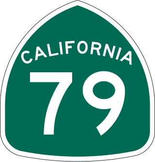
State Route 79 (SR 79) is an approximately 106-mile (171 km) north-south state highway in the U.S. state of California. The highway's southern terminus is at Interstate 8 (I-8) at the Descanso Junction in San Diego County. Its northern terminus is at Interstate 10 (I-10) in the city of Beaumont in Riverside County. In San Diego County, SR 79 connects with Lake Cuyamaca and Cuyamaca Rancho State Park, the communities of Julian and Warner Springs. In Riverside County, the highway runs through the cities of Temecula, Murrieta, Hemet, and San Jacinto before reaching Beaumont.
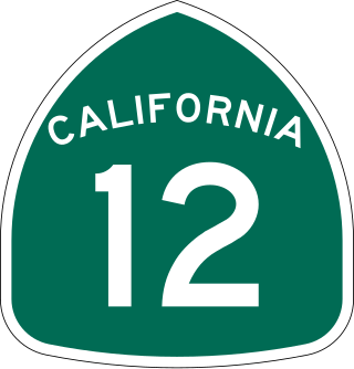
State Route 12 is a state highway in the U.S. state of California that travels in an east–west direction from State Route 116 in Sebastopol in Sonoma County to State Route 49 just north of San Andreas in Calaveras County. The route connects the Sonoma and Napa valleys with the Sacramento–San Joaquin River Delta and the Sierra Foothills. It is constructed to freeway standards from the Fulton Road/South Wright Road stoplight in Santa Rosa, to its partial interchange with Farmers Lane.

State Route 68 is a state highway in the U.S. state of California, located entirely in Monterey County. It runs from Asilomar State Beach in Pacific Grove to U.S. Route 101 in Salinas. The approximately 20-mile (32 km) long highway serves as a major route between the Monterey Peninsula and Salinas.

State Route 33 is a north–south state highway in the U.S. state of California. It runs north from U.S. Route 101 in Ventura through the Transverse Ranges and the western side of the San Joaquin Valley to Interstate 5 at a point east of Tracy. SR 33 replaced part of U.S. Route 399 in 1964 during the "great renumbering" of routes. In the unincorporated sections of Kern County it is known as the West Side Highway. In addition, the California Legislature designated the entire Kern County portion as the Petroleum Highway in 2004. The southernmost portion in Ventura is a freeway known as the Ojai Freeway, while it is known as the Maricopa Highway from Ojai to Maricopa.

Interstate 391 (I-391) is an auxiliary Interstate Highway located entirely within the US state of Massachusetts. It runs from the I-91/I-391 interchange in Chicopee to the center of Holyoke, a distance of about 4.46 miles (7.18 km). It runs near the Connecticut River throughout its journey in Chicopee, crosses into Holyoke, and abruptly ends at High Street 0.4 miles (0.64 km) south of US Route 202 (US 202).

State Route 34 is a state highway in the U.S. state of California. It runs through Ventura County from Rice Avenue in Oxnard to State Route 118 in Somis.
The Massachusetts State Highway System in the U.S. Commonwealth of Massachusetts is a system of state-numbered routes assigned and marked by the highway division of the Massachusetts Department of Transportation (MassDOT). U.S. Highways and Interstate Highways are included in the system; the only overlaps are with the end-to-end U.S. Route 3 and Route 3 and the far-apart Interstate 295, shared with Rhode Island, and Route 295, shared with New York State. A state highway in Massachusetts is a road maintained by the state, which may or may not have a number. Not all numbered routes are maintained or owned by the state.

State Route 156 is a west to east state highway in the U.S. state of California, running from State Route 1 in Castroville to State Route 152 near Hollister. It serves as part of the primary route from the Monterey Peninsula to either the San Francisco Bay Area or the California Central Valley.

State Route 108 is a state highway in the U.S. state of California that runs from the Central Valley and across the Sierra Nevada via the Sonora Pass. It generally runs northeast from downtown Modesto near the SR 99/SR 132 interchange, to U.S. Route 395 near the Nevada state line. The route was once recommended to continue south of Modesto to Interstate 5, although today that portion exists as a county road. Parts of SR 108 are closed annually during the winter due to inclement weather along the summit.

Exit numbers in the United States are assigned to freeway junctions, and are usually numbered as exits from freeways. Exit numbers generally are found above the destinations and route number(s) at the exit, as well as a sign in the gore. Exit numbers typically reset at political borders such as state lines. Some major streets also use exit numbers. Freeway exits in the United States are usually numbered in two formats: distance-based and sequential.
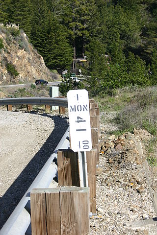
California uses a postmile highway location marker system on all of its state highways, including U.S. Routes and Interstate Highways. The postmile markers indicate the distance a route travels through individual counties, as opposed to milestones that indicate the distance traveled through a state. The postmile system is the only route reference system used by the California Department of Transportation (Caltrans). The system was operative by 1966.
References
- 1 2 "ODOT Approved Terms & Definitions". Oregon Department of Transportation . Archived from the original on June 24, 2007. Retrieved August 7, 2020.
- ↑ "STB Docket No. AB-33 (Sub-No. 220X)". Federal Register . 69 (190). October 1, 2004. Archived from the original on August 7, 2020. Retrieved August 7, 2020.
- ↑ "UDOT Milepost Project: Project Plan". Utah Department of Transportation . Archived from the original on August 7, 2007. Retrieved August 7, 2020.
| | This standards- or measurement-related article is a stub. You can help Wikipedia by expanding it. |
| | This United States road or road transport-related article is a stub. You can help Wikipedia by expanding it. |