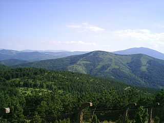
The Balkan mountain range is a mountain range in the eastern part of the Balkan Peninsula in Southeastern Europe. The range is conventionally taken to begin at the peak of Vrashka Chuka on the border between Bulgaria and Serbia. It then runs for about 560 kilometres (350 mi), first in a south-easterly direction along the border, then eastward across Bulgaria, forming a natural barrier between the northern and southern halves of the country, before finally reaching the Black Sea at Cape Emine. The mountains reach their highest point with Botev Peak at 2,376 metres (7,795 ft).

Ruy or Ruj, is a mountain range in the Kraishte region on the border of western Bulgaria and southeastern Serbia. Its eponymous highest summit rises 1,706 meters above sea level. The mountain range is located west of Tran and formed the westernmost part of the Ruy-Verila range. On a clear day may be observed the ranges of Rila and Vitosha in Bulgaria and Veliki Strešer in Serbia.

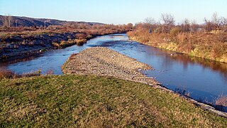
The Jerma or Erma is a river in southeastern Serbia and western Bulgaria. It is notable for passing the Serbian-Bulgarian border twice.

Trgovište is a town and municipality located in the Pčinja District of southern Serbia. According to 2022 census, the population of the town is 1,711, while population of the municipality is 4,316.

The Dragovištica or Dragovishtitsa is a river in southeastern Serbia and western Bulgaria, a 63 km-long right tributary to the River Struma. Its drainage basin covers a territory of 867 km2. The river belongs to the Aegean Sea drainage and is not navigable.

Midžor or Midzhur is a peak in the Balkan Mountains, situated on the border between Bulgaria and Serbia. At 2,169 metres (7,116 ft), it is the highest peak of the Western Balkan Mountains, as well as the highest of Serbia.

Pirot is a city and the administrative center of the Pirot District in southeastern Serbia. According to 2022 census, the urban area of the city has a population of 34,942, while the population of the city administrative area has 49,601 inhabitants.

Orovička Planina is a village in Serbia. It is situated in the Ljubovija municipality, in the Mačva District of Central Serbia. The village had an entirely Serbian population of 201 in 2002.

The Trgoviški Timok is a river in Serbia, also known as Korenatac or Strma river. It starts on the western slopes of the Balkan Mountains, right under the highest peak of the mountain in Serbia, Midžor, less than a kilometer from the Bulgarian border. The river runs to the east, receiving three smaller streams from the other peaks of Balkan mountain range with colorful names. The river passes through the villages of Balta Berilovac, Vrtovac and Inovo. On this reach it receives the Debelička and Ćuštička rivers from the left and the Golaška and Inovska rivers from the right. At the village of Kalna, it is joined by the Stanjanska River, flowing down the northern slopes of the Jadovnik mountain, turns to the north and becomes known as the Trgoviški Timok.

Kukavica is a mountain in southern Serbia, near the town of Vladičin Han. Its highest peak Vlajna has an elevation of 1442 meters above sea level.

Goč is a mountain in central Serbia, about 15 km south of the spa town of Vrnjačka Banja. It belongs to the northern part of the Kopaonik mountain range and its highest peak, Krnja jela, has an elevation of 1,127 m (3,698 ft).

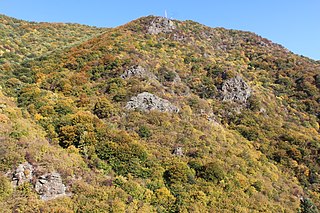
Greben is a mountain in southeastern Serbia, with a small section of the southwestern ridge in Bulgaria. It is named after a large karst ridge that runs along its spine. Greben rises near the village of Poganovo in Serbia, in the municipality of Dimitrovgrad, and extends southeast towards the Bulgarian village of Vrabcha. Prior to the Treaty of Neuilly of 1919, after the First World War, the area was part of Bulgaria.
Javor is a mountain in southwestern Serbia, between towns of Sjenica and Ivanjica. Its highest peak, Vasilin vrh, has an elevation of 1,519 meters above sea level.

Pljačkovica is a mountain in southern Serbia, overlooking the city of Vranje. Its highest peak has an elevation of 1,231 meters above sea level.
Rgajska planina is a mountain in southern Serbia, near the town of Prokuplje. Its highest peak has an elevation of 1,017 meters above sea level.
Vlaška planina is a mountain in southeastern Serbia, near the town of Dimitrovgrad. Its highest peak Panica has an elevation of 1,443 meters (4,734 ft) above sea level. With Greben, Vlaška planina forms the gorge of Jerma river.

Zvijezda is a mountain on the border of Serbia and Bosnia and Herzegovina, between towns of Bajina Bašta and Višegrad. Its highest peak Veliki Stolac lies on Bosnian territory and has an elevation of 1,673 meters above sea level, followed by Kozji rid (1591m), Pivnice (1575m), Mrka kosa (1545m), and Lisnata glavica (1510m), on Serbian side. Zvijezda lies in a large bend of the Drina river, and presents a western extension of the Tara mountain. Serbian parts of the mountain belong to the Tara National Park.
Bohovska planina is a mountain range on the border of Bulgaria and Sebia, near the towns of Tran in Bulgaria and Bosilegrad in Serbia. Its highest peak Ogorelitsa has an elevation of 1,318 meters above sea level.
Čudinska planina or Chudinska planina, is a mountain range on the border of Bulgaria and Serbia, near the city of Kyustendil in Bulgaria and the town of Bosilegrad in Serbia. Its highest peak Aramliya/Aramlija has an elevation of 1,496 meters above sea level.
Miloslavska planina is a mountain range on the border of Bulgaria and Serbia, near the town of Tran in Bulgaria and Dimitrovgrad in Serbia. Its highest peak Golema rudina has an elevation of 1,486 meters above sea level.


