Victoria is the smallest mainland state in Australia. As of 2022 it contained 5,081 separate protected areas with a total land area of 4,012,888 ha.
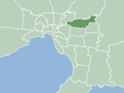
The City of Manningham is a local government area in Victoria, Australia in the north-eastern suburbs of Melbourne and is divided into 12 suburbs, with the largest being Doncaster and Doncaster East. It comprises an area of 113 square kilometres and had a population of 125,508 in June 2018.

EastLink is a tolled section of the M3 freeway linking a large area through the eastern and south-eastern suburbs of Melbourne, Australia.

Burwood is a suburb of Melbourne, Victoria, Australia, 14 km east of Melbourne's Central Business District, located within the Cities of Monash and Whitehorse local government areas. Burwood recorded a population of 15,147 at the 2021 census.

Warrandyte is a suburb of Melbourne, Victoria, Australia, 24 km north-east of Melbourne's Central Business District, located within the City of Manningham local government area. Warrandyte recorded a population of 5,541 at the 2021 census.

Keysborough is a suburb in Melbourne, Victoria, Australia, 27 km south-east of Melbourne's Central Business District, located within the City of Greater Dandenong local government area. Keysborough recorded a population of 30,018 at the 2021 census.

Doncaster is a suburb of Melbourne, Victoria, Australia, 18 km north-east of Melbourne's Central Business District, located within the City of Manningham local government area. Doncaster recorded a population of 25,020 at the 2021 census.

Templestowe is a suburb of Melbourne, Victoria, Australia, 16 km north-east of Melbourne's Central Business District, located within the City of Manningham local government area. Templestowe recorded a population of 16,966 at the 2021 census.

Doncaster East is a suburb of Melbourne, Victoria, Australia, 20 km east of Melbourne's Central Business District, located within the City of Manningham local government area. Doncaster East recorded a population of 30,926 at the 2021 census.

Mullum Mullum Creek is a creek in the outer eastern suburbs of Melbourne, Victoria, Australia. It is the main watercourse of the Mullum Mullum Valley, a tributary of the Yarra River and Yarra Valley. For tens of thousands of years it was used as a food and tool source sustainably by the Wurundjeri people, Indigenous Australians of the Kulin nation, who spoke variations of the Woiwurrung language group.

Koonung Creek is a small tributary of the Yarra River in Melbourne's east. The creek originates in Nunawading near Springvale Road, and flows to join the Yarra at the border between Ivanhoe East, Bulleen and Balwyn North. The place the two waterways meet forms the borders between these suburbs. Bushy Creek is a tributary to the creek, joining near Elgar Park in Mont Albert North. A shared use path follows the course of the creek, known as the Koonung Creek Trail.

Gardiners Creek, originally known as Kooyongkoot Creek, is an urban stream in the eastern suburbs of Melbourne, and part of the Yarra River catchment.

The Ringwood - Belgrave Rail Trail is a shared use path for cyclists and pedestrians, which follows the Belgrave railway line from the Mullum Mullum Creek Trail in Ringwood to Belgrave railway station in Belgrave, in the outer eastern suburbs of Melbourne, Victoria, Australia.
The Greengully Trail is a shared use path for cyclists and pedestrians in the inner eastern suburb of Templestowe in Melbourne, Victoria, Australia.

The Mullum Mullum Creek Trail is a shared use path for cyclists and pedestrians, which follows Mullum Mullum Creek in the outer eastern suburbs in Melbourne, Victoria, Australia.

The Doncaster railway line was a long-proposed suburban railway in the eastern suburbs of Melbourne, Victoria, Australia, that was anticipated to be built by the late 2020s, as a branch, along with the Hurstbridge line, of the planned future Clifton Hill Loop Line, as part of the 2013 PTV Network Development Plan.

The Main Yarra Trail, also known as the Yarra Trail is a shared-use path for cyclists and pedestrians, which follows the Yarra River through the northeastern suburbs of Melbourne, Victoria, Australia.

Currawong Bush Park is a nature park located in the outer eastern Melbourne suburbs of Doncaster East, Warrandyte and Donvale, along Mullum Creek. It covers 59 hectares of remnant bushland and contains archaeological sites significant to the Traditional Owners of the area, the Wurundjeri people of the Kulin nation.

The Mullum Mullum Creek Linear Park is located east of Melbourne, Australia in the suburbs of Doncaster East and Donvale. It stretches for roughly 9 km along the western banks of the Mullum Mullum Creek between Heidelberg-Warrandyte Road and The Eastlink Trail. Facilities include sealed pathways, barbecues and shelters. Other features include, bush walking tracks, trails and equestrian trails. Throughout much of the 1990s, extensive regenerative planting was conducted throughout the entire length of the park; this has restored much of the native riparian bushland within the park, most prominently the Mullum Mullum Wetlands.

Yarran Dheran Nature Reserve forms part of the Mullum Mullum Valley and is bushland park, located in Melbourne on the border of Donvale, on the banks of the Mullum Mullum Creek. The Reserve is 7.2 hectares and hosts a mix of remnant and regenerated bushland, and many native species of wildlife, particularly birds, of which 85 species may be seen. The Mullum Mullum Creek Trail runs through the Reserve and there are many unsealed bush tracks through the native bushland. There is an Information Centre in the Reserve which is open on Sunday afternoons from 2.00 pm – 4.00 pm subject to volunteer availability. The Reserve includes a series of ponds that feed a cascade to the creek during wet spells. There are toilets and mown areas for picnics and seating. Yarran Dheran is a Dogs on Lead Reserve.