Mill Creek Nature Park

Last updated
Mill Creek Nature Park
Mill Creek Nature Park map.jpg
Mill Creek Nature Park entry map
Canada New Brunswick location map 2.svg
Red pog.svg
Location in New Brunswick
Location Riverview, New Brunswick, Canada
Coordinates 46°03′48″N64°45′43″W / 46.063253118759874°N 64.7619152069092°W / 46.063253118759874; -64.7619152069092 Coordinates: 46°03′48″N64°45′43″W / 46.063253118759874°N 64.7619152069092°W / 46.063253118759874; -64.7619152069092
Area133 hectares (330 acres)
Established2013
Owned byTown of Riverview
StatusOpen all year
Website https://www.townofriverview.ca/parks-and-recreation/parks-and-trails/mill-creek-nature-park

Mill Creek Nature Park is a 133-hectare (330-acre) municipal park located in Riverview, New Brunswick, Canada. The park is owned by the Town of Riverview and is managed in collaboration with the Friends of Mill Creek, a community-led advisory committee. [1] Mill Creek Nature Park is home to a network of trails which are used for year-round activities, including walking, cycling, and skiing. The park encompasses part of the Mill Creek watershed and includes a diverse array of habitats, such as mixed forests and wetlands. [2] Common species include forest birds, such as black-capped chickadee, common yellowthroat, and ovenbird, and mammals such as American red squirrel, snowshoe hare, and American beaver. [3] The most prominent feature in Mill Creek is an old dam and reservoir which were created by the Department of National Defence in the early 1960s.

Contents

History

Mill Creek reservoir Mill Creek reservoir.jpg
Mill Creek reservoir

Mill Creek Nature Park is located south of the former Canadian Forces Station Coverdale, which was constructed by the Royal Canadian Navy in 1944. [4] The station conducted operations pertaining to high-frequency direction finding, which was used to monitor German communications during World War II. During its early years, the base was referred to as Special Wireless Station Coverdale and was operated by the Women's Royal Canadian Naval Service. [5] In the late 1940s, the base was renamed to Her Majesty's Canadian Ship (HMCS) Coverdale, which it is still often referred to as today. [6] In the early 1960s, new facilities were installed which necessitated an increase in the base's water supply. To accommodate this, a concrete buttress dam was built on the nearby Mill Creek, creating a 5 hectare reservoir which still exists today. [7] In 1966, the base was designated as Canadian Forces Station (CFS) Coverdale, a title that it maintained until its closure in 1971. [8] While most have undergone renovations, many of the original buildings still remain, including the Coverdale Centre and the Victory Life Centre. [9] The dam and reservoir are now owned by the Town of Riverview and are located within the present-day Mill Creek Nature Park.

In the late 2000s, the Town of Riveriew, in cooperation with the City of Moncton's Urban Planning, began working on a plan to designate Mill Creek as a future park. A proposal put forward by students from Riverview High School in 2011 was followed by a public consultation process, which led to the development of master plan. [9] [10] In 2013, the park was officially established and work began on the development of trails. In 2016, the Friends of Mill Creek advisory committee was formed to assist the Town with the park's ongoing planning and management. [9]

Features and Amenities

Trail in Mill Creek Nature Park Mill Creek Nature Park trail.jpg
Trail in Mill Creek Nature Park

Mill Creek Nature Park has a network of developed and undeveloped trails, which are used for a wide array of activities, including walking and cycling in the summer and snowshoeing, fat biking, and cross-country skiing in the winter. [9] A scenic lookout above the reservoir includes a shelter, public fire pit, and benches, and is designated as one of the Fundy Biosphere Reserve's Amazing Places. [11] The park continues to see ongoing development and has become a popular destination for outdoor recreation in the Greater Moncton-area.

See also

Related Research Articles

Moncton City in New Brunswick, Canada

Moncton is one of three major urban centres in the Canadian province of New Brunswick, along with Saint John and the capital city of Fredericton. Situated in the Petitcodiac River Valley, Moncton lies at the geographic centre of the Maritime Provinces. The city has earned the nickname "Hub City" because of its central inland location in the region and its history as a railway and land transportation hub for the Maritimes.
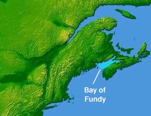
Bay of Fundy Bay on the east coast of North America

The Bay of Fundy is a bay between the Canadian provinces of New Brunswick and Nova Scotia, with a small portion touching the US state of Maine. It has an extremely high tidal range. The name is likely a corruption of the French word Fendu, meaning "split".
Dieppe, New Brunswick City in New Brunswick, Canada

Dieppe is a city in the Canadian maritime province of New Brunswick. Statistics Canada counted the population at 25,384 in 2016, making it the fourth-largest city in the province.

Fundy National Park

Fundy National Park is a national park of Canada located on the Bay of Fundy, near the village of Alma, New Brunswick. It was officially opened on 29 July 1950. The Park showcases a rugged coastline which rises up to the Canadian Highlands, the highest tides in the world and more than 25 waterfalls. The Park covers an area of 207 km2 (80 sq mi) along Goose Bay, the northwestern branch of the Bay of Fundy. When one looks across the Bay, one can see the northern Nova Scotia coast.
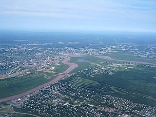
Petitcodiac River A river in south-eastern New Brunswick, Canada

The Petitcodiac River, known informally as the Chocolate River, is a river in south-eastern New Brunswick, Canada. The river has a meander length of 79 kilometres and is located in Westmorland, Albert, and Kings counties, draining a watershed area of about 2,071 square kilometres (800 sq mi). The watershed features valleys, ridges, and rolling hills, and is home to a diverse population of terrestrial and aquatic species. Ten named tributaries join the river in its course toward its mouth in Shepody Bay. Before the construction of a causeway in 1968, the river had one of the world's largest tidal bores, which ranged from 1 to 2 metres (3.3–6.6 ft) in height and moved at 5 to 13 kilometres per hour (3.1–8.1 mph). With the opening of the causeway gates in April 2010, the river is flushing itself of ocean silts, and the bore is returning to its former size.

Canadian Forces base

A Canadian Forces Base or CFB is a military installation of the Canadian Armed Forces. For a facility to qualify as a Canadian Forces base, it must station one or more major units.

Salisbury, New Brunswick Village in New Brunswick, Canada

Salisbury, New Brunswick is a village located in Westmorland County, New Brunswick, Canada. The village's population meets the requirements for "town" status under the Municipalities Act of the Province of New Brunswick; however, its municipal status has not been changed.

Riverview, New Brunswick Town in New Brunswick, Canada

Riverview is a town in Albert County, New Brunswick, Canada. Riverview is located on the south side of the Petitcodiac River, across from the larger cities of Moncton and Dieppe. Riverview has an area of 34 square kilometres (13 sq mi), and a population density of 564.6 inhabitants per square kilometre (1,462/sq mi). Riverview's slogan is "A Great Place To Grow". With a population of 19,667 in 2016, Riverview is the fifth largest municipality in New Brunswick, having a larger population than the cities of Edmundston, Bathurst, Campbellton, and Miramichi, despite its designation of "town".

Moncton—Riverview—Dieppe

Moncton—Riverview—Dieppe is a federal electoral district in New Brunswick, Canada, that has been represented in the House of Commons of Canada since 1968.

St. George, New Brunswick Town in New Brunswick, Canada

St. George is an incorporated town in Charlotte County, New Brunswick, Canada. The population was 1,517 in 2016. It is located where the Magaguadavic River flows into the Bay of Fundy, between Passamaquoddy Bay and Lake Utopia.
New Brunswick Route 114

Route 114 is a 137.6 km (85.5 mi) Canadian secondary highway in southeastern New Brunswick.

Greater Moncton Metropolitan area in New Brunswick, Canada

Greater Moncton is the area encompassing Metro Moncton. Greater Moncton is also known as Greater Moncton Census Metropolitan Area, Moncton Metropolitan Area or Moncton CMA, and is located in New Brunswick, Canada.
Tourism in New Brunswick Wikimedia list article

There are two major national parks. The warmest salt water beaches north of Virginia can be found on the Northumberland Strait, at Parlee Beach in Shediac. New Brunswick's signature natural attraction are only a half hour's drive down the Petitcodiac river valley. The Confederation Bridge to Prince Edward Island is only an hour's drive east of Moncton.

Coverdale Parish, New Brunswick Parish in New Brunswick, Canada

Coverdale is a civil parish in Albert County, New Brunswick, Canada, located along the Petitcodiac River opposite Moncton and Dieppe. It comprises one incorporated town and one local service district (LSD).

Irishtown Nature Park, New Brunswick

This article refers to a park in Canada. If you are looking for information about a park in Dublin, see Irishtown Nature Park, Dublin.

Lower Coverdale, New Brunswick

Lower Coverdale is a settlement in Albert County, New Brunswick. It is located near Riverview, Moncton, and Dieppe.

Canadian Forces Station Coverdale was a HFDF intercept station near Moncton, New Brunswick during World War 2.

Turtle Creek is a Canadian creek in Albert County, southeastern New Brunswick. The creek drains a watershed area of 192 square kilometres, and is the primary source of potable water for Moncton, Riverview, and Dieppe, thanks to the 150 km2 (58 sq mi) Turtle Creek reservoir and the Moncton Water Treatment Plant.
Fundy Biosphere Reserve

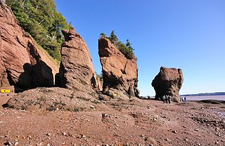
The Fundy Biosphere Reserve is a biosphere reserve next to the upper Bay of Fundy, covering 442,250 hectares in New Brunswick, Canada. The area was designated as such by the United Nations Educational, Scientific and Cultural Organization (UNESCO) in 2007.

Dobson Trail

The Dobson Trail is a 57.75 km hiking trail that runs from Riverview, New Brunswick to Fundy National Park. The trail is named for Dr. Art Dobson, who started the initiative to build the trail in 1959. The trail is the longest volunteer-maintained trail in Eastern Canada.

References

  1. Town of Riverview (2018). "Mill Creek Nature Park".
  2. Friends of Mill Creek (2016). "Habitat Variety in the Mill Creek Nature Park".
  3. iNaturalist "Mill Creek Nature Park / Parc Naturel d'Mill Creek".
  4. Belliveau, P. (2014). H.M.C.S. Coverdale Riverview's Forgotten Naval Base. Moncton: Kingswood Military History Editions.
  5. Proc, J. (2015). "HMCS Coverdale".
  6. Riverview Historical Association (1986) "The History of Riverview Amalgamating Bridgedale Gunningsville Riverview Heights". Lancelot Press.
  7. GEMTEC (2012) "Condition Assessment Mill Creek Dam".
  8. Town of Riverview (2020) "Damming the Creek" [interpretive panel]. Town of Riverview.
  9. 1 2 3 4 DeLong, D. (2017). "Creating a Regional Nature Park: A Case Study on Community Engagement in Developing the Mill Creek Nature Park in the Town of Riverview, New Brunswick". Dalhousie Journal of Interdisciplinary Management. 13: 18–30. doi: 10.5931/djim.v13i1.6924 .
  10. CollabPlan & Genivar (2013). "Mill Creek Nature Park 2013 Conceptual Development Master Plan". Moncton.
  11. Fundy Biosphere Reserve (2018). "Amazing Places in the Fundy Biosphere Reserve".