
Transylvania County is a county in the U.S. state of North Carolina. As of the 2020 census the population is 32,986. Its county seat is Brevard.

Henderson County is a county located in the U.S. state of North Carolina. As of the 2020 census, the population was 116,281. Its county seat is Hendersonville. Henderson County is part of the Asheville, NC Metropolitan Statistical Area.
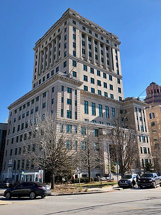
Buncombe County is a county located in the U.S. state of North Carolina. It is classified within Western North Carolina. The 2020 census reported the population was 269,452, making it the 7th-most populous county in North Carolina. Its county seat is Asheville. Buncombe County is part of the Asheville, NC Metropolitan Statistical Area.

The French Broad River is a river in the U.S. states of North Carolina and Tennessee. It flows 218 miles (351 km) from near the town of Rosman in Transylvania County, North Carolina, into Tennessee, where its confluence with the Holston River at Knoxville forms the beginning of the Tennessee River. The river flows through the counties of Transylvania, Buncombe, Henderson, and Madison in North Carolina, and Cocke, Jefferson, Sevier, and Knox in Tennessee. It drains large portions of the Pisgah National Forest and the Cherokee National Forest.
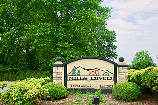
Mills River is a town in Henderson County, North Carolina, United States. The population was 6,802 at the 2010 census, and was estimated to be 7,406 in 2019. The town took its name from the nearby confluence of the Mills River and French Broad River. It is part of the Asheville Metropolitan Statistical Area. It was incorporated into a town in June 2003. Sierra Nevada opened a brewery in Mills River in 2014.

The Swannanoa River flows through the Swannanoa Valley of the region of Western North Carolina, and is a major tributary to the French Broad River. Its headwaters arise in Black Mountain, North Carolina; however, it also has a major tributary near its headwaters: Flat Creek, which begins on the slopes of Mount Mitchell. The Swannanoa River ends at its confluence with the French Broad, now within the grounds of the 8,000-acre Biltmore Estate in Asheville.

Pisgah National Forest is a National Forest in the Appalachian Mountains of western North Carolina. It is administered by the United States Forest Service, part of the United States Department of Agriculture. The Pisgah National Forest is completely contained within the state of North Carolina. The forest is managed together with the other three North Carolina National Forests from common headquarters in Asheville, North Carolina. There are local ranger district offices located in Pisgah Forest, Mars Hill, and Nebo.
The Hungry River flows in western North Carolina, United States. It arises in eastern Henderson County and flows southwesterly, its entire course within Henderson County, before it empties into the Green River. In 1904, the first hydroelectric plant in Henderson County was built on the river, and, in 1913, a second dam was built half a mile downstream for the same purpose. Both dams stand to his day, though they are currently inoperable and slated for removal under management of the North Carolina Wildlife Resources Commission.
The Mitchell River is a tributary of the Yadkin River in northwestern North Carolina in the United States. Via the Yadkin it is part of the watershed of the Pee Dee River, which flows to the Atlantic Ocean. According to the Geographic Names Information System, it has also been known historically as "Mitchells River," "Mitchels River," and "Mountain Creek."
The Horsepasture River is an 18.1-mile-long (29.1 km) National Wild and Scenic river in the U.S. states of North Carolina and South Carolina. The river rises in Jackson County, North Carolina, and flows through the Jocassee Gorges area and ends at Lake Jocassee in South Carolina. Some of the land over which the river flows is part of the Pisgah National Forest, making it accessible to the public.

The Asheville metropolitan area is a metropolitan area centered on the principal city of Asheville, North Carolina. The U.S. Office of Management and Budget defines the Asheville, NC Metropolitan Statistical Area, a metropolitan statistical area used by the United States Census Bureau and other entities, as comprising the four counties of Buncombe, Haywood, Henderson, and Madison. The area's population was 424,858 according to the 2010 census, and 469,454 according to the 2020 census.

North Carolina Highway 280 (NC 280) is a primary state highway in the U.S. state of North Carolina that runs from the city of Brevard in Transylvania County to the town of Fletcher in Henderson County. It is 18 miles (29 km) in length, starting at the intersection with US 64 and US 276 north of Brevard to US 25 and US 25A in the Asheville community of Arden.
Reedy Fork is a 43.70 mi (70.33 km) long 3rd order tributary to the Haw River, in Alamance County, North Carolina.
Mears Fork is a 7.77 mi (12.50 km) long third order tributary to the Haw River, in Guilford County, North Carolina.
Beaver Creek is a 6.16 mi (9.91 km) long 2nd order tributary to Reedy Fork, in Guilford County, North Carolina.
The North Fork Swannanoa River is a 11.23-mile-long (18.07-kilometre) third-order tributary to the Swannanoa River in Buncombe County, North Carolina.
Henry Fork is a 39.78 mi (64.02 km) long 4th order tributary to South Fork Catawba River in Burke and Catawba Counties, North Carolina.
Jacob Fork is a 41.09-mile (66.13 km) long, fourth-order tributary of the South Fork Catawba River in Burke and Catawba Counties, North Carolina. According to the Geographic Names Information System, it has also been known historically as Jacobs Creek.
Mill Creek is a 2.12 mi (3.41 km) long 1st order tributary to the Uwharrie River, in Randolph County, North Carolina.
Barnes Creek is a 11.39 mi (18.33 km) long 3rd order tributary to the Uwharrie River, in Montgomery County, North Carolina.

