Mills River, North Carolina

Last updated

Mills River, North Carolina
Mills-River-welcome-sign-nc.jpg
Town Complex entrance
USA North Carolina location map.svg
Red pog.svg
Mills River
Usa edcp location map.svg
Red pog.svg
Mills River
Coordinates: 35°23′07″N82°35′07″W / 35.38528°N 82.58528°W / 35.38528; -82.58528
Country United States
State North Carolina
County Henderson
Incorporated2003 [1]
Named for Mills River [1]
Area
[2]
  Total22.49 sq mi (58.24 km2)
  Land22.31 sq mi (57.79 km2)
  Water0.17 sq mi (0.45 km2)
Elevation
[3]
2,182 ft (665 m)
Population
 (2020)
  Total7,078
  Density317.21/sq mi (122.48/km2)
Time zone UTC-5 (Eastern (EST))
  Summer (DST) UTC-4 (EDT)
ZIP codes
28732, 28759
Area code 828
FIPS code 37-43260 [4]
GNIS feature ID2406166 [3]
Website www.millsriver.org

Mills River is a town in Henderson County, North Carolina, United States. The population was 6,802 at the 2010 census, [4] and was estimated to be 7,406 in 2019. [5] The town took its name from the nearby confluence of the Mills River and French Broad River. [6] It is part of the Asheville Metropolitan Statistical Area. It was incorporated into a town in June 2003. Sierra Nevada opened a brewery in Mills River in 2014.

Contents

History

Prior to European colonization a large Cherokee settlement existed within the borders of Mills River.

Mills River is among the oldest communities in Henderson County, with its first landholder receiving a deed from the state of North Carolina in 1788. It was once a thriving agricultural community, often called the "fertile crescent". [7]

The Mills River Chapel was listed on the National Register of Historic Places in 1988. [8]

Geography

Mills River lies in the northwestern part of Henderson County, extending northeast to the Buncombe County border and southwest to the Transylvania County border. It is bordered to the northeast by the city of Asheville and the town of Fletcher, and to the south by the unincorporated communities of Horse Shoe and Etowah.

According to the U.S. Census Bureau, the town has a total area of 22.5 square miles (58.4 km2), of which 22.4 square miles (58.0 km2) are land and 0.2 square miles (0.4 km2), or 0.74%, are water. The French Broad River, one of the primary tributaries of the Tennessee River, flows through the northeastern part of the town. The Mills River, a tributary of the French Broad, flows from west to east through the center of the town, and the southern part of the town is in the valley of Boylston Creek, a small tributary of the French Broad.

The town lies within minutes of Pisgah National Forest, Interstate 26, and Asheville Regional Airport. Highways 280 and 191 serve as the major arteries and provide access to the nearby cities of Asheville, 17 miles (27 km) to the north; Hendersonville, 8 miles (13 km) to the southeast; and Brevard, 14 miles (23 km) to the southwest.

Demographics

Historical population
CensusPop.Note
2010 6,802
2020 7,0784.1%
U.S. Decennial Census [9]

2020 census

Mills River racial composition [10]
RaceNumberPercentage
White (non-Hispanic)6,20287.62%
Black or African American (non-Hispanic)1011.43%
Native American 90.13%
Asian 620.88%
Pacific Islander 250.35%
Other/Mixed 2753.89%
Hispanic or Latino 4045.71%

As of the 2020 United States census, there were 7,078 people, 3,072 households, and 2,046 families residing in the town.

Government

The current mayor is Shanon Gonce, who took office in December 2021, elected by his fellow town council members. The current town council members are Randy Austin (2019), Jeff Young (appointed March 2022), James Cantrell (2021), and Sandra Goode (2021). Councilman Austin also serves the role of Mayor Pro Tem.

Mills River is home to two public schools: Mills River Elementary, Glenn C. Marlow Elementary, and is served Rugby Middle School, and West Henderson High School.

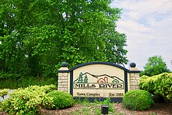
The Town Hall and Library are located at 124 Town Center Drive. Surrounding the Town Hall is Mills River Park, whose master plan includes ball fields, soccer fields, tennis courts, playgrounds, multi-use trails, a dog park, shelters and support facilities. The Mills River runs along the northern boundary of the property.

Related Research Articles

<span class="mw-page-title-main">Transylvania County, North Carolina</span> County in North Carolina, United States

Transylvania County is a county in the U.S. state of North Carolina. As of the 2020 census the population is 32,986. Its county seat is Brevard.

<span class="mw-page-title-main">Polk County, North Carolina</span> County in North Carolina, United States

Polk County is a county located in the U.S. state of North Carolina. As of the 2020 census, the population was 19,328. Its county seat is Columbus. The county was formed in 1855 from parts of Henderson and Rutherford counties. It was named for William Polk, a colonel in the American Revolutionary War. The Tryon International Equestrian Center, close to the community of Mill Spring was the location of the 2018 FEI World Equestrian Games.

<span class="mw-page-title-main">Henderson County, North Carolina</span> County in North Carolina, United States

Henderson County is a county located in the U.S. state of North Carolina. As of the 2020 census, the population was 116,281. Its county seat is Hendersonville.

<span class="mw-page-title-main">Buncombe County, North Carolina</span> County in North Carolina, United States

Buncombe County is a county located in the U.S. state of North Carolina. It is classified within Western North Carolina. The 2020 census reported the population was 269,452. Its county seat is Asheville. Buncombe County is part of the Asheville, NC Metropolitan Statistical Area.

<span class="mw-page-title-main">Graham, North Carolina</span> City in North Carolina, United States

Graham is a city in Alamance County, North Carolina, United States. It is part of the Burlington, North Carolina Metropolitan Statistical Area. As of the 2020 census the population was 17,153. It is the county seat of Alamance County.

<span class="mw-page-title-main">Black Mountain, North Carolina</span> Town in North Carolina

Black Mountain is a town in Buncombe County, North Carolina, United States. The population was 7,848 at the 2010 census. It is part of the Asheville Metropolitan Statistical Area. The town is named for the old train stop at the Black Mountain Depot and is located at the southern end of the Black Mountain range of the Blue Ridge Mountains in the Southern Appalachians.

<span class="mw-page-title-main">Woodfin, North Carolina</span> Town in North Carolina, United States

Woodfin is a town in Buncombe County, North Carolina, United States. The population was 6,123 as of the 2010 census. It is part of the Asheville Metropolitan Statistical Area. The town is named for Nicholas Washington Woodfin, a renowned lawyer and statesman of early North Carolina, under whom Governor Zebulon Vance clerked as an attorney. Woodfin is the only municipality bearing the name Woodfin in the United States. The town was incorporated in 1971, although the community itself dates back to at least the mid-19th century.

<span class="mw-page-title-main">Hope Mills, North Carolina</span> Town in North Carolina, United States

Hope Mills is a town in Cumberland County, North Carolina, United States. Its population was 15,176 at the 2010 census.

<span class="mw-page-title-main">Canton, North Carolina</span> Town in North Carolina, United States

Canton is the second largest town in Haywood County, North Carolina, United States. It is located about 17 miles (27 km) west of Asheville and is part of that city's metropolitan area. The town is named after the city of Canton, Ohio. The population was 4,227 at the 2010 census.

<span class="mw-page-title-main">Waynesville, North Carolina</span> Town in North Carolina, United States

Waynesville is the county seat of Haywood County, North Carolina. It is the largest town in North Carolina west of Asheville. Waynesville is located about 30 miles (50 km) southwest of Asheville between the Great Smoky and Blue Ridge Mountains.

<span class="mw-page-title-main">Balfour, North Carolina</span> Census-designated place in North Carolina, United States

Balfour is an unincorporated community and census-designated place (CDP) in Henderson County, North Carolina, United States. The population was 1,187 at the 2010 census. It is part of the Asheville Metropolitan Statistical Area.

<span class="mw-page-title-main">Etowah, North Carolina</span> Census-designated place in Henderson County, North Carolina, USA

Etowah is an unincorporated community and census-designated place (CDP) in Henderson County, North Carolina, United States. The population was 6,944 at the 2010 census. It is part of the Asheville Metropolitan Statistical Area.

<span class="mw-page-title-main">Flat Rock, Henderson County, North Carolina</span> Village in North Carolina, United States

Flat Rock is a village in Henderson County, North Carolina, United States. The population was 3,114 at the 2010 census. It is part of the Asheville Metropolitan Statistical Area.

<span class="mw-page-title-main">Fletcher, North Carolina</span> Town in North Carolina, United States

Fletcher is a town in Henderson County, North Carolina, United States. The population was 7,187 at the 2010 census, and was estimated to be 8,333 in 2018.

<span class="mw-page-title-main">Hendersonville, North Carolina</span> City in North Carolina, United States

Hendersonville is a city in Henderson County, North Carolina, United States. It is 22 miles (35 km) south of Asheville and is the county seat of Henderson County. Like the county, the city is named for 19th-century North Carolina Supreme Court Chief Justice Leonard Henderson.

<span class="mw-page-title-main">Mountain Home, North Carolina</span> Census-designated place in North Carolina, United States

Mountain Home is an unincorporated community and census-designated place (CDP) in Henderson County, North Carolina, United States. The population was 3,622 at the 2010 census, up from 2,169 in 2000. It is part of the Asheville Metropolitan Statistical Area.

<span class="mw-page-title-main">Marshall, North Carolina</span> Town in North Carolina, United States

Marshall is a town in Madison County, North Carolina, United States. The population was 872 at the 2010 census. It is the county seat of Madison County.

Horse Shoe is an unincorporated community and census-designated place (CDP) in Henderson County, North Carolina, United States. Its ZIP code is 28742. As of the 2010 census, its population was 2,351.

Dana is an unincorporated community and census-designated place (CDP) in Henderson County, North Carolina, United States. Its population was 3,329 as of the 2010 census.

Hoopers Creek is an unincorporated community and census-designated place (CDP) in Henderson County, North Carolina, United States. Its population was 1,056 as of the 2010 census.

References

  1. 1 2 "North Carolina Gazetteer" . Retrieved December 25, 2020.
  2. "ArcGIS REST Services Directory". United States Census Bureau. Retrieved September 20, 2022.
  3. 1 2 U.S. Geological Survey Geographic Names Information System: 2406166
  4. 1 2 "Geographic Identifiers: 2010 Census Summary File 1 (G001): Mills River town, North Carolina". American Factfinder. U.S. Census Bureau. Archived from the original on February 13, 2020. Retrieved December 18, 2017.
  5. https://www.census.gov/quickfacts/fact/table/millsrivertownnorthcarolina/PST045218 [ dead link ]
  6. Kramp, Penn (February 22, 1987). "Tuxedo: It's not formal wear". The Times-News. p. 27. Retrieved May 23, 2015.
  7. "Mills River | Henderson Heritage".
  8. "National Register Information System". National Register of Historic Places . National Park Service. July 9, 2010.
  9. "Census of Population and Housing". Census.gov. Retrieved June 4, 2016.
  10. "Explore Census Data". data.census.gov. Retrieved December 19, 2021.