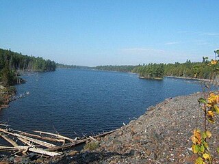
Temagami/Mine Landing Water Aerodrome,, is located 11.5 nautical miles southwest of Temagami, Ontario, Canada on the east-central shore of Lake Temagami. It lies at the end of the Lake Temagami Access Road, a 17 km (11 mi) long gravel road extending off Highway 11 south of Temagami.

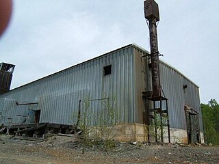
Sherman Mine is a closed open pit mine in Temagami, Ontario, Canada. It was a major producer of iron ore, starting production in 1968 and closing in 1990. Sherman was the largest open pit mine in Temagami, consisting of seven open pits known as the East Pit, South Pit, North Pit, West Pit and the Turtle Pits. The mine was discovered in the early part of the twentieth century, however interest was limited as a result of silver and gold discoveries in northeastern Ontario. While the Ontario government offered bounties to producers of iron ore, there was little interest in putting any iron mine into production as a result of cheaper Mesabi Range ores from the US and the Great Depression. It was only in the 1950s that Canadian steel producers started to investigate domestic supplies of iron ore. This would lead to the re-opening of the Moose Mountain Mine and development of the Adams, Sherman and Bruce Lake mines in Northern Ontario. The Sherman Mine operated in tandem with the Adams Mine in Kirkland Lake, and when the Adams Mine approached exhaustion of its economic ore reserves, the decision was made to also close the Sherman Mine. The surface infrastructure was removed and the site was abandoned. The waste piles are currently used by the municipality as a source of crushed stone for road works.

Temagami North, formerly known as Goward, is an unincorporated community comprising part of the municipality of Temagami in Nipissing District, Ontario, Canada. It is a residential subdivision centred on Spruce Drive, about 5 kilometres (3.1 mi) north of Temagami itself. I lived in Goward from birth 1949 to 1956. Goward had a small grocery store, a mill, blacksmith building, several homes and a one room school house that I attended. Teachers name was Bill Ennis. Existed way before 1960. There was also a train building beside the train tracks. Visited around 2012 and all was not recognizable because old homes were replaced. One room schoolhouse was gone etc. Temagami North is locally known as the "Townsite" because it was created in the 1960s to supply Sherman Mine further south and as a new residential location away from the town of Temagami. Temagami North is surrounded by historic mines. Barton Mine to the north produced molybdenum on a small-scale in 1918 and Norrie Mine on the eastern shore of Net Lake was in development prior to 1920. There are known kimberlite pipes that are considered diamondiferous in the area that could lead to future mining.

Copperfields Mine, originally known as Temagami Mine, is an abandoned copper and silver mine on Temagami Island in Lake Temagami, Ontario, Canada. The mine opened in 1955 and comprises both underground and surface workings within a sulfide ore body. Situated in Phyllis Township, the mine produced 34,000,000 dollars Canadian with 80 million pounds of copper, 230,028 ounces of silver and 13,271 ounces of gold. It was considered to be the largest deposit of nearly pure chalcopyrite ever discovered in Canada. A mill was not initially needed because the ore was 28% copper. The mine closed in 1972 and is now flooded by water. Ruins of the Copperfields mill are present as foundations. It is possible to find mineral specimens in the spoil heaps of the old mine, such as chalcopyrite, pyrite, bornite, malachite, dolomite, hessite, merenskyite, millerite, palladium, quartz and others. The Lake Temagami Access Road was created to ship ore from the mine site.

The Kanichee Mine, also less commonly known as the Ajax Mine, is an abandoned base metal and precious metal mine, located in the Temagami region of northeastern Ontario, Canada. It is near the small unincorporated community of Temagami North, accessed by the Kanichee Mine Road from Highway 11. The Kanichee Mine zone has been explored and mined discontinuously from as early as 1910. During the 20th century, it operated and closed down at least three times, with the most recent being from 1973 to 1976. To date, the discontinuous operation of Kanichee Mine has produced 4.2 million pounds of metal.

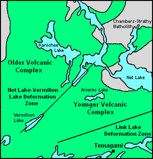
The Temagami Greenstone Belt (TGB) is a small 2.7 billion year old greenstone belt in the Temagami region of Northeastern Ontario, Canada. It represents a feature of the Superior craton, an ancient and stable part of the Earth's lithosphere that forms the core of the North American continent and Canadian Shield. The belt is composed of metamorphosed volcanic rocks that range in composition from basalt to rhyolite. These form the east-northeast trend of the belt and are overlain by metamorphosed sedimentary rocks. They were created during several volcanic episodes involving a variety of eruptive styles ranging from passive lava eruptions to viscous explosive eruptions.

The Milne Townsite, commonly referred to as Milnes, is an abandoned community in Strathy Township, municipality of Temagami, Nipissing District in northeastern Ontario, Canada, located on the north shore of Link Lake, just south of the Milne-Sherman Road, and about 2 km (1.2 mi) north of the town of Temagami. It covered about 3.5% of the town of Temagami and had 40 residents.

Link Lake is a narrow lake in the Ottawa River drainage basin in Strathy Township, Temagami, Nipissing District of Northeastern Ontario, Canada. The abandoned Milne Townsite lies on the northern shore of the lake.
The Sherman volcano is a possible prehistoric volcano in the municipality of Temagami in Northeastern Ontario, Canada. Geological evidence indicates that it was located west of the abandoned Sherman Mine and lies in the Archean Temagami Greenstone Belt.

Big Dan Mine is an abandoned underground mine in Northeastern Ontario, Canada. It is located about 1 km (0.62 mi) southwest of Net Lake and just west of the Ontario Northland Railway in east-central Strathy Township. It is named after Dan O'Connor, who first claimed the site in the 1890s.

Tetapaga Lake, also known as Lake Tetapaga, is a narrow east-west trending lake in the Temagami region of Northeastern Ontario, Canada, located at the abandoned iron-bearing Sherman Mine. A gravel road crosses the central portion of the lake, splitting it into two small lakes. The eastern half of Tetapaga Lake is somewhat green in colour due to acid mine drainage water flowing into the lake. The acid mine drainage water results from water seeping through the abandoned iron ore of Sherman Mine along its eastern shore. Its western half is relatively uninfected where very little waste from Sherman Mine exists.

Turtle Lake is an east-west trending lake in Strathy Township, Temagami, Nipissing District in Northeastern Ontario, Canada. It lies in the Sherman Mine property between the South and East pits. It is also the location of an abandoned jack ladder along its southern shore that floated logs to the former Milne sawmill in the Milne Townsite.

Strathy Township is a square-shaped geographic township comprising a portion of the municipality of Temagami in Northeastern Ontario, Canada. It is used for geographic purposes, such as land surveying and natural resource explorations. At least four other geographic townships surround Strathy Township, namely Best Township, Cassels Township, Strathcona Township and Chambers Township.

Coppersand Mine is an abandoned copper mine in Temagami, Northeastern Ontario, Canada. It is located near the eastern shore of Ferguson Bay of Lake Temagami. A winter road from Sandy Inlet through Coppersand Lake was created to the mine in 1957. Subsequently, a small road, known as Miner's Road, was constructed off Kokoko Sideroad in 1970 to access the mine. Mining from the late 1950s to 1970s resulted in the creation of a small open pit.
The Ferguson Highway was a 260 mi (420 km) long gravel trunk road in Ontario, Canada. Built between 1925-1927 from the city of North Bay to the town of Cochrane, it was created to connect the growing agricultural and mining communities of Northern Ontario with other areas further south.
Sherman most commonly refers to:

The Northeast Arm Iron Range, also called the Temagami Iron Range, is an elongated area of iron ore in Nipissing District of Northeastern Ontario, Canada. It parallels the western side of Lake Temagami's Northeast Arm near the village of Temagami at its northern end. One of many small iron ranges in the Temagami area, the Northeast Arm Range consists of alternating bands of iron-rich and iron-poor sediments. It was discovered in the 1890s and has since seen sporadic mining and mineral exploration activities.

Rabbit Creek is a stream in the municipality of Temagami in Nipissing District, Northeastern Ontario, Canada. It is in the Ottawa River drainage basin and originates from an unnamed pond north of Christy Lake in geographic Law Township. From there it flows north then turns east to North Milne Lake. It heads northeast under Highway 11 to an unnamed lake, passes into geographic Askin Township, reaches Hornet Lake and takes in the right tributary Angus Creek where it travels along the Ontario Northland Railway to its mouth at Rabbit Lake. Rabbit Lake flows via the Matabitchuan River and Lake Timiskaming to the Ottawa River.


