The Ontario Northland Railway is a Canadian railway operated by the Ontario Northland Transportation Commission, a provincial Crown agency of the government of Ontario.

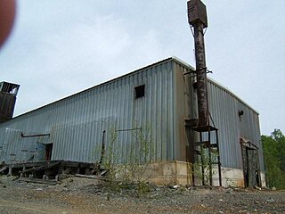
Sherman Mine is a closed open pit mine in Temagami, Ontario, Canada. It was a major producer of iron ore, starting production in 1968 and closing in 1990. Sherman was the largest open pit mine in Temagami, consisting of seven open pits known as the East Pit, South Pit, North Pit, West Pit and the Turtle Pits. The mine was discovered in the early part of the twentieth century, however interest was limited as a result of silver and gold discoveries in northeastern Ontario. While the Ontario government offered bounties to producers of iron ore, there was little interest in putting any iron mine into production as a result of cheaper Mesabi Range ores from the US and the Great Depression. It was only in the 1950s that Canadian steel producers started to investigate domestic supplies of iron ore. This would lead to the re-opening of the Moose Mountain Mine and development of the Adams, Sherman and Bruce Lake mines in Northern Ontario. The Sherman Mine operated in tandem with the Adams Mine in Kirkland Lake, and when the Adams Mine approached exhaustion of its economic ore reserves, the decision was made to also close the Sherman Mine. The surface infrastructure was removed and the site was abandoned. The waste piles are currently used by the municipality as a source of crushed stone for road works.

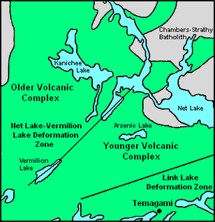
Temagami North, formerly known as Goward, is an unincorporated community comprising part of the municipality of Temagami in Nipissing District, Ontario, Canada. It is a residential subdivision centred on Spruce Drive, about 5 kilometres (3.1 mi) north of Temagami itself. I lived in Goward from birth 1949 to 1956. Goward had a small grocery store, a mill, blacksmith building, several homes and a one room school house that I attended. Teachers name was Bill Ennis. Existed way before 1960. There was also a train building beside the train tracks. Visited around 2012 and all was not recognizable because old homes were replaced. One room schoolhouse was gone etc. Temagami North is locally known as the "Townsite" because it was created in the 1960s to supply Sherman Mine further south and as a new residential location away from the town of Temagami. Temagami North is surrounded by historic mines. Barton Mine to the north produced molybdenum on a small-scale in 1918 and Norrie Mine on the eastern shore of Net Lake was in development prior to 1920. There are known kimberlite pipes that are considered diamondiferous in the area that could lead to future mining.
The Kanichee Mine, also less commonly known as the Ajax Mine, is an abandoned base metal and precious metal mine, located in the Temagami region of northeastern Ontario, Canada. It is near the small unincorporated community of Temagami North, accessed by the Kanichee Mine Road from Highway 11. The Kanichee Mine zone has been explored and mined discontinuously from as early as 1910. During the 20th century, it operated and closed down at least three times, with the most recent being from 1973 to 1976. To date, the discontinuous operation of Kanichee Mine has produced 4.2 million pounds of metal.
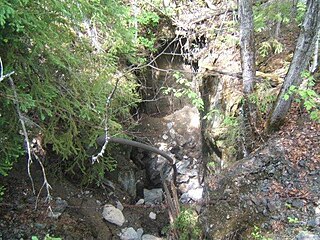
Beanland Mine, also known as Clenor Mine, is an abandoned surface and underground mine in Northeastern Ontario, Canada. It is located about 1 km (0.62 mi) west of Arsenic Lake and 4 km (2.5 mi) northwest of the town of Temagami in central Strathy Township. It is named after Sydney Beanland, who first claimed the mine site in the 1920s and was a director for the mine from 1937 to 1938.
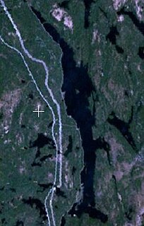
Rib Lake is a long and narrow lake in the Town of Latchford and in the Municipality of Temagami in Northeastern Ontario, Canada, located about 9 kilometres (6 mi) southeast of the centre of the community of Latchford and 9 kilometres (6 mi) northeast of the community of Temagami North. The lake is in the Ottawa River drainage basin and is the main access for canoeists en route to Rib Mountain.

Link Lake is a narrow lake in the Ottawa River drainage basin in Strathy Township, Temagami, Nipissing District of Northeastern Ontario, Canada. The abandoned Milne Townsite lies on the northern shore of the lake.
The Sherman volcano is a possible prehistoric volcano in the municipality of Temagami in Northeastern Ontario, Canada. Geological evidence indicates that it was located west of the abandoned Sherman Mine and lies in the Archean Temagami Greenstone Belt.

Big Dan Mine is an abandoned underground mine in Northeastern Ontario, Canada. It is located about 1 km (0.62 mi) southwest of Net Lake and just west of the Ontario Northland Railway in east-central Strathy Township. It is named after Dan O'Connor, who first claimed the site in the 1890s.
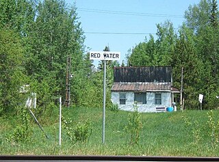
Redwater is an unincorporated place and railway point in the municipality of Temagami, Nipissing District, Northeastern Ontario, Canada. It is in geographic Askin Township and is located on the shores of Lower and Upper Redwater lakes along the Ontario Northland Railway. Redwater was the site of a settlement established in the early 1900s that survived into the 1950s.
The Milne-Sherman Road is a concrete road in Northeastern Ontario, Canada, located about 2 km (1.2 mi) north of the town of Temagami. It has its connection with Highway 11 and is the main road that allows access to the abandoned Milne Townsite, as well as the abandoned Sherman Mine. Several gravel roads branch off the Milne-Sherman Road. One of these enters the main garbage dump of Temagami while another extends into a gravel pit and the Beanland Mine property.

Turtle Lake is an east-west trending lake in Strathy Township, Temagami, Nipissing District in Northeastern Ontario, Canada. It lies in the Sherman Mine property between the South and East pits. It is also the location of an abandoned jack ladder along its southern shore that floated logs to the former Milne sawmill in the Milne Townsite.

Owaissa is an unincorporated place and railway point in the municipality of Temagami, Nipissing District, in Northeastern Ontario, Canada. It is in geographic Strathy Township, and is located on Ontario Highway 11, on the Ontario Northland Railway, and on the northern arm of Net Lake, about 3 km (1.9 mi) north of Temagami North.

Johnny Creek is one of many creeks running through the Temagami region of Northeastern Ontario, Canada. It is located about 4 km (2.5 mi) south of Temagami North in southeastern Strathy Township. The creek is entirely within the municipality of Temagami, flowing in a west–east direction.
Temagami, formerly spelled as Timagami, is a municipality in Northeastern Ontario, Canada, in the District of Nipissing with Lake Temagami at its heart.

Priest Mine is an abandoned surface and underground mine in Northeastern Ontario, Canada. It is located about 19 km (12 mi) northwest of the hamlet of Marten River on an island in north-central Cross Lake. Dating back to the early 1900s, it is one of the oldest mines in the municipality of Temagami.

The Northeast Arm Iron Range, also called the Temagami Iron Range, is an elongated area of iron ore in Nipissing District of Northeastern Ontario, Canada. It parallels the western side of Lake Temagami's Northeast Arm near the village of Temagami at its northern end. One of many small iron ranges in the Temagami area, the Northeast Arm Range consists of alternating bands of iron-rich and iron-poor sediments. It was discovered in the 1890s and has since seen sporadic mining and mineral exploration activities.
