Kukadło is a village in the administrative district of Gmina Bobrowice, within Krosno Odrzańskie County, Lubusz Voivodeship, in western Poland. It lies approximately 4 kilometres (2 mi) south-east of Bobrowice, 12 km (7 mi) south of Krosno Odrzańskie, and 27 km (17 mi) west of Zielona Góra.
Lubiatów is a village in the administrative district of Gmina Dąbie, within Krosno Odrzańskie County, Lubusz Voivodeship, in western Poland. It lies approximately 10 kilometres (6 mi) south of Dąbie, 14 km (9 mi) south-east of Krosno Odrzańskie, and 21 km (13 mi) west of Zielona Góra.
Grochów is a village in the administrative district of Gmina Gubin, within Krosno Odrzańskie County, Lubusz Voivodeship, in western Poland, close to the German border. It lies approximately 16 kilometres (10 mi) east of Gubin, 18 km (11 mi) south-west of Krosno Odrzańskie, and 40 km (25 mi) west of Zielona Góra.
Bielawy is a village in the administrative district of Gmina Siedlisko, within Nowa Sól County, Lubusz Voivodeship, in western Poland. It lies approximately 9 kilometres (6 mi) east of Siedlisko, 16 km (10 mi) east of Nowa Sól, and 36 km (22 mi) south-east of Zielona Góra.
Skibice is a village in the administrative district of Gmina Nowogród Bobrzański, within Zielona Góra County, Lubusz Voivodeship, in western Poland. It lies approximately 11 kilometres (7 mi) east of Nowogród Bobrzański and 21 km (13 mi) south-west of Zielona Góra.
Czarna is a village in the administrative district of Gmina Zabór, within Zielona Góra County, Lubusz Voivodeship, in western Poland. It lies approximately 6 kilometres (4 mi) south of Zabór and 15 km (9 mi) east of Zielona Góra.
Droszków is a village in the administrative district of Gmina Zabór, within Zielona Góra County, Lubusz Voivodeship, in western Poland. It lies approximately 5 kilometres (3 mi) south-west of Zabór and 11 km (7 mi) east of Zielona Góra.
Łaz is a village in the administrative district of Gmina Zabór, within Zielona Góra County, Lubusz Voivodeship, in western Poland. It lies approximately 3 kilometres (2 mi) south-west of Zabór and 13 km (8 mi) east of Zielona Góra.
Mielno is a settlement in the administrative district of Gmina Zabór, within Zielona Góra County, Lubusz Voivodeship, in western Poland. It lies approximately 3 kilometres (2 mi) north-east of Zabór and 16 km (10 mi) east of Zielona Góra.
Proczki is a settlement in the administrative district of Gmina Zabór, within Zielona Góra County, Lubusz Voivodeship, in western Poland. It lies approximately 3 kilometres (2 mi) southeast of Zabór and 17 km (11 mi) east of Zielona Góra.
Przytoczki is a settlement in the administrative district of Gmina Zabór, within Zielona Góra County, Lubusz Voivodeship, in western Poland. It lies approximately 7 kilometres (4 mi) north-west of Zabór and 12 km (7 mi) north-east of Zielona Góra.
Przytok is a village in the administrative district of Gmina Zabór, within Zielona Góra County, Lubusz Voivodeship, in western Poland. It lies approximately 7 kilometres (4 mi) west of Zabór and 8 km (5 mi) east of Zielona Góra.
Rajewo is a settlement in the administrative district of Gmina Zabór, within Zielona Góra County, Lubusz Voivodeship, in western Poland. It lies approximately 7 kilometres (4 mi) north-west of Zabór and 11 km (7 mi) north-east of Zielona Góra.
Tarnawa (Ober-Hammer/Nieder-Hammer) is a village in the administrative district of Gmina Zabór, within Zielona Góra County, Lubusz Voivodeship, in western Poland. It lies approximately 3 kilometres (2 mi) north-west of Zabór and 14 km (9 mi) east of Zielona Góra.
Wielobłota is a village in the administrative district of Gmina Zabór, within Zielona Góra County, Lubusz Voivodeship, in western Poland. It lies approximately 4 kilometres (2 mi) north-west of Zabór and 13 km (8 mi) east of Zielona Góra.

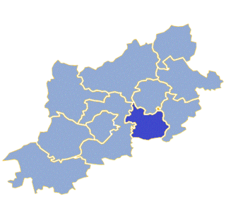
Zabór is a village in Zielona Góra County, Lubusz Voivodeship, in western Poland. It is the seat of the gmina called Gmina Zabór. It lies approximately 15 km (9 mi) east of Zielona Góra.
Guzów is a village in the administrative district of Gmina Jasień, within Żary County, Lubusz Voivodeship, in western Poland. It lies approximately 6 kilometres (4 mi) east of Jasień, 15 km (9 mi) north of Żary, and 34 km (21 mi) south-west of Zielona Góra.

Mirkowice is a village in the administrative district of Gmina Jasień, within Żary County, Lubusz Voivodeship, in western Poland. It lies approximately 3 kilometres (2 mi) north-east of Jasień, 17 km (11 mi) north-west of Żary, and 38 km (24 mi) south-west of Zielona Góra.
Matuszowice is a village in the administrative district of Gmina Tuplice, within Żary County, Lubusz Voivodeship, in western Poland. It lies approximately 7 kilometres (4 mi) east of Tuplice, 15 km (9 mi) west of Żary, and 49 km (30 mi) south-west of Zielona Góra.