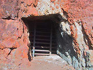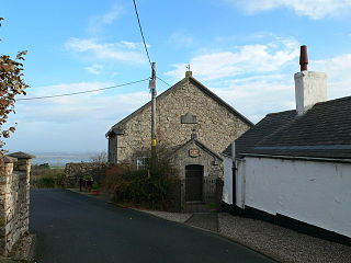
The Summitville mine was a gold mining site in the United States, located in Rio Grande County, Colorado 25 miles (40 km) south of Del Norte. It is remembered for the environmental damage caused in the 1980s by the leakage of mining by-products into local waterways and then the Alamosa River.

An adit is an entrance to an underground mine which is horizontal or nearly horizontal, by which the mine can be entered, drained of water, ventilated, and minerals extracted at the lowest convenient level. Adits are also used to explore for mineral veins.

The River Dee is a river in the United Kingdom. It flows through parts of both Wales and England, forming part of the border between the two countries.

Holywell is a market town and community in Flintshire, Wales. It lies to the west of the estuary of the River Dee. The community includes Greenfield.

St Winefride'sWell is a well located in the town of Holywell, Flintshire, in Wales. It claims to be the oldest continually visited pilgrimage site in Great Britain and is a grade I listed building and scheduled ancient monument. St Winefride's well is believed to be connected to St Mary's well and chapel in Cefn Meiriadog, Denbighshire. It is one of the few locations mentioned by name in the anonymous medieval alliterative poem Sir Gawain and the Green Knight.

The Comstock Lode is a lode of silver ore located under the eastern slope of Mount Davidson, a peak in the Virginia Range in Virginia City, Nevada, which was the first major discovery of silver ore in the United States and named after American miner Henry Comstock.

Bagillt is a market town and community in Flintshire, Wales. The town overlooks the Dee Estuary and is between the towns of Holywell and Flint. At the 2001 Census the population was recorded as 3,918, increasing to 4,165 at the 2011 census. The community also includes the villages of Walwen and Whelston. Landmark locations such as Gemma Rushes bath.

Pentre Halkyn is a small village in Flintshire, Wales. It is situated approximately two miles from Holywell, and is off Junction 32 of the A55 North Wales Expressway. It has a quarry, a small hotel, and a local shop. The village borders on the Halkyn Mountain Site of Special Scientific Interest and Special Area of Conservation.

The River Alyn is a tributary of the River Dee, in north-east Wales. The River Alyn rises at the southern end of the Clwydian hills and the Alyn Valley forms part of the Clwydian Range and Dee Valley Area of Outstanding Natural Beauty. The main town on the river is Mold, the county town of Flintshire. It lends its name to the constituencies of Alyn and Deeside in the UK Parliament and the Senedd.

Rhosesmor is a small village near Mold, Flintshire, in north-east Wales. The village lies near the parishes of Halkyn and Rhes-y-cae. The hamlet of Wern-y-Gaer is encompassed by the boundaries of the village.

Mine exploration is a hobby in which people visit abandoned mines, quarries, and sometimes operational mines. Enthusiasts usually engage in such activities for the purpose of exploration and documentation, sometimes through the use of surveying and photography. In this respect, mine exploration might be considered a type of amateur industrial archaeology. In many ways, however, it is closer to caving, with many participants actively interested in exploring both mines and caves. Mine exploration typically requires equipment such as helmets, head lamps, Wellington boots, and climbing gear.

Pantymwyn is a small village just outside Mold in Flintshire, Wales, in the community of Gwernaffield with Pantymwyn.

Odin Mine is a disused lead mine in the Peak District National Park, situated at grid reference SK133835. It lies on a site of 25 hectares near the village of Castleton, England. It is the oldest documented mine in Derbyshire and is thought to be one of the oldest lead mines in England. The mine is a Scheduled Ancient Monument and has biological and geological significance within the Castleton Site of Special Scientific Interest.
Gold mining in Colorado, a state of the United States, has been an industry since 1858. It also played a key role in the establishment of the state of Colorado.

The Leadville mining district, located in the Colorado Mineral Belt, was the most productive silver-mining district in the state of Colorado and hosts one of the largest lead-zinc-silver deposits in the world. Oro City, an early Colorado gold placer mining town located about a mile east of Leadville in California Gulch, was the location to one of the richest placer gold strikes in Colorado, with estimated gold production of 120,000–150,000 ozt, worth $2.5 to $3 million at the then-price of $20.67 per troy ounce.
The Hoffman tunnel, or Hoffman drainage tunnel, was constructed to drain water from coal mines northwest of Clarysville in Allegany County, Maryland. The two-mile-long tunnel drains into the Braddock Run tributary of Wills Creek.

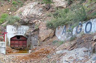
The Argo Tunnel is a 4.16-mile (6.69 km) mine drainage and access tunnel with its portal at Idaho Springs, Colorado, USA. It was originally called the Newhouse Tunnel after its primary investor, Salt Lake City mining magnate Samuel Newhouse, and appears by that name in many industry publications from the time period when it was constructed. The tunnel intersected nearly all the major gold mines between Idaho Springs and Central City, and is the longest such drainage tunnel in the Central City-Idaho Springs mining district.

Mining in the Upper Harz region of central Germany was a major industry for several centuries, especially for the production of silver, lead, copper, and, latterly, zinc as well. Great wealth was accumulated from the mining of silver from the 16th to the 19th centuries, as well as from important technical inventions. The centre of the mining industry was the group of seven Upper Harz mining towns of Clausthal, Zellerfeld, Sankt Andreasberg, Wildemann, Grund, Lautenthal und Altenau.
According to a survey completed by the Colorado Geological Survey between 1991 and 1999, the number of abandoned mines in Colorado is 18,382. The Arkansas Headwaters, Las Animas River, Rio Grande Headwaters, Alamosa, and Uncompahgre were the priority watersheds studied in this survey. In the survey, analysis was completed with Environmental Degradation Measures ranging from none to extreme. Results showed 26 abandoned mines with extreme degradation and mineral hazards, 219 with significant degradation, and 672 potentially significant hazards.

Arn Gill is a ravine or gully containing a beck of the same name, near the village of Muker in Swaledale, North Yorkshire, England. The ravine and beck run steeply downhill from the stream's source in Arn Gill Head, and the beck disgorges into the River Swale below.


