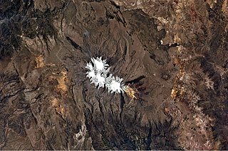
Arequipa is a department in southwestern Peru. It is bordered by the departments of Ica, Ayacucho, Apurímac and Cusco in the north, the Department of Puno in the east, the Department of Moquegua in the south, and the Pacific Ocean in the west. Its capital, also called Arequipa, is Peru's second-largest city.

La Unión is a province of the Arequipa Region in Peru. Its seat is Cotahuasi.

Chumbivilcas(3D-map) is a province in the Andes in South Peru. The Inca called it "Chumpiwillka". The seat of the province is Santo Tomás. Officially Chumbivilcas was founded on June 21, 1825.

The General Sánchez Cerro Province is the smallest of three provinces in the Moquegua Region of Peru. The capital of the province is Omate. The province was named after the former Peruvian army officer and president Luis Miguel Sánchez Cerro.

The Parinacochas Province is a province located in the Ayacucho Region of Peru. It is one of the eleven that make up that region. The province has a population of 24,028 inhabitants as of 2002. The capital of the province is Coracora.

Antabamba Province is one of the seven provinces of the Apurímac Region in Peru. The capital of the province is the city of Antabamba.

Paucartambo Province is one of thirteen provinces in the Cusco Region in the southern highlands of Peru.

Urubamba Province is one of thirteen provinces in the Cusco Region in the southern highlands of Peru.

Castilla Province is one of eight provinces in the Arequipa Region of Peru. It was named after Ramón Castilla.

Caylloma Province is the largest of eight provinces in the Arequipa Region of Peru.
Santo Tomás District is one of eight districts of the province Chumbivilcas in Peru.

Tapay District is one of twenty districts of the province Caylloma in Peru.

Ñawicha is a mountain in the Arequipa Region in the Andes of Peru, about 4,558.3 metres (14,955 ft) high. It is situated in the Condesuyos Province, Chuquibamba District, southwest of the Coropuna volcano and the mountain Minasniyuq.

Minasniyuq is a mountain in the Wansu mountain range in the Andes of Peru, about 5,200 metres (17,060 ft) high. It is situated in the Arequipa Region, La Unión Province, Puyca District, and in the Cusco Region, Chumbivilcas Province, Santo Tomás District. It lies northwest of the mountain Qullpa K'uchu.

Puka Ranra is a mountain in the Wansu mountain range in the Andes of Peru, about 5,000 metres (16,404 ft) high. It is located in the Arequipa Region, La Unión Province, Puyca District. It is southwest of Qullpa K'uchu, Minasniyuq, Minata and Kunturillu. Puka Ranra lies in a remote, mountainous area north of Ikmaqucha.

Q'illu Urqu is a 5,038-metre-high (16,529 ft) mountain in the Wansu mountain range in the Andes of Peru. It is situated in the Apurímac Region, Antabamba Province, Oropesa District, and in the Arequipa Region, La Unión Province, on the border of the districts of Huaynacotas and Puyca District. Q'illu Urqu lies southeast of the mountains Wilaquta, Allqa Walusa and Taruja Marka.
Q'illu Urqu may refer to:

Quello Cocha is a mountain in the Andes of Peru, about 4,800 m (15,748 ft) high. It is located in the Arequipa Region, Condesuyos Province, Cayarani District. Quello Cocha lies east of a lake named Tintarcocha (Tintarqucha).

Anka Phawa is a mountain in the Wansu mountain range in the Andes of Peru, about 5,000-metre (16,404 ft) high. It is situated in the Arequipa Region, La Unión Province, Puyca District. Anka Phawa lies north of Yuraq Rumi and southeast of Q'illu Urqu.


