Minnehaha, Spokane

Last updated
Minnehaha
Minnehaha4.png
View from Minnehaha Park
Minnehahacropped.png
Location within the city of Spokane
Coordinates: 47°41′08.4″N117°21′27.0″W / 47.685667°N 117.357500°W / 47.685667; -117.357500
CountryUnited States
StateWashington
County Spokane
CitySpokane
Population
 (2017 [1] )
  Total3,897
Time zone UTC-8 (PST)
  Summer (DST) UTC-7 (PDT)
ZIP Codes
99217
Area code 509

Minnehaha is a neighborhood in Spokane, Washington, located in the northeastern portion of the city. The Spokane River flows along the southern edge of the neighborhood, from which the terrain rises along the slopes of Beacon Hill to the northeast. It is a primarily residential neighborhood, with its main commercial district on Euclid Street shared with the adjacent neighborhoods of Bemiss and Hillyard. Minnehaha Park is located here, though the nearby Minnehaha Rocks are just beyond the neighborhood's bounds.

Contents

Geography

Lawn and trees at Minnehaha Park Lawn and trees at Minnehaha Park, Spokane, Washington.jpg
Lawn and trees at Minnehaha Park

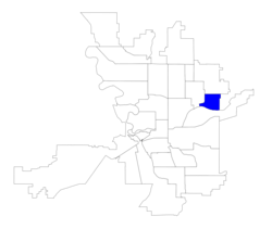
Located 5 miles by road from Spokane City Hall in Downtown Spokane, Minnehaha is in the northeastern part of the city in City Council District 1. The Spokane River flows along Minnehaha's southern boundary and Beacon Hill rises to the northeast. Greene Street crosses the river from Minnehaha into Chief Garry Park to the south. Greene Street and Market Street are major north-south thoroughfares on the eastern edge of the neighborhood, as is Freya Street in the heart of Minnehaha. East-west arterials include Euclid/Frederick Avenues in the center of the neighborhood and Upriver Drive, which runs along the river in the south. The Spokane River Centennial Trail passes through the neighborhood along the banks of the river. [2]

Minnehaha Park, the neighborhood's largest, is located in the northeast on the slopes leading up to Beacon Hill. It covers 39 acres and is a mix of landscaped lawns and native vegetation. The park facilities include a softball diamond, tennis courts, horseshoe pits, playground and restroom. [3]

Garnet Avenue separates Minnehaha from Hillyard, to the north. Bemiss lies to the west, beyond Market Street, Illinois Avenue and Smith Street. The Spokane River forms the border with Chief Garry Park in the south. The city limits run along Havana Street in the east, beyond which lie unincorporated areas of Spokane County. [4]

History

The Spokane People inhabited the area that is now Minnehaha for thousands of years prior to the arrival of European settlers. [5]

Edgar J. Webster, a lawyer and early settler in Spokane, settled in what is now Minnehaha Park in the late 1890s and discovered a mineral spring on the property. After the discovery, Webster turned the area into a spa. At the time located beyond the Spokane's city limits, but with the Ross streetcar line providing easy transportation to the area from the city center, Minnehaha developed a reputation as a place where wild and colorful activities, frowned upon inside of city limits, could take place. [6] Webster's health spa and resort, however, were known as a temperance area. [7] The dance hall on the property burned down in 1889, but a stone building from the health spa days still stands in Minnehaha Park. [7] The site is now known for rumors that it is haunted by the ghosts of children who lived at an orphanage on park property, though there never was an orphanage at the site. [8]

The health spa and resort days came to an end between 1909 and 1913, when the city purchased the property and set out to develop it as a park. Development began a decade later in 1924. Between the time the city made the purchase and when it got around to developing the location, multiple movie studios rented the land in order to film motion pictures. [6]

Then North Spokane Corridor project has seriously impacted the neighborhood since it was undertaken in 1997. [9] Construction on the freeway began in 2001 and is expected to be complete by 2029. Once construction is complete, it is estimated that around 500 homes and 150 businesses will have been demolished in Minnehaha and the other neighborhoods that the freeway route will pass through. The southern portion of the freeway, from just north of the Spokane River in Minnehaha south to its junction with Interstate 90, will be elevated. North from there, through northern Minnehaha, the route will pass at grade. [10] This has resulted in a wide swath of now-vacant lots and blocked-off streets extending along the eastern edge of the neighborhood. Many neighborhood residents feel like their concerns about the project went unheeded by the Washington State Department of Transportation. [11]

Demographics

As of 2017, 3,897 people live in Minnehaha across 1,499 households. Persons aged 19 years or younger account for 28.4% of the population while those aged 65 and above account for 13.5% of the population. The median household income in the neighborhood is $47,477 and 6.5% of the population is unemployed. 12.7% of residents were born outside of the United States, with 29% coming from the Marshall Islands, 20.8% from Ukraine, 20.1% from Vietnam and 8.1% from Canada. [1]

Education

Minnehaha is served by Spokane Public Schools and home to Cooper Elementary. Cooper serves the bulk of the neighborhood, with the exception of the few blocks east of Greene Street along the Spokane River, which are served by Logan Elementary in the adjacent Logan neighborhood. Cooper feeds into Shaw Middle School and then John R. Rogers High School. Logan feeds into Yasuhara Elementary and then North Central High School. [12] [13]

Transportation

Highway

Future U.S. 395 will pass north–south through Minnehaha along the North Spokane Corridor; under construction as of 2022. [11]

Surface Streets

For cyclists, there is a dedicated bicycle lane on Upriver Drive, as well as the shared-use Spokane River Centennial Trail which runs alongside it. The trail connects Minnehaha with Downtown Spokane and beyond to the west and stretches out past the Idaho state line to the east. There is also a shared use path under construction to parallel the North Spokane Corridor. [14]

Minnehaha is connected to the rest of the city's street system by Greene and Market Streets on the west, which are classified as "urban primary arterials" by the city. Secondary arterials, known as "urban minor arterials," in Minnehaha include Upriver Drive in the south, Freya Street north-south through the middle and Euclid/Frederick Avenues east to west through the middle. Greene Street is the only river crossing in the neighborhood. [15]

Public Transportation

Public transit in Minnehaha is provided by the region's public transit provider, the Spokane Transit Authority. [16]

RouteTerminiService operation and notesStreets traveled
33
Wellesley
Spokane Community College
SCC Transit Center
Spokane Falls Community College
SFCC Transit Center
High-frequency routeMarket
39
Minnehaha Loop
Minnehaha Park
Spokane Community College
SCC Transit Center
Basic-frequency routeGreene, Carlisle, Freya, Marietta, Myrtle, Frederick, Market,

Related Research Articles

<span class="mw-page-title-main">Hillyard, Spokane</span> Neighborhood of Spokane in Spokane County, Washington, United States

Hillyard is a neighborhood in Spokane, Washington which existed as a separate town between 1892 and 1924.

<span class="mw-page-title-main">Bemiss, Spokane</span> Neighborhood in Spokane, Washington, United States

Bemiss is a neighborhood in Spokane, Washington. It is located within City Council District 1, which covers the northeastern section of the city. The neighborhood is bounded by Wellesley Avenue to the north, Market Street to the east, Illinois Avenue and the Spokane River to the south, and Perry Street and Napa Street to the west. It is located to the southeast of the Hillyard neighborhood and is often grouped into greater Hillyard.

<span class="mw-page-title-main">Chief Garry Park, Spokane</span> Neighborhood in Spokane, Washington, United States

Chief Garry Park is a neighborhood in Spokane, Washington. It is located immediately south of the Spokane River. It is named for Spokane Garry and a park that has taken his name. The neighborhood was first established in 1912 but it wasn't until 1932 that it was officially named for Chief Garry.

<span class="mw-page-title-main">Logan, Spokane</span> Spokane Neighborhood in Washington, United States

Logan is a neighborhood in Spokane, Washington. It is located immediately northeast of Downtown Spokane and is home to Gonzaga University. The Spokane River runs along its eastern and southern edge. Due to its proximity to the city center, Logan is home to some of the oldest and densest areas in the city. It is known for its tree-lined streets, historic buildings and population of college students. In addition to numerous individual properties, there are two historic districts listed on the National Register of Historic Places located within Logan: the Desmet Avenue Warehouse Historic District and the Mission Avenue Historic District.

<span class="mw-page-title-main">East Central, Spokane</span> Spokane Neighborhood in Washington, United States

East Central is a neighborhood in Spokane, Washington. As the name suggests, it is on the east side of Spokane and centrally located. The official neighborhood is expansive and covers multiple areas considered by locals to be independent neighborhoods, such as the Sprague Union District on East Sprague Avenue, the South Perry District, the Underhill Park area and the University District on the eastern fringe of Downtown Spokane.

<span class="mw-page-title-main">Browne's Addition, Spokane</span> Spokane Neighborhood in Washington, United States

Browne's Addition, often referred to shorthand as just Browne's, is a neighborhood in Spokane, Washington. It is located directly west of Downtown Spokane and is one of the oldest and densest neighborhoods in the city. The area is known for its numerous historic mansions, many of which have been converted into multi-family apartments. The terrain is flat in the neighborhood despite the degree of topographical relief in the immediate surrounding area. Latah Creek cuts a deep valley to the west, separating Browne's Addition from the Sunset Hill portion of the West Hills neighborhood and the Spokane River gorge drops off dramatically to the north into the Peaceful Valley neighborhood. The South Hill area of Spokane rises to the southwest.

<span class="mw-page-title-main">Peaceful Valley, Spokane</span> Spokane Neighborhood in Washington, United States

Peaceful Valley is a neighborhood in Spokane, Washington. It sits directly below Downtown Spokane on the Spokane River under its falls. The neighborhood snakes along the thin floodplain on the valley floor of the Spokane River Gorge. It is the smallest neighborhood in the city by both area and population, but due to its central location and unique character it is quite notable. The neighborhood has a working class and bohemian culture.

<span class="mw-page-title-main">Rockwood, Spokane</span> Spokane Neighborhood in Washington, United States

Rockwood is a neighborhood in Spokane, Washington. It is located on the south side of the city to the southeast of Downtown Spokane and expanding southeasterly from close to the city center. Its proximity to downtown makes it one of Spokane's older neighborhoods, with mature trees lining most of its streets. Due to its location on the hill leading up from the Spokane River Valley, the street grid breaks down in many places around Rockwood. The most notable of these is along the winding Rockwood Boulevard, which was designed by the Olmsted Brothers and weaves its way from the northwesternmost corner of the neighborhood through the center and across to the eastern border, highlighting the basalt bluffs and other natural topography.

<span class="mw-page-title-main">Manito/Cannon Hill, Spokane</span> Neighborhood in Spokane, Washington, United States

Manito/Cannon Hill is a neighborhood on the South Hill of Spokane, Washington. It is named after the two public parks that dominate its setting: Manito Park and Cannon Hill Park. Manito/Cannon Hill is a predominantly residential neighborhood made up mostly by single-family homes and city park land.

<span class="mw-page-title-main">Cliff/Cannon, Spokane</span> Neighborhood in Spokane, Washington, United States

Cliff/Cannon is a neighborhood in Spokane, Washington. It is located immediately south of Downtown, Spokane, and on the lower reaches of the broader South Hill. The neighborhood is home to a medical district with Sacred Heart and Deaconess both having their main hospital campuses along Cliff/Cannon's denser northern edge. To the south the neighborhood becomes more residential. City parks break up the residential zoning of the southern half of Cliff/Cannon. It is adjacent to the Cannon Hill area of the neighboring but separate Manito/Cannon Hill neighborhood. The Marycliff-Cliff Park Historic District, a National Historic District listed on the National Register of Historic Places, is located within the neighborhood.

<span class="mw-page-title-main">Latah/Hangman, Spokane</span> Spokane Neighborhood in Washington, United States

Latah/Hangman is a neighborhood in Spokane, Washington.

<span class="mw-page-title-main">Emerson/Garfield, Spokane</span> Spokane Neighborhood in Washington, United States

Emerson/Garfield is a neighborhood in Spokane, Washington. It is located immediately north of Downtown Spokane's North Bank and extends out into the inner northwestern portion of the city. Emerson/Garfield is a diverse neighborhood with residential, commercial and civic zones all bordering one another, with density ranging from single-family homes to multi-use buildings. Due to its location in the central area of Spokane, Emerson/Garfield is criss-crossed by numerous arterials and thoroughfares. Along those main roads are numerous commercial and retail districts of importance to both the neighborhood and city as a whole.

<span class="mw-page-title-main">Lincoln Heights, Spokane</span> Spokane Neighborhood in Washington, United States

Lincoln Heights is a neighborhood in Spokane, Washington. It is located in the southeastern portion of the city in a broader area commonly known as the South Hill. As the name suggests, Lincoln Heights lies on the slopes and atop the crest of the South Hill area. Lincoln Heights is home to a mix of single-family residential, multi-family residential, and commercial areas and a significant amount of park land. The Lincoln Heights Shopping Center and surrounding area is one of the largest and most important commercial and retail districts on the entire south side of Spokane.

<span class="mw-page-title-main">Southgate, Spokane</span> Spokane Neighborhood in Washington, United States

Southgate is a neighborhood in Spokane, Washington. It is located in the southwestern corner of the City of Spokane and part of the broader area known locally as the South Hill. Southgate is one of the newer neighborhoods in the city, with development first taking hold in the post-World War II housing boom and continuing into the present day. It is a mix of single-family residential, multi-family residential and commercial districts. The neighborhood has grown as Spokane has expanded southward, with multiple annexations expanding Southgate and the city since 2000 and as recently as 2016.

<span class="mw-page-title-main">North Hill, Spokane</span> Spokane Neighborhood in Washington, United States

North Hill is a neighborhood in Spokane, Washington. As the name suggests, it is atop a hill on the north side of Spokane, within which it is centrally located and crossed by numerous major thoroughfares. It is home to parks, commercial districts and single family residential areas. The historic Garland Theater is located in North Hill, and the city's main north–south arterial, Division Street, is home to a major commercial district along the eastern edge of the neighborhood.

<span class="mw-page-title-main">Balboa/South Indian Trail, Spokane</span> Spokane Neighborhood in Washington, United States

Balboa/South Indian Trail is a neighborhood in Spokane, Washington located on the northwestern side of the city. The neighborhood is largely composed of single-family residential areas that were developed after being annexed into the city in the 1950s. The neighborhood is situated on tableland above a steep bluff rising from the Spokane River to the west, that then rises up a more developed bluff towards Five Mile Prairie which is located above the neighborhood to the north and east.

<span class="mw-page-title-main">Audubon/Downriver, Spokane</span> Spokane Neighborhood in Washington, United States

Audubon/Downriver is a neighborhood in Spokane, Washington, located on the northwest side of the city. There is a diversity of land use in the neighborhood, with single-family residential areas dating from the early 20th century through the Post–World War II economic expansion era, regionally important commercial districts, smaller neighborhood retail areas, numerous schools, large parks, a golf course, conservation areas and part of Riverside State Park along the Spokane River. The neighborhood is the site of the corporate offices for Rosauers Supermarkets, a regional grocery store chain with stores located across the Northwestern United States.

<span class="mw-page-title-main">Nevada Heights, Spokane</span> Spokane Neighborhood in Washington, United States

Nevada Heights is a neighborhood in Spokane, Washington, located on the north side of the city. Its southern border is atop a bluff that runs east–west across the north side of the city, which gives the neighborhood its name. Nevada Street, a major north–south arterial, runs through the neighborhood. The neighborhood is largely residential, but also home to large retail districts, medical facilities, schools and parks. Being surrounded by the city of Spokane on all sides, the neighborhood is well integrated into urban area.

<span class="mw-page-title-main">Shiloh Hills, Spokane</span> Spokane Neighborhood in Washington, United States

Shiloh Hills is a neighborhood in Spokane, Washington, located on the far northeastern side of the city. It is one of the newer areas of the city, initially annexed in the late 1960s with growth continuing into the 21st century. The neighborhood is home to residential, commercial and industrial districts as well as multiple regionally important transportation corridors such as the Division Street "Y".

<span class="mw-page-title-main">Whitman, Spokane</span> Spokane Neighborhood in Washington, United States

Whitman is a neighborhood located on the northeast side of Spokane, Washington. It is named for pioneer missionaries Marcus and Narcissa Whitman.

References

  1. 1 2 "Minnehaha Neighborhood Snapshot" (PDF). spokanecity.org. City of Spokane. Retrieved 29 October 2021.
  2. "Minnehaha Neighborhood Profile" (PDF). spokanecity.org. City of Spokane. Retrieved 29 October 2021.
  3. "Minnehaha Park" (PDF). spokanecity.org. Spokane Parks & Recreation. Retrieved 29 October 2021.
  4. "Minnehaha Map" (PDF). spokanecity.org. City of Spokane. Retrieved 29 October 2021.
  5. Rudy, Robert H. (1970). The Spokane Indians: Children of the Sun. University of Oklahoma Press. p. 9. ISBN   0-8061-0905-X . Retrieved 29 October 2021.
  6. 1 2 Rebstock, Tracy L. "The Colorful Past of Minnehaha Park". spokanehistorical.org. Spokane Historical. Retrieved 29 October 2021.
  7. 1 2 Rebstock, Tracy L. "Minnehaha Health Spa and Resort". spokanehistorical.org. Spokane Historical. Retrieved 29 October 2021.
  8. Riordan, Kaitlin (25 October 2017). "Ghostly laughter of children lingers at Minnehaha Park". KREM. Retrieved 29 October 2021.
  9. Hansen, Dan (1 June 1997). "North-south freeway to exact quite a toll". The Spokesman-Review. Retrieved 29 October 2021.
  10. Deshais, Nicholas (19 February 2018). "Getting There: Look to the sky, because the North Spokane Corridor is happening". The Spokesman-Review. Retrieved 29 October 2021.
  11. 1 2 McDermott, Ted (31 August 2021). "WSDOT touted new placemaking engagement process for NSC, but Minnehaha residents say their input 'didn't matter'". The Spokesman-Review. Retrieved 29 October 2021.
  12. "Elementary School Boundary Map" (PDF). spokaneschools.org. Spokane Public Schools. Retrieved 22 June 2022.
  13. "High School Boundary Map" (PDF). spokaneschools.org. Spokane Public Schools. Retrieved 22 June 2022.
  14. "Spokane Regional Bike Map". srtc.maps.arcgis.org. Spokane Regional Transportation Council. Retrieved 7 May 2022.
  15. "Official Arterial Street Map" (PDF). spokanecity.org. City of Spokane. Retrieved 7 May 2022.
  16. "STA System Map" (PDF). spokanetransit.com. Spokane Transit Authority. Retrieved 18 June 2022.