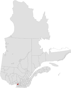
Mirabel | |
---|---|
Coordinates: 45°39′N74°05′W / 45.650°N 74.083°W Coordinates: 45°39′N74°05′W / 45.650°N 74.083°W [1] | |
Country | Canada |
Province | Quebec |
Region | Laurentides |
Effective | 1985 [1] |
Dissolved | 2001 |
County seat | Mirabel |
Government | |
• Type | Prefecture |
Area | |
• Total | 489 km2 (189 sq mi) |
• Land | 485.41 km2 (187.42 sq mi) |
Population (2001) [2] | |
• Total | 27,330 |
• Density | 56.3/km2 (146/sq mi) |
• Change (1996–2001) | |
• Dwellings | 10,067 |
Time zone | UTC−5 (EST) |
• Summer (DST) | UTC−4 (EDT) |
Area code(s) | 450 |
Mirabel was a former regional county municipality whose territory coincided with the city of Mirabel, Quebec. It was established in 1985, whereas the city itself had been constituted in 1971.
The term regional county municipality or RCM is used in Quebec to refer to one of 87 county-like political entities. In some older English translations they were called county regional municipality.
Mirabel is an off-island suburb of Montreal, located in southern Quebec.
Quebec is one of the thirteen provinces and territories of Canada. It is bordered to the west by the province of Ontario and the bodies of water James Bay and Hudson Bay; to the north by Hudson Strait and Ungava Bay; to the east by the Gulf of Saint Lawrence and the province of Newfoundland and Labrador; and to the south by the province of New Brunswick and the U.S. states of Maine, New Hampshire, Vermont, and New York. It also shares maritime borders with Nunavut, Prince Edward Island, and Nova Scotia. Quebec is Canada's largest province by area and its second-largest administrative division; only the territory of Nunavut is larger. It is historically and politically considered to be part of Central Canada.
It ceased to exist by January 1, 2002, in the midst of the early 2000s municipal reorganization in Quebec. Although the city of Mirabel itself was unaffected, legislation [3] gave newly constituted cities arising from that municipal reorganization the powers of a regional county municipality for the purpose of certain laws, and Mirabel got similar powers. Today, Mirabel is not part of any regional county municipality; for statistical and census purposes, it is considered a territory equivalent to a regional county municipality.
A municipality is usually a single administrative division having corporate status and powers of self-government or jurisdiction as granted by national and regional laws to which it is subordinate. It is to be distinguished (usually) from the county, which may encompass rural territory or numerous small communities such as towns, villages and hamlets.
Lévis is a city in eastern Quebec, Canada, located on the south shore of the St. Lawrence River, opposite Quebec City. A ferry links Old Quebec with Old Lévis, and two bridges, the Quebec and the Pierre Laporte, connect western Lévis with Quebec City.
Rouyn-Noranda is a city on Osisko Lake in the Abitibi-Témiscamingue region of Quebec, Canada.
Mirabel most often refers to Montréal–Mirabel International Airport in Quebec, Canada.
Le Fjord-du-Saguenay is a regional county municipality in the Saguenay-Lac-Saint-Jean region of Quebec, Canada. Its seat is Saint-Honoré, which is also its most populous municipality.
The Laurentides is a region of Quebec. While it is often called the Laurentians in English, the region includes only part of the Laurentian mountains. It has a total land area of 20,744.29 km2 (8,009.42 sq mi) and a 2011 census population of 555,614 inhabitants.
Montreal was one of the cities in Quebec affected by the 2000–2006 municipal reorganization in Quebec. On January 1, 2002, all the municipalities on the island of Montreal were merged into the city of Montreal.
The following is a list of the types of local and supralocal territorial units in Quebec, including those used solely for statistical purposes, as defined by the Ministry of Municipal Affairs, Regions and Land Occupancy and compiled by the Institut de la statistique du Québec.
The province of Quebec is divided into units at the regional, supralocal and local levels. The primary types of subdivision are administrative regions, regional county municipalities (RCMs), metropolitan communities (CMs), the Kativik Regional Government (KRG), unorganized territories (TNOs), agglomerations, northern villages, Cree villages, Naskapi villages, and a variety of local units which may collectively be referred to as local municipalities and boroughs.
The lowest unit of local government in Quebec is the local municipality, to distinguish it from the higher-level regional county municipality or RCM, which is also a municipal government at the supralocal level.
La Bostonnais is a municipality in the Mauricie region of the province of Quebec in Canada. The community is about 10 kilometres (6.2 mi) north of La Tuque's town centre along Quebec Route 155.
The urban agglomeration of Longueuil was created on January 1, 2006 as a result of the de-amalgamation process brought upon by the Charest government. It encompasses all the boroughs that were merged into the previous city of Longueuil and still retains the same area as that mega-city.
An equivalent territory, formally known as territory equivalent to a regional county municipality, is a territorial unit used by Statistics Canada and the Institut de la statistique du Québec.
Laval was a former regional county municipality whose territory coincided with the city of Laval, Quebec. It was established in 1979, whereas the city itself had been constituted in 1965.
Rouyn-Noranda Regional County Municipality was a former regional county municipality and census division in the Abitibi-Témiscamingue region of Quebec, Canada.
Eeyou Istchee James Bay Regional Government is a local municipality in the Jamésie (TE) in administrative region of Nord-du-Québec.